How was Indias Area Increased by 40% ? |
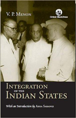
Integration of the
Indian Princely States |
With Interesting Details on the Integration of
Junagadh, Hyderabad and Kashmir |
Rajnikant Puranik |
How was Indias Area Increased by 40% ?
Integration of the Indian Princely States
with Interesting Details on the Integration of
Junagadh, Hyderabad and Kashmir
by
Rajnikant Puranik
Categories: Non-fiction, History, Biography
First Edition, August 2018
Copyright 2018 Rajnikant Puranik
Print & Digital Editions
Available on Amazon and Pothi.com
Please check
www.rkpbooks.com
for all the books by the author,
for their details, and from where to procure them
All rights reserved. No part of this publication may be reproduced, distributed or transmitted in any form or by any means, whether electronic/digital or print or mechanical/physical, or stored in an information storage or retrieval system, without the prior written permission of the copyright owner, that is, the author, except as permitted by law. However, extracts up to a total of 1,000 words may be quoted without seeking any permission, but with due acknowledgement of the source. For permission, please write to .
Preface
The problem of the [Princely] states is so difficult
that only you can solve it.
Gandhi to Sardar Patel . {RG/406}
Sir Stafford Cripps had estimated it would take India 10 to 15 years or more, to merge the States with India. It was a surprise to all, and a tribute to the Sardars abilities, that he took, not 10 to 15 years, but less than 10 to 15 months to merge all the 548 Princely States with India, extending Indias geographical area by a whopping 40%.
__________________________________
This book comprehensively covers the Integration of the Indian Princely States into India.
India of today is what was British India after partition, plus additional 40% geographical area on account of the integration of 548 Princely States into it (out of 562, 14 went to Pakistan), which Britain had declared to be independent upon lapse of their paramountcy. The credit for expanding Indias area by a massive 40% goes to Sardar Patel. This book provides interesting details on that integration.
But for Sardar Patel Hyderabad would have been either another Pakistan or Kashmir. J&K would not have been a perennial problem as it has become, bleeding India profusely in terms of men, money and materials through the decades, and Kashmiri Pandits would not have seen the terrible days that they have, had Nehru allowed Sardar to handle J&K too, like he [Sardar] had successfully handled the integration of all the other Princely States. This book brings out all the critical details on both Hyderabad and Kashmir.
Rajnikant Puranik
www.rkpbooks.com
A Note on Citations & Bibliography
Citations are given as super-scripts in the text, such as {Azad/128}.
Citation Syntax & Examples:
{Source-Abbreviation/Page-Number}
e.g. {Azad/128} = Azad, Page 128
{Source-Abbreviation/Volume-Number/Page-Number}
e.g. {CWMG/V-58/221} = CWMG, Volume-58, Page 221
{Source-Abbreviation} for URLs (articles on the web), and for digital books (including Kindle-Books), that are searchable, where location or page-number may not be given.
e.g. {VPM2} , {URL15}
{Source-Abbreviation/Location-Number} for Kindle Books
e.g. {VPM2} , {VPM2/L-2901}
Example from Bibliography Table at the end of this Book
Azad | B | Maulana Abul Kalam Azad India Wins Freedom . Orient Longman. New Delhi. 2004 |
CWMG | D, W | Collected Works of Mahatma Gandhi. Vol. 1 to 98. http://gandhiserve.org/e/cwmg/cwmg.htm |
The second column above gives the nature of the source : B=paper Book, D=Digital Book/eBook other than Kindle, K=Kindle eBook, U=URL of Document/Article on Web, W=Website, Y=YouTube
To the fond memory of my late parents
Shrimati Shakuntala and Shri Laxminarayan Puranik
Thanks to
Devbala Puranik, Manasi and Manini
Dedicated to the two greats who measured up to the Himalayan task of expanding partitioned-Indias geographical area by 40% by Integration of the
Princely States, using sam, dam, dand, bhed.
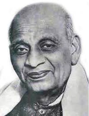
Sardar Vallabhbhai Patel 18751950 |
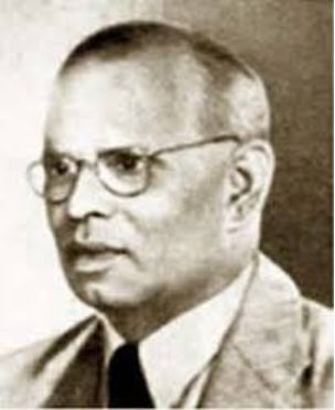
VP Menon 18931965 |
Table of Contents
{ 1 }
Interesting Statistics
60% | of the Total Area of Undivided India was under the Britishcalled the British India. |
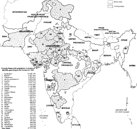
40% | of the Total Area of Undivided India was under Indian Princely States. |
75% | of the Total Population (400 million) of Undivided India was under the British India. |
25% | of the Total Population of Undivided India was under Indian Princely States. |
| were the Total Number of the Indian Princely States in Undivided India. |
| (97.5%) were the Total Number of the Indian Princely States that joined (partitioned) India. |
| (2.5%) were the Total Number of the Indian Princely States that joined Pakistan. |
| were the Total Number of the Indian Princely States that signed the Instrument of Accession (IoA) with India by 15 August 1947. |
| were the Total Number of major Indian Princely States that refused to sign the Instrument of Accession (IoA) with India by 15 August 1947; and did so later, after military action by India. They were Junagadh, Hyderabad and J&K, |
| (or 58%) of the 562 Princely States were very small states, with an average area of about 20 square miles, average population of about 3000, and average annual revenue of about 22,000 rupees. |
| (or 40%) of the 562 states, covering an area of about 22,000 square miles, were in just one region in Saurashtra in Gujarat stateKathiawar. |
| Princely States were in Orissa alone. |
| Princely States were in Chhattisgarh alone. |
25% | of the Princely States had the status of a salute state. Salute state was one whose ruler was honoured by receiving 9 to 21 gun salutes, depending upon its status, on ceremonial occasions. Rulers entitled to 11 gun salutes and above received the style of Highness. Being the Faithful Ally of the British Empire (a title bestowed on him by the Raj for being most dog-like), the Nizam of Hyderabad was honoured with an exalted style by the British: Exalted Highness. The premier 21-gun salute states were Hyderabad and Jammu & Kashmir. |
| States were represented directly in the Chamber of Princes, an advisory body constituted under the GoI Act 1919. 127 were allowed 12 seats, and the remaining 326 were considered too small to be represented. |

