2020 Georgetown University Press. All rights reserved. No part of this book may be reproduced or utilized in any form or by any means, electronic or mechanical, including photocopying and recording, or by any information storage and retrieval system, without permission in writing from the publisher.
The publisher is not responsible for third-party websites or their content. URL links were active at time of publication.
Library of Congress Cataloging-in-Publication Data
Names: Clark, Robert M., author.
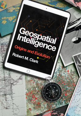
Title: Geospatial Intelligence : Origins and Evolution / Robert M. Clark.
Description: Washington, DC : Georgetown University Press, 2020. | Includes bibliographical references and index.
Identifiers: LCCN 2020002221 (print) | LCCN 2020002222 (ebook) | ISBN 9781647120108 (hardcover) | ISBN 9781647120115 (paperback) | ISBN 9781647120122 (ebook)
Subjects: LCSH: Geographic information systems. | Geospatial data. | Digital mapping. | Intelligence serviceUnited States.
Classification: LCC G70.212 .C56 2020 (print) | LCC G70.212 (ebook) | DDC 910.285dc23
LC record available at https://lccn.loc.gov/2020002221
LC ebook record available at https://lccn.loc.gov/2020002222

This book is printed on acid-free paper meeting the requirements of the American National Standard for Permanence in Paper for Printed Library Materials.
21 20 9 8 7 6 5 4 3 2 First printing
Printed in the United States of America.
Cover design by Jeremy John Parker.
Interior design and composition by click! Publishing Services.
Preface
This book tells the story of how the current age of geospatial knowledge evolved from its ancient origins to become ubiquitous in daily life around the globe. Within this historical frame, the book weaves a rich tapestry of storiesabout the people, events, and ideas that affected the trajectory of what has become known as geospatial intelligence, or GEOINT.
The explosive development of geospatial intelligence as an entity followed much the same pattern as that of the internet, with similar transformative effects. The internet originated from a need for scientists and engineers in several countries to share research results, and it relied on a synthesis of technologies (computers and communications). GEOINT has a more complicated history, long predating the name itself; but it gained wide international attention after an initiative of the Department of Defense and the US intelligence community broke through many decades of division and merged mapping and imaging organizations. That merger led to a synthesis of mapping, imaging, and geolocation practices with information technologies to create the governmental and commercial phenomenon that we now know as GEOINT.
The history of geospatial intelligence is the story of three things that have been with us since we organized into tribes: war, commerce, and taxes. These are constant threads throughout the journey from the roots of ancient charts to today, where we carry our geospatial information around with us in our smartphones, automobiles, and, most currently, our wristwatches.
And the far-reaching growth isnt over. Many applications of GEOINT have developed in recent years, and these are explored here. Geospatial intelligence has many chapters yet to come, and they will be at least as exciting as the past ones. There are many new breakthroughs unfolding, and this book addresses a few of them.
GEOINT comprises many disciplines and technologies. Of necessity, most of these subjects receive introductory or overview treatment in this narrative. Entire university courses are devoted to subjects such as cartography, imagery, remote sensing, and geographic information systems that are covered here, sometimes in a single chapter. The books chapters take a primarily chronological view, explaining the historical origins and subsequent evolution of the various disciplines that have contributed to the current body of geospatial knowledge and now are driving new developments. Starting from their roots in ancient maps and charts, it traces the development of geospatial applications in human activities. It describes how a number of disciplines, enabled by information technology, converged, filled a need, and continue to do so.
My first introduction to geospatial intelligence was as a young United States Air Force (USAF) intelligence officer in the Strategic Air Command, planning for targets to attack and flight routes to use to avoid air defenses for our wings B-52 heavy bombers in the event of a nuclear war. After joining the Central Intelligence Agency (CIA) as an analyst, I became involved in a different type of geospatial intelligence: working with imagery analysts at the National Photographic Interpretation Center (NPIC) on unidentified facilities and intelligence enigmas that were found in overhead imagerya problem that continues to bedevil national-level GEOINT analysts. After leaving the CIA, I worked as a private contractor and consultant in planning for development of new imaging systems for the National Reconnaissance Office (NRO).
This book takes a US perspective on geospatial intelligence. After all, this is my background. But that point of view is not intended to downplay the major advances in the field that have come from around the world. A number of the advances across the centuries, in fact, have come from across the Atlantic and the Pacific, and many are highlighted throughout the text.
The book draws on a wide range of sources, including my personal experiences. Extensive related materials on geospatial intelligence are covered, from disciplines such as geographic information systems, geography, geographic information science, cartography, remote sensing, photogrammetry, geodesy, and geophysics. While a plethora of general sources (including common historical knowledge) inform the book, those most relevant focus on the path that lead to the burgeoning field of geospatial intelligence. Intelligence practitioners can spend their entire careers in highly specialized disciplines, and many books are devoted to topics covered only briefly here. Instead, this book is a general guide for students, intelligence customers, and analysts alike, with references to lead the reader to more in-depth studies and reports on specific topics or techniques.
This book was made possible by a diverse set of professionals, whom I both respect and admire. My foremost appreciation goes to Donald Jacobs, senior acquisitions editor, for inviting me into the Georgetown University Press family and stewarding me through its rigorous process. I am especially grateful to Lieutenant General (Retired) James Clapper for giving me his valuable time for an interview and the excitement of interacting with him as he attempted to have a simple breakfast in a diner. I thank Stu Shea, chief executive officer of Peraton, for sharing his inexhaustible enthusiasm for the subject matter and also his lengthy interview. Many of the important insights herein have come from two colleagues as we collaborated on developing an introductory course in geospatial intelligence: Todd Bacastow at Pennsylvania State University and Tim Walton at James Madison University. My special thanks to them and to Peter Oleson, who provided invaluable historical context. Many people throughout the US intelligence community, the military, and academia have provided wisdom that I have incorporated; I cannot name them all, but I appreciate their help. On the personal front, my daughter, Allison Clark, contributed from her experience with local government applications of geospatial intelligence. Above all, Im indebted to my wife and partner in this effort, Abigail, whose conversations and extensive revisions made this a better book.

 This book is printed on acid-free paper meeting the requirements of the American National Standard for Permanence in Paper for Printed Library Materials.


