
Toward Spatial Humanities

| THE SPATIAL HUMANITIES David J. Bodenhamer, John Corrigan, and Trevor M. Harris, editors |
Geographies of the Holocaust, Edited by Anne Kelly Knowles, Tim Cole, and Alberto Giordano
Locating the Moving Image: New Approaches to Film and Place, Edited by Julia Hallam and Les Roberts
The Spatial Humanities: GIS and the Future of Humanities Scholarship, Edited by David J. Bodenhamer, John Corrigan, and Trevor M. Harris
Troubled Geographies: A Spatial History of Religion and Society in Ireland, Ian N. Gregory, Niall A. Cunningham, C. D. Lloyd, Ian G. Shuttleworth, and Paul S. Ell
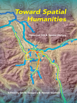
TOWARD SPATIAL HUMANITIES
HISTORICAL GIS AND SPATIAL HISTORY
EDITED BY IAN N. GREGORY AND ALISTAIR GEDDES
INDIANA UNIVERSITY PRESS Bloomington & Indianapolis
This book is a publication of
INDIANA UNIVERSITY PRESS
Office of Scholarly Publishing
Herman B Wells Library 350
1320 East 10th Street
Bloomington, Indiana 47405 USA
iupress.indiana.edu
Telephone 800-842-6796
Fax 812-855-7931
2014 by Indiana University Press
All rights reserved
No part of this book may be reproduced or utilized in any form or by any means, electronic or mechanical, including photocopying and recording, or by any information storage and retrieval system, without permission in writing from the publisher. The Association of American University Presses Resolution on Permissions constitutes the only exception to this prohibition.
 The paper used in this publication meets the minimum requirements of the American National Standard for Information SciencesPermanence of Paper for Printed Library Materials, ANSI Z39.481992.
Manufactured in the
United States of America
Library of Congress
Cataloging-in-Publication Data
Toward spatial humanities : historical GIS and spatial history / edited by Ian N. Gregory and Alistair Geddes.
pages cm
Includes bibliographical references and index.
ISBN 978-0-253-01180-0 (cloth : alkaline paper) ISBN 978-0-253-01186-2 (paperback : alkaline paper) ISBN 978-0-253-01190-9 (ebook) 1. Historiography Methodology. 2. Geographic information systems. 3. History Sources. 4. Historical geography Methodology. 5. History Data processing. I. Gregory, Ian N. II. Geddes, A. (Alistair)
D16.T74 2014
910.285 dc23
2013037075
1 2 3 4 5 18 17 16 15 14
Acknowledgments
WE EXPRESS OUR SINCERE GRATITUDE TO ALL OF THE CONTRIBUTORS for their efforts and speedy replies to our requests and queries. The work was strengthened as a result of detailed anonymous review, and we thank those involved in that process. The series editors David Bodenhamer especially gave sagacious advice, and we benefited from guidance of Darja Malcolm-Clarke, Dan Pyle, Robert Sloan, and Jenna Whittaker, all at Indiana University Press. We are also very grateful to Mary M. Hill for undertaking the copyediting. Others gave their support and kindness unstintingly: Alistair would particularly like to thank Jen and Robin Flowerdew.
The groundwork for this book came as a result of an Economic and Social Research Council (ESRC) Seminar Series Grant, The Historical GIS Research Network (RES-451-25-4307). Its completion benefited from support from the European Research Council (ERC) under the European Unions Seventh Framework Programme (FP7/20072013)/ERC Grant Spatial Humanities: Texts, GIS, Places (agreement number 283850).
Introduction: From Historical GIS to Spatial Humanities: Deepening Scholarship and Broadening Technology
IAN N. GR EGORY AND ALISTAIR GEDDES
WHEN GEOGR APHICAL INFOR MATION SYSTEMS (GIS) FIRST began to be used by academic geographers in the late 1980s, their use was nothing if not controversial. Proponents of the new field argued that it had the potential to reinvigorate geography as a discipline under a more computational paradigm. One thing on which they both agreed or perhaps took for granted was that GIS was a quantitative technology that was to be used in a social scientific manner (to its supporters) or a positivist way (to its antagonists).
When GIS first began to be used by historians it was not surprising that much of the early focus was also quantitative and social science based. It is no coincidence that the first special issue of a journal dedicated to historical GIS (HGIS), published in Social Science History, included essays on topics such as fertility, migration, urban history, and economic growth, all well suited to quantitative analysis.in the quantitative sessions was also interesting. Rather than concentrating on issues associated with database construction and potential applications, many of these papers had developed to focus on conducting applied works of history studies that developed the historiography by answering applied research questions. This was an indication of two emerging trends within HGIS that have continued since: HGIS is deepening from an applied perspective, and it is broadening from a technical perspective. It is deepening in that it has reached a stage where researchers apply it to scholarship that develops new knowledge about the past. This must be the ultimate aim of the field, as it takes HGIS beyond a narrow technical specialism and makes it relevant to a much wider audience. HGIS is also broadening its technical scope in terms of the ever-widening potential for its application to both qualitative and quantitative sources. This means that GIS is thus able to expand beyond social science history a fairly narrow field to be applicable to the discipline more broadly, and beyond that to spread outside the disciplinary boundaries of history into other humanities disciplines.
GIS AND HISTORICAL RESEARCH
There are many different definitions of GIS and related terms such as GISc (Geographical Information Science).
To take this further, GIS can be thought of as a type of software that provides a way of representing features on the Earths surface and a suite of operations that allow the researcher to query, manipulate, visualize, and analyze these representations. The representations, or data models, combine two types of data: attribute data, which were traditionally held in a table and tend or perhaps tended to be quantitative, and spatial data, which locate each item of data using a point, a line, a polygon (which represents an area or a zone), or a pixel. Points, lines, and GIS allows researchers to ask questions about their topics or sources that stress the importance of location and thus geography. This emphasis on geography, combined with the tools to represent and explore georeferenced data, is what allows scholars to conduct their research in new ways.
This approach to defining GIS leads to the conclusion that a Geographic Information System is really a database for managing georeferenced data. Until recently this conclusion made a quantitative paradigm almost inevitable, as databases were, almost by definition, quantitative, holding either numbers or structured textual information such as is found in library catalogs. Recent developments in Information Technology (IT) mean that this paradigm is no longer the case. Increasingly, almost any type of data can be held within a computer system, including unstructured texts such as books and web pages, still images, moving images, and sounds. As long as a location can be found for these items, they can be held within a GIS-type structure. This means that the need for attribute data to be quantitative is increasingly disappearing.
Next page



 The paper used in this publication meets the minimum requirements of the American National Standard for Information SciencesPermanence of Paper for Printed Library Materials, ANSI Z39.481992.