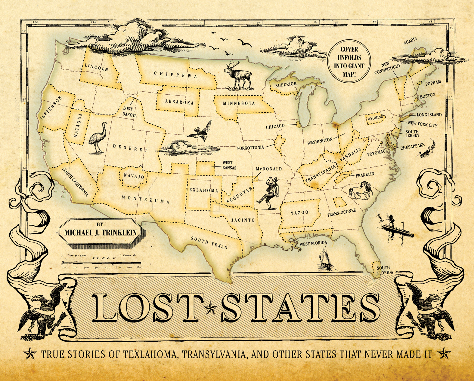
Copyright 2010 by Michael J. Trinklein
All rights reserved. No part of this book may be reproduced in any form without written permission from the publisher.
Library of Congress Cataloging in Publication Number: 2009934891
eBook ISBN: 978-1-59474-752-6
Hardcover ISBN: 978-1-59474-410-5
Hardcover Design by Doogie Horner
Hardcover Production Management by John J. McGurk
Quirk Books
215 Church Street
Philadelphia, PA 19106
www.quirkbooks.com
All images courtesy the author except the following: Chicago Historical Society, Chicago Daily News neg. coll. DN-0076962, .
All maps created by the author. The following resources helped in their creation: CIA World Factbook, (FHWA\HEPI-10, Aug. 2003).
v3.1
INTRODUCTION
Fifty states. Its such a nice, round number. It might even seem preordained that America would gobble up the perfect amount of territory to create fifty just-right states.
Sorry. It wasnt nearly that tidy.
You know the winners, but dozens of other statehood proposals didnt quite make the cut. Some came remarkably close to joining the union. Others never had a chance. Many are still trying. Its possible that someday one of these pitches will get the green light, becoming state number fifty-one. Why stop there?
This book isnt meant to offer exhaustive detail on every unsuccessful statehood proposal; rather, the goal is to pique your curiosity, instill a sense of wonder, and enjoy a laugh or two. Because geography can be a lot of fun. Unfortunately, the study of Americas geography is often framed as the memorization of state capitals. How boring! The real stories of the states are often laugh-out-loud funny, replete with absurd characters, stunning ignorance, and monumental screw-ups.
For decades I have been collecting these long-forgotten stories, and I thought it was time to share them. Ive always felt a sense of wonder gazing at old maps, imagining the stories behind each squiggly line. Maps are a record of individuals trying to make a difference in how the world works. For the generation or two of Americans who have not seen any new states added, this proposition might seem odd.
After reading this book, you might see things differently.
ABOUT THE MAPS
All maps have a purpose, perhaps even an agenda. Mine are no exception.
The goalalwayswas to create maps that illustrate borders and locations as clearly as possible. This means that the maps often lack extraneous detail. So dont use them to plan a hiking trip. Youll get lost.
Also, I designed each map to reflect the historic era in which the events took place. For some, I modified an existing map from the appropriate historical period; for others, I created an old map from scratch.
Because most failed statehood plans never had an official map, I had to conjecture a bit here and there to draw the proposed boundaries. If you have better information on a particular border, please send me a note. Ill try to include it in the second edition.
Some readers may be annoyed that I did not include inset maps that offer a you are here overview, but this omission was deliberate. Each map contains enough cues to address that need.
And even though certain maps may inspire you to try to establish your own state, please follow all constitutional guidelines. Dont attempt a coup. You will fail. (But if you do, please mention this book as your inspiration. It will probably help sales.)
ABSAROKA
J UST WHAT WE NEED : A NOTHER SQUARISH WESTERN STATE .
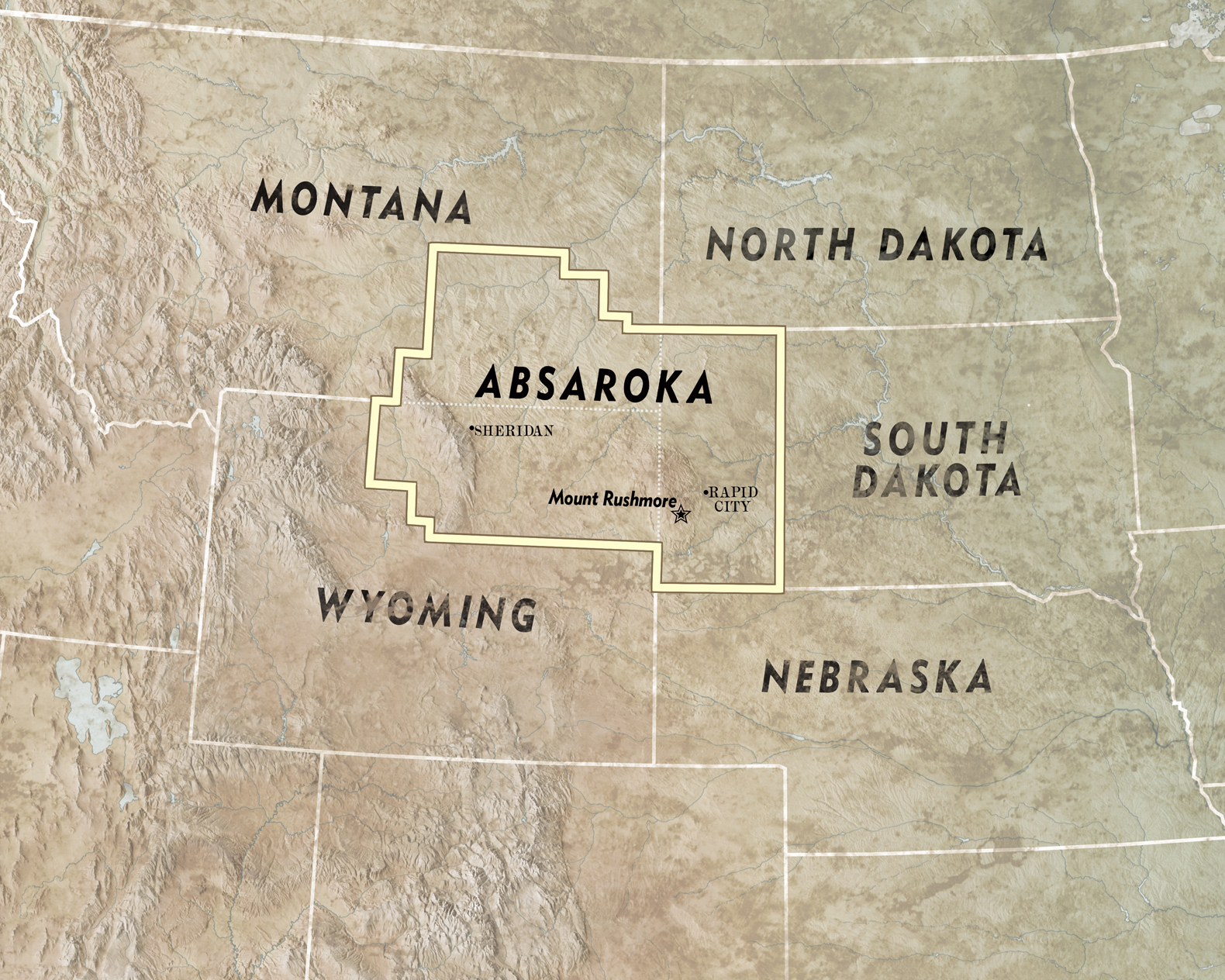
Approximation of Absarokas boundaries.
Y ou may laugh at the notion of Absaroka becoming a state, but the same people who proposed the idea may have persuaded your family to visit this region when you were a kid.
The story goes like this: Because the area was so desolate, local businesspeople figured they needed a monumental attraction to convince people to visit.
So they carved Mount Rushmore.
Granted, Im leaving out a lot of detail, but the point is that many of the big thinkers who pushed for the giant president heads also thought it would be nifty to have their own state.
At least thats what they proposed back in the 1930s. Absaroka would have sliced off sections of South Dakota, Montana, and Wyoming to create the forty-ninth state. The boundaries on my map are conjectural because Absaroka enthusiasts produced several different maps.
Petitions circulated, especially in South Dakota, and aggressive proponents stamped out license plates and even held a Miss Absaroka pageant in 1939. Since no follow-up contest ever occurred, I assume the winner is still wearing her tiara.
Even today, there remains a certain economic logic to Absaroka. The state would be the nations top producer of a particularly valuable commodity: grass. There may be no better place to grow the stuff. The regions grass farmers earn a tidy incomebecause cows really like to eat grass. And people really like to eat cows.
Americans are also fascinated with the men who tend the cows, so thats become another economic engine for the area. For dudes who want the real cowboy experience, no other setting can match Absaroka. Its not uncommon for city slickers to spend $2,000 a day for the privilege of sleeping on the ground, drinking water from a creek, and watching horses poop (hopefully not in the same creek).
And the name? Absaroka comes from a Crow word meaning children of the large-beaked bird. So if Sesame Streets Big Bird ever has a baby, they have to name him Absaroka, dont you think?
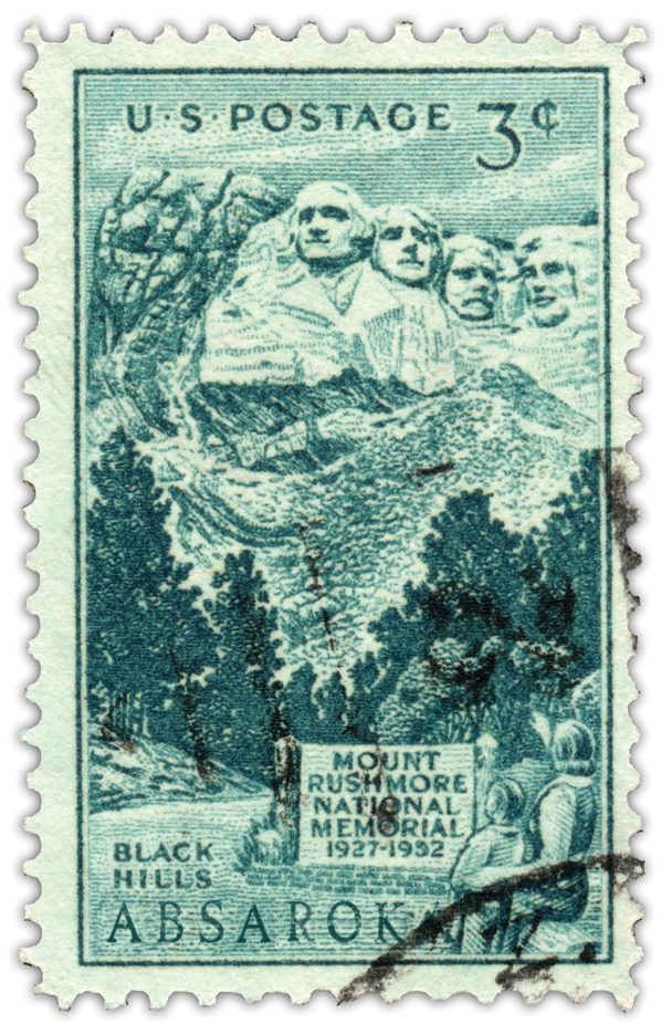
As this fictional stamp implies, Absaroka would have had the benefit of South Dakotas biggest tourist attractionand one of the great icons of America: Mount Rushmore. My experience in 1971 followed the pattern of most other ten-year-olds: 12 hours of Are we there yet? followed by 14 seconds of awe and wonder followed by Whats for lunch?
ACADIA
O R J UST M AINE . T IME FOR A D IVORCE?
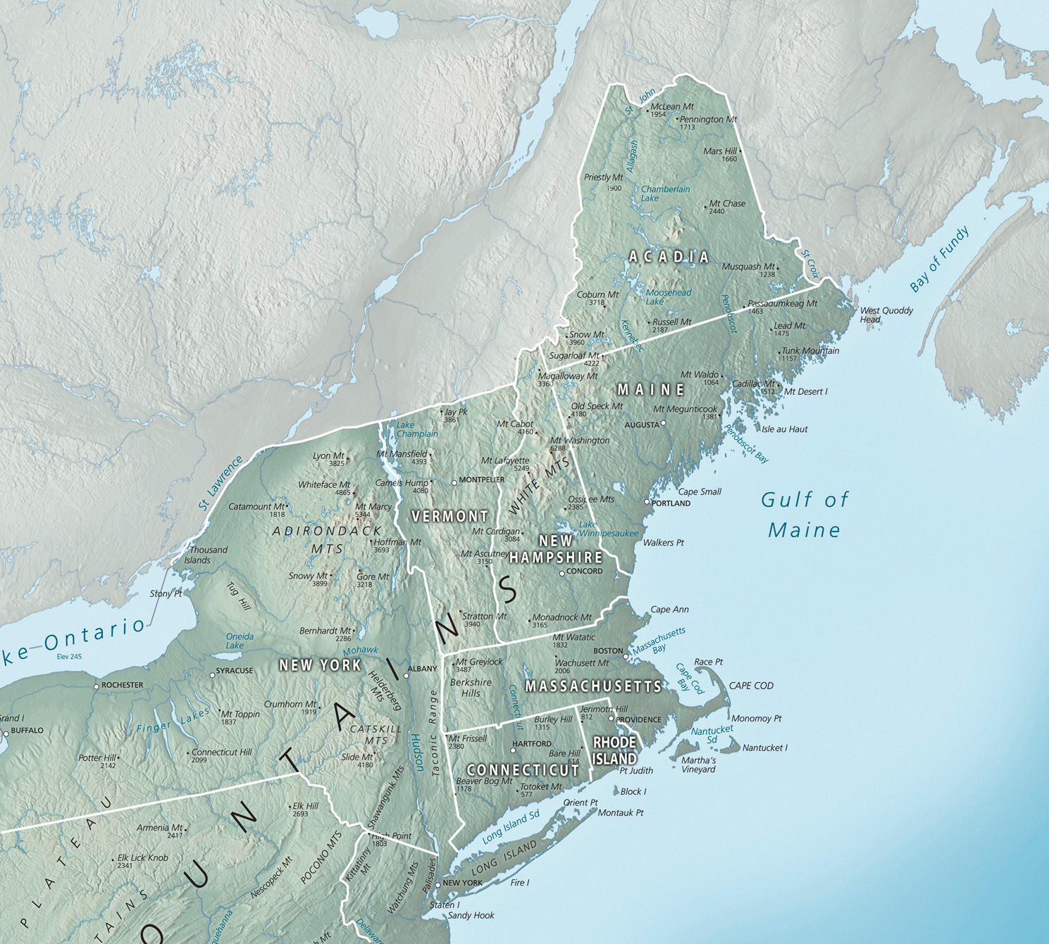
This is an educated guess of Acadias boundary. Statehood proponents never produced an official map.
T odays Maine has a split personality. The south is filled with fancy folk for whom the word summer is a verb. In the north are hardscrabble Mainers living in a still-wild country of forests and mountains. Increasingly, the two groups have little in common. So in 1998, Republican representative Henry Joy sponsored a bill to study the idea of splitting the state in two.


