AERIAL GEOLOGY
A HIGH-ALTITUDE TOUR OF NORTH AMERICAS SPECTACULAR VOLCANOES, CANYONS, GLACIERS, LAKES, CRATERS, AND PEAKS
MARY CAPERTON MORTON
TIMBER PRESS PORTLAND, OREGON
Copyright 2017 by Mary Caperton Morton. All rights reserved.
Published in 2017 by Timber Press, Inc.
The Haseltine Building
133 S.W. Second Avenue, Suite 450
Portland, Oregon 97204-3527
timberpress.com
Book design by Anna Eshelman
Cover design by Kimberly Glyder and Anna Eshelman
Library of Congress Cataloging-in-Publication Data
Names: Morton, Mary Caperton.
Title: Aerial geology: a high-altitude tour of North Americas spectacular volcanoes, canyons, glaciers, lakes, craters, and peaks / Mary Caperton Morton.
Description: Portland, Oregon: Timber Press, [2017] | Includes bibliographical references and index.
Identifiers: LCCN 2016057866
Subjects: LCSH: GeologyNorth America. | LandformsNorth America. | Landforms--North AmericaPictorial works.
Classification: LCC QE71 .M67 2017 | DDC 557dc23 LC record available at https://lccn.loc.gov/2016057866ISBN
eISBN: 9781604698350
A catalog record for this book is also available from the British Library.
to
my Big Sky family
and
my favorite Christmas tree laccolith
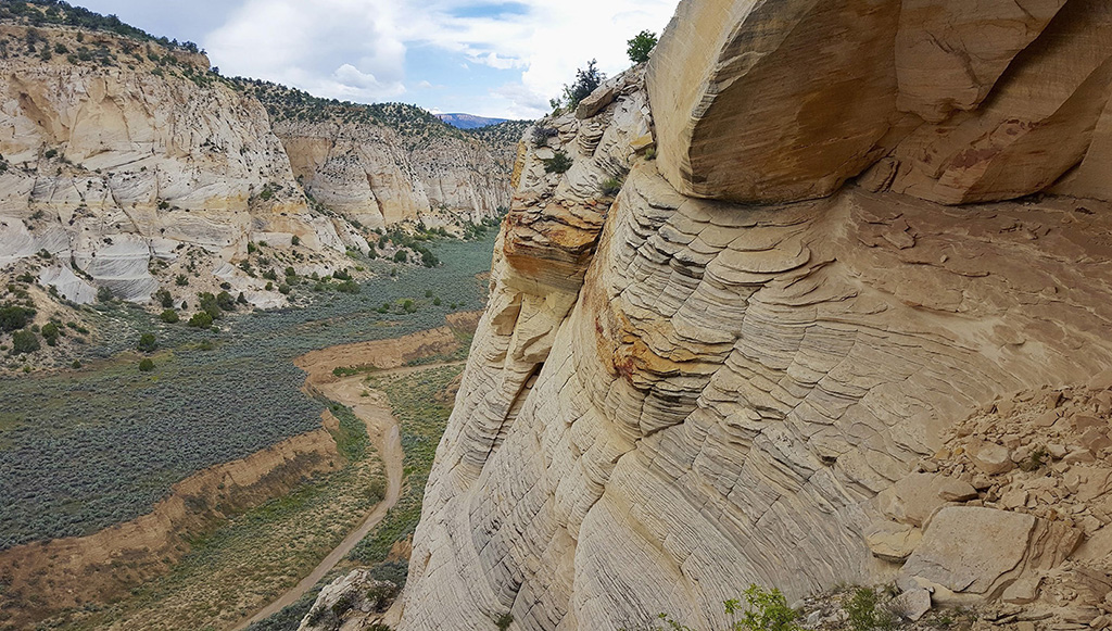
A small seasonal creek cuts a canyon through layered sandstone in southern Utah.

More than 4 billion years of geologic history have shaped the North American continent.
The results can be seen etched across the landscape: from a string of volcanic islands in the North Pacific Ocean, to an earthquake-sculpted Mexican peninsula, to a perfectly round impact crater in northern Quebec. This aerial journey will introduce you to one hundred places that offer glimpses into the greatest geologic tale ever told: the story of Earth.
CONTENTS
PREFACE
As a young girl, I overturned a rock in a stream high in the mountains of West Virginia and found it covered with seashells. I knew something about fossils then and had a vague understanding about Earths age, but finding a slice of an ancient ocean floor on a mountaintop forever changed the way I saw the world. My fascination was not fleeting and I am now a geology writer, an avid traveler, and a mountaineer.
In many ways, geology is best understood from the air. Altitude grants a greater perspective of the land and helps us begin to visualize the extraordinary forces that have shaped our planet over the last 4.5 billion years. Mountaineering is one way to gain that perspectivethe higher you go, the more you see and the more you see, the more you learn. If mountaintops are fantastic classrooms, airplane window seats are even better.
This book highlights one hundred of North Americas most distinctive geologic features and describes how they came to look the way they do from a birds-eye viewor an astronauts, or a satellites. On the ground, deserts appear devoid of moisture but from the air, large-scale features of the landscape reveal that even the most arid places are often shaped by water. Southwest expanses of sandstoneoften relics of ancient inland seashave been sculpted into magnificent canyons by rare rainwater over many millennia.
Follow me from the shores of Alaska, down the West Coast, through the desert Southwest, over the high Rockies, across the patchwork Great Plains, and up the ancient, fossil-rich mountains of my childhood, to the edge of the East. This book is for everyone who ever wondered how seashells end up on mountaintops, and for the high flyers who are transfixed by the view 30,000 feet above the planet. I hope this book changes the way you see the world and inspires you to get out and explore more of it.
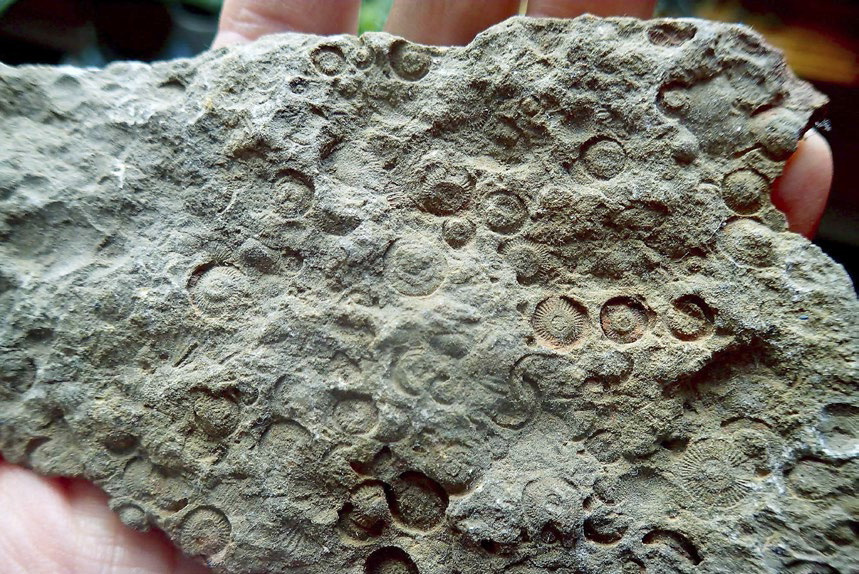
A treasure from my youth: fossilized segments of stems from an underwater plant called a crinoid adorn a 350-million-year-old rock found in the mountains of southern West Virginia.
GEOLOGY 101
The geologic story of North America is a fascinating one. Its also more than 4 billion years longmuch more than we could ever hope to cover here. However, if youre curious about the world around you, enjoy the big-picture perspective, and are interested in some of the processes that are constantly reshaping our planet, heres a crash course on the basics. Its a good place to start on your aerial tour of the continents most breathtaking landforms.
Supercontinents and Plate Tectonics
The most powerful geologic force on Earth is plate tectonics, which governs the formation and breakup of continents (such as North America) and supercontinents (such as ancient Pangaea). The planets outer shell, called the lithosphere, is broken into eight major tectonic plates and many smaller ones, which slide around the planet, driven by the convective forces (motion created by heat) produced by the planets hot inner mantle and core. Plate tectonics move continents, build mountains, fuel volcanoes, and set off earthquakes.
North America as we know it was formed around 200 million years ago, after numerous journeys to the equator and back to its more mid-latitude location. Prior to that, it was a fragment of the supercontinent Pangaea, known as Laurentia. Pangaea amassed around 300 million years ago and began to break up around 200 million years ago, when the Mid-Atlantic Ridge (a spreading ridge that runs under Iceland) began opening, forcing apart the conjoined landmasses that would become North and South America, Eurasia, and Africaand creating the Atlantic Ocean.
The majority of North America is situated on the North American Plate: a massive tectonic puzzle piece that runs from Mexico and the Caribbean to the Arctic, and from the edge of the Pacific Ocean to the spreading Mid-Atlantic Ridge under the Atlantic Ocean. As the Atlantic Ocean continues to widen at a rate of about an inch per year, the North American Plate is pushed toward the southwest, where it collides with the Pacific Platethe major plate underlying the Pacific Oceanand several smaller oceanic plates.
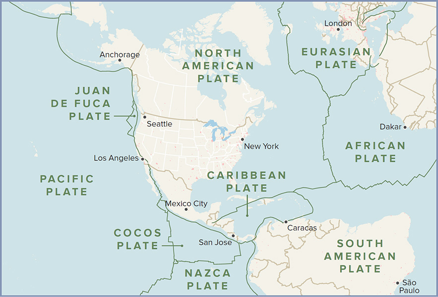
Earths rigid outer shell is broken into dozens of major and minor tectonic plates. Most of North America sits atop the North American Plate.
Continental crust is less dense than waterlogged oceanic crust, so the more buoyant North American Plate rides over the top of the Pacific Plate, forcing the oceanic plate downward, forming a subduction zone. The tremendous forces generated at these plate boundaries, or subduction zones, fuel earthquakes and volcanism along the active western margin of the continent, such as the magnitude 9 megaquake unleashed by the Cascadia Subduction Zone on January 26, 1700, and the eruption of Mount Saint Helens on May 18, 1980.
Tectonic plates are bounded and fractured by faults, where two adjacent masses of rock meet and move relative to each other. Major types of faults include transform faults, thrust faults, and normal faults. Transform faults, also known as strike-slip faults, occur when bordering volumes of rock slide past one another in a lateral motion, with little or no vertical movement. The San Andreas Fault on the coast of California is an example of this kind of fault, where the North American Plate is moving laterally to the Pacific Plate, at a rate of one to two inches per year. This movement sometimes occurs smoothlyaseismicallyand other times makes violent jumps that unleash earthquakes.


