MARKETS IN EARLY MEDIEVAL EUROPE
Markets in Early Medieval Europe
Trading and Productive Sites, 650850
Edited by Tim Pestell and Katharina Ulmschneider

Windgather Press
is an imprint of Oxbow Books
First published in the United Kingdom in 2003. as a paperback in 2019 by
OXBOW BOOKS
The Old Music Hall, 106-108 Cowley Road, Oxford OX4 1JE
and in the United States by
OXBOW BOOKS
1950 Lawrence Road, Havertown, PA 19083
Windgather Press 2003
Paperback edition: ISBN 978-1-911188-47-6
Paperback edition: eISBN 978-1-911188-48-3
Paperback edition: Mobi ISBN 978-1-911188-49-0
A CIP record for this book is available from the British Library
All rights reserved. No part of this publication may be reproduced,
stored in a retrieval system, or transmitted in any form or by any means
(whether electronic, mechanical, photocopying or recording) or otherwise
without the written permission of both the publisher and the copyright holder.
For a complete list of Windgather titles, please contact:
United Kingdom
Oxbow Books
Telephone (01865) 241249
Email:
www.oxbowbooks.com
United States of America
Oxbow Books
Telephone (610) 853 9131
Fax (610) 853 9146
Email:
www.casemateacademic.com/oxbow
Oxbow Books is part of the Casemate Group
Cover Illustrations
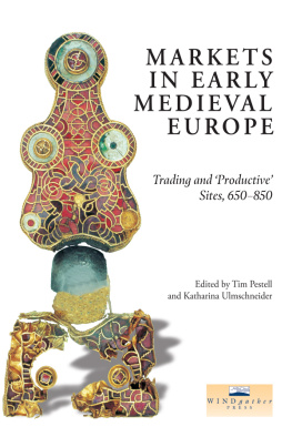
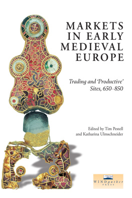
Front: the gold bow brooch found at Tjitsma in the 1950s.
Collection Fries Museum, Leeuwarden.
Back: the excavated Early Medieval manor and market
at Tiss, Denmark. Lars Jrgensen.
List of Illustrations
Figures
| Front cover. The gold bow brooch found at Tjitsma in the 1950s. Total length 163.5mm. Collection Fries Museum, Leeuwarden. |
|
|
| 3.1 | The principal productive sites in Britain, as detailed in the Appendix |
| 3.2 | Histogram comparing hoards and single-finds from England, 780-900 |
| 3.3a-c | Finds from Hamwic, Tilbury and near Royston |
| 3.4a-c | Finds from Bawsey, South Lincolnshire and Hollingbourne |
| 3.5a-c | Finds from near Malton 1, South Newbald and Whithorn |
| 3.6 | Isolated finds from England south of the Humber |
| 3.7a-b | Finds from London and Lincoln |
| 4.1 | Regression analysis showing the frequency of Hamwic coinage within Wessex, mapped in contours |
| 4.2 | Regression analysis showing the proportion of primary porcupine sceattas compared to all primary sceatta finds, mapped in contours |
| 4.3 | Regression analysis of Type 15 secondary sceattas of Hwiccian style, mapped in contours |
| 4.4 | Regression analysis of Series L sceattas, mapped in contours |
| 5.1 | Distribution map of sites in receipt of traded goods, based on Palmer (i998) |
| 5.2 | Navigable rivers in England before the era of canals (after Sherratt 1996) |
| 5.3 | Coin-productive sites (excluding hoards) and Roman roads in Hampshire (after Ulmschneider 2000a, Map 21) |
| 6.1 | Some eighth-to eleventh-century finds from Meols (drawn by Mark Faulkner) |
| 6.2 | Llanbedrgoch site plan (drawn by Tony Daly National Museums and Galleries of Wales) |
| 7.1 | The location and geography of the Isle of Wight |
| 7.2 | A simplified map of the geology of the Isle of Wight |
| 7.3 | Coin-productive sites and markets around the Solent |
| 8.1 | Map of East Kent, showing the reconstructed coastline c . 800 and its relation to some of the sites and roads mentioned in the text |
| 8.2 | Thiessen polygon interpolation, showing the environmental pays of Kent and their relation to early estate-centres, as defined by Everitt (1986) |
| 8.3 | Trend surfaces produced from the average number of imported artefacts interred with each individual in Early Anglo-Saxon cemeteries of East Kent |
| 8.4 | Trend surface of Early Medieval coin finds in East Kent |
| 9.1 | South-east Suffolk, showing the position of Barham and Coddenham in relation to Ipswich, other Middle Anglo-Saxon sites and the local system of Roman roads (sources: Margary 1973; Moore 1988) |
| 9.2 | Barham, Suffolk, showing the distributions of artefact-types |
| 9.3 | Finds from Coddenham |
| 9.4 | Sceatta finds from Suffolk showing the number of coins known from each site (source: Suffolk SMR) |
| 10.1 | Location map of sites discussed in Chapter 10 |
| 10.2 | Bawsey: an aerial view of the site from the north-west. (Photograph: D. A. Edwards, Norfolk Museums and Archaeology Service) |
| 10.3 | Selected finds from Rudham |
| 11.1 | Locations mentioned in Chapter 11 |
| 11.2 | (a) Bawsey and its surrounding parishes; (b) East and West Rudham and surrounding parishes; (c) Hindringham and its surrounding parishes |
| 11.3 | The parish church of Burnham Overy St Clements from the south |
| 12.1 | Finds of Early Anglo-Saxon metalwork from Lincolnshire |
| 12.2 | Middle Anglo-Saxon finds from Lincolnshire and imported material of similar date. Roman roads and early trackways are shown as broken lines |
| 12.3 | Tenth-century and Viking metalwork shown against the pattern of Middle Anglo-Saxon finds |
| 12.4 | Selected finds from Melton Ross |
| 12.5 | The site at Melton Ross |
| 12.6 | The combined parishes of Melton Ross, Barnetby le Wold and the surrounding sites |
| 12.7 | The Yarborough Camp earthworks. Plan based on a survey carried out by K. A. Leahy and J. C. Dyson in May 1984 |
| 13.1 | The location of the sites at Cottam |
| 13.2 | The distribution of metal-detector finds (marked by crosses) superimposed on crop-mark features of the Cottam B enclosures |
| 13.3 | The Anglo-Scandinavian farmstead at Cottam B, seen as a magnetometer plot |
| 13.4 | The distribution of lead weights, Norse bells, and other objects attributed to the tenth century, superimposed on the crop-mark enclosure and the suggested northward settlement shift |
| 13.5 | The distribution of strap-ends |
| 14.1 | Markets and fairs in Norway and Sweden mentioned in Chapter 14 |
| 15.1 | The distribution of major productive sites in Denmark and southern Sweden. Sites mentioned in the text are numbered |
| 15.2 | Plan of the specialized production site at Ns on Zealand. (after M0ller-Hansen and H0ier 2000, redrawn) |
| 15.3 | Plan of the Toftegrd complex near K0ge. (after Tornbjerg 1998, redrawn) |
| 15.4 | The manor complex from the seventh to tenth centuries at Lejre with the residential area and workshop area to the east |
| 15.5 | Plan of one of the great halls in Lejre. (after Christensen 1997, redrawn) |
| 15.6 | Map showing the archaeological status of the Tiss area in the Viking period |
Next page
