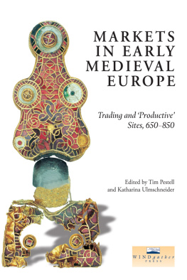
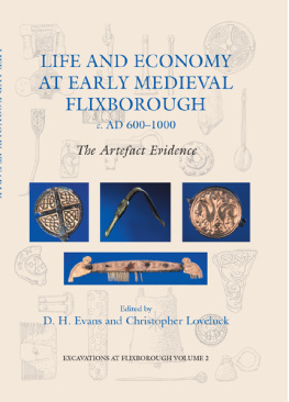
| Front cover. The gold bow brooch found at Tjitsma in the 1950s. Total length 163.5mm. Collection Fries Museum, Leeuwarden. |
|
|
| 3.1 | The principal productive sites in Britain, as detailed in the Appendix |
| 3.2 | Histogram comparing hoards and single-finds from England, 780-900 |
| 3.3a-c | Finds from Hamwic, Tilbury and near Royston |
| 3.4a-c | Finds from Bawsey, South Lincolnshire and Hollingbourne |
| 3.5a-c | Finds from near Malton 1, South Newbald and Whithorn |
| 3.6 | Isolated finds from England south of the Humber |
| 3.7a-b | Finds from London and Lincoln |
| 4.1 | Regression analysis showing the frequency of Hamwic coinage within Wessex, mapped in contours |
| 4.2 | Regression analysis showing the proportion of primary porcupine sceattas compared to all primary sceatta finds, mapped in contours |
| 4.3 | Regression analysis of Type 15 secondary sceattas of Hwiccian style, mapped in contours |
| 4.4 | Regression analysis of Series L sceattas, mapped in contours |
| 5.1 | Distribution map of sites in receipt of traded goods, based on Palmer (i998) |
| 5.2 | Navigable rivers in England before the era of canals (after Sherratt 1996) |
| 5.3 | Coin-productive sites (excluding hoards) and Roman roads in Hampshire (after Ulmschneider 2000a, Map 21) |
| 6.1 | Some eighth-to eleventh-century finds from Meols (drawn by Mark Faulkner) |
| 6.2 | Llanbedrgoch site plan (drawn by Tony Daly National Museums and Galleries of Wales) |
| 7.1 | The location and geography of the Isle of Wight |
| 7.2 | A simplified map of the geology of the Isle of Wight |
| 7.3 | Coin-productive sites and markets around the Solent |
| 8.1 | Map of East Kent, showing the reconstructed coastline c . 800 and its relation to some of the sites and roads mentioned in the text |
| 8.2 | Thiessen polygon interpolation, showing the environmental pays of Kent and their relation to early estate-centres, as defined by Everitt (1986) |
| 8.3 | Trend surfaces produced from the average number of imported artefacts interred with each individual in Early Anglo-Saxon cemeteries of East Kent |
| 8.4 | Trend surface of Early Medieval coin finds in East Kent |
| 9.1 | South-east Suffolk, showing the position of Barham and Coddenham in relation to Ipswich, other Middle Anglo-Saxon sites and the local system of Roman roads (sources: Margary 1973; Moore 1988) |
| 9.2 | Barham, Suffolk, showing the distributions of artefact-types |
| 9.3 | Finds from Coddenham |
| 9.4 | Sceatta finds from Suffolk showing the number of coins known from each site (source: Suffolk SMR) |
| 10.1 | Location map of sites discussed in Chapter 10 |
| 10.2 | Bawsey: an aerial view of the site from the north-west. (Photograph: D. A. Edwards, Norfolk Museums and Archaeology Service) |
| 10.3 | Selected finds from Rudham |
| 11.1 | Locations mentioned in Chapter 11 |
| 11.2 | (a) Bawsey and its surrounding parishes; (b) East and West Rudham and surrounding parishes; (c) Hindringham and its surrounding parishes |
| 11.3 | The parish church of Burnham Overy St Clements from the south |
| 12.1 | Finds of Early Anglo-Saxon metalwork from Lincolnshire |
| 12.2 | Middle Anglo-Saxon finds from Lincolnshire and imported material of similar date. Roman roads and early trackways are shown as broken lines |
| 12.3 | Tenth-century and Viking metalwork shown against the pattern of Middle Anglo-Saxon finds |
| 12.4 | Selected finds from Melton Ross |
| 12.5 | The site at Melton Ross |
| 12.6 | The combined parishes of Melton Ross, Barnetby le Wold and the surrounding sites |
| 12.7 | The Yarborough Camp earthworks. Plan based on a survey carried out by K. A. Leahy and J. C. Dyson in May 1984 |
| 13.1 | The location of the sites at Cottam |
| 13.2 | The distribution of metal-detector finds (marked by crosses) superimposed on crop-mark features of the Cottam B enclosures |
| 13.3 | The Anglo-Scandinavian farmstead at Cottam B, seen as a magnetometer plot |
| 13.4 | The distribution of lead weights, Norse bells, and other objects attributed to the tenth century, superimposed on the crop-mark enclosure and the suggested northward settlement shift |
| 13.5 | The distribution of strap-ends |
| 14.1 | Markets and fairs in Norway and Sweden mentioned in Chapter 14 |
| 15.1 | The distribution of major productive sites in Denmark and southern Sweden. Sites mentioned in the text are numbered |
| 15.2 | Plan of the specialized production site at Ns on Zealand. (after M0ller-Hansen and H0ier 2000, redrawn) |
| 15.3 | Plan of the Toftegrd complex near K0ge. (after Tornbjerg 1998, redrawn) |
| 15.4 | The manor complex from the seventh to tenth centuries at Lejre with the residential area and workshop area to the east |
| 15.5 | Plan of one of the great halls in Lejre. (after Christensen 1997, redrawn) |
| 15.6 | Map showing the archaeological status of the Tiss area in the Viking period |

