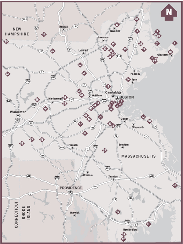
MAP LEGEND

HIKE LIST


DISCLAIMER
This book is meant only as a guide to select trails in the Boston area and does not guarantee hiker safety in any wayyou hike at your own risk. Neither Menasha Ridge Press nor Helen Weatherall is liable for property loss or damage, personal injury, or death that result in any way from accessing or hiking the trails described in the following pages. Please be aware that hikers have been injured in the Boston area. Be especially cautious when walking on or near boulders, steep inclines, and drop-offs, and do not attempt to explore terrain that may be beyond your abilities. To help ensure an uneventful hike, please read carefully the introduction to this book, and perhaps get further safety information and guidance from other sources. Familiarize yourself thoroughly with the areas you intend to visit before venturing out. Ask questions, and prepare for the unforeseen. Familiarize yourself with current weather reports, maps of the area you intend to visit, and any relevant park regulations.
Copyright 2008 by Helen Weatherall
All rights reserved
Printed in the United States of America
Published by Menasha Ridge Press
Distributed by Publishers Group West
First edition, first printing
 | Printed on recycled paper |
Library of Congress Cataloging-in-Publication Data:
Weatherall, Helen.
60 hikes within 60 miles, Boston: including Essex, Middlesex, Suffolk, Norfolk, Plymouth, and Worcester counties/Helen Weatherall.1st ed.
p. cm.
ISBN-13: 978-0-89732-636-0
ISBN-10: 0-89732-636-9
1. HikingMassachusettsBoston RegionGuidebooks. 2. Boston Region (Mass.)Guidebooks. I. Title. II. Title: Sixty hikes with sixty miles, Boston.
GV199.42.M42B67 2008
796.5109744dc22
2007045529
Text and cover design by Steveco International and Scott McGrew
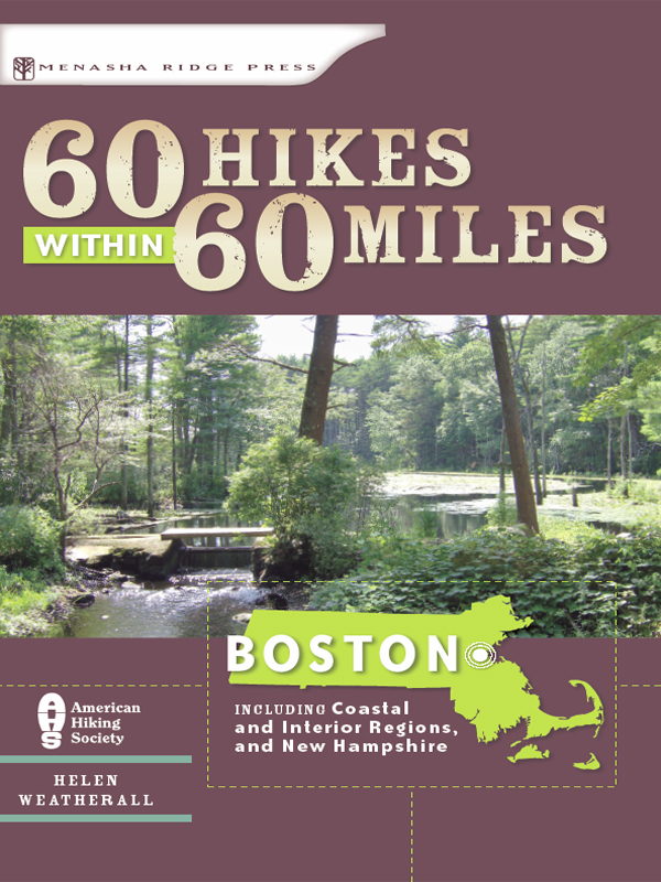
Cover photograph by Helen Weatherall
All other photographs by Helen Weatherall unless otherwise noted.
Author photograph by Flora Wadsworth
Cartography and elevation profiles by Lohnes+Wright, Scott McGrew, and Helen Weatherall
Menasha Ridge Press
P.O. Box 43673
Birmingham, AL 35243
www.menasharidge.com
To my mother, Sally Lunt Weatherall, as true a hero of the
natural world, goodness, and truth as there will ever be.
ACKNOWLEDGMENTS
THIS BOOK and a frighteningly great many of the most wonderful places in Massachusetts likely would not exist as open space if it wasnt for Charles Eliot, landscape architect and founder of the Trustees of Reservations. He did not work alone, but his accomplishments certainly demonstrate the vast difference one inspired individual can make to the betterment of the world. In getting to know each of these 60 hikes, I grew even more aware of the vulnerability of Massachusettss natural places (including state parks!) and both humbled and heartened by the enormous amount of work myriad organizations are doing to preserve them. In the interest of fostering support, I would like to shine a halo of light on all those at the Essex County Greenbelt Association, the Sudbury Valley Trustees, the Dartmouth Natural Resource Trust, the Andover Village Improvement Society (AVIS), the Trust for Public Land, the Charles River Conservancy, the Appalachian Mountain Club, the Audubon Society, Friends of Lynn Woods, Friends of Middlesex Fells, Friends of Hemlock Gorge, Friends of Manchester-Essex Woods, the Waters family of Sutton, everyone behind the Bay Circuit Trail (Eliots baby), the Wapack Trail, the Mid-State Trail, The Trustees of Reservations, and the gutsy, huge-hearted members of every last conservation commission in the state. Gratitude to friends and family who have maintained interest and support helped carry this book to fruition. Thanks to my tremendous brothers, Bobby and Alexander. Thanks, too, to my father, Robert Weatherall (who gave me his strong legs, curiosity, love of trees, and propensity for taking the long scenic route); thanks to my trusty and courageous hiking companion, Katy (my 14-pound terrier who always knows the right way), and with my deepest respect, appreciation, and love, thanks to my husband, Christopher.
HELEN WEATHERALL
FOREWORD
Welcome to Menasha Ridge Presss 60 Hikes within 60 Miles. Our strategy was simple: First, find a hiker who knows the area and loves to hike. Second, ask that person to spend a year researching the most popular and very best trails around. And third, have that person describe each trail in terms of difficulty, scenery, condition, elevation change, and all other categories of information that are important to hikers. Pretend youve just completed a hike and met up with other hikers at the trailhead, we told each author. Imagine their questions, and be clear in your answers.
Youll get more out of this book if you take a moment to read the Introduction explaining how to read the trail listings. The Topographic Maps section will help you understand how useful topos will be on a hike, and will also tell you where to get them. And though this is a where-to, rather than a how-to guide, those of you who have hiked extensively will find the Introduction of particular value. As much for the opportunity to free the spirit as well as to free the body, let these hikes elevate you above the urban hurry.
All the best,
The Editors at Menasha Ridge Press
ABOUT THE AUTHOR

HELEN WEATHERALL is a writer, sculptor and environmentalist who prefers to spend her time outdoors. Having explored wildlands from Mt. Washington to Montana; the Amazon to Sri Lanka, and much in between, Helen recently settled in Ipswich, Massachusetts, where in the company of her husband, cat, and terrier, she is undertaking her first novel.
PREFACE
TODAY, WHEN THE NEW YORK MINUTE is thought slow from Boston to Beijing, and real people spend real cash for virtual homes for their pixel-rendered avatars, the time is right to lace on a reliable pair of walking shoes and head outdoors. The surest way to regain peace and clarity is to winnow down to a pair of legs and turn them loose on an open trail.
As a kid growing up near the town wharf where the Ipswich River turns salty, I had a favorite way to burn up an afternoon: rouse the dog and go out marsh trotting. This pastimeinvented by someone other than meis hiking in one of its messiest and most delightful forms. Explained simply, to marsh trot is to hike from point A to point B, or Q, crossing salt marsh and jumping minnow-filled ditches to do so. Using boulders, tree stumps, and other landmarks to navigate, youre guaranteed by trips end to be mud splattered, half soaked, and joyfully exhausted.

