First published 1987 by KPI Ltd.
Published 2019 by Routledge
2 Park Square, Milton Park, Abingdon, Oxon OX14 4RN
52 Vanderbilt Avenue, New York, NY 10017
Routledge is an imprint of the Taylor & Francis Group, an informa business
Copyright 1987, Gary L. Fitzpatrick
First issued in paperback 2019
All rights reserved. No part of this book may be reprinted or reproduced or utilised in any form or by any electronic, mechanical, or other means, now known or hereafter invented, including photocopying and recording, or in any information storage or retrieval system, without permission in writing from the publishers.
Notice:
Product or corporate names may be trademarks or registered trademarks, and are used only for identification and explanation without intent to infringe.
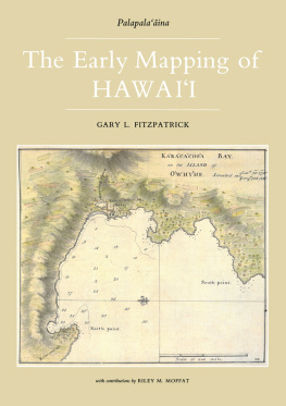
Cover: Kealakekua Bay, Henry Roberts, 1779 (Illus. 6)
Title page: Hawaii, Harrison & Co., 1784 (111. 76)
Endpapers: Stephen Kraft
ISBN 13: 978-1-138-96814-1 (pbk)
ISBN 13: 978-0-7103-0240-3 (hbk)
P ALAPALAINA IS THE TITLE of a projected series of books about the mapping of Hawaii. This first volume, The Early Mapping of Hawaii, covers the initial phase of mapmaking in the islands. The manuscript for the second volume is nearing completion, covering the period roughly from 1870 to 1898.
The Early Mapping of Hawaii is an overview of the history of the mapping of Hawaii from the time of European discovery in 1778 through the mid-19th century. Mapmaking was not an art indigenous to Hawaii; foreigners were responsible for the introduction of mapmaking in the islands. For well over seventy years, mapping in Hawaii was largely carried out by Europeans or Americans, and the early maps of Hawaii were mostly made to serve the needs of those foreigners.
The Early Mapping of Hawaii is not intended to be the definitive work on this subject; many libraries and archivesparticularly those in Europestill need to be scoured thoroughly in the search for important manuscript and printed maps that have escaped notice of those interested in Hawaiian history. Little has been written about the historical maps of Hawaii, so I was faced with multiple tasks: locating the historical maps still in existence, finding information about the maps and the people who made them, organizing this material into a logical arrangement, andfinallydetermining and writing about the themes that explain why and how the maps were made. From the outset it was recognized that at best this book could be used to illustrate the breadth of the cartographic heritage of Hawaii, thereby facilitating and encouraging additional research into this facet of Hawaiian history.
I am indebted to my publisher, Gaylord Wilcox, for making The Early Mapping of Hawaii larger in format, richer in production qualities, and longer than anticipated when the project began. As his interest and involvement in this project grew, a key decision was made that shaped the nature of the book. Originally, this volume was to be a collaborative effort and was to cover the entire history of Hawaiian cartography from 1778 to the present. It became quite apparent, however, that such a large scope meant shortchanging both the historical and current facets of that cartographic history. Consequently, I worked on finishing this volume, while my collaborator, Riley Moffat, concentrated on researching a sequel to this, a volume that will relate the story of the mapping of Hawaii in the second half of the 19th century.
When the decision was made to divide the project, it was apparent that our research had not corresponded precisely to the new responsibilities of each author. Therefore, I have made use of Mr. Moffats research into early charts of Honolulu, Lahaina, and Hilo. He also contributed significantly to this volume by helping sort out the problems, define the themes, and suggest ideas regarding its organization and structure.
The Early Mapping of Hawaii was written with two distinct audiences in mind. Those who live in Hawaii or are interested in the history of the islands constitute the first audience. For those readers, the book is intended to be an introduction to a subject probably somewhat unfamiliar to them. Hawaii has an extremely rich cartographic heritage, and it is hoped this book makes the people of Hawaii aware of that history. The second audience is the growing number of people interested in the history of cartography. This group of map enthusiasts is already familiar with many of the mapmakers and cartographic themes described in this book, so for those readers I have tried to relate the aspects of Hawaiian history, geography, and society that help explain the variety and quality of historic Hawaiian maps.
In writing for two audiences, many discussions of both Hawaiian and cartographic history were necessarily simplified. It should be noted that I did not follow a formula in the treatment of any sections of the book. In some cases the discussion tends to be a recitation of known facts, in other cases I present an analysis of maps, and in still others I relate stories about the people who made the early maps of Hawaii and the circumstances under which the maps were made.
Some subjects are treated in more depth than others. While I tried to develop an overview of the subject, certain aspects of Hawaiian cartographic history seemed to warrant substantially more discussion than others. The more detailed discussions provided an opportunity to show different approaches to the study of historic maps. The mapping of two early explorers, Cook and La Prouse, was used to illustrate the cooperative nature of cartography and show that maps need to be interpreted carefully in light of the abilities, intentions, and resources of the people who made them. The volcanoes of Hawaii have played an important part in the geological sciences in general, so the early mapping of Hawaiian volcanoes has received extensive coverage. The chapter Hawaii in the World is used to develop the concept that since Hawaii does not exist by itself in the world, an examination of Hawaii on regional and world maps is a valid and often illuminating aspect of the cartographic history of the islands.
Very little has been written about historic maps of Hawaii, but many people are interested in and knowledgable about various aspects of the subject. I hope this book stimulates others to commit their expertise to writing and to further investigating the history of themes and individual maps presented here.
As a librarian, I also hope that this book contributes to an increased awareness of the need to provide for the care and preservation of the early maps of Hawaii. The size of maps and the way in which they are used contribute to their deterioration. There is always the possibility that a book such as this opens a Pandoras Box; an increased interest in Hawaiian cartographic history will necessarily increase the use of the older maps, and many of the older maps simply cannot stand up to much additional use. I hope, therefore, that publicizing the rich cartographic heritage of Hawaii will also aid the libraries and archives of Hawaii in obtaining the necessary support for preserving these important documents of Hawaiian history.
Basic References for Information Pertaining to Hawaii
In lieu of specific citations for every piece of factual information, readers are advised that a few major books have been used as basic references. Ralph Kuykendalls three-volume work,
 The Early Mapping of Hawaii


