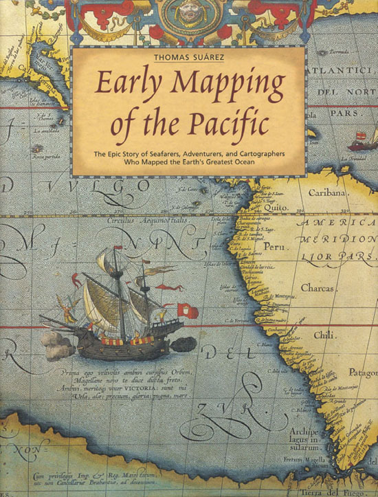
Thomas Suarez - Early Mapping of the Pacific: The Epic Story of Seafarers, Adventurers and Cartographers Who Mapped the Earths Greatest Ocean
Here you can read online Thomas Suarez - Early Mapping of the Pacific: The Epic Story of Seafarers, Adventurers and Cartographers Who Mapped the Earths Greatest Ocean full text of the book (entire story) in english for free. Download pdf and epub, get meaning, cover and reviews about this ebook. year: 2004, publisher: Periplus Editions (HK) ltd., genre: History. Description of the work, (preface) as well as reviews are available. Best literature library LitArk.com created for fans of good reading and offers a wide selection of genres:
Romance novel
Science fiction
Adventure
Detective
Science
History
Home and family
Prose
Art
Politics
Computer
Non-fiction
Religion
Business
Children
Humor
Choose a favorite category and find really read worthwhile books. Enjoy immersion in the world of imagination, feel the emotions of the characters or learn something new for yourself, make an fascinating discovery.

- Book:Early Mapping of the Pacific: The Epic Story of Seafarers, Adventurers and Cartographers Who Mapped the Earths Greatest Ocean
- Author:
- Publisher:Periplus Editions (HK) ltd.
- Genre:
- Year:2004
- Rating:4 / 5
- Favourites:Add to favourites
- Your mark:
Early Mapping of the Pacific: The Epic Story of Seafarers, Adventurers and Cartographers Who Mapped the Earths Greatest Ocean: summary, description and annotation
We offer to read an annotation, description, summary or preface (depends on what the author of the book "Early Mapping of the Pacific: The Epic Story of Seafarers, Adventurers and Cartographers Who Mapped the Earths Greatest Ocean" wrote himself). If you haven't found the necessary information about the book — write in the comments, we will try to find it.
Thomas Suarez: author's other books
Who wrote Early Mapping of the Pacific: The Epic Story of Seafarers, Adventurers and Cartographers Who Mapped the Earths Greatest Ocean? Find out the surname, the name of the author of the book and a list of all author's works by series.


Early Mapping of the Pacific: The Epic Story of Seafarers, Adventurers and Cartographers Who Mapped the Earths Greatest Ocean — read online for free the complete book (whole text) full work
Below is the text of the book, divided by pages. System saving the place of the last page read, allows you to conveniently read the book "Early Mapping of the Pacific: The Epic Story of Seafarers, Adventurers and Cartographers Who Mapped the Earths Greatest Ocean" online for free, without having to search again every time where you left off. Put a bookmark, and you can go to the page where you finished reading at any time.
Font size:
Interval:
Bookmark:
Published by Periplus Editions
with editorial offices at
61 Tai Seng Avenue, #02-12
Singapore 534167
Copyright 2004 Periplus Editions (HK) Ltd
Text 2004 Thomas Surez
All rights reserved
ISBN 9781-462906970 (ebook)
Printed in Singapore
Distributors:
North America, Latin America, and Europe
Tuttle Publishing, 364 Innovation Drive,
North Clarendon, VT 05759 9436, USA
Tel: (802) 773 8930; fax: (802) 773 6993
email:
www.tuttlepublishing.com
Asia Pacific
Berkeley Books Pte. Ltd.
61 Tai Seng Avenue, #02-12
Singapore 534167
Tel: (65) 6280 1330
Fax: (65) 6280 6290
Email:
Web site: www.periplus.com
Japan
Tuttle Publishing Japan
Yaekari Building 3rd Floor, 5412
Osaki Shinagawa-ku, Tokyo 1410032
Tel: 81 (03) 5437 0171
Fax 81 (03) 5437 0755
email:
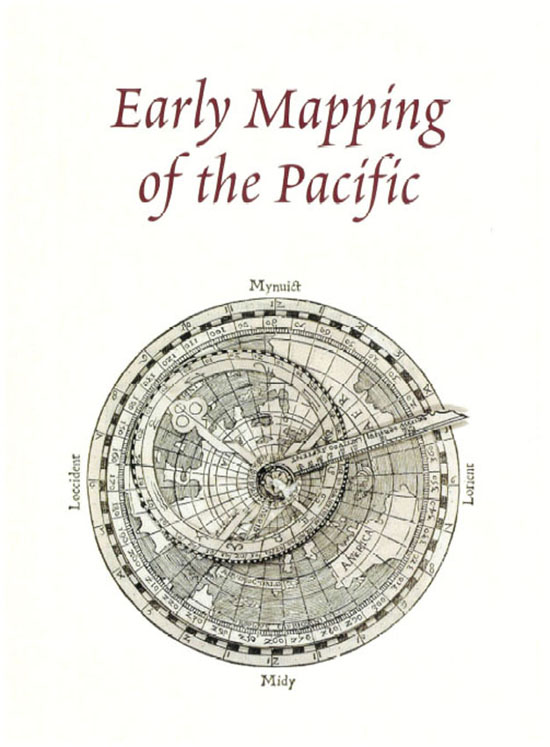
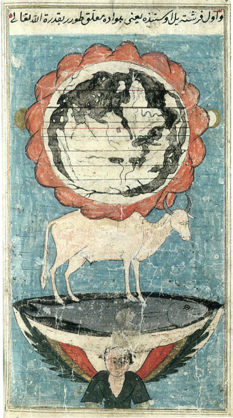
Front endpaper. Fig. 1. World map, Frederic de Wit, 1660 (ca. 1700). [Maryayan Lan, NY] Page 1: Fig. 2. Volvelle on a north polar projection, Peter Apianus, 1524, based on the Waldseemiiller pattern of 1507 (Fig. 28). Apianus's use of a north polar projection allows the Pacific to be mapped unbroken. The landmass labeled "America" is South America; the island above left is Central and North America. The Pacific's only inhabitants are Japan, based on Marco Polo (just left of North America, at 270), and a simple representation of Southeast Asian islands. Page 2: Fig. 3. Islamic World Map, Zekeriya Kazvin, Acaib-l Mahlkat (The Wonders of Creation), Istanbul, ca. 1553. An unusual depiction of the earths seas contained by the encircling mountains of Qaf, the whole resting, via land and sea creatures, in the firmament on an "ocean" in a cosmic vessel. [Library of Congress] Back endpaper: Fig. 223. Physical map of the Pacific by Philippe Buache, 1744 (1754), illustrating his theories about the "grand chain of mountains that traverses eastern Asia and western America." An "inhabited island" lies at virtually the exact position of Hawaii, about 40 west of Baja California and 19 north latitude. Quirs's Marquesas are based on a similar source as later used by Dalrymple (Fig. 130), and Roggeveen's Easter Island (Isle de Pques) lies near Davis's land, which Roggeveen had been searching for when he discovered it. [Antipodean Books].
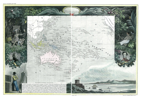
Above: Fig. 4. World map, Jose da Costa Miranda, 1706. [The Mitchell Library, Library of New South Wales, Sydney] Overleaf. Fig. 5. Pacific Ocean, Levasseur, 1838. Pages 8 and 9: Fig. 6. Japan wedged between California and China, with Pacific islands discovered by Bernardo de la Torre in 1543 on the east, and the Liu-ch'iu islands ending at Taiwan (fermosa) on the west (detail), Abraham Ortelius, 1570; Fig. 7. Depiction of the Portuguese in the Indian Ocean, from Linschoten's Itinerario, 1596; Fig. 8. Southeasternmost section of the "Catalan Atlas," a world map attributed to Abraham Cresques, ca. 1375. [From a facsimile in the Library of Congress]; Fig. 9. Polynesian girl, drawing by Alfred Agate of the US Exploring Expedition, ca. 1840. [Naval Historical Foundation]
for my parents, to whom I owe everything
Acknowledgments
My thanks to Rodrigue Levesque for saving me from would-be errors in my coverage of Micronesia; Frank Manasek for guiding me on scientific matters; David and Cathy Lilburne of Antipodean Books for opening their reference library to me; Jared Manasek for translating the old German relating to derives; also David Woodward, Ben Finney, Giinter Schilder, and John Suarez.
Several of the finest dealers in early maps generously allowed me to reproduce items from their collections, and they are acknowledged with the images. Three of these stand out in terms of the sheer greed with which I imposed on them: Robert Augustyn, early map specialist at Martayan Lan Rare Maps and Books, New York; Alan and Charlene Walker of Lahaina Printsellers, Maui; and Paul and Mona Nicholas of Kauai Fine Arts.
The reproduction of maps in institutions would not have been possible without the assistance of specific individuals. At the Library of Congress, Washington, DC, I would like to thank first and foremost the remarkable James Flatness of the Map Division, whose expertise is rivaled only by his generosity; also Tracy Arcaro, Gerald Wager, and David Robinson of the Rare Book Division, and Jeffrey Flannery of the Manuscript Division. My gratitude also to Dr Cornelia Topelmann, Universitatsbibliothek Miinchen; Eliane Perez, Biblioteca Nacional (Rio de Janeiro); Christine Campbell, The British Library; Marijke Bessels, Koninklijke Bibliotheek (The Hague); Barbara Dunn, Hawaiian Historical Society; Janea Milburn, Naval Historical Foundation; Margot Riley, The Mitchell Library, Library of New South Wales, Sydney; Ellen R. Cordes, Beinecke Rare Book and Manuscript Library, Yale University, and Louis A. Hieb, University of Washington Libraries.
Robert Augustyn and Nick Ingleton were instrumental in making possible the publication of my previous book, Early Mapping of Southeast Asia (Periplus Editions, 1999) and without the success of that book, the present volume would never have materialized.
Finally, my thanks to Eric Oey of Periplus Editions, for whom writing has been a pleasure and an honor, and Noor Azlina Yunus, whose editorial expertise helped my work remain organized despite this being utterly alien to my nature.
Chapter 1 The Pacific Islands and Their People
Chapter 2 Mariners, Mapmakers, and the Great Ocean
Chapter 3 The Pacific Evolves after Magellan
Chapter 4 In the Wake of the Solomon Islands
Chapter 5 Earliest Mapping of Australia and New Zealand
Chapter 6 The Age of Enlightenment
Chapter 7 The Three Voyages of James Cook
Chapter 8 The Discovery of Tahiti and Hawaii
Chapter 9 The Eighteenth Century after Cook
Chapter 10 Micronesia, the Elusive Isles
Chapter 11 Surveyors, Whalers, and Missionaries
Imagine thousands of self-sufficient nations, terrestrial microcosms linked not by valleys and rivers, not by deserts or forests, but by seemingly endless, featureless ocean. To the Pacific Islanders, this was the world. Around it, they evolved their civilizations and geographic methods. To Europeans, this ocean was the far side of the earth. An ocean that in maximum breadth spans virtually half the earth's circumference, it baffled mapmakers for four and a half centuries before its surface was laid down with confidence. In its scale, diversity, extremes of climate, and lack of points of reference, the challenges it presented the explorer and mapmaker dwarfed those of any other entity on earth.
Font size:
Interval:
Bookmark:
Similar books «Early Mapping of the Pacific: The Epic Story of Seafarers, Adventurers and Cartographers Who Mapped the Earths Greatest Ocean»
Look at similar books to Early Mapping of the Pacific: The Epic Story of Seafarers, Adventurers and Cartographers Who Mapped the Earths Greatest Ocean. We have selected literature similar in name and meaning in the hope of providing readers with more options to find new, interesting, not yet read works.
Discussion, reviews of the book Early Mapping of the Pacific: The Epic Story of Seafarers, Adventurers and Cartographers Who Mapped the Earths Greatest Ocean and just readers' own opinions. Leave your comments, write what you think about the work, its meaning or the main characters. Specify what exactly you liked and what you didn't like, and why you think so.