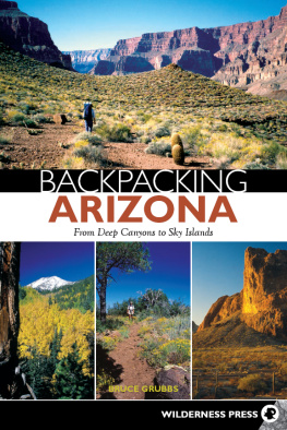
Bruce Grubbs - Hiking Northern Arizona
Here you can read online Bruce Grubbs - Hiking Northern Arizona full text of the book (entire story) in english for free. Download pdf and epub, get meaning, cover and reviews about this ebook. year: 2020, publisher: Falcon Guides, genre: Children. Description of the work, (preface) as well as reviews are available. Best literature library LitArk.com created for fans of good reading and offers a wide selection of genres:
Romance novel
Science fiction
Adventure
Detective
Science
History
Home and family
Prose
Art
Politics
Computer
Non-fiction
Religion
Business
Children
Humor
Choose a favorite category and find really read worthwhile books. Enjoy immersion in the world of imagination, feel the emotions of the characters or learn something new for yourself, make an fascinating discovery.

- Book:Hiking Northern Arizona
- Author:
- Publisher:Falcon Guides
- Genre:
- Year:2020
- Rating:5 / 5
- Favourites:Add to favourites
- Your mark:
Hiking Northern Arizona: summary, description and annotation
We offer to read an annotation, description, summary or preface (depends on what the author of the book "Hiking Northern Arizona" wrote himself). If you haven't found the necessary information about the book — write in the comments, we will try to find it.
Bruce Grubbs: author's other books
Who wrote Hiking Northern Arizona? Find out the surname, the name of the author of the book and a list of all author's works by series.


Hiking Northern Arizona — read online for free the complete book (whole text) full work
Below is the text of the book, divided by pages. System saving the place of the last page read, allows you to conveniently read the book "Hiking Northern Arizona" online for free, without having to search again every time where you left off. Put a bookmark, and you can go to the page where you finished reading at any time.
Font size:
Interval:
Bookmark:
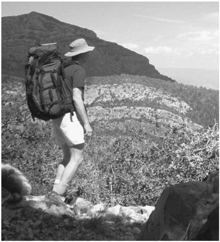
Bruce Grubbs has a serious problemhe doesnt know what he wants to do when he grows up. Meanwhile, hes done such things as wildland fire fighting, running a mountain shop, flying airplanes, shooting photos, and writing books. Hes a backcountry skier, climber, figure skater, mountain biker, amateur radio operator, river runner, and sea kayakerbut the thing that really floats his boat is hiking and backpacking. No matter what else he tries, Bruce always comes back to hikingespecially long, rough, cross-country trips in places like the Grand Canyon. Some people never learn. But what little he has learned, hes willing to share with youvia his books, of course, but also via his websites, blogs, and whatever works. His website is BruceGrubbs.com.
Id like to thank all the USDA Forest Service and other agency personnel who made valuable comments and suggestions. Warm thanks to Duart Martin for encouraging this project, not to mention hiking with me. Thanks to Marvin and Sharon Baur for doing shuttles and hikes. And thanks to all my other hiking companions over the years. It wouldnt have been nearly as much fun without you. Thanks to Emily Chiarelli, Mason Gadd, Jessica dArbonne, and John Burbidge, my editors, for working with me to make this fourth edition the best possible book. And I greatly appreciate the production people at Globe Pequot who turned my rough work into another fine FalconGuide.
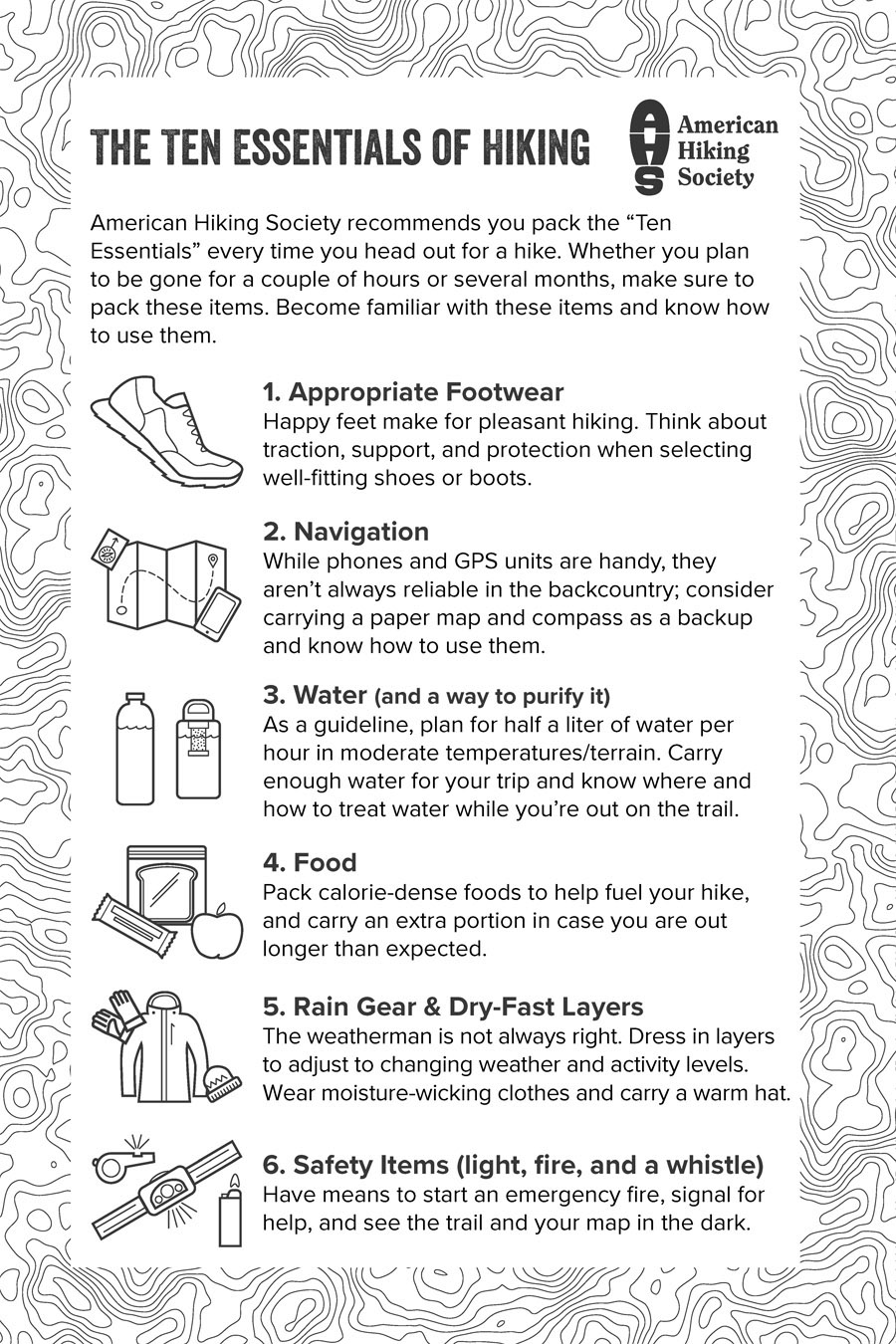
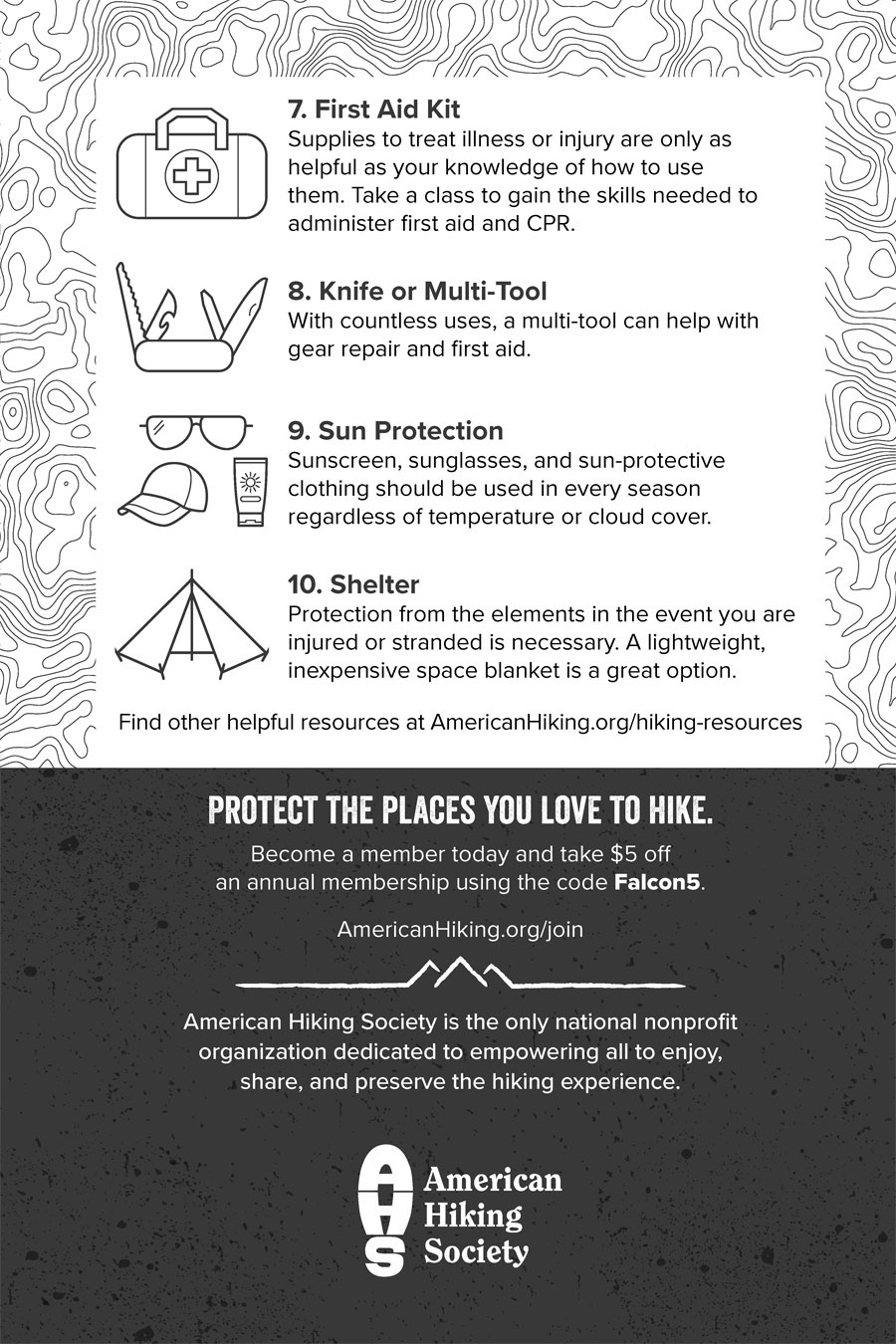
Although you should be able to find any of the hikes with the descriptions and maps for each hike, its still a good idea to carry a detailed topographic map of your hiking area. This can either be a paper map, or a digital map printed at home. Never depend on electronic maps on a device such as a phone or GPS receiver. Electronic devices can fail and the batteries will die anyway. Plus, its much easier to orient yourself on a paper map than on a tiny screen.
The 7.5-minute series of topographic maps published by the US Geological Survey are the most detailed maps available. Each map covers an area of about 7 by 9 miles at a scale of 1:24,000, or 1 inch to 2,000 feet. Computerized methods are used to produce these extremely accurate maps from aerial photography. The sheer number of maps makes it difficult to revise them very often. Trails, roads, and other man-made features may be shown incorrectly. Also, dont rely on springs and permanent streams shown on USGS maps unless you can confirm their presence with a ranger, another experienced outdoor person, or a guidebook. These maps are available as paper copies from outdoor retailers and directly from USGS at https://ngmdb.usgs.gov/topoview/. Using the Topo Viewer, you can look at maps online, order paper copies, and download free digital copies.
Land management agencies and private companies publish maps for certain popular desert wilderness and recreation areas. If available, these are often the best maps for the area, because they show an entire wilderness or park on one map and are updated fairly frequently. Also, local backcountry regulations and guidelines are often shown. The most comprehensive series are the Trails Illustrated maps published by National Geographic.
The US Forest Service and the Bureau of Land Management publish maps of the areas they manage. Although these maps are usually planimetric and therefore dont show terrain features, they are excellent road maps. Back roads are shown as maintained, unmaintained, and four-wheel-drive on most of these maps. Agency road numbers are also shown; national forest road junctions are generally signed with these numbers.
Recreation maps are available as web-based applications and smartphone apps. The best of these have many different map layers to choose from, including USGS topo maps, Trails Illustrated maps, US Forest Service and US National Park Service maps, satellite and aerial imagery, wildfire history, and much more. Trip planning tools let you map out trails, save waypoints for GPS use, and synchronize with your smartphone or upload to a dedicated GPS receiver. My current favorites are CalTopo.com and GaiaGPS.com. Whichever app you use, make sure you can print maps for use on your hike.
Always carry a reliable, liquid-filled compass so that you can determine directions in dense forest or bad weather. Because backcountry navigation in the generally open terrain of northern Arizona consists primarily of map reading, your compass will probably languish in your pack for years before you use it. When you finally do need it, you will need it badlynot a good time to find out that the needle has fallen off.
The satellite navigation system maintained by the Department of Defense makes it possible to find your location nearly anywhere on earth. GPS consists of a set of twenty-one active satellites orbiting 12,000 miles above the earth. Low-cost, portable receivers are available that are designed specifically for ground navigation. The readout shows your position within about 16 feet, or 5 meters. Weather conditions do not affect the accuracy of GPS, but the receiver must have a clear view of the sky. This means that dense forest, narrow canyons, or poor satellite geometry can prevent an accurate fix. A GPS unit is no substitute for a good map and a reliable compass. Keep in mind that the GPS unit is useless if the batteries die: take spares! When buying a unit for hiking, make sure it uses the Universal Transverse Mercator (UTM) coordinate system as well as latitude and longitude. UTM is found on USGS topographic maps and is easier to use than the latitude and longitude system, at least with paper maps. If youre using digital maps on your computer or phone, then either coordinate system works. Any map accurate enough for wilderness navigation will have at least one coordinate system. Be sure that you set the correct datum when using a GPS receiver with paper maps. Most maps use the WGS84 datum, but USGS topo maps use NAD27. Failure to set the correct datum will result in position errors.
Walking in wild country is not just a matter of picking em up and putting em down. Most novice hikers try to go too fast, then find themselves out of breath and having to stop frequently. The group should move at a speed that allows easy conversation among all members. Long hikes, especially uphill sections, should be paced so that rest breaks are needed only about once an hour. Thats not to say that you shouldnt stop at scenic viewpoints or other points of interest. If you find yourself taking a great many breaks, youre probably going too fast. Keep rest stops short so that you dont become chilled. Its harder to get going after a long break.
As you walk, always pay attention to the stretch of ground immediately in front of you. Hazards such as spiny plants, overhanging sharp branches, and sunbathing rattlesnakes are easy to miss if you have eyes only for the scenery. On the other hand, daydreaming is an important part of hiking. There are always sections of trail that arent that interesting. The experienced hiker can let his or her mind wander far away but still pay attention to the trail underfoot and the route ahead. Or he or she can focus on aspects of the environment such as bird song or identifying trees from a distance by their general shape. Either technique lets the miles pass almost unnoticed.
Font size:
Interval:
Bookmark:
Similar books «Hiking Northern Arizona»
Look at similar books to Hiking Northern Arizona. We have selected literature similar in name and meaning in the hope of providing readers with more options to find new, interesting, not yet read works.
Discussion, reviews of the book Hiking Northern Arizona and just readers' own opinions. Leave your comments, write what you think about the work, its meaning or the main characters. Specify what exactly you liked and what you didn't like, and why you think so.