Every effort has been made by the author and editors to make this guide as accurate and useful as possible. However, many things can change after a guide is publishedtrails are rerouted, regulations change, techniques evolve, facilities come under new management, and so on.
We would appreciate your comments concerning your experiences with this guide and how you feel it could be improved and kept up to date. While we may not be able to respond to all comments and suggestions, well take them to heart, and well also make certain to share them with the author. Please send your comments and suggestions to the following address:
P.O. Box 480
To my parents, who taught me to love the outdoors.
Copyright 2008 Morris Book Publishing, LLC
ALL RIGHTS RESERVED. No part of this book may be reproduced or transmitted in any form by any means, electronic or mechanical, including photocopying and recording, or by any information storage and retrieval system, except as may be expressly permitted in writing from the publisher. Requests for permission should be addressed to The Globe Pequot Press, Attn: Rights and Permissions Department, P.O. Box 480, Guilford, CT 06437.
Falcon and FalconGuides are registered trademarks of Morris Book Publishing, LLC.
Interior photos by Bruce Grubbs unless otherwise credited
Compass, p. iii Shutterstock
Text design by Sheryl P. Kober
Maps by Bruce Grubbs Morris Book Publishing, LLC
Library of Congress Cataloging-in-Publication Data
Grubbs, Bruce.
Best hikes near Phoenix / Bruce Grubbs.
p. cm.
ISBN-13: 978-1-4930-0624-3
1. HikingArizonaPhoenix RegionGuidebooks. 2. Phoenix Region (Ariz.)Guidebooks. I. Title.
GV199.42.A72P485 2008
796.510979173dc22
2008016204
The author and The Globe Pequot Press assume no liability for accidents happening to, or injuries sustained by, readers who engage in the activities described in this book.
Contents
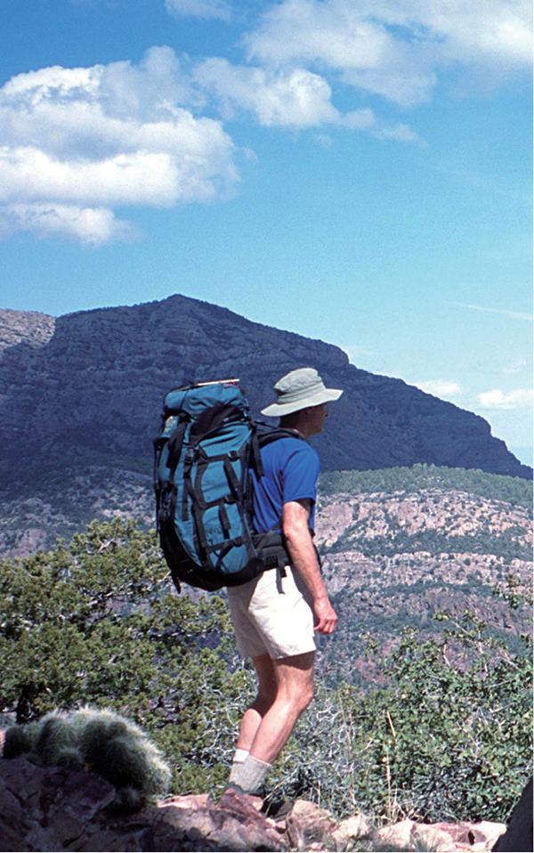
Pausing to take in the view from the Mazatzal Divide Trail ().
Acknowledgments
Thank you to Stewart Aitchison, who graciously allowed me to use some of his trail descriptions. Warm thanks to Duart Martin, who patiently put up with yet another book project. And finally, thanks to my editors at The Globe Pequot PressBill Schneider, Julie Marsh, Carol Kopec, Ann Seifert, and Scott Adams for their patient efforts in making this FalconGuide a reality.
How to Use This Book
Each hike in the book has a number and name. Some trails have more than one common name, and some hikes use more than one trail to complete a loop or otherwise create a more interesting route. In each case, Ive attempted to use either the official trail name or to give the hike a name based on the best-known trail or feature.
Each hike begins with a summary that gives a brief overview of the hike, its attractions, and location.
Start. Often the nearest town or city, this is the approximate starting point for the directions given in the Finding the trailhead description.
Distance. This is the total distance of the hike. It includes the return on an out-and-back or lollipop hike and is a one-way distance for loop hikes. A lollipop hike is one with both an out-and-back section and a loop. None of the hikes in this book require a car shuttle.
Approximate hiking time. This is an average hiking time in hours for day hikes and in days for backpack trips. It is based on the total distance, the elevation gain, the condition of the trail, and the difficulty of cross-country hiking, if any. Fit, fast hikers will be able to do the hikes in less time, and inexperienced or out-of-shape hikers may take considerably more.
Elevation change. This is the approximate elevation gain or loss for the entire hike, including ups and downs. Some out-and-back hikes start from a canyon rim or other high trailhead, so that the first portion of the hike is a descent and the return is uphill.
Difficulty. All hikes are rated as easy, moderate, or strenuous. Although this is necessarily a highly subjective rating, nearly anyone who can walk should be able to do an easy hike that can be completed in a few hours. Moderate hikes are longerup to a full dayand may involve several hundred feet or more of elevation gain and possibly cross-country hiking as well. Experienced hikers will have no problems; beginners should hike with someone more experienced and will have more fun if they are in reasonable shape. Strenuous hikes are very long, requiring a full day of hiking by fit hikers or several days, in the case of backpack trips. The hiking may involve cross-country or faint, rough trails that require good map and compass skills, and the rough terrain may require some rock scrambling. Only fit, experienced hikers should tackle these hikes.
Seasons. This section gives the best seasons for the hike, taking into account such things as winter weather and snow, as well as hot summer weather.
Trail surface. Most trails in the Phoenix region are rocky, so you should expect that. Other trail surface conditions, if known, are described here, including hikes on old roads, on paved trails, and cross-country.
Water. For backpackers, known water sources are described here. Most desert springs and creeks should be considered seasonal, and you should never depend on a single source of water. All water should be purified before using it to drink or cook. Day hikers should carry all the water theyll need.
Other trail users . This is a list of the other trail users you might encounter, primarily including equestrians and mountain bikers.
Land status. The agency managing the land is named here; the management unit, if any, is also given.
Nearest town. This is the nearest town or city for resupply, lodging, restaurants, and other necessities.
Fees and permits. This section describes the fees and permits that are required, as well as unusual rules and regulations.
Maps. Here youll find a list of the US Geological Survey 7.5-minute series topographic maps covering the hikes (except for very short nature trails), as well as specialized maps that may be useful. These may include government national forest or wilderness maps and privately produced maps.
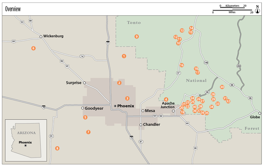
All the hikes are shown on maps included in the book. On the maps, I give GPS coordinates in UTM format for most trailheads as well as occasional critical points. Make certain your GPS is set to the WGS84 datum to avoid errors.
Trail contacts. Look here for the name of the agency or organization responsible for managing the land crossed by the hike. Detailed contact information is listed in the appendix. Its a good idea to call or e-mail the land management agency before your hike to check on road and trail conditions. Where possible, the contact information includes the mailing and street address, phone number, and Web site. E-mail addresses are not included because they often change, but you can usually find them on an agencys Web site under a Contact link. Sometimes Web addresses change as well, but you can find land management units on the Internet with a search engine such as Google.


