If you were asked to define the word satellite, you might describe a man-made, metal machine moving through space. You would be right. However, those are a planet or star. This means that Earth itself is a satellite because it orbits the Sun. The moon is also a satellite because it orbits Earth.
The first man-made satellites were built in the late 1950s. People sent them into space to learn important information about Earth. More than 60 years later, satellites are still being launched for the same reason. Every day, thousands of artificial satellites circle the planet. They take pictures, send data, and keep track of what is happening on Earth. These eyes in space have changed what we know about the world.
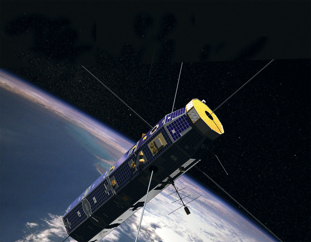
The CINDI-CNOFS satellite is one of the many satellites that the United States has circling Earth.
SPACE FACT:
Saturn has many natural satellites with its 62 moons. Between 2004 and 2017, it also had Cassini. This spacecraft spent years orbiting the planet to gather data about Saturn.
THE SPACE RACE
The first artificial satellite was called in October 1957. It was a silver ball, just 23 inches (58 centimeters) across.
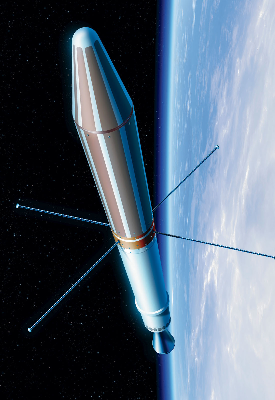
The United States rushed to join the Soviets in what was being called the space race. Both countries wanted to dominate the new territory of outer space. In January 1958, the U.S. sent up its first satellite, the Explorer 1. For years, these two countries focused on launching more complex spacecraft into space. Each satellite brought back more detailed information about Earths atmosphere, as well as what conditions were like in space. Eventually, this information led to human space flight. The National Aeronautics and Space Administration (NASA) worked to get astronauts on the moon. The Soviets built the first space station. It was called Salyut 1. Astronauts lived there and studied outer space.
Explorer 1 was 6.5 feet (2 meters) long and weighed 31 pounds (14 kilograms).
As technology developed, more countries launched satellites. These machines could provide amazing amounts of information. They could track the weather and make long-distance phone calls faster. They could even watch Earths surface for fires or volcanic eruptions. Today thousands of satellites circle Earth.
BUILDING AND LAUNCHING SATELLITES
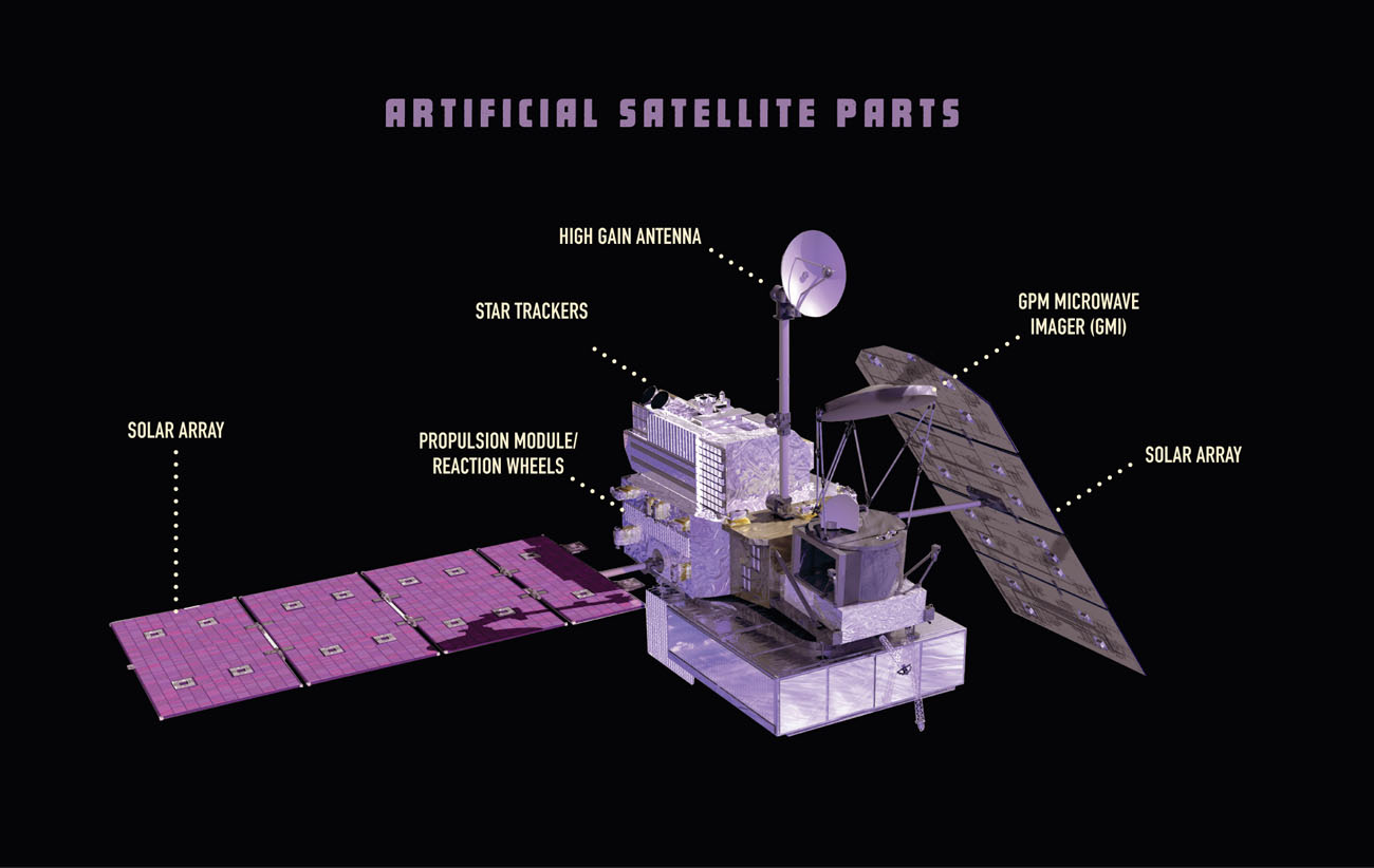
Satellites differ in size and purpose. But they all tend to be made of the same four parts. They have a power system that keeps them running. Most satellites use solar power. Batteries store some of this power to use when the satellite is in darkness. Satellites also all have a way to control their movements and flight. They have equipment to measure or record data such as cameras. Finally, an antenna sends and receives information to and from Earth.
Rockets launch satellites into space. Satellites circle Earth at very high speeds of between 2 and 5 miles (3.2 and 8 kilometers) per second. keeps them in orbit. From Earth, a satellite often looks just like another star. Sunshine reflects off the machines metal and makes it sparkle in the sky. Unlike stars, however, satellites move.
Collision in Space
Space is full of thousands of satellites. Space is so huge that the chance of two objects being in the exact same place at the same time is extremely rare. In 2009, however, a U.S. satellite hit a Russian satellite at 26,000 miles (41,843 km) per hour. Both were destroyed and broke into thousands of pieces. Many of the pieces burned up in Earths atmosphere. Hundreds more are still floating in space.
CHAPTER TWO
SATELLITES TO THE RESCUE
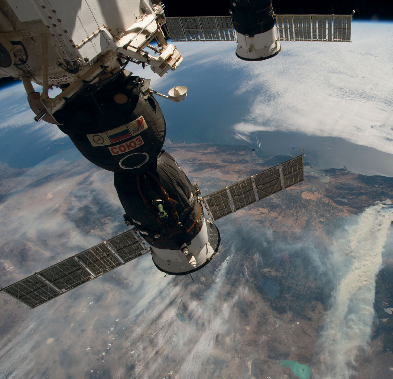
On August 3, 2018, astronaut Alexander Gerst looked down at Earth from the International Space Station (ISS). He was amazed at what he saw. Below him, he could see that much of California was on fire!
In natural disasters such as Californias wildfires, satellites are incredibly helpful. The pictures they take provide images of where fires are raging. They also help experts predict where they will likely spread.
Today satellite images can help first responders in all kinds of emergency situations. First responders and search-and-rescue workers rely on satellites to find people who need help. They use satellite imagery to see what is happening at the scene of disasters. They also use satellites to track where 911 emergency calls are coming from.
The International Satellite System for Search and Rescue relies on a system of distress emergency beacons linked to satellites. Airplanes or ships can activate these beacons. Hikers can carry these beacons in case they get lost or injured. On average, this agency rescues five people a day.
Giant plumes of smoke from the 2018 California wildfires were easily viewable from the ISS.
AN INTERNATIONAL EFFORT
In 2000, the .
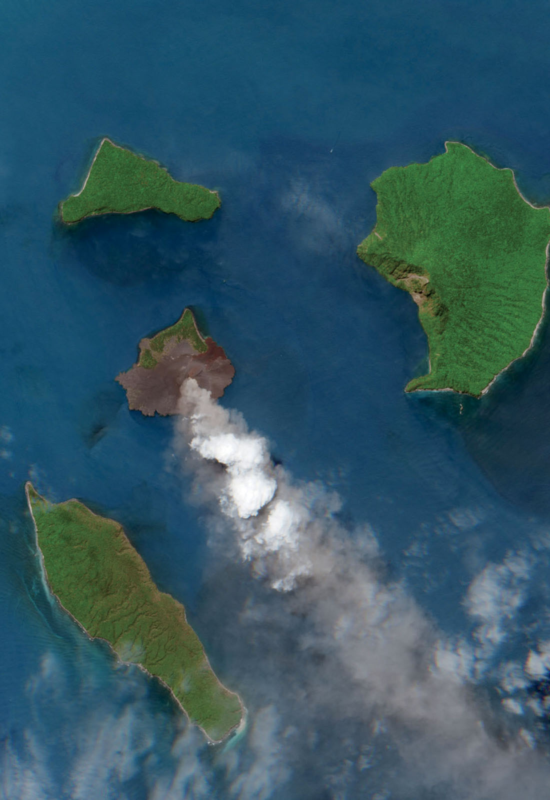
The European Space Agencys Sentinel 2 satellite tracked the activity of the Indonesian volcano Anak Krakatau in June 2018.
Mapping the Ocean Floor
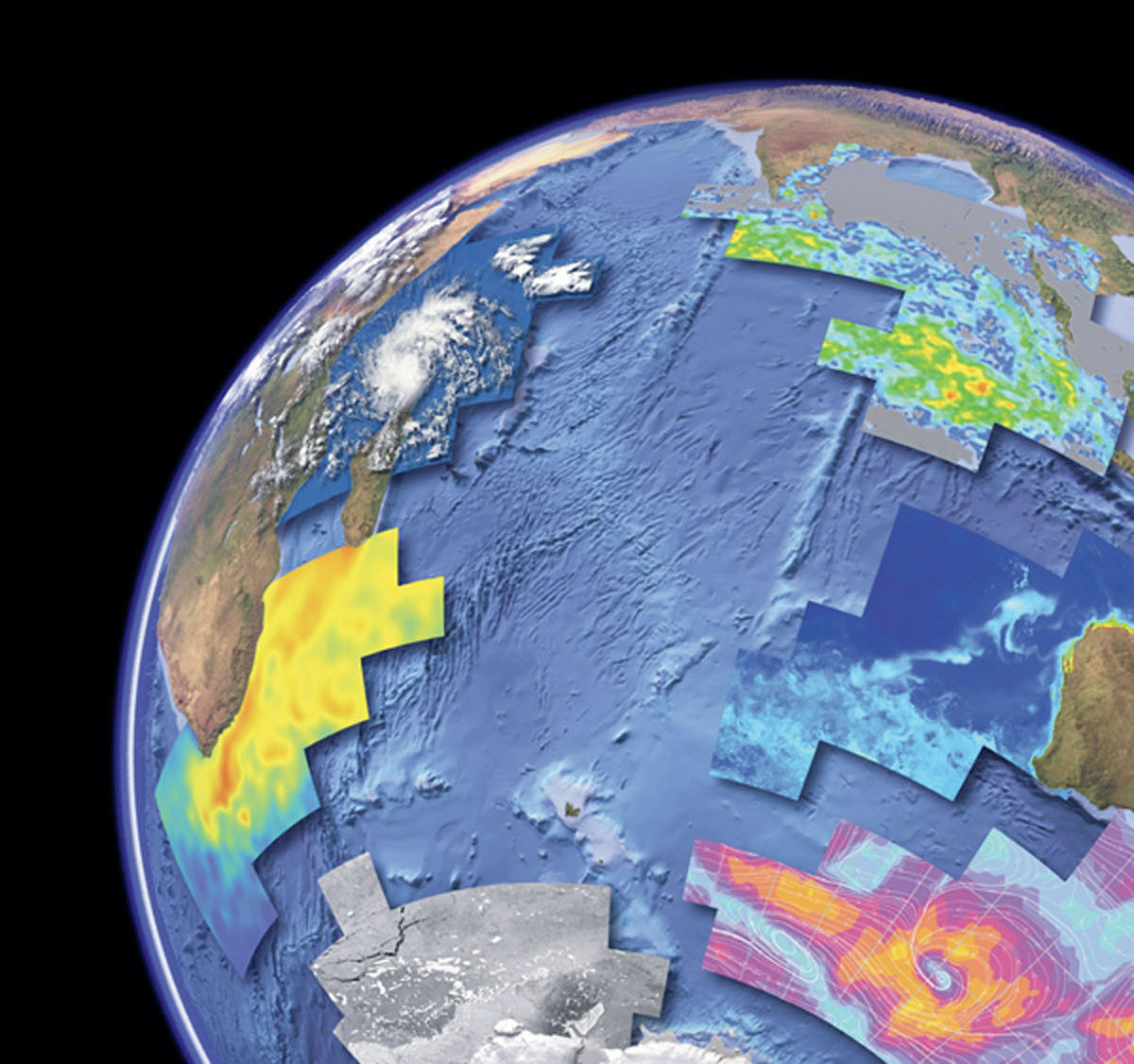
Today more is known about the geography of the moon and Mars than the ocean floor. But satellites could change that. Currently satellites provide scientists with information about possible tsunamis. As satellite technology improves, humans will have access to even more detailed data. In the future, scientists may be able to use satellites to create detailed maps of each ocean. Spotting shipwrecks, trenches, and underwater volcanoes would be much easier.
This image shows the different types of data that satellites can collect. They include underwater land formations (center), ice cover (bottom left), sea surface temperature (center left), cloud cover (top left), rainfall levels (top right), plant life (center right), and wind speed (bottom right).
TRACKING POSSIBLE RISKS
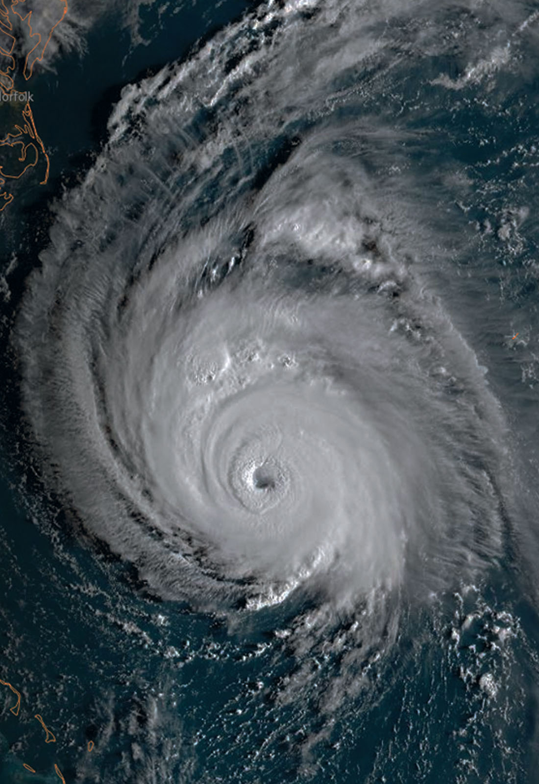
Satellites dont just help during disasters. They can also help people prepare for them. Currently, satellites use data about rainfall to pinpoint areas most at risk for floods or landslides. By tracking a storm might make landfall. This is where the storm would be most threatening to peoples safety.
The GOES East satellite tracked Hurricane Florence as it was about to make landfall along the United States East Coast on September 13, 2018.

