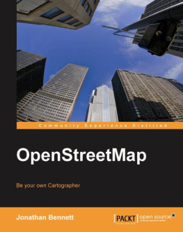
Bennett - OpenStreetMap: be your own cartographer
Here you can read online Bennett - OpenStreetMap: be your own cartographer full text of the book (entire story) in english for free. Download pdf and epub, get meaning, cover and reviews about this ebook. City: Birmingham, U.K, year: 2010, publisher: Packt Publishing Ltd, genre: Computer. Description of the work, (preface) as well as reviews are available. Best literature library LitArk.com created for fans of good reading and offers a wide selection of genres:
Romance novel
Science fiction
Adventure
Detective
Science
History
Home and family
Prose
Art
Politics
Computer
Non-fiction
Religion
Business
Children
Humor
Choose a favorite category and find really read worthwhile books. Enjoy immersion in the world of imagination, feel the emotions of the characters or learn something new for yourself, make an fascinating discovery.
OpenStreetMap: be your own cartographer: summary, description and annotation
We offer to read an annotation, description, summary or preface (depends on what the author of the book "OpenStreetMap: be your own cartographer" wrote himself). If you haven't found the necessary information about the book — write in the comments, we will try to find it.
Bennett: author's other books
Who wrote OpenStreetMap: be your own cartographer? Find out the surname, the name of the author of the book and a list of all author's works by series.
OpenStreetMap: be your own cartographer — read online for free the complete book (whole text) full work
Below is the text of the book, divided by pages. System saving the place of the last page read, allows you to conveniently read the book "OpenStreetMap: be your own cartographer" online for free, without having to search again every time where you left off. Put a bookmark, and you can go to the page where you finished reading at any time.
Font size:
Interval:
Bookmark:
Copyright 2010 Packt Publishing
All rights reserved. No part of this book may be reproduced, stored in a retrieval system, or transmitted in any form or by any means, without the prior written permission of the publisher, except in the case of brief quotations embedded in critical articles or reviews.
Every effort has been made in the preparation of this book to ensure the accuracy of the information presented. However, the information contained in this book is sold without warranty, either express or implied. Neither the author, nor Packt Publishing, and its dealers and distributors will be held liable for any damages caused or alleged to be caused directly or indirectly by this book.
Packt Publishing has endeavored to provide trademark information about all of the companies and products mentioned in this book by the appropriate use of capitals. However, Packt Publishing cannot guarantee the accuracy of this information.
First published: September 2010
Production Reference: 1170910
Published by Packt Publishing Ltd. 32 Lincoln Road Olton Birmingham, B27 6PA, UK.
ISBN 978-1-847197-50-4
www.packtpub.com
Cover Image by Faiz Fattohi (<> )
Author
Jonathan Bennett
Reviewers
Steve Coast
Richard Fairhurst
Acquisition Editor
Sarah Cullington
Development Editor
Chaitanya Apte
Technical Editor
Roger D'souza
Copy Editor
Neha Shetty
Indexer
Tejal Daruwale
Editorial Team Leader
Mithun Sehgal
Project Team Leader
Priya Mukherji
Project Coordinator
Prasad Rai
Proofreader
Clyde Jenkins
Production Coordinator
Aparna Bhagat
Cover Work
Aparna Bhagat
Jonathan Bennett is a British journalist, writer, and developer. He has been involved in the OpenStreetMap project since 2006, and is a member of the OpenStreetMap Foundation. He has written for print and online technical publications including PC Magazine, ZDNet, CNET, and has appeared on television and radio as a technology commentator. He has an extensive collection of out-of-date printed maps.
To Katie, Matthew, Joseph and Rosie. Thank you for putting up with the little excursion every journey with me involves.
I would like to thank Steve Coast, Richard Fairhurst, Andy "Gravitystorm" Allan, Grant "Firefishy" Slater, Tom Hughes, and Matt "Zerebubuth" Amos for help while writing this book, and anyone who's ever added something to OpenStreetMap, from a single postbox to entire road networks.
Steve Coast has worked in a variety of heavy lifting computing applications, from computational geometry to artificial life, and mapping applications. Steve lives in Denver, Colorado, and enjoys hangliding, Mongolian throat singing, and soccer.
As founder of OpenStreetMap, the free wiki world map, Steve undertakes a wide variety of roles within the project, from creating the API to his many public speaking appearances around the world. Steve is also chairman of the OpenStreetMap Foundation, a not-for-profit that supports and guides the project.
I'd like to thank the thousands of OpenStreetMap contributors around the world for making the best map possible.
Richard Fairhurst is a journalist, cartographer, and programmer who has been involved with OpenStreetMap since the very first days of the project. He is best known for the Potlatch online map editor, but his favorite OSM activity is strapping a GPS to the handlebars of his trusty hybrid bike and going out to map a National Cycle Network route.
His day job is editing Waterways World magazine. In his spare time, as well as mapping, he is a volunteer Sustrans cycle ranger and plays the church organ. He lives in a small Oxfordshire town, which is reputed to have the highest concentration of OSM users anywhere in the world.
This book will allow you to take control of your own maps and use them smoothly. This book introduces the reader to the OpenStreetMap project and shows you how to participate in the project, and make use of the data it provides. No prior knowledge of the project is assumed, and technical details are kept to a minimum.
, Making a Free, Editable Map of the World explains how and why the project was started, how freely redistributable geographic data is different from maps that are merely free of charge to use, and some of the things the project has already achieved.
, Getting Started at openstreetmap.org covers the main features of openstreetmap.org and how to create and personalize an account on it. It explains how to use the documentation in the OpenStreetMap wiki, and how to communicate with the OpenStreetMap community.
, Gathering Data using GPS looks at the tools and techniques used by the OpenStreetMap community to gather data using GPS and upload it to the website. It also explains some basic surveying techniques.
, How OpenStreetMap Records Geographical Features covers the types of data you can record, such as nodes, ways, and relations. It also looks at the tagging system and how the community uses and manages it.
, OpenStreetMap's Editing Applications looks at the basic operation of OpenStreetMap's three most popular editors, including Potlatch, JOSM, and Merkaartor.
, Mapping and Editing Techniques explains how to draw features based on GPS traces, how to tag them, and how to find tags that mappers have used, but not documented.
, Checking OpenStreetMap Data for Problems explains how to find the cause of any problems you're having with OpenStreetMap data using the data inspection tools on openstreetmap.org, the NoName layer, ITOWorld OSM Mapper, and Geofabrik's OSM Inspector.
, Producing Customised Maps explains how to create maps using the standard renderings on openstreetmap.org, using a standalone rendering application for Windows and Kosmos, and in Scalable Vector Graphics (SVG) format using Osmarender.
, Getting Raw OpenStreetMap Data discusses ways of accessing the data in the OpenStreetMap database, such as Planet files, the main OpenStreetMap API, and the Extended API (XAPI).
, Manipulating OpenStreetMap Data using Osmosis looks at a tool that is used heavily within OpenStreetMap to manipulate data from planet files or extracts, or databases containing OpenStreetMap data, called Osmosis.
, OpenStreetMap's Future explains some of the changes being developed by the coders and mappers working on OSM, and how they'll affect users of the data.
This book would be the perfect aid for geographic-information professionals interested in using this data in their work, and web designers and developers who want to include mapping in their sites, and want a distinctive style. This book is for you if you have a need to use maps and geographic data for work or leisure, and want accurate, up-to-date maps showing the information you're interested in, without details you don't need. If you want to use maps for navigation, and want more or less detail than traditional printed maps give, this book would be perfect for you.
In this book, you will find a number of styles of text that distinguish between different kinds of information. Here are some examples of these styles, and an explanation of their meaning.
Font size:
Interval:
Bookmark:
Similar books «OpenStreetMap: be your own cartographer»
Look at similar books to OpenStreetMap: be your own cartographer. We have selected literature similar in name and meaning in the hope of providing readers with more options to find new, interesting, not yet read works.
Discussion, reviews of the book OpenStreetMap: be your own cartographer and just readers' own opinions. Leave your comments, write what you think about the work, its meaning or the main characters. Specify what exactly you liked and what you didn't like, and why you think so.

