Using Google Earth in Libraries
Practical Guides for Librarians
 About the Series
This innovative series written and edited for librarians by librarians provides authoritative, practical information and guidance on a wide spectrum of library processes and operations.
Books in the series are focused, describing practical and innovative solutions to a problem facing todays librarian and delivering step-by-step guidance for planning, creating, implementing, managing, and evaluating a wide range of services and programs.
The books are aimed at beginning and intermediate librarians needing basic instruction/guidance in a specific subject and at experienced librarians who need to gain knowledge in a new area or guidance in implementing a new program/service.
 About the Series Editor
The Practical Guides for Librarians series was conceived by and is edited by M. Sandra Wood, MLS, MBA, AHIP, FMLA, Librarian Emerita, Penn State University Libraries.
M. Sandra Wood was a librarian at the George T. Harrell Library, The Milton S. Hershey Medical Center, College of Medicine, Pennsylvania State University, Hershey, PA, for over 35 years, specializing in reference, educational, and database services. Ms. Wood worked for several years as a Development Editor for Neal-Schuman Publishers.
Ms. Wood received a MLS from Indiana University and a MBA from the University of Maryland. She is a Fellow of the Medical Library Association and served as a member of MLAs Board of Directors from 1991 to 1995. Ms. Wood is founding and current editor of Medical Reference Services Quarterly , now in its 35th volume. She also was founding editor of the Journal of Consumer Health on the Internet and the Journal of Electronic Resources in Medical Libraries and served as editor/co-editor of both journals through 2011.
Titles in the Series
- How to Teach: A Practical Guide for Librarians by Beverley E. Crane
- Implementing an Inclusive Staffing Model for Todays Reference Services by Julia K. Nims, Paula Storm, and Robert Stevens
- Managing Digital Audiovisual Resources: A Practical Guide for Librarians by Matthew C. Mariner
- Outsourcing Technology: A Practical Guide for Librarians by Robin Hastings
- Making the Library Accessible for All: A Practical Guide for Librarians by Jane Vincent
- Discovering and Using Historical Geographical Resources on the Web: A Practical Guide for Librarians by Eva H. Dodsworth and L. W. Lalibert
- Digitization and Digital Archiving: A Practical Guide for Librarians by Elizabeth R. Leggett
- Makerspaces: A Practical Guide for Librarians by John J. Burke
- Implementing Web-Scale Discovery Services: A Practical Guide for Librarians by JoLinda Thompson
- Using iPhones and iPads: A Practical Guide for Librarians by Matthew Connolly and Tony Cosgrave
- Usability Testing: A Practical Guide for Librarians by Rebecca Blakiston
- Mobile Devices: A Practical Guide for Librarians by Ben Rawlins
- Going Beyond Loaning Books to Loaning Technologies: A Practical Guide for Librarians by Janelle Sander, Lori S. Mestre, and Eric Kurt
- Childrens Services Today: A Practical Guide for Librarians by Jeanette Larson
- Genealogy: A Practical Guide for Librarians by Katherine Pennavaria
- Collection Evaluation in Academic Libraries: A Practical Guide for Librarians by Karen C. Kohn
- Creating Tutorials: A Practical Guide for Librarians by Hannah Gascho Rempel and Maribeth Slebodnik
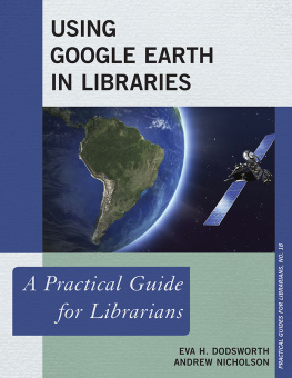
- Using Google Earth in Libraries: A Practical Guide for Librarians by Eva H. Dodsworth and Andrew Nicholson
Using Google Earth in Libraries
A Practical Guide for Librarians
By Eva H. Dodsworth and Andrew Nicholson
Practical Guides for Librarians, No. 18
ROWMAN & LITTLEFIELD
Lanham Boulder New York London
Published by Rowman & Littlefield
A wholly owned subsidiary of The Rowman & Littlefield Publishing Group, Inc.
4501 Forbes Boulevard, Suite 200, Lanham, Maryland 20706
www.rowman.com
Unit A, Whitacre Mews, 26-34 Stannary Street, London SE11 4AB
Copyright 2015 by Rowman & Littlefield
All rights reserved . No part of this book may be reproduced in any form or by any electronic or mechanical means, including information storage and retrieval systems, without written permission from the publisher, except by a reviewer who may quote passages in a review.
British Library Cataloguing in Publication Information Available
Library of Congress Cataloging-in-Publication Data
Dodsworth, Eva, 1976
Using Google Earth in libraries : a practical guide for librarians / Eva Dodsworth, Andrew Nicholson.
pages cm. (Practical guides for librarians ; no. 18)
Includes bibliographical references and index.
ISBN 978-1-4422-5503-6 (cloth : alk. paper) ISBN 978-1-4422-5504-3 (pbk. : alk. paper) ISBN 978-1-4422-5505-0 (ebook) 1. Information storage and retrieval systemsGeography. 2. Google Earth. 3. Geographic information systems. I. Nicholson, Andrew, 1970 II. Title.
Z699.5.G38D63 2015
910.285dc23 2015016789
 The paper used in this publication meets the minimum requirements of American National Standard for Information SciencesPermanence of Paper for Printed Library Materials, ANSI/NISO Z39.48-1992.
Printed in the United States of America
Preface
June 2015 marked the tenth anniversary of Google Earth. Over the last decade since it was launched to the public as a free downloadable application, Google Earth has completely changed the way people use maps and geographical information. Today, Google Earth is so ubiquitous, it is difficult to imagine a time when there wasnt a mapping application to rely on for reference and research.
Prior to the 2005 launch of Google Earth, the world of online mapping was still very new terrain. Paper maps for tourism and recreation purposes were still the dominant format. Talk of electronic maps focused on those available on CD-ROM which were clunky to use, expensive, and not practical for the driver or hiker needing the information at their fingertips. On the Internet, MapQuest had been around for nine years and was seen by many as the go to source for online mapping, but had limited capabilities beyond providing routes, hotels, and restaurant information. It also didnt have satellite imagery and offered limited coverage outside of North America.
The launch of Google Earth (and its sister app Google Maps) would change all this by providing maps and satellite views of every part of the globe. For the first time, people could see in an easy-to-use, digital way, just how geographically connected everyone is. For example, Google Earth would provide the world with a virtual globe complete with clear satellite imagery and a host of embedded datasets containing geographical information from several categories including current issues, scientific research, historical maps, tourism and traffic data, and so much more. Google Earth will build on this success with the addition of its Street View imagery, allowing people to see for themselves complete streetscapes of their own cities, but also strange and exotic places that they had only imagined visiting before. Further enhancing the user experience of Google Earth is its interactive functionality, including its map making and mashup capabilities that would set Google Earth apart from other online mapping apps both before its launch and even since then. Arguably, it can be said that Google Earth has been one of the defining web tools of the past ten years for its ability to visualize user-created maps with real world data and then share it easily with whomever was interested.
Next page


 About the Series
 The paper used in this publication meets the minimum requirements of American National Standard for Information SciencesPermanence of Paper for Printed Library Materials, ANSI/NISO Z39.48-1992.