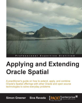
Greener Simon - Applying and extending Oracle Spatial
Here you can read online Greener Simon - Applying and extending Oracle Spatial full text of the book (entire story) in english for free. Download pdf and epub, get meaning, cover and reviews about this ebook. City: Birmingham, UK, year: 2013, publisher: Packt Publishing, genre: Computer. Description of the work, (preface) as well as reviews are available. Best literature library LitArk.com created for fans of good reading and offers a wide selection of genres:
Romance novel
Science fiction
Adventure
Detective
Science
History
Home and family
Prose
Art
Politics
Computer
Non-fiction
Religion
Business
Children
Humor
Choose a favorite category and find really read worthwhile books. Enjoy immersion in the world of imagination, feel the emotions of the characters or learn something new for yourself, make an fascinating discovery.
- Book:Applying and extending Oracle Spatial
- Author:
- Publisher:Packt Publishing
- Genre:
- Year:2013
- City:Birmingham, UK
- Rating:5 / 5
- Favourites:Add to favourites
- Your mark:
- 100
- 1
- 2
- 3
- 4
- 5
Applying and extending Oracle Spatial: summary, description and annotation
We offer to read an annotation, description, summary or preface (depends on what the author of the book "Applying and extending Oracle Spatial" wrote himself). If you haven't found the necessary information about the book — write in the comments, we will try to find it.
Applying and extending Oracle Spatial — read online for free the complete book (whole text) full work
Below is the text of the book, divided by pages. System saving the place of the last page read, allows you to conveniently read the book "Applying and extending Oracle Spatial" online for free, without having to search again every time where you left off. Put a bookmark, and you can go to the page where you finished reading at any time.
Font size:
Interval:
Bookmark:
Copyright 2013 Packt Publishing
All rights reserved. No part of this book may be reproduced, stored in a retrieval system, or transmitted in any form or by any means, without the prior written permission of the publisher, except in the case of brief quotations embedded in critical articles or reviews.
Every effort has been made in the preparation of this book to ensure the accuracy of the information presented. However, the information contained in this book is sold without warranty, either express or implied. Neither the authors, nor Packt Publishing, and its dealers and distributors will be held liable for any damages caused or alleged to be caused directly or indirectly by this book.
Packt Publishing has endeavored to provide trademark information about all of the companies and products mentioned in this book by the appropriate use of capitals. However, Packt Publishing cannot guarantee the accuracy of this information.
First published: September 2013
Production Reference: 1210913
Published by Packt Publishing Ltd.
Livery Place
35 Livery Street
Birmingham B3 2PB, UK.
ISBN 978-1-84968-636-5
www.packtpub.com
Cover Image by Aashish Variava (aashishvariava@hotmail.com)
Authors
Simon Greener
Siva Ravada
Reviewers
Paul Thomas Dziemiela
Jan Espenlaub
John O'Toole
Brendan Soustal
Acquisition Editors
Pramila Balan
Rukhsana Khambatta
Lead Technical Editor
Dayan Hyames
Technical Editors
Shashank Desai
Dylan Fernandes
Krishnaveni Haridas
Ankita Thakur
Project Coordinators
Anurag Banerjee
Shiksha Chaturvedi
Proofreaders
Maria Gould
Ameesha Green
Paul Hindle
Indexers
Mariammal Chettiyar
Rekha Nair
Tejal R. Soni
Graphics
Sheetal Aute
Valentina D'silva
Disha Haria
Yuvraj Mannari
Production Coordinator
Conidon Miranda
Cover Work
Conidon Miranda
Simon Greener has university qualifications in geomatics, computing science, database technologies, and project management.
He started his working career with mining and surveying experience. He then found his calling as a computer scientist with his first job as a database programmer on IBM mainframes for Telstra. He switched to GIS three years later through working in a multi-disciplinary GIS research team at Telecom's Research Laboratories (TRL) in Clayton, Victoria. While at TRL, he worked on projects whose outcome saw the creation of what is now Telstra's Sensis group.
After leaving TRL, he worked as a lecturer and consultant for CenSIS (University of Tasmania) under Professor Peter Zwart, writing student and technical training courses. While there, he continued to consult to Telstra's Directory Services and Mobile groups. It was here that he came in contact with the Spatial DataBase Engine (SDBE) from Geographic Technologies Incorporated (GTI) and saw its potential for the management of large scale spatial databases within relational database technologies, a merging of his IT and GIS worlds. This led to the foundation of Salamanca Software Pvt Ltd (SalSoft), for which he was a Director until it was purchased by ESRI Australia in 1996.
Some notable achievements while at SalSoft included helping brokers with the sale of SDBE to ESRI Inc (now ArcSDE), winning the first ArcSDE sale to Telstra to power its White pages/Yellow pages mapping portal, co-authoring a geocoding specification for Spatial Decision Systems (now Sensis), consulting for Geographic Technologies Australia on numerous projects based on Universal Press street directory data, and the creation of GeoCASE/Blueprint, the world's first data modeling tool that enabled the modeling of spatial data and relationships.
In 1997, he was appointed GIS Manager for Forestry Tasmania (FT) in Hobart, Tasmania. While at FT, he architected the complete revamp of FT's GIS systems using Oracle Spatial (being one of the earliest adopters of the Sdo_Geometry implementation) as the core data management technology. He was concentrating on embedding geospatial data and processing within business systems via a value-oriented, business-centric computing model. He designed and built numerous systems during those years, the best of which was MapComposer, a three-click web-enabled business map production system that, when he left in 2005, had grown (2000-) to over 320 online uses, producing over 50,000 maps a year from a repository of over 100 different map templates (still in operation in 2013). His years at FT concluded with the writing of a GIS Strategy that saw the use of GIS increase yet the cost of the technology to the organization decrease.
He left FT in September 2005 for the precarious world of self-employment. He was a sometime copyist for Directions Magazine. As a subcontractor to a Spatial distributor in Australia, he wrote a Radius Topology training course and provided Radius Topology and Oracle Spatial consulting services for them at numerous customer sites until May 2006. From May to August 2006, he was engaged by Spatial, Cambridge, UK, under a UK Government Department of Trade and Industry's GlobalWatch program to conduct research and development in relation to enhancing the export potential of their latest product, Radius Studio (this resulted in Radius Studio being integrated with Feature Data Objects FDO technology to extend its data access capabilities).
In his consulting career, he has written a spatial strategy document and conducted a database performance analysis review for a large Tasmanian Government department. He has conducted a number of Oracle spatial database best practice, tender and system, and return on investment reviews at a number of Victorian Government departments. He wrote and delivered a user requirements document for Enterprise GIS at a large Australian corporation. He also provided guidance and implementation services to an ambulance service helping integrate Oracle Spatial into a data warehouse project that used Oracle Portal, Discoverer, and Data Warehouse Builder. He delivered many solutions for a NSW water authority; and finally, he successfully completed many migration, publication, return on investment, process improvement, and database design contracts for a number of Canberra-based Federal Government departments. Simon makes available a collection of PL/SQL and Java-based sample solutions for the Oracle database via his website. He is also principal programmer for the SQL Developer spatial extension, GeoRaptor. Finally, he was awarded, the 2011 Oracle Spatial Excellence Award for Education and Research by Oracle.
His technical areas of expertise include systems design and architecture (spatial and attribute), data management, and modeling in both the OLTP and OLAP spaces, and he is also an evangelist for O-RDMS-based spatial data. He is available for free-lance geospatial solutions architecture work, Java and PL/SQL programming, and he provides Oracle Spatial benchmarking and performance enhancement services.
His non-technical interests are his family, friends, walking, reading, singing, and motorcycle riding.
I would particularly like to acknowledge those who have helped in many ways that are required to coax a person through the difficult gestation of a new book. The first, of course, is my wife, Anna. Her quiet and unshakable support, through what was also a financially difficult period of time, is something that I, as a man, husband, and father, am deeply thankful for and immensely proud of. Ti Amo, Cara. To my co-author, Siva Ravada, for kindly stepping in to help me write this book when I felt writing the whole book was beyond my resources. The colleagues that I would particularly like to thank include John O'Toole (Spatial Ireland), who has been an amazing source of inspiration and a fantastic sounding board for all things Oracle Spatial and its application for many years. Brendan Soustal, for his support and belief provided over all my consulting years. Martin Davis, JTS architect and chief programmer, for helping with the chapter on Java in the database. I would also like to thank Holger Lbe, who started helping me programming GeoRaptor, for without his help, the Java chapter would never have eventuated. I would also like to thank Jody Garnett for helping me with GeoTools over the years, and thank you to all those who read my meager blog posts or have downloaded my PL/SQL and Java solutions from my website. Your actions confirmed for me that this book was worth writing. Finally, to the reviewers, both official and private, thank you for all your efforts and help.
Font size:
Interval:
Bookmark:
Similar books «Applying and extending Oracle Spatial»
Look at similar books to Applying and extending Oracle Spatial. We have selected literature similar in name and meaning in the hope of providing readers with more options to find new, interesting, not yet read works.
Discussion, reviews of the book Applying and extending Oracle Spatial and just readers' own opinions. Leave your comments, write what you think about the work, its meaning or the main characters. Specify what exactly you liked and what you didn't like, and why you think so.

