GRAHAM ROBB
THE DEBATABLE LAND
The Lost World Between Scotland and England
PICADOR
T O G ILL C OLERIDGE
AND IN AFFECTIONATE MEMORY OF
D EBORAH R OGERS AND D AVID M ILLER
Contents
List of Illustrations
S ECTION O NE
S ECTION T WO
List of Figures
The four Border counties in the early twenty-first century.
Ptolemys coordinates for the British Isles as plotted in Joan Blaeus atlas of Scotland (1654).
Determining the correct graticule for Ptolemys coordinates.
Places in Ptolemys atlas of the British Isles shown on a modern map.
The towns of the Damnonii, Selgovae and Votadini in relation to the Debatable Land.
The Anglo-Scottish border and the Marches (inset: The Debatable Land).
Surnames of the West Marches and the Debatable Land.
Marriages in and around the Debatable Land and Liddesdale.
A key to Henry Bullocks platt of the Debatable Land, 1552.
The partition of the Debatable Land on Bullocks platt.
The colonization of the Debatable Land.
Ptolemys map of Albion and Hibernia (Britain and Ireland), with parts of Gaul and Germany.
Ptolemys atlas of the British Isles.
Ptolemys map of Southern and South-Western England.
Ptolemys map of Northern England.
Ptolemys map of Caledonia.
An Iron Age buffer zone in the region of the Debatable Land.
The Great Caledonian Invasion (1).
The Great Caledonian Invasion (2).
A Guide to Pronunciation
Annan: stress on first syllable
Arthuret: Arthrut
Berwick: Berrick
Buccleuch: Bucloo (stress on second syllable)
Burgh by Sands: Bruff be Sands
Carlisle: on pronunciations and spellings, see note 4, .
Fenwick: Fennick
Furness: as furnace
Gaelic (Scottish): gaa-lik
Hawick: Hoik
Haythwaite: Hethet
Hepburn: Hebburn
Hollows: Hollus
Kershope: Kirsop
Kielder: Keelder
knowe (hill): as now
Langholm: Langum (silent g)
Liddesdale: in three syllables
Lochmaben: Lochmaybn (stress on second syllable)
Note o the Gate: Note as knot
pele (tower): peel
Penton: stress on second syllable (as Penrith)
reiver: reever
Sanquhar: Sankhar (stress on first syllable)
Scrope: Scroop
Stanegarthside: Stingerside
Stanwix: Stannix
Whithaugh: Whitaff
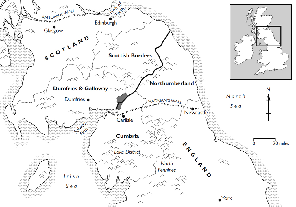
The four Border counties in the early twenty-first century.
PART ONE
Hidden Places
Early one evening in the autumn of 2010, my wife Margaret and I stood in front of Carlisle railway station in the far north-west of England with two loaded bicycles and a one-way ticket from Oxford. After twenty-three years in the South, we had decided to move to Scotland. The idea was to live closer to my mother her son and daughter-in-law becoming every day a more distant memory and to find a home more conducive to those two inseparable pursuits: writing and cycling. By chance, our search had ended just short of Scotland, at a lonely house on the very edge of England. The title deed showed that we would own a stretch of the national border. If Scotland regained its independence which seemed a remote prospect we would be custodians of an international frontier.
During our last months in Oxford, I had read about our future home and discovered that the river which almost surrounds the house had once marked the southern boundary of a region called the Debatable Land. For several centuries, this desolate tract running north-east from the Solway Firth had served as a buffer between the two nations. Within those fifty square miles, by parliamentary decrees issued by both countries in 1537 and 1551, all Englishmen and Scottishmen are and shall be free to rob, burn, spoil, slay, murder and destroy, all and every such person and persons, their bodies, property, goods and livestock... without any redress to be made for same. By all accounts, they availed themselves of the privilege. Under Henry VIII, Elizabeth I, James V and James VI, the Debatable Land had been the bloodiest region in Britain.
Finding out about the area as it exists today had proved surprisingly difficult. The name on the postal address, a collective term for a scattering of small settlements and isolated farms, seemed to refer to a mythical place. It was missing entirely from a book titled The Hidden Places of Cumbria (1990); even the long valley in which it lies had remained invisible to the author. When, a few weeks after moving, I mentioned the name of the place to a Carlisle taxi driver, a faraway look appeared in his eyes. Ive heard of it, he said, as though I was asking to be driven to a place out of legend.
Those days of first contact with the borderlands now seem to belong to a distant past. I had no idea how much there was to be explored and no intention of writing a book about the place in which we had found a home. The history of the area was a threadbare tapestry on which scenes of fruitless chaos in a derelict realm were monotonously depicted. The border itself was little more than a quaint memento of the Anglo-Scottish wars, and there were few signs that it would rise from the enormous burial mound of British history, proclaiming its ancient identity like a sleeping knight to whom life but not memory had been restored.
Then, under the powerful spell of idle curiosity, documents and maps arrived unbidden: the land and its inhabitants seemed to have become aware that someone was taking an interest in them. The story unfolded itself between 2010 and 2016, and the independent territory which used to exist between Scotland and England began to look like a crucial, missing piece in the puzzle of British history.
It was towards the end of that period, when the United Kingdom was entering a new and unpredictable world, that I made the two discoveries described in the last part of this book. One was a second-century atlas of Iron Age and Roman Britain so wonderfully accurate that it could still be used today. The other was the earliest account of a major historical event in Britain from a British point of view. The past, too, then seemed to dissolve and reshape itself, and the existence of those ancient documents would have seemed fantastic were it not for the tangible reality of their revelations.
*
The country in miniature known as the Debatable Land came to the attention of the outside world in the sixteenth century. Surveyors were sent from London to explore and chart its moors and meadows, its plains and wooded gorges, its bogs and hidden glens. Fifty years later, when most of its population was slaughtered or deported, it became the last part of Great Britain to be conquered and brought under the control of a state.
The Debatable Land a name it acquired in the last two centuries of its existence is the oldest detectable territorial division in Great Britain. Its roots lie in an age when neither England nor Scotland nor even the Roman Empire could be imagined. At the height of its notoriety, it preoccupied the monarchs and parliaments of England, Scotland and France. Today, though some of its boundaries survive as sections of the national border, it has vanished from the map and no one knows exactly where and what it was.
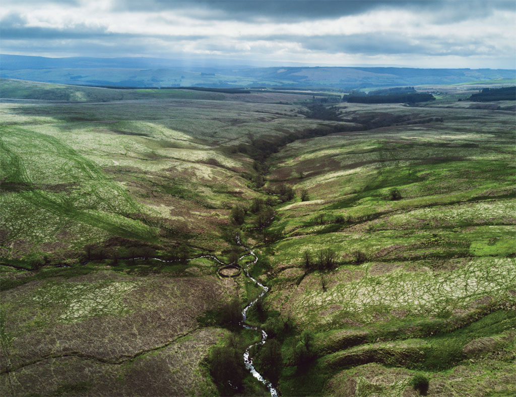
This book, which I had never expected to write, now seems almost too slender to encompass that magically expanding realm. From its northernmost point, one thousand feet above sea level, to the great estuary into which all its becks, burns, gills, sikes and waters flow, the Debatable Land measures only thirteen miles. The widest crossing is eight and a half miles, and it can be circumambulated with difficulty in two days. There are three ranges of hills, one mountain and, when the tide is in, a mile of coastline. A main artery of the British road system passes through it, yet it is quite possible to spend a long day walking across it without seeing another human being, even in the distance.

