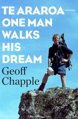
A travel book of vivid encounters with people and landscape.
When Geoff Chapple wrote a newspaper article that set out a vision for a 2600-km hiking trail the length of New Zealand, he never imagined that he, a journalist, would become the trail-blazer. Over the past five years he has talked to farmers and landowners, seeing where the route might be possible, and then walked every step of an adventurous and often remote off-road trail from Cape Reinga to Bluff.
Chapple set up a trail-building and fund-raising body, Te Araroa Trust, that has enlisted support from mayors and councils throughout New Zealand. He was named the countrys first social entrepreneur, in 2001, for his work on the trail.
This is the story of how an individual took up a dream, and is single-mindedly creating a heritage for future generations to enjoy.
I admire his energy and creativity, and support the vision of a national trail. The story itself makes great reading.
Sir Edmund Hillary
A fine far-sighted quest. And one that is of enormous benefit to all New Zealanders who care about their countrys historical and natural heritage. I commend this book wholeheartedly.
Michael King
A marvellous record of how a Kiwi with a fiery passion for the outdoors is making The Long Path happen.
Gary McCormick
To those who love the New Zealand outdoors
CONTENTS
- First Footing
Cape Reinga to Auckland - To the Mountain
Auckland to Ruapehu - Down and Out
Ruapehu to Wellington - Leafy Paths, Rocky Routes
Ship Cove to Arthurs Pass - Swift Rivers, High Passes
Arthurs Pass to Omarama - Rainbows End
Omarama to Bluff
This book and its maps are not a hiking guide. I walked from Cape Reinga to Bluff and am proud of that, but it was a trial walk only. The route I took, whether in the North or South Islands, cannot be followed as of right. Some South Island station owners, for example, generously granted access to me as an individual but made clear that their land should not therefore be seen as ipso facto part of any national trail. I took note of such objections, and as a result the future trail will not traverse those properties. Other station owners who agreed to my walking across their land wanted more facts on what any agreement on a national route might involve. Negotiations will continue there. When the trail secures legal access through the North Island farms or in the South Islands high country, this will be noted on the trusts website.
Te Araroa Trusts website is www.teararoa.org.nz. Its postal address is PO Box 5106, Wellesley Street, Auckland.
Bob Ussher, then president of the Alpine Sports Club, deserves credit for first proposing a long scenic trail in 1967, and more recently two people influenced the reincarnation of that. My good friend William Ball triggered the idea in my mind. Denis McLeans 1986 book TheLongPathwayTeAraroa, about an 800-km East Coast walk, almost certainly sat in memory and afforded the name for the longer trail when the time came. The people of Te Araroa, the East Coast settlement, have been generous since in allowing wider use of the name.
Many whove helped are mentioned in the text, and I wont repeat my gratitude here. The 100-odd regional, district and city council planners, Department of Conservation staff and others who helped with the original trail design are thanked in my two trail route publications of 1997 and 2001. Allan Turner from Waikato District Council and Warren Stace of Environment Waikato both encouraged me to use the Waikato stopbanks for a river trail. Rob Holmes, and Malcom and Ngaire Entwisle, allowed this same river trail to cross private land, and 12 other farmers generously agreed.
Ken Beatson, designer of the New Zealand walkway symbol, gave us a standout logo, and the late R. G. S. Beatson helped my first North Island walk. Two former trampers gave the first $25 after my internet appeal for money to keep walking their letter ruefully noted their own hip replacements and shot knees, and urged me on. Thanks also, in the context of helping my walk, to Jenny Wheeler, Barry Fell, the Willi Fels Trust and Wilderness Walks, to John and Robyn Rule for homebaked bread, and freshly gathered mussels and paua. Also Liz and Pete Watkinson for use of their bach.
Glenda Bostwick took a close planning interest at North Shore City and later at Whangarei District Council. Mark Thompson supervised Te Araroas trail through the Herekino Forest. Sonia Frimmel was in charge of the recent extension of our Waikato trail to Huntly. Dave Thompson, Mike Grace, Tahi Ngakete and Jaqi Brown all helped with Maori liaison. Graeme Campbell gave advice on the memorandum of understanding with DoC, and John Tizard and Bob Stevens gave legal advice. John Ringer and Peter Crowe from Paradigm designed a distinctive trust booklet, architect Nigel Cook a smart and cheap tramping shelter. Ian Rodger stood in for me on trail matters while I was walking in the south.
Thanks to the Fairburn estate for permission to quote from the poem To a Friend in the Wilderness and to the Topp Twins for lines from the song Turangawaewae.
The various organisations that have given free goods, services or grants include PriceWaterhousecoopers, Vodafone, the Giltrap Motor Group, Grant Alexander at Studio Alexander, BellGullys David McGregor and Linda OReilly, Saatchi & Saatchis Howard Greive, also the Lottery Grants Board, the Tindall Foundation, the Hillary Commission, the Winston Churchill Memorial Trust, the WEL Energy Trust, Gallagher Group, Trust Waikato, and the Community Employment Group.
Polly, Irene and Amos Chapple have all at separate times said theyll walk this trail or did I imagine that? At any rate, they urged me on. Miriam has been my great support throughout. Any reading of this book will find her work both in and between the lines.
I saw it in peoples eyes even before I did my own walk. Sitting down with trampers, with planners and others to figure a possible permanent trail down the North Island, I watched their eyes lift. Theyd gain the thousand-metre stare out the window and away. And sometimes theyd mutter, with a kind of awe imagine that, just to pick up your pack and go.
And then I walked every step of the way from Cape Reinga to Bluff. Long walks are very physical, very psychological, probably slightly irrational, but also great fun. I experienced terrific meetings with people that happens naturally when you come in on foot. And out on the tramp itself I experienced a happy mindlessness that seemed peculiarly contoured to the trees, the rivers, the summits damp with cloud, to the folding blue hills that stretched away with no natural boundary but the sea.
I walked slowly into a dream, but the dream was bigger than my walk. Te Araroas trustees were a staunch organising force behind me. I was lucky enough to be the one that tested a proposed route, but the trustees and I, and whoever else was willing, were committed also to putting the trail itself in place. That work has begun, with work teams cutting the track.
A reader-friendly warning is in order here statistics follow. If you want the tracks colourful beginnings and the feel of it underfoot, cut as it were, straight to the chase, and come back to these more objective assessments later. After all, it took us years to figure out just what the task was. We had only our enthusiasm at first. The analysis, and recruitment of our various allies came later.
The proposed hiking route the length of New Zealand, is 2600 km long. Some 1107 km of this distance, or 43 percent of the total, is on existing trails. Some of these are in good condition and await only the additional signage that will identify them as part of the trail. Others are routes that will require some upgrading, as well as signage. But whether walking track or route standard, this 1107 km of existing trail gives Te Araroa a solid start.

