Published in the United Kingdom in 2015 by
OXBOW BOOKS
10 Hythe Bridge Street, Oxford OX1 2EW
and in the United States by
OXBOW BOOKS
908 Darby Road, Havertown, PA 19083
Oxbow Books and the individual authors 2015
Paperback Edition: ISBN 978-1-78297-970-8
Digital Edition: ISBN 978-1-78297-971-5
Kindle Edition: ISBN 978-1-78297-972-2
PDF Edition: ISBN 978-1-78297-973-9
A CIP record for this book is available from the British Library
Library of Congress Control Number: 2015945526
All rights reserved. No part of this book may be reproduced or transmitted in any form or by any means, electronic or mechanical including photocopying, recording or by any information storage and retrieval system, without permission from the publisher in writing.
Printed in Malta by Melita Press
For a complete list of Oxbow titles, please contact:
UNITED KINGDOM
Oxbow Books
Telephone (01865) 241249, Fax (01865) 794449
Email:
www.oxbowbooks.com
UNITED STATES OF AMERICA
Oxbow Books
Telephone (800) 791-9354, Fax (610) 853-9146
Email:
www.casemateacademic.com/oxbow
Oxbow Books is part of the Casemate Group
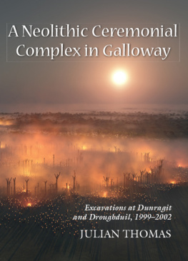
Front cover: Reconstruction of the Late Neolithic palisaded enclosure at Dunragit, looking toward the Droughduil mound. Image by Aaron Watson
CONTENTS
Julian Thomas
Julian Thomas
Julian Thomas and Matthew Leivers
Julian Thomas, David Sanderson and Colin Kerr
Richard Tipping, David Smith and Jason Jordan
Matthew Leivers with Julian Thomas
Elizabeth Healey
Jacqueline I. McKinley
Helen Lewis
Derek Hamilton and Julian Thomas
Julian Thomas
LIST OF FIGURES AND TABLES
List of Figures
List of Tables
LIST OF CONTRIBUTORS
DEREK HAMILTON
Scottish Universities Environmental Research Centre
Rankine Avenue
Scottish Enterprise Technology Park
East Kilbride
G75 0QF
ELIZABETH HEALEY
School of Arts, Languages and Cultures
University of Manchester
Oxford Road
Manchester
M13 9PL
JASON JORDAN
Geography, Environment and Disaster Management
Coventry University
Priory Street
Coventry
CV1 5FB
COLIN KERR
Scottish Universities Environmental Research Centre
Rankine Avenue
Scottish Enterprise Technology Park
East Kilbride
G75 0QF
MATTHEW LEIVERS
Wessex Archaeology
Portway House
Old Sarum Park
Salisbury
SP4 6EB
HELEN LEWIS
UCD School of Archaeology
Newman Building
University College Dublin
Belfield, Dublin 4
JACQUELINE MCKINLEY
Wessex Archaeology
Portway House
Old Sarum Park
Salisbury
SP4 6EB
DAVID SANDERSON
Scottish Universities Environmental Research Centre
Rankine Avenue
Scottish Enterprise Technology Park
East Kilbride
G75 0QF
DAVID SMITH
Oxford University Centre for the Environment
South Parks Road
Oxford
OX1 3QY
JULIAN THOMAS
School of Arts, Languages and Cultures
University of Manchester
Oxford Road
Manchester
M13 9PL
RICHARD TIPPING
Biological and Environmental Sciences
University of Stirling
Stirling
FK9 4LA
ACKNOWLEDGEMENTS
First and foremost, I should like to thank the landowners at Dunragit, Mr and Mrs J. McKie for their generosity in allowing the excavation to take place. Forest Enterprise kindly allowed investigation to take place on the Droughduil mound. The funding for the project was generously provided by Historic Scotland, the University of Southampton and the University of Manchester, and the former also contributed support for a period of teaching buyout, during which a substantial part of the writing of this report was completed. At Historic Scotland, Patrick Ashmore, Gordon Barclay, Deirdre Cameron and Rod McCullagh provided invaluable assistance and advice. In the years since the fieldwork concluded, Rod has contributed unstinting support, and answered innumerable questions. John Pickin of Stranraer Museum helped us out with computing and communications facilities, and access to collections during our time in the field. Jane Brann, Dumfries and Galloway regional archaeologist, gave support and information. Marilyn Brown and Kenny Brophy, then of the Royal Commission on the Ancient and Historic Monuments of Scotland, gave advice, and assistance both on site and above it. Trevor Cowie turned a welcome critical eye onto our ceramic assemblage. Dave Webb constructed and maintained the project website, and brought us to the attention of the international archaeological community. Julia Roberts cooked for the multitudes on site, and Rick Peterson managed the project and kept things from falling apart. David Aspden, Ange Brennan, Chris Fowler, and Matthew Leivers supervised the excavation, and generally kept order. Thanks are finally owed to the students from Southampton, Manchester and other universities, and the other volunteers and drivers who did all the hard work.
The site plans and maps were drawn by Jo Wright and Julian Thomas, the sections by Nick Overton, Jo Wright and Julian Thomas, often on the basis of pen and ink originals drawn by Matthew Leivers. The cover illustration was created by Aaron Watson.
This volume is published with the support of a subvention from Historic Scotland, which is gratefully acknowledged.
INTRODUCTION
Julian Thomas
Location, topography and geology
The modern village of Dunragit lies between Stranraer and Glenluce in Western Galloway, immediately to the north of Luce Bay (at approximately NGR NX 150576). The major road between Stranraer and Newton Stewart, the A75, runs ESE-WNW through the village, parallel with the railway that links Girvan with the ferry port at Stranraer. Both of these exploit the expanse of flat ground that lies at the foot of Challoch Hill, which borders on the sand dunes of Torrs Warren to the south. The road has been established since at least the eighteenth century, when it was constructed to serve the port of Portpatrick (MacHaffie 2001). The level ground is narrowest immediately to the east of Dunragit, at East Challoch, where Challoch Hill overlooks Luce Sands. Dunragit is thus located on a natural routeway, where the north-south axis of the Water of Luce turns westward to the isthmus between Loch Ryan and Luce Bay. Further west, the country opens up onto the Rhins of Galloway, while to the east the coast skirts the low uplands of the Machars. North beyond Challoch Hill, the land rises toward Cairnscarrow and Cairnerzean Fell. Overall, then, the location of Dunragit represents an area of gently rolling lowland sandwiched between the uplands to the north and Luce Bay to the south.
South from the village, the large mound of Droughduil Mote stands on the border of Torrs Warren sands. This is a major dune system covering an area of 1200 hectares, with a coastal frontage of approximately 7 kilometres (Cowie 1996: 14). The uplands to the north and west of Dunragit, and the northern part of the Rhins of Galloway are composed of Ordovecian sedimentary rocks, while the southern Rhins and the country south of Glenluce are Silurian rocks of the Llandovery series. A broad strip running southward from Loch Ryan, however, is composed of more recent sediments, principally alluvium and glacial outwash gravel. This provides the subsoil at Dunragit itself. The place-name Dunragit may be derived from Din Rheged, meaning the fort of Rheged, which would refer to the Dark Age kingdom. This name probably does not relate to the prehistoric sites, but to Round Dounan, a fort located on a natural rock outcrop overlooking Dunragit village. The fort is stone built, with a containing wall and an entrance passage. It has been argued to be of fifth or sixth century AD date (Reid 1952).
Next page
