Published in 2017 by The Rosen Publishing Group, Inc.
29 East 21st Street, New York, NY 10010
Copyright 2017 by The Rosen Publishing Group, Inc.
First Edition
All rights reserved. No part of this book may be reproduced in any form without permission in writing from the publisher, except by a reviewer.
Library of Congress Cataloging-in-Publication Data
Names: Meyer, Susan, 1986 author.
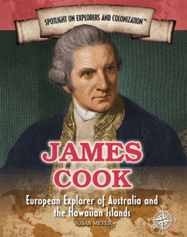
Title: James Cook: European Explorer of Australia and the Hawaiian Islands / Susan Meyer.
Description: New York : Rosen Publishing, 2017. | Series: Spotlight on explorers and colonization | Includes bibliographical references and index.
Identifiers: LCCN 2016023156 | ISBN 9781508172352 (library bound) | ISBN 9781508172321 (pbk.) | ISBN 9781508172338 (6-pack)
Subjects: LCSH: Cook, James, 17281779Juvenile literature. | ExplorersGreat BritainBiographyJuvenile literature.
Classification: LCC G420.C65 M49 2017 | DDC 910.92 [B] dc23
LC record available at https://lccn.loc.gov/2016023156
Manufactured in China
THE GREAT NAVIGATOR
T oday, many people can list the earths seven continents and the oceans that separate them from memory. There was a time, though, when people didnt know what lay on the other side of the world.
The Age of Exploration (or Age of Discovery) took place between the fifteenth and eighteenth centuries. At this time, European countries made great strides in understanding the worlds geography. Explorers like Christopher Columbus, Vasco de Gama, and Ferdinand Magellan set sail on behalf of Spain and Portugal.
In the seventeenth and eighteenth centuries, Great Britain explored the world and claimed new lands. James Cook was a British Navy captain as well as navigator and explorer. He helped to map much of the South Pacific, including New Zealand and Australia. Twice, he circumnavigated the world and explored the dangerous waters around Antarctica. In the process, he changed what Europe knew about the world.
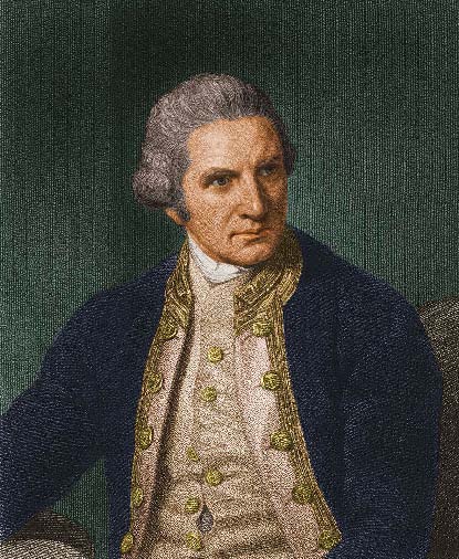
James Cook managed to travel to six of the seven continents during his three voyages of discovery, and he was very close to discovering the seventh: Antarctica.
FROM HUMBLE BEGINNINGS
J ames Cook was born in a small farming village called Morton in Yorkshire, England, on October 27, 1728. His father was a farmer who couldnt afford to send him to school. As a boy, young James worked on the farm. When he was seventeen, he won an apprenticeship with a merchant sailing company under the command of Captain John Walker. Because of this, he moved to a town called Whitby on the coast of England. The merchant company he worked for traded coal and sailed ships through the choppy waters of the North and Baltic Seas.
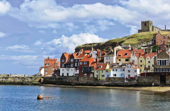
The seaside town of Whitby, where Cook first learned seamanship skills, was established in the Middle Ages as a port for whalers and herring fishermen.
During this time, Cook learned all about ships. He quickly mastered the tools used for navigation. A love of travel and sailing the high seas grew in him. He also learned how to chart coastal waters. The company wanted to make him a ships captain, but Cook had other ideas.
JOINING THE NAVY
D uring Cooks lifetime, Great Britain included the countries of Scotland and England. The British Empire, or the colonies Great Britain established in North America and India, was steadily growing more powerful.
In 1755, when Cook was in his late twenties, he quit his job at the coal company and joined the British Royal Navy. He was older than the average recruit, but he was also already skilled at navigation. The first ship he sailed on was called the Eagle. It patrolled the waters of the English Channel, which separates Great Britain from the rest of Europe. Cook kept detailed logs of his time aboard the Eagle.
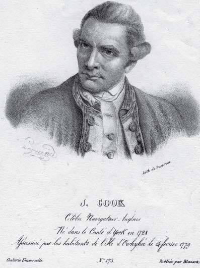
Already a skilled navigator and seaman, Cook soon became Captain Cook after impressing the British Royal Navy with his abilities.
The Royal Navy soon recognized Cooks talents. He rose quickly through the ranks to masters mate, the second in command to the ships master, also called the captain. By the time he was twenty-nine, Cook was made captain of his own ship, the Pembroke.
SEVEN YEARS WAR
W hen Cook joined the British Royal Navy, Great Britain had just begun the Seven Years War. It was fought between many European countries from 1756 until 1763. While much of the war took place in Europe, part of it was also fought in North America. There, France and Great Britain both had colonies. This portion of the Seven Years War is referred to as the French and Indian War.
Cook captained a ship that sailed to North America to take part in the Seven Years War. While there, he fought a number of important naval battles. In 1758, he and the crew of the Pembroke participated in the siege of the Fortress of Louisbourg. This was a French fortress in what is now a part of Canada called Nova Scotia. The siege lasted six weeks, as the British ships surrounded the fortress. Finally, the French surrendered it on July 26, 1758.
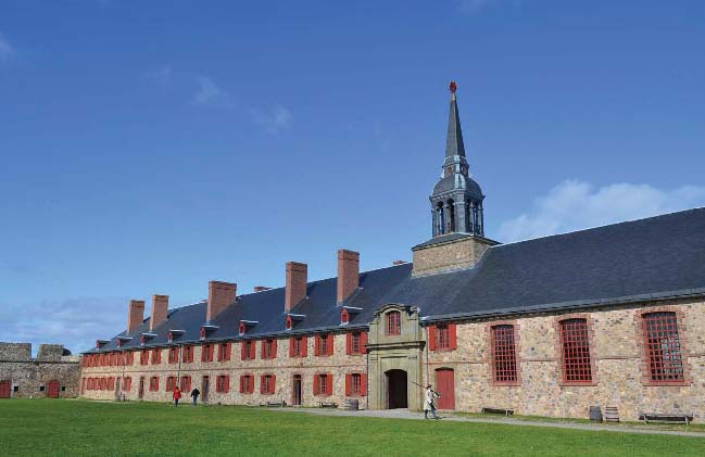
The Fortress of Louisbourg in Nova Scotia is now a popular tourist attraction. The King Bastion Barracks, seen here, is where the fortresss soldiers lived.
THE FRENCH VERSUS THE BRITISH
T he British occupied the Fortress of Louisbourg and used it as a jumping-off point for their next attack. Control of this location allowed the British ships to travel by sea to attack Quebec City. Quebec City sits farther down the St. Lawrence River in what is today Canada. Quebec City was an important stronghold for the French. Cook and his ship again took part in a threemonth siege of the city. During this time, Cook began mapping the St. Lawrence River. His skill and reputation as an excellent cartographer grew.
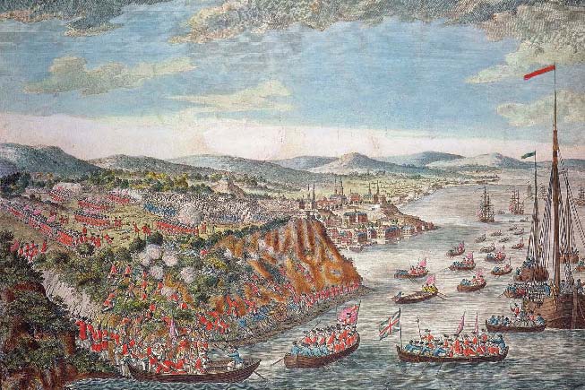
This painting depicts the British troops scaling the cliffs of the St. Lawrence River to reach Quebec City.
The siege ended when the British faced off against the French in a land and sea battle called the Battle of the Plains of Abraham. It lasted only fifteen minutes! The British won what became a turning point in the war. By losing control of Quebec City, the French lost one of the major ports they had for getting supplies.
SURVEYING NEWFOUNDLAND
B ecause he had proved himself so skilled at surveying and mapping during the Seven Years War, Cook received a new mapping assignment. He was asked to map the coast of Canada, specifically the area called Newfoundland and Labrador. Newfoundland is a large island with a jagged coastline. No one had yet made a detailed map that showed all of its many inlets.
Cook began his work in 1763. For the next five years, he sailed the coasts of Newfoundland and Labrador recording everything that could be useful for mapping. He marked the location of rocks and reefs that would damage ships and recorded places where it would be safe for ships to land. He made note of tides, currents, and weather patterns as well. While he was in Newfoundland, Cook also saw and recorded an eclipse of the sun.

