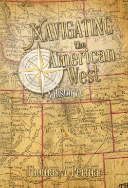
Navigating the
American West
A History

Thomas A Permar
Copyright 2014 Thomas A Permar
All rights reserved.
ISBN: 0990730603
ISBN 13: 9780990730606
Library of Congress Control Number: 2014915060
The Western Sea Press, Morgan, UT
To family: Carol, Jessie, and Matthew

Table of Contents

List of Illustrations

Introduction
B y strict interpretation there is no such thing as a Native American. Go far enough back in history, and we find that the ancestors of every person ever living in the Americas emigrated here from someplace else. In fact, for all but the last twenty thousand or so of the two hundred thousand years of human existence, no one lived in most of the Western Hemisphere. For 90 percent of human history, while people made love and war and traded and traveled across Europe, Africa, and the East, not a single human voice was heard or human foot imprint found within the sixteen million square miles of land now called the Americas. But eventually the first hardy souls headed east from Asia, crossed the Bering Strait, and traveled south along the Pacific coast to populate two continents as far as Tierra del Fuego, the Land of Fire, at the tip of South America. These were the ancestors of the first people, the first emigrants who traveled to the American West. Many would follow in waves from Asia and, much later, many more from the east.
So the story of the American West is a story of movement. From the first emigrants entering this land tens of thousands of years ago to the not-so-distant past, countless millions traveled the West. They walked the driest, most inhospitable deserts on foot. Some found their way across plains as flat and featureless as a billiard table without reference or landmark. Others drove heavily loaded wagons over mountain ranges whose peaks topped fourteen thousand feet. Put simply, the story told here is about how they did ithow they were able to find their way and survive on a long journey through the American West.
Navigating means setting a course and guiding oneself or a partyon foot, ship, canoe, horseback, or wagonfrom one place to another. To do that a traveler needs an understanding of positionwhere he is relative to where he wants to go. Navigation requires a means of measuring direction, time, distance, and speed. And assuming the navigator may want to make the same journey again or pass his travel experiences on to others, it requires methods of recording and communicating those experiences.
While the way-finding aspect is important, the process of navigating presented here, in a broader view, includes the means and modes of travel. For an illustration of their significance, we can look back in time to the beginning of westward movement.
Imagine an early morning in the town of San Sebastian, Gomera Island, in the Canaries. Its a fall day near the end of the fifteenth century but still warm in these dots of land off the coast of West Africa, then the edge of the known world. The admiral of a small fleet leaves his lodgings and walks to the harbor, only to find that the ships are gone. He has with him everything necessary to find his waya compass under his arm, and he knows which direction he wants to travel: west. The admiral steps into the surf and begins to swim south, to open water, and then west, checking his course as necessary. He might make a few miles before he drowns. Suppose, however, that when the admiral reaches the harbor, his ships are there but empty. He could possibly get one underway and sail west for a few days before he died of hunger and thirst. Of course, what really happened on that fateful September morning was that the admiral went to the harbor and found his ships, his men, and provisions and equipment to last the whole company for a year. With this, his compass, and lots of seagoing experience, the admiral guided his little fleet across thousands of miles of open ocean, discovered a continent, and sailed safely home. Leaving aside the fact that he was sure he had landed on islands off the coast of Japan, or possibly China, it was a remarkable feat. The lesson is the same for any traveler on sea or land. Navigating from one place to another requires much more than the ability to find the way. Without the human necessities of travelfood, water, shelter, and means of transportthe only successful journeys would be very short ones.
Navigating the American West is a story of movement not only through space but also through time, from the mid sixteenth to the mid nineteenth centuries. It shows how four different cultures in four different eras dealt with the ways and means of travel into the land that came to be known as the American West.
of this book addresses the land itself, two million square miles of dirt and rock, the center around which this history revolves and the stage on which all the action takes place. Its geography, to a large extent, determines where and how travelers could travel, and the reader needs at least a glimpse of what the early traveler saw.
The remaining four parts of the book deal with the human element, people over innumerable trails, some covering thousands of miles. They migrated or settled primarily near geographical marginsalong the boundary between mountains and plains, where rivers cut the open prairie, or where the land met the sea, and understood their importance for survival.
looks at the mid sixteenth century, when the Spanish entered the American West: Francisco Vasquez de Coronado traveled from Mexico to present-day Kansas with his force of three hundred soldiers and one thousand Aztec warriors, and Hernando de Soto led his expedition from Florida into Texas. They found their way using native guides and rudimentary navigational instrumentsthe astrolabe to calculate latitude and the compass for direction. From thriving Spanish ranches and livestock farms in the Caribbean and Mexico, they shipped horses and mules to ride and to use as pack animals. Behind mounted conquistadors came cattle, sheep, and pigsportable rations on the hoof. They moved across the land primarily in search of gold. Their reputations proceeded them, and one native chief, at their first meeting, told Hernando de Soto, I have long since learned who you Castilians areTo me you are professional vagabonds who wander from place to place, gaining your livelihood by robbing, sacking, and murdering people who have given you no offence (Garcilasco de la Vega, Florida of the Inca, 1605).
and emerged from tiny Bayou Manchac into the Mississippi River, just south of where Baton Rouge now stands.
Going upriver on this great water highway, they reached the Red, the Arkansas, and Missouri Rivers and found their way out onto the Tallgrass Prairie. But western waterways were different than the land of lakes and rivers known to the French voyageur and the Coureur de Bois of the far north. There were fewer of them, they were filled with water hazards, and most were only seasonally navigable. And where the rivers ended, French watermen had to learn the skills of the plainsmen.
Better educated than adventurers of the past, usually in Jesuit schools, French navigators and surveyors made careful notes of their travels to send back to cartographers in Paris. A major improvement in map making came during this period with recently published logarithm tables and the surveyors technique of triangulation. This new procedure made it possible to stand in one spot and calculate distances to and between any object that could be seen, no matter how far away. Officially, the French presence in the American West ended in 1762, in the later years of the French and Indian War, when the Louisiana Country was secretly ceded to Spain. Unofficially, individual French, French-Canadians, and their descendants continued to play major roles in the exploration of the Great Plains and the Rocky Mountains for many generations.
Next page
