PRAISE FOR PREVIOUS EDITIONS
... an asset to any wilderness traveler. Even if youve never used a compass or a GPS receiver before, youll have a good understanding of the process after reading this book.
Will Gadd, champion ice climber and author of Ice & Mixed Climbing: Modern Technique
An ideal book for those who aspire to travel with precision in the backcountry.
Lewiston Morning Tribune
An informative book on how to walk in the woods.
Reel News
If youre planning a wilderness excursion, swallow your pride and pick up Wilderness Navigation.
Pittsburgh Tribune-Review
Required reading for anyone who spends time in the outdoors with a map and compass.
St. Paul Pioneer Press
... essentials for using a map and a compass as well as easy and practical techniques for using global positioning devices.
The News-Herald (Willoughby, Ohio)
... a great resource.
The Post Register (Idaho Falls)
Easy-to-understand instruction on map-reading and compass use.
Outside Bozeman
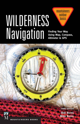
WILDERNESS Navigation
Finding Your Way Using Map, Compass, Altimeter & GPS
Third Edition
Bob Burns
Mike Burns
To the memories of the teachers of navigation who have gone before us, including Clinton M. Kelley, Richard B. Kaylor, Erhard Wichert, and Scott Fischer. Without their knowledge and leadership, some of us would still be lost in the wilderness.
| Mountaineers Books is the publishing division of The Mountaineers, an organization founded in 1906 and dedicated to the exploration, preservation, and enjoyment of outdoor and wilderness areas. |
1001 SW Klickitat Way, Suite 201, Seattle, WA 98134 800.553.4453, www.mountaineersbooks.org |
Copyright 2015 by Bob Burns and Mike Burns
All rights reserved. No part of this book may be reproduced or utilized in any form, or by any electronic, mechanical, or other means, without the prior written permission of the publisher.
Printed in the United States of America
Distributed in the United Kingdom by Cordee, www.cordee.co.uk
First edition, 1999. Second edition, 2004. Third edition, 2015.
Copyeditor: Jane Crosen
Design: Mountaineers Books
Layout: Jen Grable
Illustrations: Jennifer Shontz, www.redshoedesign.com.
were adapted from Freedom but with major modifications.
All photos by the authors unless otherwise indicated.
Cover photograph: Silva Explorer Pro compass and Green Trails Mount Olympus Climbing Map (Photo by Bob Burns)
Library of Congress Cataloging-in-Publication Data
Burns, Bob, 1942
Wilderness navigation : finding your way using map, compass, altimeter & gps / Bob Burns and Mike Burns.Third edition.
pages cm.
Includes bibliographical references and index.
ISBN 978-1-59485-945-8 (pbk.)ISBN 978-1-59485-946-5 (ebook)
1. OrienteeringEquipment and supplies. 2. NavigationEquipment and supplies. 3. Outdoor recreationEquipment and supplies. I. Burns, Mike, 1970
II. Title.
GV200.4.B87 2015
796.58dc23
2014034380
ISBN (paperback): 978-1-59485-945-8
ISBN (ebook): 978-1-59485-946-5
Contents
Preface
The origins of this book are lost among the rough notes of The Mountaineers first climbing course, held in 1934. They were eventually published in 1960 as Mountaineering: The Freedom of the Hills, a comprehensive mountain climbing book containing information on equipment, navigation, wilderness travel, and technical details of climbing on rock, snow, and glaciers. It has been revised seven times since its initial publication, and we have contributed to the last five revisions.
In addition to writing about navigation, we have hiked, scrambled, snowshoed, and climbed extensively, as well as taught navigation in courses sponsored by The Mountaineers and Green Trails Maps. In some of the nonclimbing classes, we have often been asked to recommend a book covering the material presented in our courses and lectures. However, the only book using the same methods and covering the same material as these courses was Freedom. Some skiers, snowshoers, and hikers balked at buying a large, expensive book filled with details of technical rock and ice climbing just to obtain information on navigation; it was out of this need that the idea for Wilderness Navigation emerged.
This book was originally envisioned as a small, affordable book containing the same information covered in the navigation chapter of Freedom. However, a lot of useful information had been excluded from Freedom in order to keep its size manageable. Wilderness Navigation was therefore expanded, with the addition of considerable technical information as well as material on wilderness routefinding. This book now provides more than twice as much material as the navigation chapter in Freedom.
The methods of using maps and compasses in this book have been taught for many years by The Mountaineers. When using the methods explained in this book, orienting the map is not necessary, nor is it necessary to add or subtract declination, nor to draw declination lines on your maps. Instead, we encourage the use of compasses with adjustable declination and explain how to make all compasses work like such compasses. This has proven to be an easy and dependable method of dealing with declination.
Since the publication of the second edition in 2004, we have received from readers a number of suggestions for improvement. We have incorporated many of these into this third edition, including an update to the descriptions of presently available maps, compasses, altimeters, and Global Positioning System (GPS) receivers, as well as updated declination maps for the United States and the world. Since 2004 there have also been some important changes to the GPS, requiring updates to that chapter, including the interfacing of the GPS receiver with the home computer, as well as using the GPS function in smart phones. We have also added more information on navigational techniques, as well as websites and other sources containing useful navigational information. Some of this information came about when researching GPS usage for our other book, Wilderness GPS (Mountaineers Books, 2013), and is included herein, although in a severely abridged form.
Acknowledgments
We wish to express our appreciation to a number of individuals who have contributed to this book. We are grateful to our friend Ronald Gailis for his research into sources of information on geomagnetism and GPS, as well as his assistance and suggestions during the writing of this book. We also wish to thank John Bell for his significant contributions to the navigation chapter of the eighth edition of Mountaineering: The Freedom of the Hills.
We also thank the staff of Mountaineers Books, particularly Margaret Sullivan and Laura Shauger. Finally, a thank-you to Peter Hendrickson, current chairman of The Mountaineers Navigation Committee, for his many helpful and constructive suggestions for improvement of this book, which is required reading for The Mountaineers navigation course.
Next page
