Table of Contents
Preface to the Third Edition
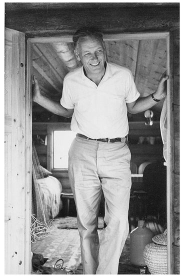
Bjrn Kjellstrm at his beloved cabin in Sweden in the 1960s.
This book has been around for longer than I have, and I am no spring chicken, as they say, having just crossed that notorious half -century mark. First published in 1955, Be Expert with Map & Compasshas become an institution as a guide for generations of people seeking important basic navigational skills. Over 500,000 copies have been sold in English- language editions, and it has been published in French, Italian, and Chinese.
I am always pleased when I meet people from all walks of life who are familiar with, and indeed fond of, this book. From former Boy Scouts to Marines to avid deer hunters to 4-H leaders to search-and-rescue dog teams, I have been impressed by the number of people who become animated when the book is brought up. For many, it rekindles memories of the great outdoor opportunities it led them to; for others, it seems to remind them of younger, simpler days spent fidgeting with the dials and trying to master the mystery of magnetism.
Many things are different from when my late father, Bjrn Kjellstrm, last updated this book in 1994, with the help of one of my dear brothers, Tord. International and national -level orienteering has continued to develop into a highly technical sport, utilizing the most modern techniques and materials. Global Positioning Systems, known as GPS, were certainly not a readily available consumer item just a few years ago. This book, however, is still the ideal for anyone who wants to learn the basics of compass navigation, as it helps you get comfortable with map and compass skills and gets you ready to participate in or organize a local orienteering event.
It was Green Bar Bill, Bill Hillcourt, a hero in American scouting circles, who initially encouraged my father to write this guide. My father had been a Championship Orienteer, on foot and on skis, in his native Sweden, though his passion was admittedly for nature and the compass, not for trophies and medals. An entrepreneur from the start, he registered the company that was to become known the world over as Silva at the ripe age of nineteen.
A few years later, in 1933, he and his brother, Alvar, joined forces with another young orienteer named Gunnar Tillander. Together they made history by producing and marketing the first protractor-compass, the concept of which still defines the modern orienteering compass today. Silva compasses became the standard, selling over 500,000 a year in the United States alone.
In 1946, my father took his first business trip to the United States, during which he helped Scout leaders organize the first orienteering event in the United States, at Indiana Dunes State Park, near Lake Michigan. He is credited with introducing the sport of orienteering to North America, and even with coining the English word orienteering.
He moved permanently to Westchester County, New York, in the late 1950s. He had the 4,700-acre Ward Pound Ridge Reservation as his backyard, so to speak, and quickly made it a point to clear and mark cross-country ski and hiking trails. A professional orienteering map followed, and soon training events were a regular occurrence one hour north of New York City. He somehow found time to be vice-president of the International Ski Federation and was actively involved in the Swedish, U.S., and International Orienteering Federations.
When the time came to update the book, I took the project on with trepidation. How could you improve upon what was considered a classic? Even though newer books have appeared on the market, it seems there is none better at providing a simple, step-by-step guide to success. I quickly realized there wasnt much I needed to change, though I had a good time modernizing some of the content and some of the Swinglish (Swedish-English) language.
Going through this book page by page reminded me of many days spent by his side in the Reservation, training scout leaders and other willing participants. As I retyped the various practices given in the book, I remembered being a young girl and doing them all, under his kind, patient eye. He hiked or skied the trails daily, and often, as a child, I would go along, slowing down his six-foot-three pace notably. Frequently, we would stop at a coffee place in the middle of the woods, enjoy some juice and cookies, and marvel at the beauty around us. I thank him for so many things, including that love of nature and a very useful innate sense of direction.
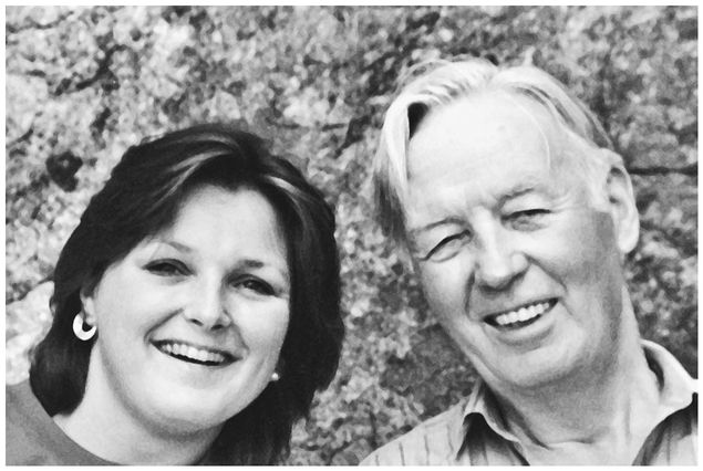
Carina Elgin with her father, Bjrn Kjellstrm.
In his eighties, the gentle giant with the warm wit was slowed by Parkinsons disease. I know he was frustrated when his long legs stopped being able to handle those daily walks through the woods. One of the last days we spent together was on the deck of our summer cabin in Sweden. It was a beautiful day, the kind Swedes wait all year for, with a bright, warming sun and a fresh, gentle breeze. On days like that, the sun has a special way of warming up the scents over there (maybe its the lack of humidity?), and I clearly remember the soft wafts of the pines and the delicate vapors of the dry, gray moss clinging to the Baltic rocks. Seagulls cawed overhead, and the line from the flagpole clanged a consistent beat.
We sat there relaxing, the soft sun on our faces, savoring, with every one of our senses, this moment of true pleasure put on by Mother Nature. With his eyes closed, he started talking, calmly wondering which way we should go. Should we try that trail? Or maybe that way, where we just saw that deer? He spoke happily, as if he were exploring some wonderful new orienteering terrain. I dont know whether it was the medicines he was taking, or if the Parkinsons was making him delusional, but I sat quietly and listened to the contentment in his voice.
To this day, it has given me peace that in his last days he could continue enjoying his greatest passion. And, I truly believe, he is orienteering still, somewhere.
Carina Kjellstrm Elgin
The Plains, Virginia
INTRODUCTION
The Art (and Science) of Orienteering
Primitive maps have guided man since our earliest days on this planet. What led us on trade routes, ensured our return from exploration, and helped locate opposing forces in war eventually evolved into the modern map and compass.
In the 1930s, two Swedish brothers, Bjrn and Alvar Kjellstrm, were at the top of the sport of orienteering, which requires accurate and fast use of a map and compass to find various markers, or control points, in the terrain. Together with engineer Gunnar Tillander, they developed the Silva compass, and established the Silva Company in Stockholm, Sweden, to manufacture and market their product. What was so different about the Silva system was the clear base, the built-in protractor, and the liquid-filled compass capsule that offered a faster reading. All modern field compasses are based on these developments, which provide speed and accuracy in the taking of bearings, especially key in the sport of orienteering.


