ACKNOWLEDGMENTS
The purpose of the Cuttyhunk Historical Society is to preserve the traditions, records, and history of the Elizabeth Islands for the benefit of present and future generations.
The process of creating this book has given us an even greater appreciation for the Elizabeth Islands and the lasting legacy of the people who have lived and worked on them. It has also been a privilege to collaborate with so many who share our love and respect for the islands varied history.
We are appreciative of the generosity of the following people, who were invaluable for their historical information, images, resources, and editing: Mary Jean Blasdale, Janet Bosworth, Elaine Doran, Jennifer Gaines, Kitsy Garfield, Wye Garfield, Thomas Gregg, Oriel Ponzecchi, Carolyn Powers, Betty Stevens, George Stetson, Olive Swanson, Charles Tilton Jr., David Twichell Jr., Nic Van Dongen, Alan Wilder, and Jan Wilder. A special thank-you goes to Holly Leon for her contributions to the chapter on Naushon, Pasque, and Nashawena and to Tom Buckley for his help on the Penikese chapter.
We extend our gratitude to all those friends and Cuttyhunk Historical Society members who, over the years, have contributed artifacts, information, postcards, photographs, and (recently) words of encouragement. A very special thank-you goes to our families for their love, humor, and support.
Ethel R. Twichell and Shelly L. Merriam
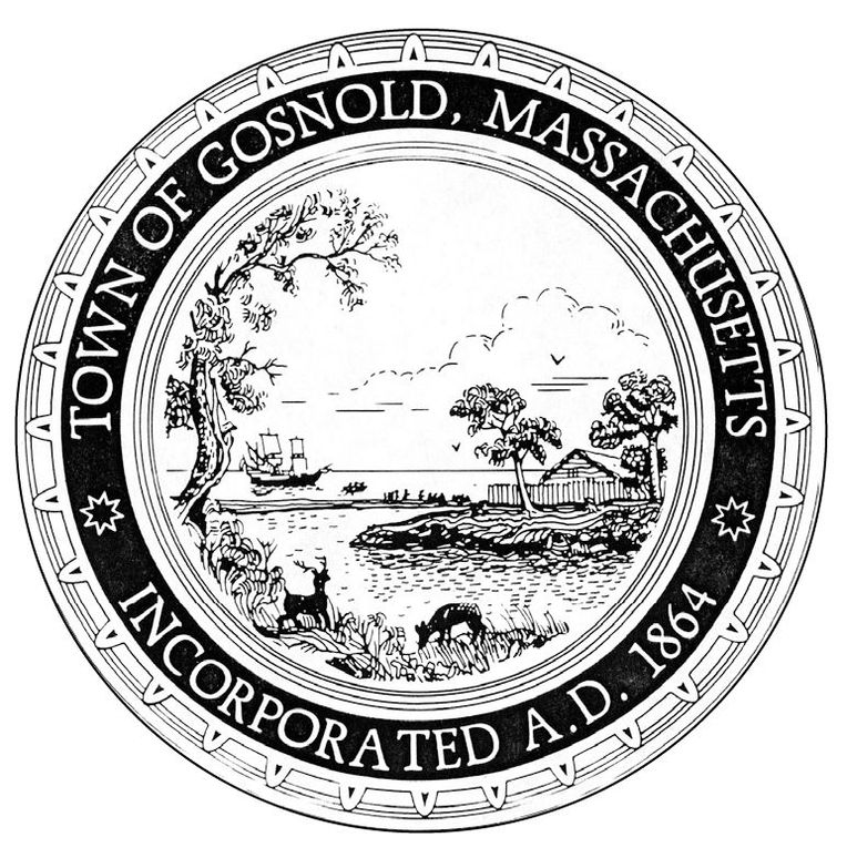
The town seal was designed by Arthur Motta Jr.
BIBLIOGRAPHY
Bosworth, Janet, ed. Cuttyhunk and the Elizabeth Islands from 1602. Cuttyhunk Historical Society, 1993.
Bosworth, Janet, ed. Three Town Buildings: the School, the Library, the Town Hall; and the Church, the Store, the Post Office. Monograph. July 1985.
Brewer, Margaret. Cuttyhunk As I Remember It (in 1904) . Cuttyhunk Historical Center, 1979.
Buckley, I. Thomas. Penikese Island of Hope. Privately printed, 1997.
Clark, Admont G. The Tarpaulin Cove Lighthouse. Monograph. Cuttyhunk Historical Society, spring 2001.
Cuttyhunk Historical Society. A Letter from Tim Akin. Quarterboard, spring 2001.
Cuttyhunk Historical Society. People of Cuttyhunk. 1986.
Cuttyhunk Historical Society. People of Cuttyhunk II. 1988.
Dexter, Lincoln A., ed. The Gosnold Discoveries in the North Part of Virginia, 1602. Universal Tag Inc., 1982.
Early CYC History. Cuttyhunk Yacht Club Newsletter, spring 1988.
Forbes, Kathleen A. An Anthology of Nashawena. Privately printed, 1972.
Forbes, Kathleen A. Naushon Anthology . Privately printed, 1979.
Garfield, Wyatt. Tales of Cuttyhunk: As Remembered by Wye Garfield. Weezrock Publications, June 2000.
Hale, Thomas. New York Harbor Car Floats and the Barges Beach. Monograph. December 1993.
Haskell, Louise T. The Story of Cuttyhunk. 1953.
Howland, Alice Forbes. Three Islands: Pasque, Nashawena and Penikese. Privately printed, 1964.
Reeves, Marjorie Snow. Memories of Growing up on Cuttyhunk Island 19171925. Monograph. Cuttyhunk Historical Society, winter 2000.
Twichell, Ethel R. Cuttyhunk during World War II. Monograph. Cuttyhunk Historical Society, January 1993.
Wilder, Alan. A Town of Many Islands. Vineyard Gazette, July 30, 1999.
Wilder, Donald. Progress. Monograph. Cuttyhunk Historical Society, spring 1996.
Find more books like this at
www.imagesofamerica.com
Search for your hometown history, your old
stomping grounds, and even your favorite sports team.
One
EARLY HISTORY
European explorers had already met and traded with Native Americans well before 1602, when the Englishman Bartholomew Gosnold explored the waters around Cape Cod, Marthas Vineyard, and the Elizabeth Islands. Gosnolds encampment on an island in Cuttyhunks West End Pond was the first attempt at a permanent settlement in North America. While this fort was occupied for only a few weeks, journals kept by Gabriel Archer (a lawyer) and John Brereton (a cleric), who traveled with him, give a fine record of what they saw during that voyage. They describe prominent landmarks, the local flora and fauna, and the native people they encountered. Brereton writes of one meeting this way:
These people, as they are exceeding courteous, gentle of disposition, and wellconditioned, excelling all others that we have scene; so for shape of body and lovely favour, I think they excell all the people of America; of stature much higher than we; of complexion or colour, much like a darke Olive; their eibrowes and haire blacke, which they wear long, tied up behind in knots, whereon they pricke feathers of fowles in a fashion of a crownet [coronet].
These journals picture a newly discovered world, rich in resources of wildlife and timber and inhabited by a handsome people who lived in peace with their surroundings. Gosnold returned to England with a valuable cargo of cedar and sassafras. He sailed to America once more, settling in Jamestown, Virginia, where he died in 1607.
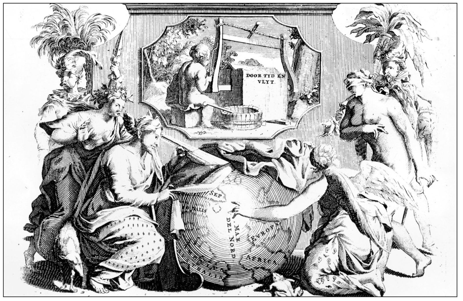
EXPLORING THE NEW WORLD. This illustration appeared in a 1706 publication of Gabriel Archers journal, translated into Old Dutch. Archer was aboard the Concord with Gosnold in 1602. In the image, a winged angel points the way to the New World for a blindfolded woman. Another woman, probably Wisdom, pulls a drapery off a globe while yet another woman and two elaborately dressed guards stand by. The words on the cartouche may be translated, through time and work. (Engraving by Pieter Vander Aa, c. 1706.)
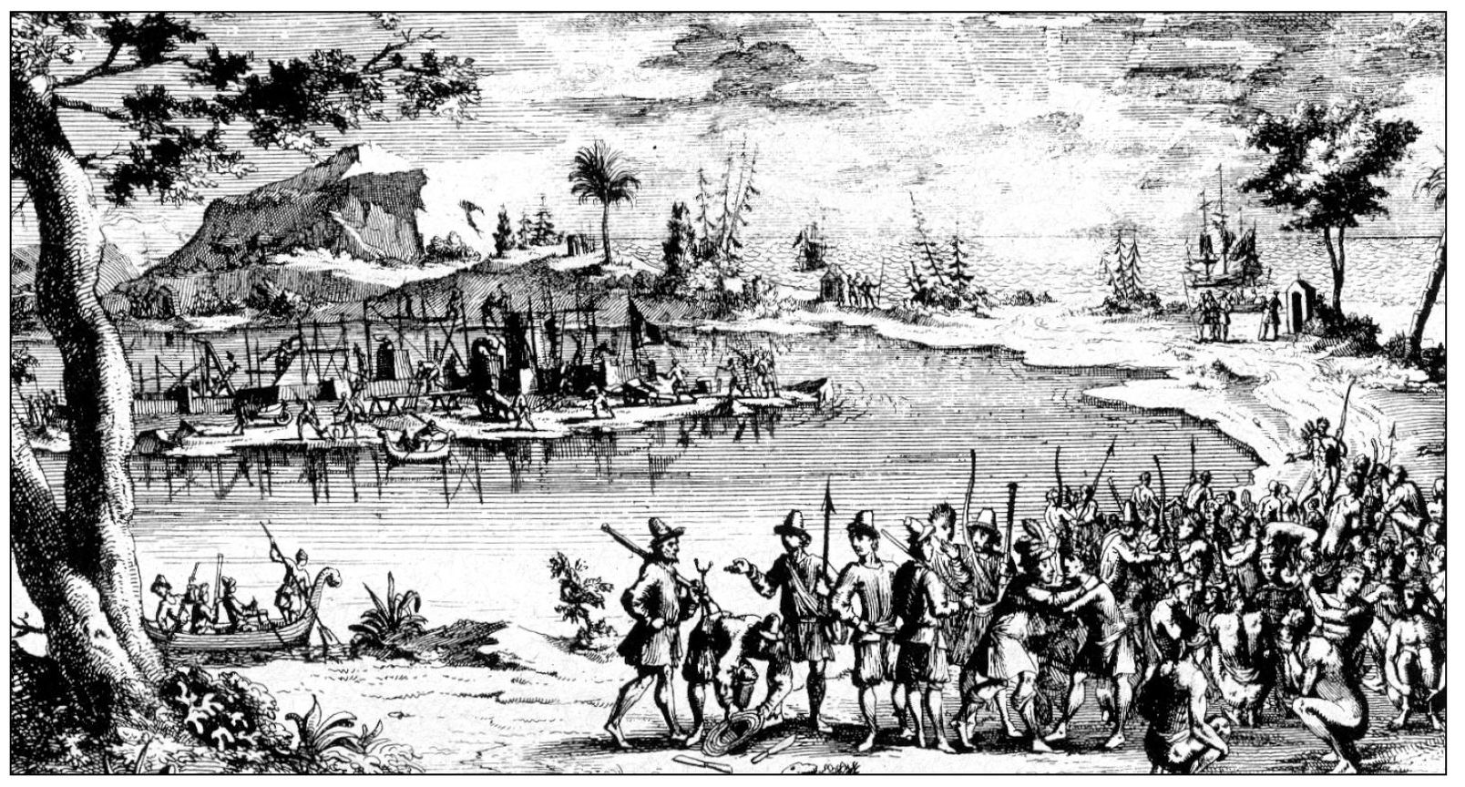
GOSNOLDS SETTLEMENT ON ELIZABETHS ISLE. Gosnold gave the name Elizabeths Isle to what is now Cuttyhunk. This representation of Gosnolds encampment there appeared in the same Old Dutch version of Archers journal. While the meeting of Gosnolds men and the Wampanoags seems friendly, Archers journal cites a few skirmishes between the two groups. (Engraving by Pieter Vander Aa, c. 1706.)
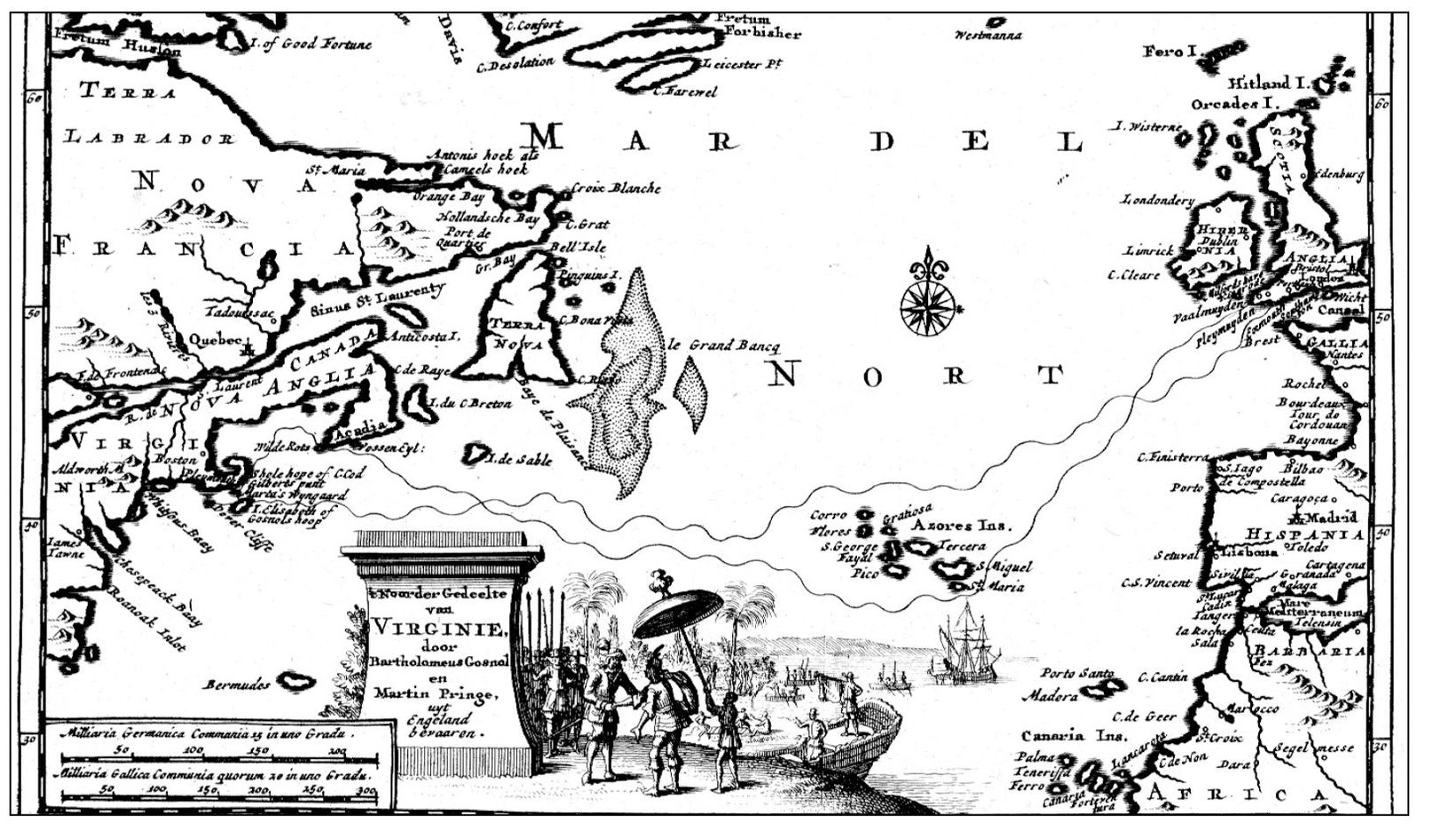
GOSNOLDS VOYAGE. This map appeared in the same 1706 Old Dutch reprint of Archers journal and uses a curious mixture of languages for place names. In Gosnolds time, New England would have been known as Northern Virginia. The palm trees and huge umbrella add exotic touches to Gosnolds meeting with the Wampanoags. (Engraving by Pieter Vander Aa, c. 1706.)
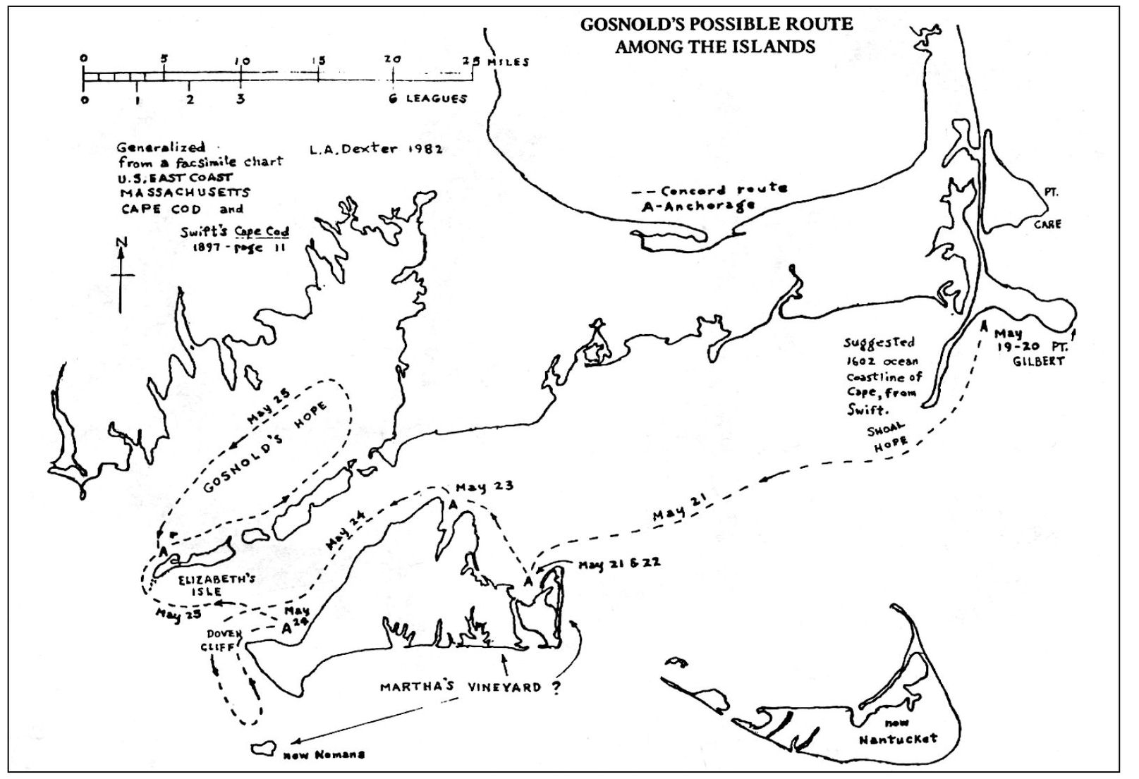
GOSNOLDS POSSIBLE ROUTE AMONG THE ISLANDS. Archers and Breretons journals are the main source of information on Gosnolds explorations. As navigation instruments were primitive, it is difficult to assign the nomenclature in their journals to present localities. This map gives a reasonable interpretation of Gosnolds route. (Courtesy Lincoln A. Dexter.)

