One
CUYAHOGA COUNTY THE PREQUEL
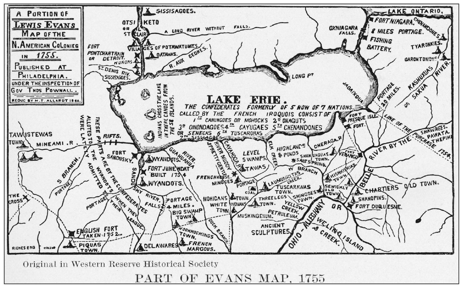
The story of Cuyahoga County officially began in 1808 with legislation that enabled its creation and later made possible its full establishment in 1810. It is easy to imagine that the land the county encompassed stood barren, undiscovered, and unoccupied prior to the 19th century. This chapter will dispel that myth and illustrate the evolution the area experienced from the dwelling place of Native Americans who called the area Cuyahoga, which was a term that denoted crooked river, to a beckoning frontier attracting settlers of the newly formed United States seeking new opportunities and a better life. The lands constituting Cuyahoga County were also subject to international interests as Spain, France, and England, at various time prior to the Revolution, staked a claim to this territory. In 1783, England surrendered all title to the Thirteen Colonies, and Connecticut finally yielded its claims in 1786 but reserved the territory that would be known as the Connecticut Western Reserve. It consisted of 3.3 million acres and extended 120 miles west from the Pennsylvania border and some 70 miles south from Lake Erie. A section of the Western Reserve would eventually become Cuyahoga County, but over 20 years passed before this became a reality. The entire Ohio country was part of the Northwest Territory, established by the ordinance of 1787, and governed by General St. Clair. In 1788, the land east of the Cuyahoga River was designated as Washington County, and the land west of the River was named Wayne County, with Detroit as its seat. More changes would follow, and in 1800 the lands east and west of the Cuyahoga River were joined in the creation of Trumbull County. Its boundaries coincided with those of the Western Reserve. Geauga County was created from the existing Trumbull County in 1806, and finally in 1808 Cuyahoga County was established, along with Ashtabula and Portage, being carved from parent counties of Geauga and Trumbull. But the past would only serve as the prelude for the development of this fledging county, and its future began with the first county commissioners meeting held on June 6, 1810.
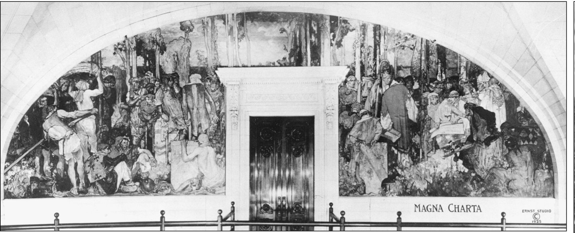
The Magna Carta, an English charter, granted to all freemen the rights and liberties it encompassed. On June 15, 1215, King John met with his barons and knights who had forced the monarch to confirm their liberties or suffer the consequences of war to the death. The Barons had submitted to John their demands some months before, and on June 15 the king affixed his seal to the preliminary draft. After fours days of negotiation regarding the particulars, John would place the great seal on all of the copies. Some have referred to the Magna Carta as the Mother of all Constitutions, and this document had a decided influence on those who drafted the Constitution of the United States. Sir Frank Brangwyns 1913 painting, King John Signing the Magna Carta at Runnymede , hangs at the entrance to the courtroom for the Court of Appeals at the Cuyahoga County Courthouse on Lakeside Avenue.
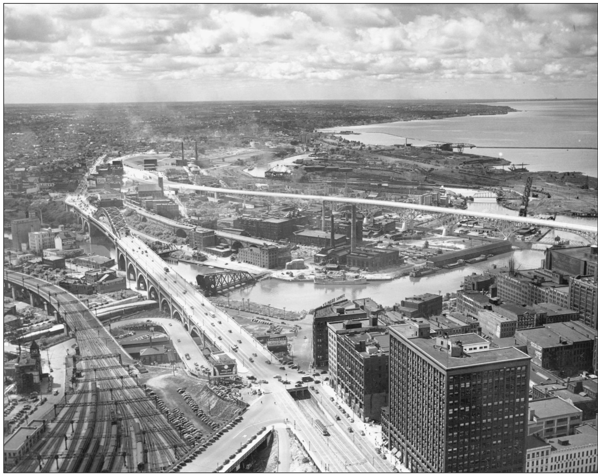
Cuyahoga Countys destiny was shaped by its location on the shores of Lake Erie and the banks of the Cuyahoga River. One of the five Great Lakes, Erie is the fourth largest and ranks among the top 20 in the world by surface area. Lake Eries waters have nurtured the growth of Cleveland and Cuyahoga County, from the city of Euclid westward to Bay Village, facilitating agricultural growth, manufacturing, popular recreation, trade, transportation, and energy production. The Cuyahoga River, the lifeblood of the county, flows south and north over a 100-mile course and derives its name from a combination of Native American references commonly translated as crooked river. This view depicts both bodies of water, and one can also observe the Veterans Memorial and the Main Avenue Bridges, two of the spans that cross the Cuyahoga River and link the east and west parts of the county.
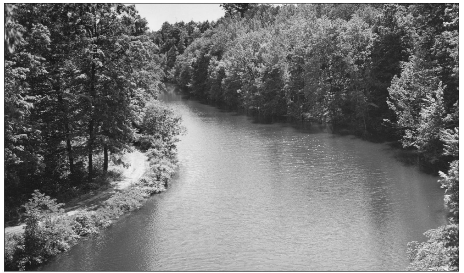
This is the forest primeval, Henry Longfellows opening to the poem Evangeline, calls to mind this view of the Rocky River, perhaps as first glimpsed by the Native Americans who settled in Cuyahoga County. The Rocky River creates the western boundaries of the cities of Cleveland and Lakewood, flowing north to Lake Erie, and carves the river valley that cradles the Rocky River Reservation, one of the Cleveland Metroparks. The plentiful trees add to the reservations characterization as a wilderness.

