IMAGES
of America
MISSION HILLS
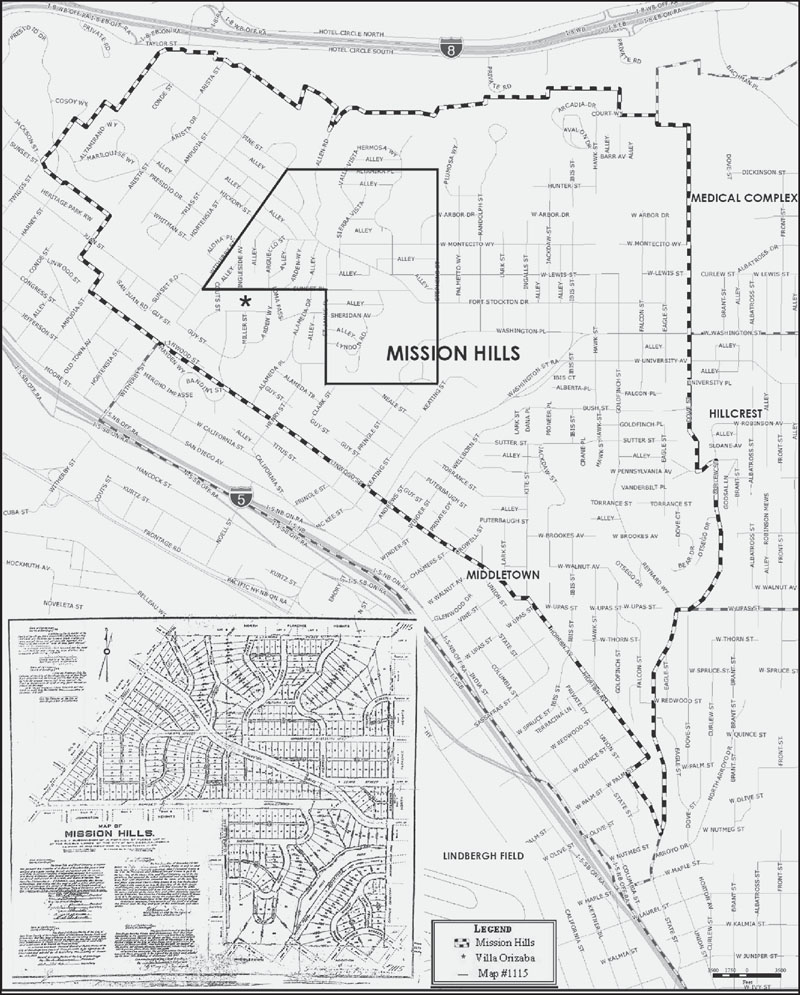
In 1908, George Marstons syndicate formed the first Mission Hills subdivision. The subdivision name embraced the regions history, and its layout rejected a grid street pattern. Marston put John Nolans 1908 San Diego: A Comprehensive Plan for its Improvement into practice, including using the topography of the land to articulate the street patterns. Over time, Mission Hills Two and Three were formed and adjacent subdivision names were forgotten. Now, a much larger area is culturally identified and recognized as Mission Hills. (Courtesy of senior planner Marlon Pangilinan, City of San Diego.)
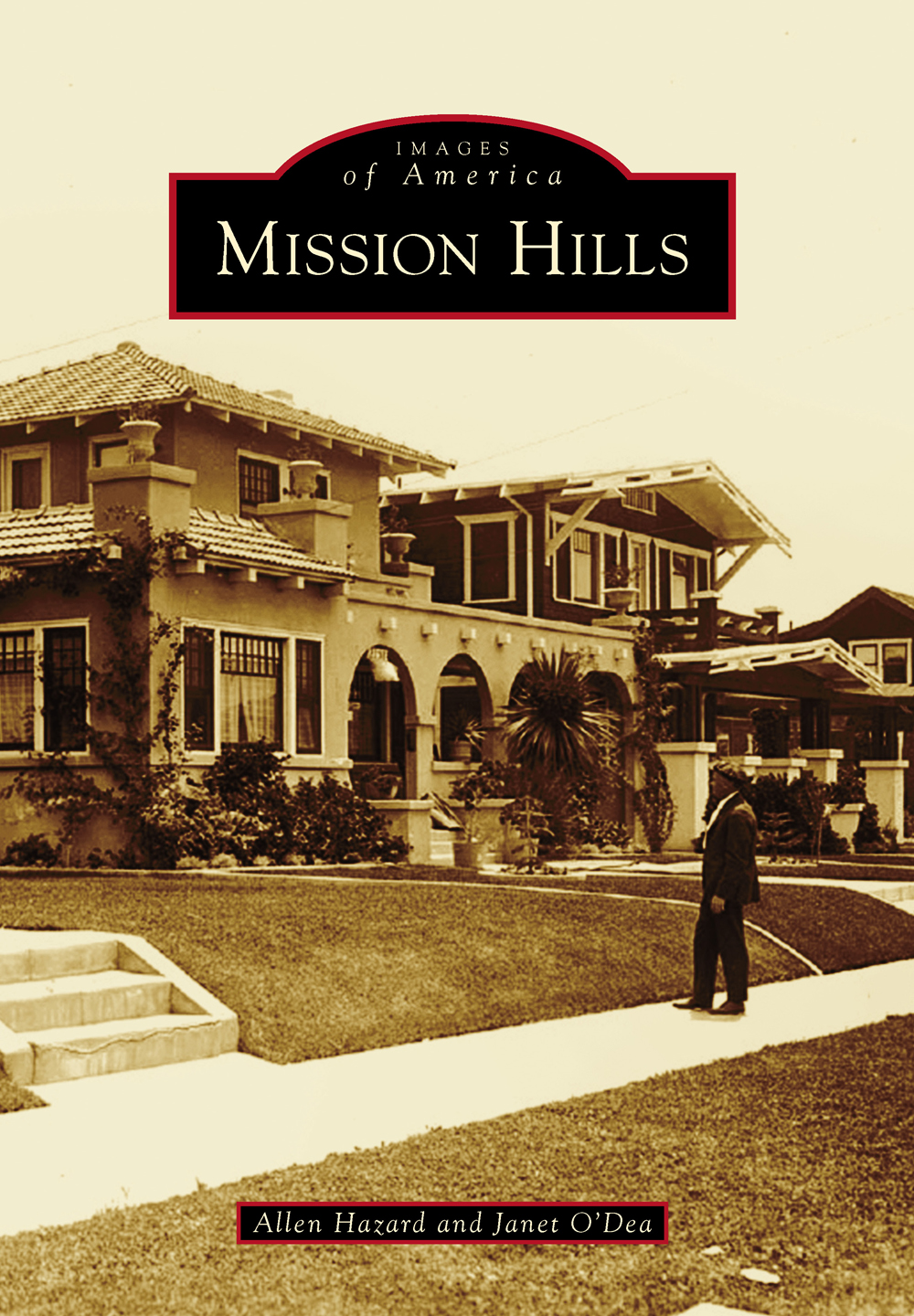
ON THE COVER: Around 1925, an unidentified man admires the unique architectural features of the houses along the north side of Fort Stockton Drive just west of the intersection with Hortensia Street in the Fort Stockton Line Historic District. The original part of Mission Hills was subdivided on January 20, 1908, and developed as a streetcar suburb. The architectural styles in the neighborhood represent a diverse range of the design aesthetic from the early 20th century. (Courtesy of Bruce and Alana Coons.)
IMAGES
of America
MISSION HILLS
Allen Hazard and Janet ODea

Copyright 2015 by Allen Hazard and Janet ODea. All rights reserved.
ISBN 978-1-4671-3268-8
Ebook ISBN 9781439650134
Published by Arcadia Publishing
Charleston, South Carolina
Library of Congress Control Number: 2014910312
For all general information, please contact Arcadia Publishing:
Telephone 843-853-2070
Fax 843-853-0044
E-mail
For customer service and orders:
Toll-Free 1-888-313-2665
Visit us on the Internet at www.arcadiapublishing.com
We dedicate this work to those who came before us and those who choose to preserve our sense of place.
CONTENTS
ACKNOWLEDGMENTS
We would like to thank our generous friends, neighbors, and folks from far and near for contributing their families photographs and giving their time to help compile the images for this book. While many photographs are undated, they all helped us to visually represent the beginnings of the delightful way of life found in the Mission Hills community. This book would not have been possible without them. We would also like to thank visitors to the Historic Mission Hills Facebook page, as those interactions encouraged us to embark upon this endeavor. We want to particularly thank the following for their numerous contributions to this work: Francis W. Parker School; the United Church of Christ (UCC); the Mission Hills Methodist Church (MHMC); Irene and Merril Miller Jr.; Tom Sandler of the Frame Station for finding images of the former Ford dealership and reframing old original photographs for us; City of San Diego senior planner Marlon Pangilinan for assistance with the official Mission Hills map; Patty Brookes for promoting our search for local images in the Presidio Sentinel newspaper; Paul and Sarai Johnson for help with scanning a very large image of St. Vincent de Paul church; Erik Hanson; and Bruce and Alana Coons. We would also like to acknowledge the inspirational work of the Save Our Heritage Organisation. It is a passion for the sense of place that has inspired us to become involved in the preservation of San Diego and the vibrant Mission Hills community. We are grateful to Alyssa Jones, our acquisitions editor and representative from Arcadia Publishing, for her enthusiasm of this work, guidance, and assistance with many items. Thanks go to our families, friends, and wonderful neighbors for your moral support and interest. Unless otherwise noted, all images appear courtesy of the authors.
INTRODUCTION
The story of Mission Hills begins with three seminal figuresSarah Johnston Cox Miller, Kate Sessions, and George Marston.
Millers stepfather, Capt. Henry Johnston, was the captain of the SS Orizaba. The Orizaba was a wooden side-wheel steamer, nicknamed the Mayflower of the West. Johnston steered the ship up and down the California coast, bringing newcomers to San Diego. In 1869, Johnston bought 65 acres on a high plot of land above San Diego Bay, in what would eventually become Mission Hills. He died before building his dream home there. In 1887, his stepdaughter Sarah Miller filed a subdivision map for Johnston Heights, and in 1888 she built a magnificent Victorian house, known as the Villa Orizaba.
In 1903, after losing her Balboa Park lease, Kate Sessions, horticulturalist and Mother of Balboa Park, and her brother Frank began buying up property in what was then known as North Florence Heights to establish her nursery business. She chose land near West Lewis Street and Stephens Street for both her nursery and growing grounds, because of the rich soil, moist sea breezes, and remote location. They built lath packinghouses at the north end of Lark Street, relocating them a few years later to where Ulysses S. Grant Elementary School lies today. From these sites, poinsettias were grown, packed, and shipped throughout North America. In 1922, Sessions sold the nursery to Giuseppe and Pasquale Antonicelli, and the Antonicellis moved the nursery to its current site on Fort Stockton Drive in 1925.
Around 1905, George Marston, a prominent businessman and progressive civic leader, brought John Nolan to San Diego to develop the first city plan; however, the city never adopted the Nolan Plan. The plan did provide a development guide aligned with the City Beautiful Movement of the late 19th century and resonated with Marston.
Meanwhile, Percy Goodwin and others organized a syndicate to buy 60 acres adjoining the north end of Sarah Millers property (along modern-day Sunset Boulevard) for $36,000. On January 20, 1908, Marston, along with family members Tom and Charles S. Hamilton, Hotel Del Coronado developer Elisha S. Babcock, John Kelly of Kelly Investment Company, and coinvestors John F. and James D. Forward, filed Subdivision Map No. 1115, composed of 22 acres. They called their new subdivision Mission Hills, reflecting Nolans ideals that San Diego embrace its romantic history... and give happy recognition to its topography. The location was close to the original site of the San Diego Presidio and the 1769 Mission San Diego de Alcal, known as the birthplace of California and Plymouth Rock of the Pacific. Marstons syndicate hired Frank A. Rhodes to survey the land and New York landscape architect George Cooke laid out the tract. Cooke used the principles from Nolans plan, such as following the topography of hilltops and deep ravines for streets and leaving canyons undisturbed for the purposes of recreation, scenic enjoyment, and open space. There is a hierarchy to the street pattern. Queen palms were planted along Sunset Boulevard to dress the street... but avoid shading the homes.
The early developers intended to make Mission Hills one of the most exclusive neighborhoods in San Diego. It was a restricted subdivision, requiring that homes cost at least $3,000 to build, when the average worker earned $10 per week. At the time, the area was mostly barren, with the exception of a citrus grove on Trias Street, olive and lemon orchards on Fort Stockton Drive and Jackdaw Street, Calvary Cemetery (now buried within Calvary Pioneer Memorial Park), Kate Sessions nursery, and a few dairy and chicken farms.
Street names in the original Mission Hills subdivision reflected San Diegos early history. Fort Stockton Drive references the old US Army fort at nearby Presidio Hill, from the Mexican War. Sierra Vista, Valle Vista, Hermosa Way, and West Montecito Way reflect Nolans vision that topographical descriptions express themselves in the soft words of the Spanish language. Portola Place is named after the Spanish explorer Gaspar de Portol; Couts Street pays homage to the wealthy 19th-century landowner Cave Johnson Couts; Cosoy Street was named after the Native Americans that lived below Presidio Hill; Altamirano was named after members of an important Spanish pioneer family; Arguello was named after Santiago Arguello, a former Californio and alcalde (mayor) of San Diego; Bandini is named after Juan Bandini, a prominent Old Town leader; Witherby was named after a prominent local judge, and Sheridan Avenue after the Civil War Union general. A literary reference is represented by Arden Way, supposedly named after a forest in Shakespeares
Next page


