Phyllis J. Perry
Copyright 2008 by Phyllis J. Perry
ISBN 978-1-6251-7157-3
Published by Arcadia Publishing
Charleston, South Carolina
Printed in the United States of America
Library of Congress Catalog Card Number: 2007941878
For all general information contact Arcadia Publishing at:
Telephone 843-853-2070
Fax 843-853-0044
E-mail
For customer service and orders:
Toll-Free 1-888-313-2665
Visit us on the Internet at www.arcadiapublishing.com
To David L. Perry, who has hiked, backpacked, snowshoed, cross-country skied, and shared his love and knowledge of this park with friends and three generations of family.
All photographs are courtesy of Rocky Mountain National Park, National Park Service.
CONTENTS
ACKNOWLEDGMENTS
The Rocky Mountain National Park archives of historic photographs proved to be a treasure trove of striking images, capturing and preserving vivid moments in time and providing a remarkable pictorial history of this area before and after it was designated a national park. All the images used in the book came from the Rocky Mountain National Park archives, National Park Service.
I am especially indebted to Tim Burchett, museum curator, Rocky Mountain National Park, for his assistance and for his patience in explaining to me how to access this vast collection using its unique filing system. I am also appreciative of the help given by Larry Frederick, chief of interpretation and education at Rocky Mountain National Park; Joan Childers, park ranger, Division of Interpretation; Kathy Brown, ranger; Ken Unitt, information technology specialist; and museum volunteer Kathy Levine, for their help in various ways on this project. Finally, I am most grateful to my husband, David L. Perry, who assisted at every step of the journey, from finding and selecting images to scanning them and commenting on the text.
I also want to thank my editor at Arcadia Publishing, Hannah Carney, for entrusting this special project to me and providing expert guidance.
INTRODUCTION
Rocky Mountain National Park, located in north-central Colorado astride the Continental Divide, is a breathtaking place. Woodrow Wilson signed the law establishing it as a national park on January 26, 1915. Its more than 415 square miles feature lush valleys and showcase the grandeur of the Rocky Mountains with Longs Peak towering at 14,259 feet.
After a stop at one of the visitor centers, some will drive through the park, admiring the spectacular views and glimpses of wildlife, the wildflowers so abundant in summer, or the golden aspen that glow in autumn. They may be fortunate enough to approach or leave the park via Trail Ridge Road, on which construction began in 1926. Eight miles of this spectacular highway in the sky are above 11,000 feet with one amazing view after another around each curve.
Other visitors may be lucky enough to stay for several days in one of the five drive-in campgrounds or more than 200 backcountry campsites that the park boasts. For those who have time to explore, there are 359 miles of trails for hikers, backpackers, and horseback riders to enjoy in spring, summer, and fall. Anglers can fish many of the streams and lakes. Bird-watchers will be busy spotting everything from songbirds and magpies to eagles and hawks. And photographers will come away with pictures of mule deer, moose, bighorn sheep, black bears, coyotes, and cougars. Some hardy visitors will climb peaks. Others who come in winter will enjoy snowshoeing or cross-country skiing.
The park is rich in history that includes Native Americans; homesteaders; early commercial activities such as mining, logging, and hunting; colorful and demanding construction projects like building Trail Ridge Road, the work of the Civilian Conservation Corps, and the creation of the Alva Adams tunnel; and tales of danger and adventure, including lightning strikes, floods, fire, and daring mountain rescues. All who are introduced to this crown jewel of the park system will be entranced with Rocky Mountain National Park.
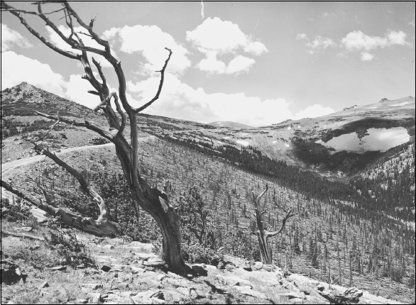
Trail Ridge Road covers 48 miles between Estes Park on Rocky Mountain National Parks east side and Grand Lake on the west. Travelers in either direction climb 4,000 feet in less than an hour. Eleven miles of the highway are above tree line. The road winds through a vast tundra to its high point at 12,183 feet in elevation. It is the highest continuous paved motor highway in the world.
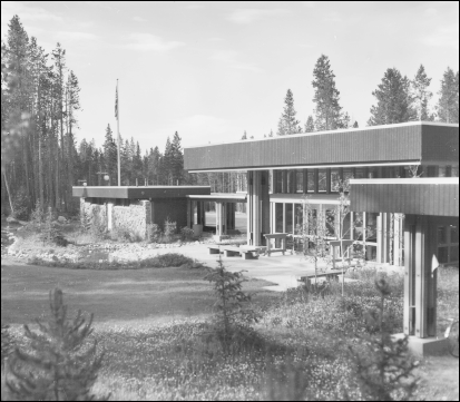
This 1974 view shows the West Side Headquarters and Kawuneechee Visitor Center. This center and the Beaver Meadows Visitor Center are open every day all year. Other places of interest that open seasonally at various times include the Fall River Visitor Center, Alpine Visitor Center, Lily Lake Visitor Center, Moraine Park Museum, Holzwarth Historic Site, Bear Lake kiosk, and Sheep Lakes and Corral Creek information stations.
One
NATIVE AMERICANS IN THE AREA
Scholars believe migrating people who were hunters crossing from Asia to North America gradually moved southward into the Rocky Mountain National Park area 10,000 to 15,000 years ago. Mammoth remains and projectile points were unearthed just 35 miles east of the park at the Dent archeological site. About 45 miles northeast of the park is the Lindenmeier site, which archeologists believe was an ancient Folsom camping spot about 11,000 years ago. Four Clovis and Folsom projectile points have been found in the park. Alpine campsites south of the park reveal large game drive systems that date between 3850 and 3400 B.C.
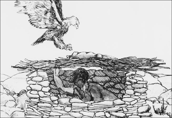
These sites suggest early Native Americans did not remain all year but came seasonally to hunt and migrated to warmer elevations in winter. What is now Trail Ridge Road was a usable east-west route for crossing the mountains. Close to Trail Ridge road is a stone wall structure that permitted hunters to direct game animals toward men waiting with weapons. Between A.D. 400 and 650, bows and arrows were used. In addition to mountain animals, these Native Americans ate berries, currants, and roots.
Ute, Arapaho, and Cheyenne were among the tribes that came into the Rocky Mountain Park area. The Ute were mentioned as being in the southern Rocky Mountains as early as 1626, and the Arapaho and Cheyenne came into Colorado around 1800. They all ranged in Colorado during the 19th century in the area of Estes Park, Grand Lake, and the land that is now Rocky Mountain National Park. They were seen by early settlers, and they left signs of having lived here or passed through. While the Arapaho and Cheyenne hunted mainly on the plains of eastern Colorado, the Ute remained in the western part of the state and ranged into central Utah. There was a deadly enmity between the Ute and the other two groups. Well-worn trails, a few teepee rings, bits of pottery, arrow points, some tools, and pieces of hunting equipment are the remains of these Native Americans in the park area.
