Wiley - Cumberland Gap National Historical Park
Here you can read online Wiley - Cumberland Gap National Historical Park full text of the book (entire story) in english for free. Download pdf and epub, get meaning, cover and reviews about this ebook. City: Cumberland Gap (Ky. and Va.);Cumberland Gap National Historical Park;United States;Cumberland Gap, year: 2014, publisher: Arcadia Publishing, genre: Home and family. Description of the work, (preface) as well as reviews are available. Best literature library LitArk.com created for fans of good reading and offers a wide selection of genres:
Romance novel
Science fiction
Adventure
Detective
Science
History
Home and family
Prose
Art
Politics
Computer
Non-fiction
Religion
Business
Children
Humor
Choose a favorite category and find really read worthwhile books. Enjoy immersion in the world of imagination, feel the emotions of the characters or learn something new for yourself, make an fascinating discovery.

- Book:Cumberland Gap National Historical Park
- Author:
- Publisher:Arcadia Publishing
- Genre:
- Year:2014
- City:Cumberland Gap (Ky. and Va.);Cumberland Gap National Historical Park;United States;Cumberland Gap
- Rating:5 / 5
- Favourites:Add to favourites
- Your mark:
Cumberland Gap National Historical Park: summary, description and annotation
We offer to read an annotation, description, summary or preface (depends on what the author of the book "Cumberland Gap National Historical Park" wrote himself). If you haven't found the necessary information about the book — write in the comments, we will try to find it.
Best known for its pivotal role in opening up the western frontier and its association with explorers and pioneers, the legendary Cumberland Gap has long been celebrated in music and literature. To better preserve that history, Cumberland Gap National Historical Park was authorized in 1940 and now covers more than 24,000 acres in Kentucky, Virginia, and Tennessee. Daniel Boone is remembered here, as well the Native Americans who used the path through the mountains for trade and warfare, the Civil War soldiers who took turns guarding this strategic portal, the geologists and industrialists who saw the potential for development, the businessmen who built one of the nations first roads for automobile travel, and the displaced residents who gave up their homes for the park. The dream of a few dedicated individuals to one day restore the historic Wilderness Road through the Cumberland Gap came true in 2002 after decades of planning, and visitors can once again walk in the footsteps...
Wiley: author's other books
Who wrote Cumberland Gap National Historical Park? Find out the surname, the name of the author of the book and a list of all author's works by series.


Cumberland Gap National Historical Park — read online for free the complete book (whole text) full work
Below is the text of the book, divided by pages. System saving the place of the last page read, allows you to conveniently read the book "Cumberland Gap National Historical Park" online for free, without having to search again every time where you left off. Put a bookmark, and you can go to the page where you finished reading at any time.
Font size:
Interval:
Bookmark:
IMAGES
of America
CUMBERLAND GAP
NATIONAL HISTORICAL PARK
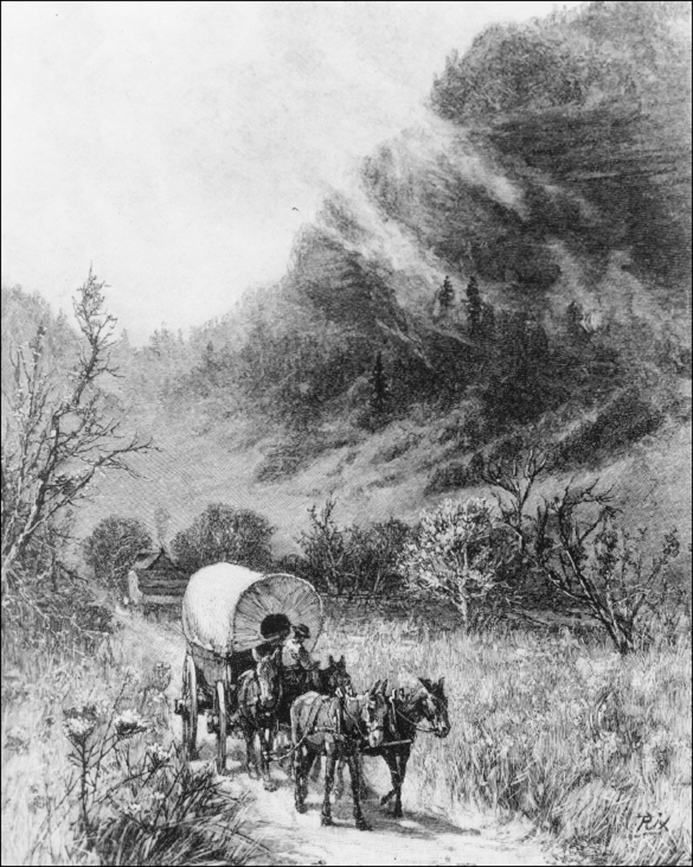
This 19th-century print depicts a familys journey westward through the Cumberland Gap. The meadows with flowers and a flat, well-tended road lend a romantic flavor to the pioneers story. The reality was often much more harsh. (Courtesy of the Cumberland Gap National Historical Park.)
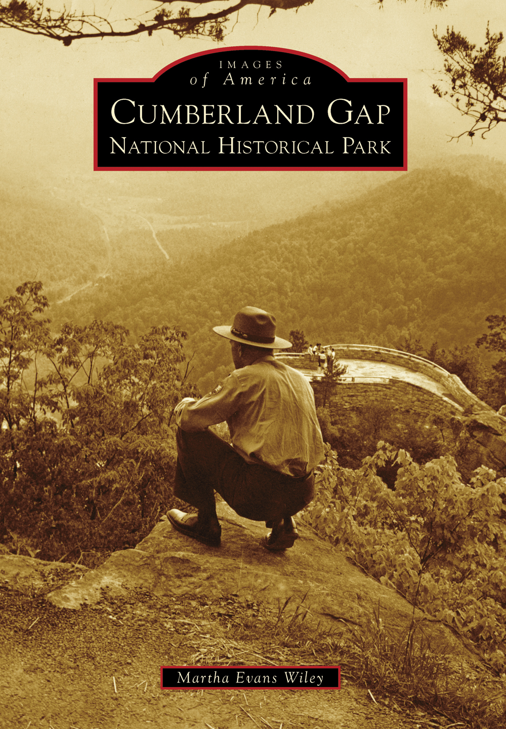
ON THE COVER: A park ranger looks out over the scenery of the Cumberland Mountains and beyond from Wind Gap overlook in 1959. From this vantage point, the three states that make up the Cumberland Gap National Historical ParkKentucky, Virginia, and Tennesseecan be seen. (Courtesy of the Cumberland Gap National Historical Park.)
IMAGES
of America
CUMBERLAND GAP
NATIONAL HISTORICAL PARK
Martha Evans Wiley

Copyright 2014 by Martha Evans Wiley
ISBN 978-1-4671-1111-9
Ebook ISBN 9781439644584
Published by Arcadia Publishing
Charleston, South Carolina
Library of Congress Control Number: 2013939948
For all general information, please contact Arcadia Publishing:
Telephone 843-853-2070
Fax 843-853-0044
E-mail
For customer service and orders:
Toll-Free 1-888-313-2665
Visit us on the Internet at www.arcadiapublishing.com
To Virginia Huff, whose commitment and love for the park have inspired so many
CONTENTS
ACKNOWLEDGMENTS
I owe many thanks to the staff at Cumberland Gap National Historical Park for their help and patience over the months I have spent working on this book, and I am especially grateful to Carol Borneman for her diligent proofreading. I would also like to thank my family, especially my daughter Emma, for helping around the house while I was preoccupied. My husband offered both encouragement and editorial help. Lincoln Memorial University archivist Michelle Ganz was always quick to respond with a photograph when needed, and fellow author Natalie Sweet helped me stay on track. Arcadia acquisitions editor Liz Gurley was always available to answer any questions I had throughout the publishing process.
Unless otherwise noted, all images are courtesy of the Cumberland Gap National Historical Park archives. Images provided by the Abraham Lincoln Library and Museum, Lincoln Memorial University are abbreviated as (ALLM of LMU), and images courtesy of the Bell County, Kentucky Historical Society are abbreviated as (BCHS).
INTRODUCTION
A gap is sometimes defined as a break in a barrier, and for centuries, that is what Cumberland Gap meant to hundreds of thousands of people. It was a means to an end, a low point in a mountain range long viewed as an impediment to the expansion of the English colonies and, later, the nascent United States. It wasnt until the early 20th century that some began to see Cumberland Gap as a place important in its own righta vital part of Americas story that deserved to be recognized and preserved.
Encompassing more than 24,000 acres in Kentucky, Virginia, and Tennessee, Cumberland Gap National Historical Park contains some of the poorest and most rugged areas of Appalachia. The park was first conceived of in 1922 and authorized by Congress in 1940, but it wasnt formally dedicated until 1959. Since then, the park has seen many changes, both in identity and purpose.
While the Cumberland Gap is closely identified with such notable historical figures as Dr. Thomas Walker and Daniel Boone, there are scores of lesser-known stories associated with this unassuming pass through the Cumberland Mountain range. When Boone hacked his trace through the deep forest and began leading settlers west, the dam broke; more than 300,000 people followed his trace to the legendary bluegrass of Kentucky and beyond. Today, it is estimated that 48 million Americans can trace their ancestors to having traveled through the Cumberland Gap.
Local citizens first floated the idea of a national park at Cumberland Gap in the 1920s, wanting to protect the spectacular scenery from the mining and logging that was devastating the landscape. But the park was also the creation of a community of dreamers who saw the need to preserve and share the stories of Boone and the pioneers who traveled through the Gap on their way to a better life.
The journey of the parks creation was at times as rough as that of the westward-bound settlers. It took almost 20 years to pass the legislation necessary to authorize the park, reflecting some confusion as to the focus of what was to be the largest national historical park east of the Mississippi. World War II delayed land acquisition, as did the difficulty in tracking down hundreds of small landowners in the mountains of the three states to convince them to sell and establish boundaries. The park boundary was surveyed three times in the 1940s and 1950s to avoid later disputes.
The dedication of the park finally arrived on the weekend of July 3, 1959. Vice Pres. Richard M. Nixon presided over a parade that Middlesboro, Kentucky, residents still recall as the biggest day in their towns history. Thousands attended, and hundreds participated in the formal recognition of the newest national historical park.
After the dedication, the park grew quickly, both in program and facilities. The focus of the parks programming alternated between the cultural history within its boundaries and its incredible natural diversity. But the dream of a few back in the early days of the park was never forgotten, that of one day being able walk through the Cumberland Gap in the footsteps of Daniel Boone.
This dream took a step forward in 1973 when a law was passed directing the National Park Service (NPS) to build a twin-bore tunnel under Cumberland Mountain to divert traffic from the dangerous road over the gap. Progress toward this goal was slow at times but picked up once the actual work began. The grand opening of the state-of-the-art tunnel was held in October 1996 and, despite the rainy weather, was well attended by dignitaries and the public. As the procession of historical reenactors paraded by, making their way through this 21st-century marvel, the frontier disappeared and all barriers were surmountable.
Thus, the stage was set for the final step in the process, one that was set in motion decades before: the physical restoration of the Wilderness Road landscape over the Cumberland Gap. The new tunnel removed the vehicle traffic and made it possible to tear up the roughly 13,000 tons of asphalt of US Highway 25Ea road that had been in place in some form or another for almost a centuryand restore the rough dirt trail of Boones time. Research on this daunting project had been ongoing throughout tunnel construction. Working from an exhaustive study prepared by NPS historian Jere L. Krakow in 1987, NPS visual information specialist Michael F. Hart combined period maps and journals, extant road traces, historic and aerial photographs, and old-fashioned field work to guide the construction crews in recreating the trail of centuries earlier.
After nine months of rigorous work, the trail was completed in 2002, averaging 10 feet in width for a 1.2-mile stretch from Virginia to Kentucky, through the saddle of the Cumberland Gap. It was time for another dedication, this time celebrating the opening of the storied Wilderness Road, once again open for foot traffic. Again, the procession of history made its way through the Cumberland Gap, echoing the footsteps of those settlers from so long ago. In a more somber mood than felt in 1996, Native Americans, pioneers with their livestock and families, and long hunters retraced the journey of so many of Americas forefathers, this time more aware of the harsh realities of the trek.
Next pageFont size:
Interval:
Bookmark:
Similar books «Cumberland Gap National Historical Park»
Look at similar books to Cumberland Gap National Historical Park. We have selected literature similar in name and meaning in the hope of providing readers with more options to find new, interesting, not yet read works.
Discussion, reviews of the book Cumberland Gap National Historical Park and just readers' own opinions. Leave your comments, write what you think about the work, its meaning or the main characters. Specify what exactly you liked and what you didn't like, and why you think so.