Best Hikes Near
Reno and Lake Tahoe
Tracy Salcedo-Chourr
HELP US KEEP THIS GUIDE UP TO DATE
Every effort has been made by the author and editors to make this guide as accurate and useful as possible. However, many things can change after a guide is publishedtrails are rerouted, regulations change, techniques evolve, facilities come under new management, and so on.
We would appreciate hearing from you concerning your experiences with this guide and how you feel it could be improved and kept up to date. While we may not be able to respond to all comments and suggestions, well take them to heart, and well also make certain to share them with the author. Please send your comments and suggestions to the following address:
GPP
Reader Response/Editorial Department
PO Box 480
Guilford, CT 06437
Or you may e-mail us at: editorial@globepequot.com
Thanks for your input, and happy trails!
This book is dedicated to the memory of Howard Friedman, who read my last Lake Tahoe hiking guide from cover to cover. Rest in peace.
Copyright 2014 by Morris Book Publishing, LLC
ALL RIGHTS RESERVED. No part of this book may be reproduced or transmitted in any form by any means, electronic or mechanical, including photocopying and recording, or by any information storage and retrieval system, except as may be expressly permitted in writing from the publisher. Requests for permission should be addressed to Globe Pequot Press, Attn: Rights and Permissions Department, PO Box 480, Guilford, CT 06437.
FalconGuides is an imprint of Globe Pequot Press.
Falcon, FalconGuides, and Outfit Your Mind are registered trademarks of Morris Book Publishing, LLC.
TOPO! Explorer software and SuperQuad source maps courtesy of National Geographic Maps. For information about TOPO! Explorer, TOPO!, and Nat Geo Maps products, go to www.topo.com or www.natgeomaps.com.
All photos by Tracy Salcedo-Chourr
Text design: Sheryl P. Kober
Layout artist: Maggie Peterson
Project editor: Ellen Urban
Maps by Alena Pearce Morris Book Publishing, LLC
Library of Congress Cataloging-in-Publication Data is available on file.
ISBN 978-1-4930-0622-9
The author and Globe Pequot Press assume no liability for accidents happening to, or injuries sustained by, readers who engage in the activities described in this book.
Contents
Acknowledgments
My thanks for advice and help in the production of this guide and previous Reno and Lake Tahoe guides to Don Lane, Mike St. Michel, and Lindsay Gusses of the USDA Forest ServiceLake Tahoe Basin Management Unit; Mark Kimbrough of the Tahoe Rim Trail Association; Hal Paris and Pandora Bahlman of the Incline Village General Improvement District; Roger Adamson of the Tahoe City Public Utility District; Bill Houdyschell of the Tahoe Donner Associations forestry division; Bill Champion of Lake TahoeNevada State Park; Dean Lutz, Jeff Wiley, and Susanne Jensen of the USFS Tahoe National Forest; Jacqui Zink, park ranger with the US Army Corps of Engineers at Martis Creek Lake; Dave Nettle; Gisela Steiner of Tahoe Trail Trekkers; Billy Sibley of the City of Reno Parks, Recreation and Community Services Department; Cheryl Surface of Washoe Countys Department of Regional Parks & Open Space; Arthur Callen of the Bureau of Land Managements Carson City District; Donna Silver at Washoe Lake State Park; and Steve Hale of the Humboldt-Toiyabe National Forest, Carson City Ranger District.
Thanks to the editors and publishers whose efforts have made this (and my other guidebooks) the best they can be, including Bill Schneider, David Lee, Charlene Patterson, Erica Olsen, Julie Marsh, Scott Adams, and Jessica Haberman. A huge shout-out to former publishers George Meyers and Merrill Wilson, who helped get it all started.
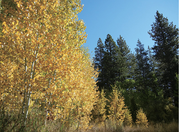
Aspen turn golden along the trail to Marlette Lake.
Thanks to my hiking partners, trail advisors, and support staff, including Penn Chourr, Julianne Roth, Linda Madan, Deb Rodman, and Mitchell and Karen Friedman. Thanks also to Linda and Mike Madan for the advice on eateries in the Reno area.
Thanks to these folks for everything: Howard and Rita Friedman and the entire Friedman/Rodman clan; Jesse and Judy Salcedo; Chris Salcedo and Angela Jones; Nick and Nancy Salcedo; Sarah Chourr and Martin Chourr; Karen, Kelly, Sara, Julie, and Kerin; and my colleagues at Dunbar Elementary School and Streetwise Reports for their flexibility.
Finally, my gratitude always to my sons Jesse, Cruz, and Penn, who never complain when I take off for the hills without themor when I drag them along.
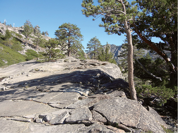
Slabs of polished granite swoop up off the Velma Lakes Trail in the Desolation Wilderness.
Introduction
We all face challenges. In the grand scheme of things, the dilemma posed by having to select the best hikes in the RenoLake Tahoe area is relatively minor. But it has been a challenge nonetheless, given the grandeur of Californias Range of Light and the boundless network of trails that weaves through it.
Then again, how could I go wrong?
The trick has been in the exploration. The Sierra Nevada have been in my soul and under my soles for decades now. I know what I like and I know where to find it. I could have stuck with my old favorites (and they are in this guide), but Sierran hikers are as varied as the terrain, so I broadened my scope. Routes in this guide range from super-short wheelchair-accessible interpretive trails to thigh-burning treks to high-altitude destinations. They ramble through scree fields above treeline, wind into thick yellow pine forests, and climb into desert scrublands. They lead to excellent viewpoints, verdant wildflower fields, calming beaches, historic sites, and awesome summits. They are informed by water, whether by Lake Tahoe itself, or the Truckee River, or smaller streams or lakes. The goal was not to be comprehensive. I hope Ive selected a tasty sampling, like chocolates in a gift box. But a whole warehouse of deliciousness remains open to the adventurer.
Most trails around Lake Tahoe feature climbingthey are in the Sierra Nevada, after all. But none will bust a gut. You may encounter comparable steepness on tracks in Reno, but the lesser altitude eases the workload. Spectacular mountain backdrops and extremes of weather lend a wildland feel to even the more urban treks around the city.
Routes in this guide are intended to be day hikes, though many of the trails extend farther into the wilderness or link to other paths that reach into remoter regions. With a good map, a little planning, and the right gear, you can use many of these trails to launch weekend backpacking trips or treks lasting a month or more. Climb onto the Pacific Crest Trail and you can head north through the Cascades to Canada, or south to Yosemite, Mount Whitney, and the Mexican border.


