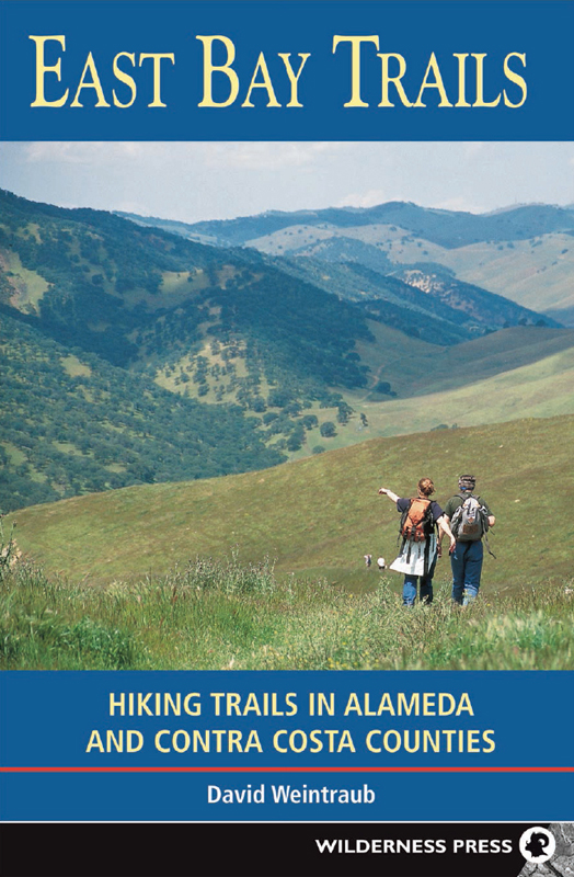

East Bay Trails: Hiking Trails in Alameda and Contra Costa Counties
1st EDITION May 1998
2nd EDITION June 2005
2nd printing April 2006
3rd printing May 2008
4th printing October 2009
Copyright 1998, 2005 by David Weintraub
Front cover photo copyright 2005 by David Weintraub
Interior photos, except where noted, by David Weintraub
Maps: Ben Pease, Pease Press
Cover design: Lisa Pletka
Book design: Margaret Copeland, Terragraphics
Book Editor: Jessica Benner
ISBN 978-0-89997-372-2
Manufactured in the United States of America
| Published by: | Wilderness Press |
| c/o Keen Communications |
| P.O. Box 43673 |
| Birmingham, AL 35243 |
| (800) 443-7227; FAX (205) 326-1012 |
| info@wildernesspress.com |
| www.wildernesspress.com |
Visit our website for a complete listing of our books and for ordering information.
Cover photo: Round Valley Regional Preserve: View northwest from high point, Hardy Canyon Trail
Frontispiece: Hikers in Mt. Diablo State Park
All rights reserved. No part of this book may be reproduced in any form, or by any means electronic, mechanical, recording, or otherwise, without written permission from the publisher, except for brief quotations used in reviews.
SAFETY NOTICE : Although Wilderness Press and the author have made every attempt to ensure that the information in this book is accurate at press time, they are not responsible for any loss, damage, injury, or inconvenience that may occur to anyone while using this book. You are responsible for your own safety and health. The fact that a trail is described in this book does not mean that it will be safe for you. Be aware that trail conditions can change from day to day. Always check local conditions and know your own limitations.
Acknowledgments
Many people contributed to the first edition of this book, some by sharing information and expertise, others by sharing miles on the trail. Thanks, then, to the fine folks at the East Bay Regional Park District, including Steve Fiala (who by now is enjoying retirement), Bert Johnson, Alan Kaplan, Juan Carlos Solis, Paul Ferreira, Anthony Fisher, and Maryanne Canaparo. Thanks as well to Bob Flasher and Pat Solo, East Bay Municipal Utility District; Cameron Morrison, Mt. Diablo State Park; John Steiner (staff) and Alvin Dockter (volunteer), Don Edwards San Francisco Bay National Wildlife Refuge; and Mike Koslosky, Hayward Area Recreation and Park District.
These friends also deserve my thanks: Laura Wood, Paul Ash, Silvia Fernandez, Elena Ash, Jed Manwaring, Brenda Tharp, Steve Gregory, Vickie Vann, Ken Kobre, Betsy Brill, Mary Thorsby, John Macchia, Angela Macchia, Susan Rouder, and George deTunq. Enjoying the trails vicariously, Denise Rehse transcribed countless hours of taped notes.
Two of the people involved with the first edition are, sadly, no longer with usDorothy L. Whitnah was a source of information and inspiration, and Galen Rowell graciously wrote the foreword.
Tom Winnett and his daughter Caroline at Wilderness Press took a chance on an untested author and helped me create what became my first book. Since then, Ive worked on five more Wilderness Press books, and I thank all the wonderful people there who translated my words and photographs into printed form. Thanks to Ben Pease for the fine maps.
Finally I thank my wife, Maggi, for her love and support.
David Weintraub
Preface to the Second Edition
The task of checking and updating the information in this new edition of East Bay Trails fell primarily to three energetic and enthusiastic colleagues: Kate Hoffman, Hayden Foell, and Jed Manwaring. Because I no longer reside in the Bay Area, they were my eyes and ears on the trail, hiking each of the 53 original trips and providing corrections, comments, suggestions, additions, and annotated maps. The three new tripsLime Ridge Open Space, Diablo Foothills Regional Park, and Round Valley Regional Preservewere ones I completed before moving to South Carolina.
The purpose of this book is three-fold: first, to help you select an enjoyable trip; second, to guide you to the trailhead and along the trail; third, to provide information about some of the features you may see during the trip. My ultimate goal is to convey the excitement and wonder I felt as I explored the trails of the East Bay, and thereby encourage you to support efforts to preserve and expand the parklands.
I have tried to be as accurate and thorough as possible, but your experience of a trail will almost certainly be different from mine. Each day in nature is unique. I was on a particular trail for one or perhaps two days, and what I saw, heard, and felt will probably not be repeated, at least not exactly. I have indicated this in the text by using the word may instead of will, as in you may see turkey vultures circling overhead, and by being specific about when things occur, such as the blooming of certain wildflowers.
As a matter of personal preference, most of the routes in this book are loops and semi-loops (a loop with a short out-and-back segment). I selected the direction of travel based on several factors, the most important being steepness of the downhill sections. As I get older, I find hiking steeply downhill more and more challenging. So if you follow the loop routes as described, you can expect to find the downhill sections less steep than the uphill ones whenever possible. If this is not to your liking, simply reverse the loop.
If you have comments, corrections, and/or suggestions, please send them to: mail@wildernesspress.com.
David Weintraub
Introduction
The East Bay
Imagine a landscape of oak-studded hills, grassy ridges, rocky peaks, forested valleys, and salt-marsh shoreline. Picture this landscape in a region blessed with a mild climate, where ocean breezes temper summers heat and a winter freeze makes the evening news. Parts of this area have been protected from development and preserved for future generations, with more than 1000 miles of trails for hiking, bicycling, walking, jogging, and horseback riding. Often this kind of outdoor recreation paradise is only found tucked away in remote corners of national parks or set aside in wilderness areas, inaccessible to many of us. But all of these things can be found in the East Bay, within easy reach of millions of people.
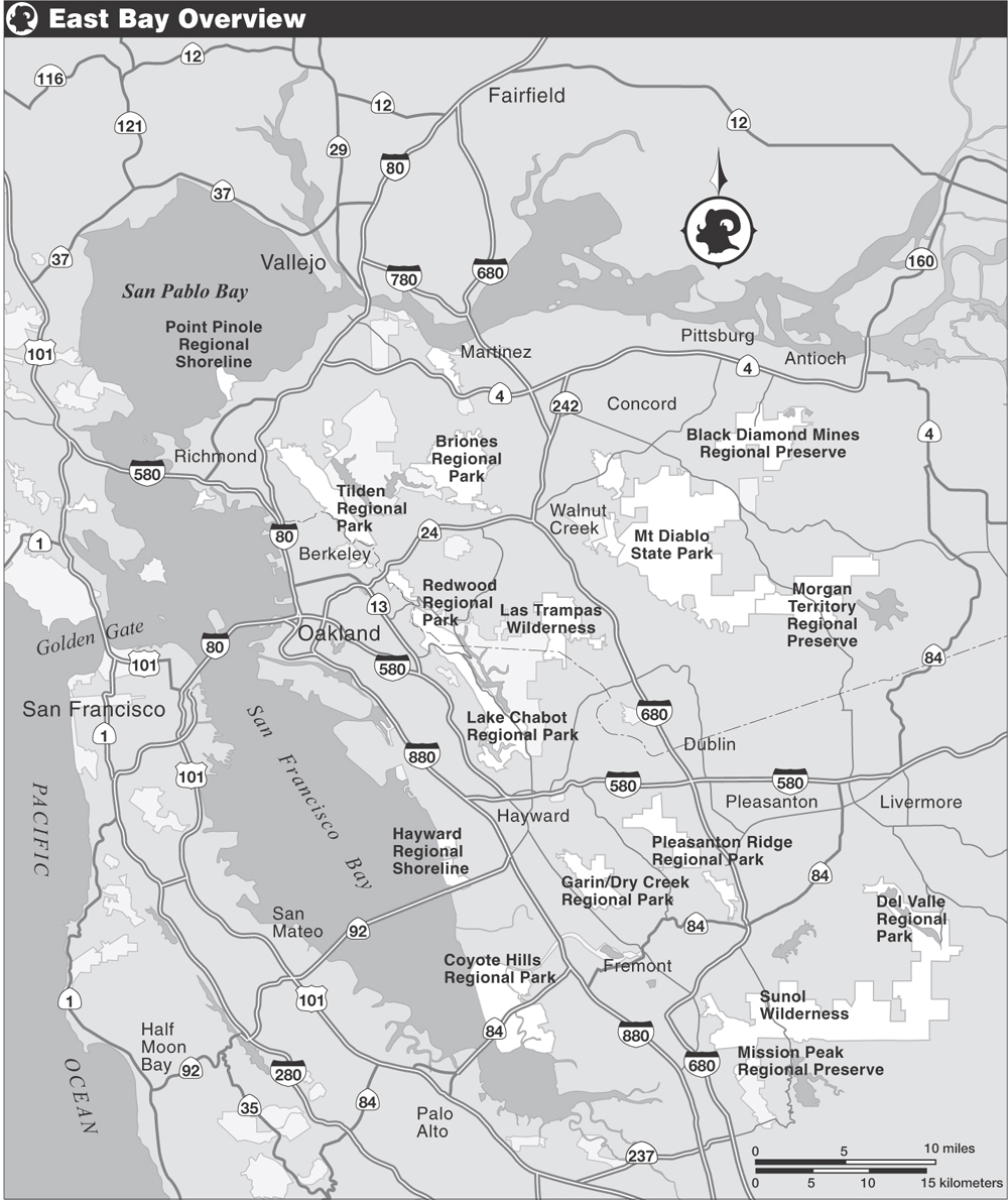
The East Bay, which extends from San Francisco Bay to the edge of the Central Valley, and from Carquinez Strait and Suisun Bay to the foothills of Mt. Hamilton, is made up of two counties, Alameda and Contra Costa, a 1700-square-mile area that is home to some 2.5 million people. Most of the open space within the two-county area is administered by four public agencies which together control roughly 172,000 acres, or about 275 square miles: East Bay Regional Park District (EBRPD), East Bay Municipal Utility District (EBMUD), Mt. Diablo State Park, and the Don Edwards San Francisco Bay National Wildlife Refuge. (Appendix 3 contains a listing of the various federal, state, and local agencies that administer East Bay parklands.)
Next page
