Jean Rusmore - Peninsula Trails: Hiking and Biking Trails on the San Francisco Peninsula
Here you can read online Jean Rusmore - Peninsula Trails: Hiking and Biking Trails on the San Francisco Peninsula full text of the book (entire story) in english for free. Download pdf and epub, get meaning, cover and reviews about this ebook. year: 2013, publisher: Wilderness Press, genre: Home and family. Description of the work, (preface) as well as reviews are available. Best literature library LitArk.com created for fans of good reading and offers a wide selection of genres:
Romance novel
Science fiction
Adventure
Detective
Science
History
Home and family
Prose
Art
Politics
Computer
Non-fiction
Religion
Business
Children
Humor
Choose a favorite category and find really read worthwhile books. Enjoy immersion in the world of imagination, feel the emotions of the characters or learn something new for yourself, make an fascinating discovery.
- Book:Peninsula Trails: Hiking and Biking Trails on the San Francisco Peninsula
- Author:
- Publisher:Wilderness Press
- Genre:
- Year:2013
- Rating:5 / 5
- Favourites:Add to favourites
- Your mark:
Peninsula Trails: Hiking and Biking Trails on the San Francisco Peninsula: summary, description and annotation
We offer to read an annotation, description, summary or preface (depends on what the author of the book "Peninsula Trails: Hiking and Biking Trails on the San Francisco Peninsula" wrote himself). If you haven't found the necessary information about the book — write in the comments, we will try to find it.
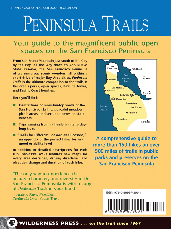
Choose from more than 150 trips on over 500 miles of trails with this comprehensive guide to every park and preserve on the San Francisco Peninsula. From Fort Funston and San Bruno Mountain south to Saratoga Gap, and from the Bay west to the Pacific Ocean, the peninsula offers something for everyone. This edition includes 18 new trips covering newly acquired public lands. Also includes maps and a trips-by-theme appendix.
Jean Rusmore: author's other books
Who wrote Peninsula Trails: Hiking and Biking Trails on the San Francisco Peninsula? Find out the surname, the name of the author of the book and a list of all author's works by series.


Peninsula Trails: Hiking and Biking Trails on the San Francisco Peninsula — read online for free the complete book (whole text) full work
Below is the text of the book, divided by pages. System saving the place of the last page read, allows you to conveniently read the book "Peninsula Trails: Hiking and Biking Trails on the San Francisco Peninsula" online for free, without having to search again every time where you left off. Put a bookmark, and you can go to the page where you finished reading at any time.
Font size:
Interval:
Bookmark:
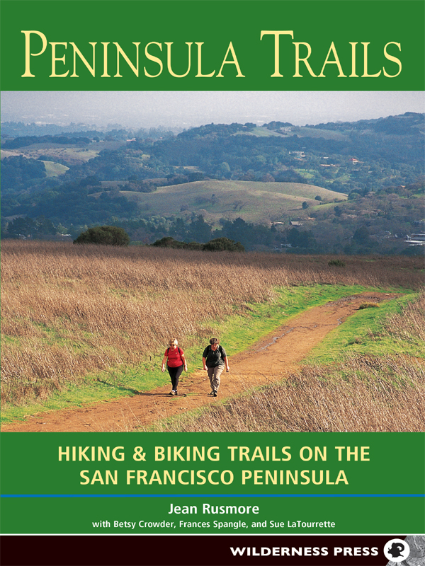
Peninsula Trails: Hiking & Biking Trails on the San Francisco Peninsula
1st EDITION January 1982
2nd EDITION January 1989
3rd EDITION May 1997
4th EDITION January 2005
2nd printing November 2007
3rd printing 2009
Copyright 2005 by Jean Rusmore, Frances Spangle, and Betsy Crowder
Front cover photo copyright 2005 by David Weintraub
Interior photos, except where noted, by Jean Rusmore
Maps: Ben Pease
Cover design: Lisa Pletka
Book design: Margaret CopelandTerragraphics
ISBN 978-0-89997-366-1
Manufactured in the United States of America
Published by: Wilderness Press
1345 8th Street
Berkeley, CA 94710
(800) 443-7227; FAX (510) 558-1696
info@wildernesspress.com
www.wildernesspress.com
Visit our website for a complete listing of our books and for ordering information.
Cover photo: The Spring Ridge Trail connects Windy Hill with Portola Valley
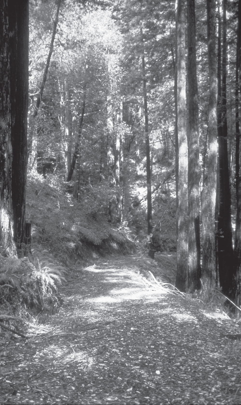
Frontispiece: Portola Redwoods State Park
All rights reserved. No part of this book may be reproduced in any form, or by any means electronic, mechanical, recording, or otherwise, without written permission from the publisher, except for brief quotations used in reviews.
SAFETY NOTICE: Although Wilderness Press and the author have made every attempt to ensure that the information in this book is accurate at press time, they are not responsible for any loss, damage, injury, or inconvenience that may occur to anyone while using this book. You are responsible for your own safety and health. The fact that a trail is described in this book does not mean that it will be safe for you. Be aware that trail conditions can change from day to day. Always check local conditions and know your own limitations.
Dedication
To the memory of Betsy Crowder
Acknowledgments
During the period of exploring new trails, revisiting familiar ones, and writing this fourth edition of Peninsula Trails, I have enjoyed the cooperation and help of many people. I especially thank Sue LaTourrette for accompanying me on the scouting hikes and for proofreading the text. Her sense of adventure and good humor made each trip a treat. To Peter LaTourrette for donating his bird photos and sharing his extensive knowledge of avian species, many thanks. To the many family members and friends who joined me on the trail, to Marilyn Walter, an outstanding trail advocate ready to hike and explore on short notice, to Joane and Ross Anderson who scouted several new trail routes, to my colleagues on the former San Mateo County Trails Advisory Committee, and to my delightful friends in the Walkie-Talkies womens hiking group, I extend my thanks.
The directors, rangers, and staffs of the public agencies through which these trails wind have been most helpful. In addition to their individual help, their maps, internet sites, and brochures have been indispensable. I thank all the dedicated people who plan, protect and care for the beautiful parks, preserves, watersheds, baylands, and beaches that grace the San Francisco PeninsulaGolden Gate National Recreation Area, State of California Parks and Recreation Department, California Coastal Commission, Midpeninsula Regional Open Space District, San Mateo County Parks and Recreation Department, Santa Clara County Parks Department, the Bay Area Ridge Trail, the San Francisco Bay Trail, the Juan Bautista de Anza Trail, and the many city parks and beaches. Two nonprofit organizations that secure land for future parks and open spaces deserve special mentionSempervirens Fund and the Peninsula Open Space Trust. Their longtime efforts to save magnificent redwood groves, ridgeline forests and meadows, and coastal properties continue to add lands for preservation and passive recreation on the San Francisco Peninsula.
Frances Spangle and I authored the first two editions of Peninsula Trails and South Bay Trails; when Frances moved away, Betsy Crowder joined me for the third edition. Unfortunately, an accident took her life on September 29, 2000. Sue LaTourrette joins me in dedicating this fourth edition of Peninsula Trails to Betsy.
Jean Rusmore November 2004
Table of Contents
Preface
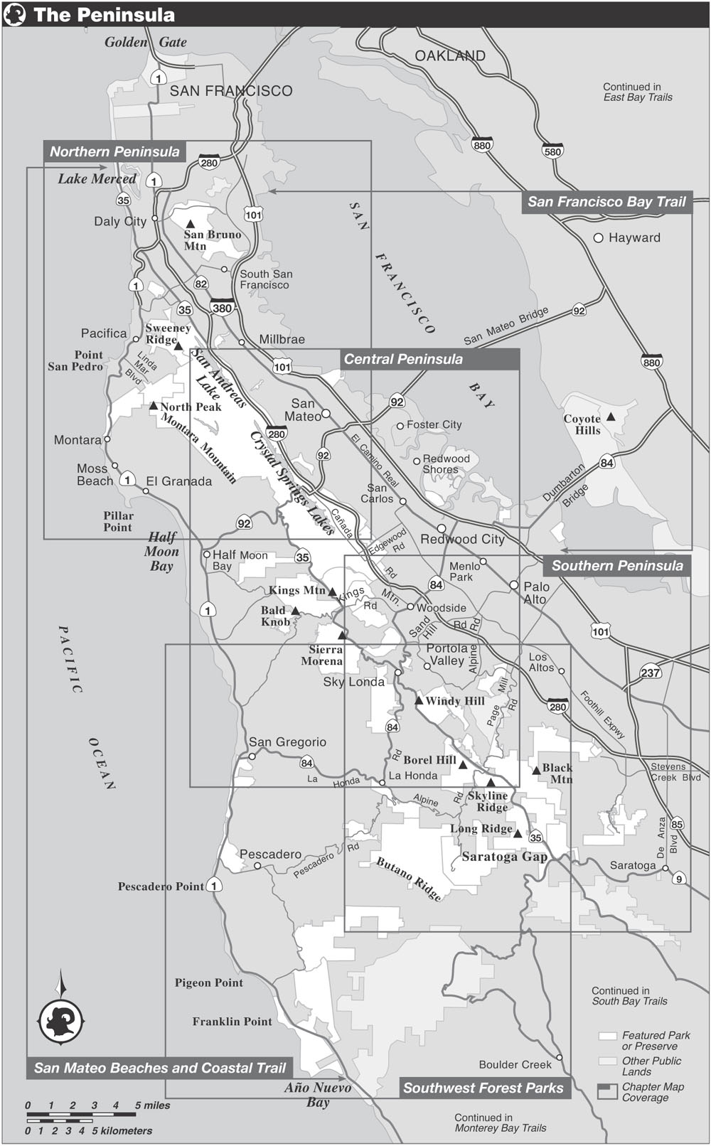
Since the publication of the first edition of Peninsula Trails in 1982, the number of parks, preserves and open spaces and the miles of trails increased more than twofold. In the last two years Sue LaTourrette and I visited all the parks covered in the 3rd edition and hiked every new trail in each new park, preserve, beach or bayside. We marveled at the beauty and accessibility of the San Francisco Peninsulafrom the San Francisco county line to Saratoga Gap and from San Francisco Bay to the Pacific Ocean. Therein is a magnificent treasury of open space for all to enjoy. Described here are 19 open space preserves, 2 watersheds, 11 lakes, 4 Golden Gate National Recreation sites, 5 state parks, 16 county parks, 11 state beaches, and 9 Coastal Access points.
We hope this book will help you, the reader, find these open spacesthe tiny coves and broad sandy beaches along the San Mateo Coast, the miles of paved Bayside trails, the route of the Juan Bautista de Anza Trail or the Bay Area Ridge Trail, the newest park or preserve, or the summit route to one of several 2400+ peaks on the Skyline ridge. Awaiting you is the pleasure of seeing a tiny wildflower brightening the trailside in spring, the discovery of a shaded dell beside a rushing stream, a picnic lunch in a new park, and the sense of wonder when gazing at the vast Pacific from a bluff recently designated Coastal Access.
Jean Rusmore and Sue LaTourrette
Introduction
The Peninsula Bayside, Mountain, and Coastside Setting
Geography
The Santa Cruz Mountains are part of the Coast Ranges of California. They run northwest to southeast, extending from Montara Mountain near San Francisco to Mt. Madonna near Watsonville. A natural divide splits the range into two parts at the Highway 17 pass between Los Gatos and Santa Cruz. The Spaniards called the southern section the Sierra Azul (blue mountains) and the northern part, the Sierra Morena (brown or dark mountains). The area covered by this guide centers on the Sierra Morena and includes land from the San Francisco Bay on the east to the Pacific Ocean on the west. The highest mountain in the Sierra Morena, at 2800 feet, is appropriately called Black Mountain.
The east side of the Santa Cruz Mountains, steeper than the west, is cut into deep canyons by streams that empty into San Francisco Bay. The upper reaches of these creeks, which still flow more or less untrammeled down through the mountains and the foothills, are some of the main delights of the mountainside parks. Where these creeks meandered across the Bay plain, they were once the dominant features of the landscape, bordered by huge oaks, bays, alders, and sycamores. Now they have all but disappeared from sight in the flatlands, being mostly confined to concrete ditches and culverts and bordered by chain-link fences. Two happy exceptions are the lower reaches of Los Trancos and San Francisquito creeks, which still retain their parklike tree borders as they wind through Portola Valley and the undeveloped lands of Stanford University. They are the sites of popular creekside trails.
The western slopes of the Santa Cruz Mountains are a different world from the eastern side. Very few roads cross the summit; those that do usually follow old Indian trails or Spanish routes or are remnants of former logging roads. Originally thickly forested, the canyons and ridges now support a second or third growth of redwoods and Douglas firs, interspersed with live oak, black oak, tan oak, bay laurel, and smaller shrubs and trees. Some groves of giant redwoods were spared the axe and saw. Toward the Coastside some areas formerly ranched are still open grassland.
Next pageFont size:
Interval:
Bookmark:
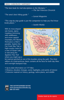
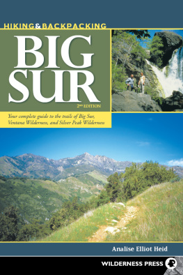
Similar books «Peninsula Trails: Hiking and Biking Trails on the San Francisco Peninsula»
Look at similar books to Peninsula Trails: Hiking and Biking Trails on the San Francisco Peninsula. We have selected literature similar in name and meaning in the hope of providing readers with more options to find new, interesting, not yet read works.
Discussion, reviews of the book Peninsula Trails: Hiking and Biking Trails on the San Francisco Peninsula and just readers' own opinions. Leave your comments, write what you think about the work, its meaning or the main characters. Specify what exactly you liked and what you didn't like, and why you think so.