Dawn J. Wright (editor) - GIS for Science, Volume 3: Maps for Saving the Planet (GIS for Science, 3)
Here you can read online Dawn J. Wright (editor) - GIS for Science, Volume 3: Maps for Saving the Planet (GIS for Science, 3) full text of the book (entire story) in english for free. Download pdf and epub, get meaning, cover and reviews about this ebook. year: 2021, publisher: Esri Press, genre: Home and family. Description of the work, (preface) as well as reviews are available. Best literature library LitArk.com created for fans of good reading and offers a wide selection of genres:
Romance novel
Science fiction
Adventure
Detective
Science
History
Home and family
Prose
Art
Politics
Computer
Non-fiction
Religion
Business
Children
Humor
Choose a favorite category and find really read worthwhile books. Enjoy immersion in the world of imagination, feel the emotions of the characters or learn something new for yourself, make an fascinating discovery.
- Book:GIS for Science, Volume 3: Maps for Saving the Planet (GIS for Science, 3)
- Author:
- Publisher:Esri Press
- Genre:
- Year:2021
- Rating:4 / 5
- Favourites:Add to favourites
- Your mark:
GIS for Science, Volume 3: Maps for Saving the Planet (GIS for Science, 3): summary, description and annotation
We offer to read an annotation, description, summary or preface (depends on what the author of the book "GIS for Science, Volume 3: Maps for Saving the Planet (GIS for Science, 3)" wrote himself). If you haven't found the necessary information about the book — write in the comments, we will try to find it.
GIS for Science: Maps for Saving the Planet, Volume 3, highlights real-world examples of scientists creating maps about saving life on Earth and preserving biodiversity.
With Earth and the natural world at risk from various forces, geographic information system (GIS) mapping is essential for driving scientifically conscious decision-making about how to protect life on Earth. In volume 3 of GIS for Science, explore a collection of maps from scientists working to save the planet through documenting and protecting its biodiversity.
In this volume, learn how GIS and data mapping are used in tandem with
- global satellite observation
- forestry
- marine policy
- artificial intelligence
- conservation biology, and
- environmental education
to help preserve and chronicle life on Earth. This volume also spotlights important global action initiatives incorporating conservation, including Half-Earth, 30 x 30, AI for Earth, the Blue Nature Alliance, and the Sustainable Development Solutions Network.
The stories presented in this third volume are ideal for the professional scientist and conservationist and anyone interested in the intersection of technology and the conservation of nature. The books contributors include scientists who are applying geographic data gathered from the full spectrum of remote sensing and on-site technologies. The maps and data are brought to life using ArcGIS software and other spatial data science tools that support research, collaboration, spatial analysis, and science communication across many locations and within diverse communities. The stories shared in this book and its companion website present inspirational ideas so that GIS users and scientists can work toward preserving biodiversity and saving planet Earth before time runs out.
Dawn J. Wright (editor): author's other books
Who wrote GIS for Science, Volume 3: Maps for Saving the Planet (GIS for Science, 3)? Find out the surname, the name of the author of the book and a list of all author's works by series.

GIS for Science, Volume 3: Maps for Saving the Planet (GIS for Science, 3) — read online for free the complete book (whole text) full work
Below is the text of the book, divided by pages. System saving the place of the last page read, allows you to conveniently read the book "GIS for Science, Volume 3: Maps for Saving the Planet (GIS for Science, 3)" online for free, without having to search again every time where you left off. Put a bookmark, and you can go to the page where you finished reading at any time.
Font size:
Interval:
Bookmark:

Esri Press, 380 New York Street, Redlands, California 92373-8100
Copyright 2021 Esri
All rights reserved
Christian Harder and Dawn J. Wright, eds.; GIS for Science: Maps for Saving the Planet, Volume 3; DOI: https://doi.org/10.17128/9781589486713
Library of Congress Control Number: 2019936340
e-ISBN 9781589486720
The information contained in this document is the exclusive property of Esri unless otherwise noted. This work is protected under United States copyright law and the copyright laws of the given countries of origin and applicable international laws, treaties, and/or conventions. No part of this work may be reproduced or transmitted in any form or by any means, electronic or mechanical, including photocopying or recording, or by any information storage or retrieval system, except as expressly permitted in writing by Esri. All requests should be sent to Attention: Contracts and Legal Services Manager, Esri, 380 New York Street, Redlands, California 92373-8100, USA.
The information contained in this document is subject to change without notice.
U.S. Government Restricted/Limited Rights: Any software, documentation, and/or data delivered hereunder is subject to the terms of the License Agreement. The commercial license rights in the License Agreement strictly govern Licensees use, reproduction, or disclosure of the software, data, and documentation. In no event shall the U.S. Government acquire greater than RESTRICTED/LIMITED RIGHTS. At a minimum, use, duplication, or disclosure by the U.S. Government is subject to restrictions as set forth in FAR 52.227-14 Alternates I, II, and III (DEC 2007); FAR 52.227-19(b) (DEC 2007) and/or FAR 12.211/12.212 (Commercial Technical Data/Computer Software); and DFARS 252.227-7015 (DEC 2011) (Technical Data Commercial Items) and/or DFARS 227.7202 (Commercial Computer Software and Commercial Computer Software Documentation), as applicable. Contractor/Manufacturer is Esri, 380 New York Street, Redlands, CA 92373-8100, USA.
@esri.com, 3D Analyst, ACORN, Address Coder, ADF, AML, ArcAtlas, ArcCAD, ArcCatalog, ArcCOGO, ArcData, ArcDoc, ArcEdit, ArcEditor, ArcEurope, ArcExplorer, ArcExpress, ArcGIS, arcgis.com, ArcGlobe, ArcGrid, ArcIMS, ARC/INFO, ArcInfo, ArcInfo Librarian, ArcLessons, ArcLocation, ArcLogistics, ArcMap, ArcNetwork, ArcNews, ArcObjects, ArcOpen, ArcPad, ArcPlot, ArcPress, ArcPy, ArcReader, ArcScan, ArcScene, ArcSchool, ArcScripts, ArcSDE, ArcSdl, ArcSketch, ArcStorm, ArcSurvey, ArcTIN, ArcToolbox, ArcTools, ArcUSA, ArcUser, ArcView, ArcVoyager, ArcWatch, ArcWeb, ArcWorld, ArcXML, Atlas GIS, AtlasWare, Avenue, BAO, Business Analyst, Business Analyst Online, BusinessMAP, CityEngine, CommunityInfo, Database Integrator, DBI Kit, EDN, Esri, esri.com, EsriTeam GIS, EsriThe GIS Company, EsriThe GIS People, EsriThe GIS Software Leader, FormEdit, GeoCollector, Geographic Design System, Geography Matters, Geography Network, geographynetwork.com, Geoloqi, Geotrigger, GIS by Esri, gis.com, GISData Server, GIS Day, gisday.com, GIS for Everyone, JTX, MapIt, Maplex, MapObjects, MapStudio, ModelBuilder, MOLE, MPSAtlas, PLTS, Rent-a-Tech, SDE, SML, SourcebookAmerica, SpatiaLABS, Spatial Database Engine, StreetMap, Tapestry, the ARC/INFO logo, the ArcGIS Explorer logo, the ArcGIS logo, the ArcPad logo, the Esri globe logo, the Esri Press logo, The Geographic Advantage, The Geographic Approach, the GIS Day logo, the MapIt logo, The Worlds Leading Desktop GIS, Water Writes, and Your Personal Geographic Information System are trademarks, service marks, or registered marks of Esri in the United States, the European Community, or certain other jurisdictions. CityEngine is a registered trademark of Procedural AG and is distributed under license by Esri. Other companies and products or services mentioned herein may be trademarks, service marks, or registered marks of their respective mark owners.
For purchasing and distribution options (both domestic and international), please visit esripress.esri.com.
All images courtesy of Esri except as noted.
Developmental editing by Mark Henry; Technology Showcase editing by Keith Mann; Copyediting by Joe DeLillo. Cover design and map by John Nelson.
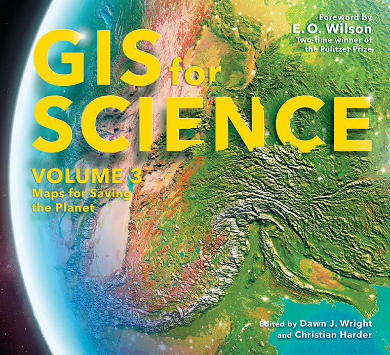
On the cover: This vibrant representation of our planet paints on its surface the World Ecological Land Unitsa segmentation of distinct bioclimate, landform, lithology, and land cover that forms the basic components of terrestrial ecosystem structure. Hillshading was derived from GEBCO 2020 elevation and bathymetric data. It was created in ArcGIS Pro. The aesthetic was inherited from the Half-Earth globe, designed by John Nelson of Esri and Estefana Casal of Vizzuality, with the goal of invoking the sense that our shared planet is something beautiful and charming and worthy of sound stewardship.
176010
See this book come alive at
GISforScience.com
By Jack Dangermond, founder and president, Esri and Dawn J. Wright, chief scientist, Esri
Sciencethat wonderful endeavor in which someone investigates a question or a problem using reliable, verifiable methods and shares the resulthas always been about increasing our understanding of the world. Early on, we applied geographic information systems (GIS) to scienceto biology, ecology, economics, or any of the other social sciences. It wasnt until about 1993, when Michael Goodchild coined the term GIScience, that the world began to realize that GIS is a science in its own right. Today, we call this The Science of Where. GIS incorporates sciences such as geology, geography, health and human science, data science, computer science, statistics, geovisual analytics, decision science, and much more. It integrates these disciplines into a kind of metascience, providing a framework for applying science to almost everything, merging the rigor of the scientific method with the technologies of GIS. The study of where things happen, it turns out, has great relevance.
We live in a world that faces more and more challenges. Even as a global pandemic continues to ravage human lives, the natural world remains under siege, with a global rate of species extinction that, according to the Intergovernmental Science-Policy Platform on Biodiversity and Ecosystem Services (IPBES), is at least tens to hundreds of times higher than at any time during the past 10 million years, and accelerating. During the coronavirus disease 2019 (COVID-19) pandemic, most African countries have reported reduced monitoring of the illegal wildlife trade. The protection of endangered species, conservation education, and anti-poaching operations also have faltered. Conversely, so few people understand how deterioration in the natural world can serve to light the fire of a new pandemic. Biodiversitythe variety of life on Earth from microscopic genes to entire ecosystemsis currently not a focus of the global response to factors threatening the lives and livelihoods of all creatures and organisms. As the venerable naturalist Edward O. Wilson has warned: The only hope for the species still living is a human effort commensurate with the magnitude of the problem.
Part of this human effort is a global mobilization to identify and map the species that are at risk and not already safeguarded. This effort involves action maps, as The Nature Conservancy calls them, to show us where things are, and what we should protect, build, and invest in. These action maps can help us decide what to do in the face of trade-offs between wild grasslands and mineral exploration, or between transportation infrastructure and wildlife, etc. Such action maps are now well within our grasp as we continue to undergo a massive digital transformation. This transformation enables a science that increasingly helps us measure and analyze things and predict what will happen next. Just as important, science helps us design, evaluate, and ultimately weave all these pieces together in a protective fabric across the planet.
Font size:
Interval:
Bookmark:
Similar books «GIS for Science, Volume 3: Maps for Saving the Planet (GIS for Science, 3)»
Look at similar books to GIS for Science, Volume 3: Maps for Saving the Planet (GIS for Science, 3). We have selected literature similar in name and meaning in the hope of providing readers with more options to find new, interesting, not yet read works.
Discussion, reviews of the book GIS for Science, Volume 3: Maps for Saving the Planet (GIS for Science, 3) and just readers' own opinions. Leave your comments, write what you think about the work, its meaning or the main characters. Specify what exactly you liked and what you didn't like, and why you think so.