Backroads
of the California Coast
YOUR GUIDE TO SCENIC GATEWAYS & ADVENTURES
TEXT BY Karen Misuraca
PHOTOGRAPHY BY Gary Crabbe

CONTENTS
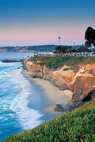
La Jolla Cove, part of Scripps Park in San Diego County, is one of the most photographed beaches in California. With crystal waters allowing for underwater visibility up to thirty feet, this cove also is a popular spot for scuba diving and snorkeling.
INTRODUCTION

Wine grapes grow on the vine at Kunde Estates, near Kenwood in Californias most well-known wine-making region, Sonoma County.
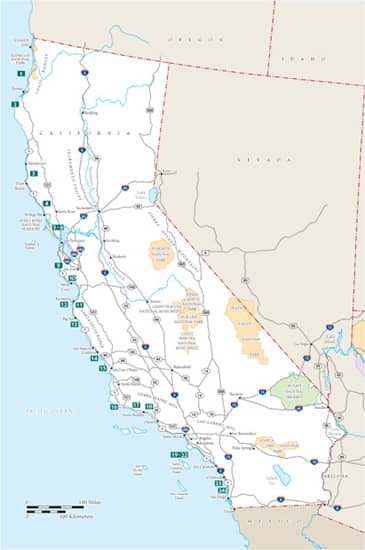
Overwhelming in its vastness, California stretches down the Pacific Coast for 1,264 miles. The state is split lengthwise by a wide central valley, warmed by intense heat of the inland Mohave and Sonoran deserts, and bordered by the high mountain frontiersthe Cascades, the Sierra Nevada, and the Coast Ranges.
Drawn irresistibly to the blue Pacific Ocean, eighty percent of Californians live within thirty miles of the sea. They turn to their coast for refreshment of their minds and bodies, as do visitors who come here by the millions from across America and the world to see the regions famous landmarks and historical sites and to enjoy the weather. Some people never touch the sand nor dip their toes in the water. They drive to the seacoast, sit in their vehicles, and breathe in the invigorating salt air.
More than one hundred California beaches, parks, preserves, and monuments, and several national parks are easily accessible from the meandering coastal routes of State (Highway 1) and U.S. Highway 101. And for adventurous travelers who venture a few miles off the two main highways, even more natural and historic attractions are in store. And that is what Backroads of the California Coast is all aboutdiscovering the lesser-known, quiet pleasures away from the sometimes maddening crowds and the well-trodden destinations.
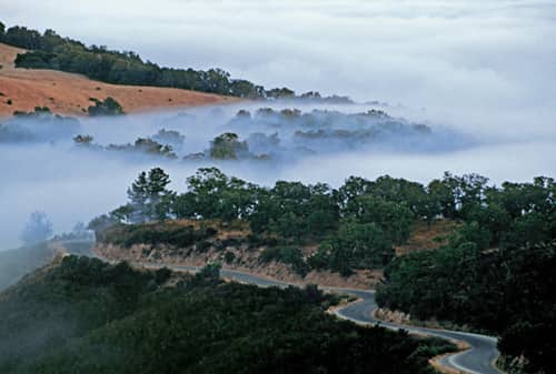
Fog covers the hills, trees, and Cachaqua Road, above Monterey Countys Carmel Valley, home to many wineries, art galleries, restaurants, and hotels.
Bill Ahern of the California Coastal Conservancy, a nonprofit organization that protects shoreline access, advises backroad adventurers to get away from roads and parking lots and hike or stroll along the spectacular trails in the state parks, which stretch along a quarter of the coast, or even across private property where we and other agencies have acquired easements [allowing] the public to walk along the coast. Bring binoculars, he adds, and check out the birds on the wetlands, the river and creek estuaries, and the beaches where the endangered snowy plovers forage for food.
About midway along the coast, around Pismo Beach, legions of palm trees signal sunny Mediterranean weather and sandy beaches all the way to the Mexican border. Everything below is Southern California; everything above is Northern Californiaand that, as they say, makes all the difference. Which is best? The cool redwood forests and romantic fishermens villages up north? Or the warm waters and vacation resorts of the southern part of the state? The central coast has its appeal, too, from the winelands of the Santa Cruz Mountains to the architectural icons of Carmel and the wild cliffs and coves of Big Sur.
Mountains meet the sea on the north coasta land of big rivers, evergreen rainforests, and an irregular shoreline scrubbed by raucous surf. Its a romantic place with few inhabitants and vast tracts of untrodden wilderness. Travelers come north for the dramatic beauty and the feeling of isolation, when the only footprints on a beach may be your own and a brooding grove of redwoods stands in utter primeval silence, as it has for more than a thousand years. Wrapped in mists and pummeled by storms, northern seacoast towns are small and snug, picturesque with Victorian- and Gold Rushera buildings.
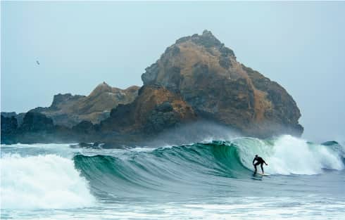
A surfer rides the waves at Pfeiffer Big Sur Beach, decorated with sea stacks and rock arches.
To the north, beaches are narrower, rockier, and home to more tide pools. Although the climate remains mild most of the year, you can expect more fog and rain in the wintertime (and even in the summertime in San Francisco). Ocean swimming in the colder northern waters is given up for beachcombing and bonfires.
The weather on the central coast south of San Francisco is always in flux. Clouds come and go, and even the densest fog usually burns off by midday. The colors and moods of the sea and sky shift, often in the span of an hour or two. Tracing the coastline south from Monterey Bay to Morro Bay, Highway 1 rides along above rocky promontories, coves, and harbors. Country roads head inland to quaint mountain villages and historic valleys where the first touristsSpanish conquistadorsonce galloped.
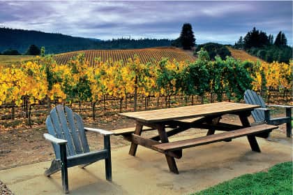
The Anderson Valley is one of Californias many places that are perfect for growing grapes used in the regions abundant winemaking.
At the entrance to the Santa Barbara channel, Point Conception is where the northsouth run of the coastline turns eastwest, and beaches are oriented toward the sun. This golden fragment of the edge of the continent creates a great, convex sandy shore separated from the intense heat of the interior deserts by narrow mountain ridges. A brilliant, overexposed sky is a blue umbrella year-round, save the occasional midwinter day. In San Diego, near the Mexican border, it rains less than ten inches a year.
Even near the population centers of Los Angeles, San Diego, and Santa Barbara, seekers of the backroads will find 1940s glamour on Catalina Island, historic ranchos and missions, some of the best bird-watching in the world in a handful of precious estuaries, and a high valley Shangri-la promising pink sunsets over Pacific shores. As Joan Dideon wrote in an essay describing her experiences living in California,... Things had better work here, because here, beneath that immense bleached sky, is where we run out of continent.
Next page

