IMAGES
of America
MIDDLESEX FELLS
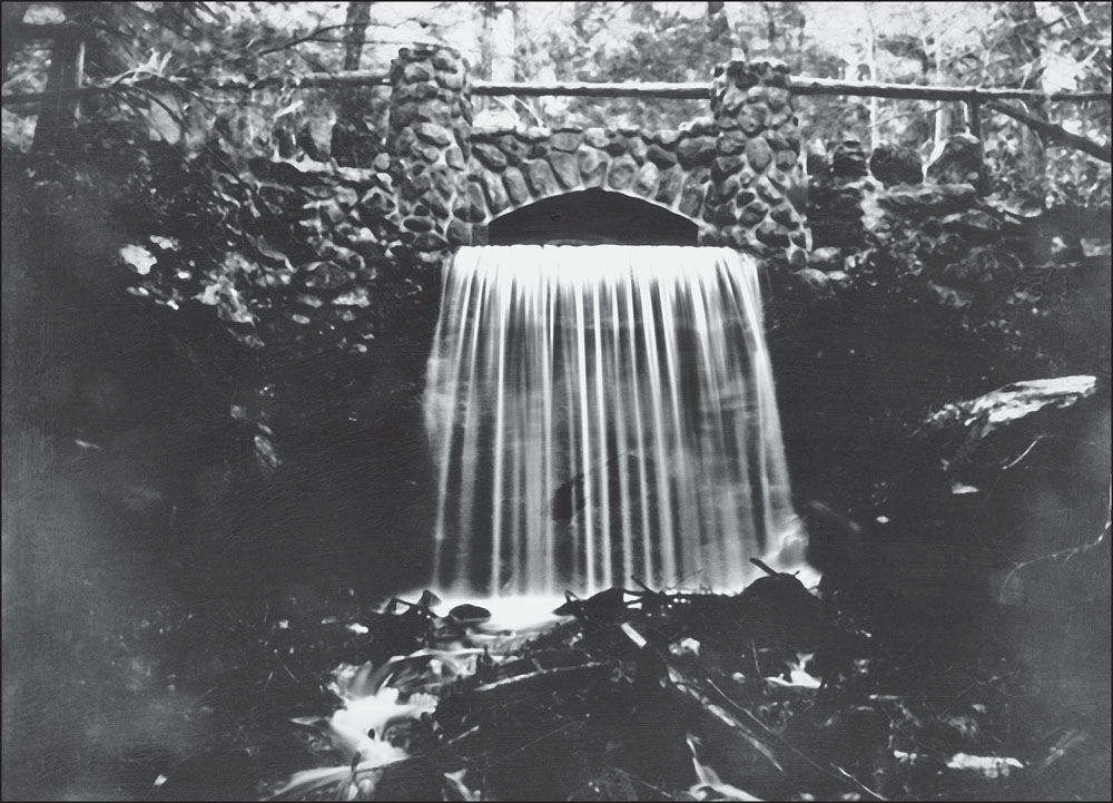
In 1862, William Foster wrote, A few days ago the Bunker Hill paper published an article of the rare beauty of a water-fall at Wyoming or Spot Pondsometimes dry, when the miller chooses to shut down the gate. This Fall among the high forest trees and over the craggy rocks is really worthy of notice. It is not mine but the brook which is the only issue from Lake Wyoming runs through my forest of very lofty trees, nearly a hundred feet high. Douglas Heath photographed this waterfall in May 2013, using 19th-century glass-plate methods. (Authors collection.)
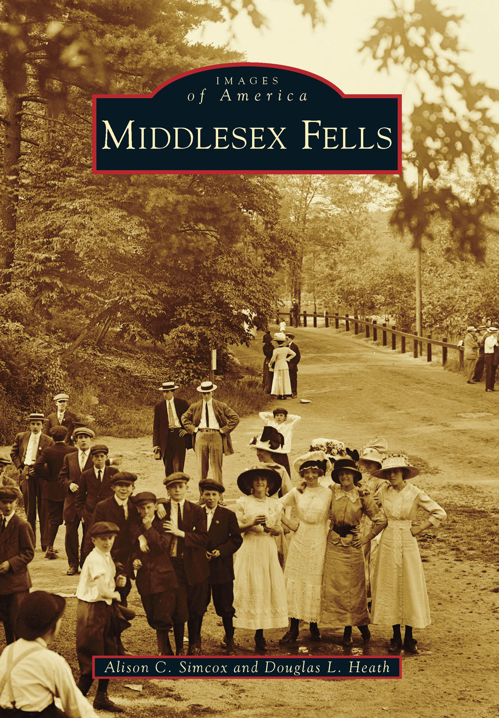
ON THE COVER: Oliver Tryon of the Metropolitan Water and Sewerage Board took this photograph on June 23, 1912, of young people, perhaps on a Sunday outing from Boston, enjoying a day at Spot Pond. From 1910 to 1946, electric streetcars gave people in the Boston area access to the Fells. Trolleys stopped at Porter Cove on Spot Pond and at the Sheepfold. People enjoyed getting off at Porter Cove for a drink at the well (far left of image) before strolling to Pickerel Rock at Spot Ponds south end. Forest Street, on the right side of the photograph, was later widened and paved and renamed Route 28. In 1959, Interstate 93 was built parallel to Route 28, and part of Porter Cove was filled. (Courtesy of Massachusetts State Archives.)
IMAGES
of America
MIDDLESEX FELLS
Alison C. Simcox and Douglas L. Heath

Copyright 2015 by Alison C. Simcox and Douglas L. Heath
ISBN 978-1-4671-2270-2
Ebook ISBN 9781439650387
Published by Arcadia Publishing
Charleston, South Carolina
Library of Congress Control Number: 2014942217
For all general information, please contact Arcadia Publishing:
Telephone 843-853-2070
Fax 843-853-0044
E-mail
For customer service and orders:
Toll-Free 1-888-313-2665
Visit us on the Internet at www.arcadiapublishing.com
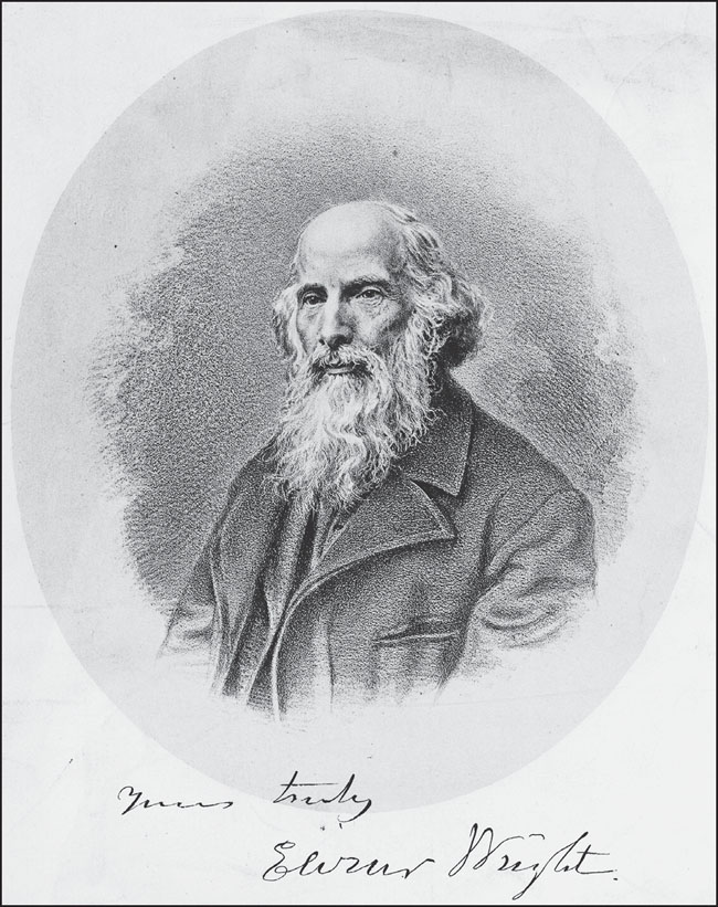
Elizur Wright (18041885), sometimes called the Father of the Middlesex Fells, wrote the following in the Melrose Journal in March 1883: The people must move and act spontaneously, if anything is done. It is everybodys axe; and if nobody grinds it, it will be dull for generations to come. The wood-choppers are sure to grind theirs while a tree is left. Here is work for the press, the pulpit, the platform, for everyone who likes to breathe pure air, drink pure water, and see green things. (Courtesy of Mike Ryan.)
CONTENTS
ACKNOWLEDGMENTS
We are indebted to many people for helping make this book possible. First, we thank Mike Ryan, former executive director of Friends of the Middlesex Fells. Mike enthusiastically shared his knowledge about the reservations formation in the 19th century. He kindly agreed to review drafts and gave excellent suggestions that resulted in a better book. Sean M. Fisher, archivist for the Massachusetts Department of Conservation and Recreation (DCR), deserves equal thanks. Sean offered his time and expertise and gave us great access to records and photographs in the DCR Archives. Other images from state collections were generously provided by Judy Greene, Mike Nelson, and Tom Walsh of the DCR and by staff at the Massachusetts State Archives.
Lester H. Stephenson Jr. and his son Donald generously contributed their 1940s photographs of the last trolleys to run through the Fells with Lesters father at the controls. Kyna Hamill and Allison Andrews of the Medford Historical Society and Museum gave us access to their wonderful collection. Becky Fullerton, archivist for the Appalachian Mountain Club (AMC), shed light on the AMCs important role in helping to make the Fells a reality. The following groups also lent us materials from their collections: Stoneham, Melrose, and Medford Public Libraries; Stoneham Historical Society (SHS); New England Historical Genealogical Society (NEHES); Middlesex Registry of Deeds; Frederick Law Olmsted National Historic Site (ONHS); Winchester Archival Center; Cleveland Colby Colgate Archives; American Antiquarian Society; Historic New England; Robert S. Peabody Museum of Archaeology (PMA); and Wakefield Department of Public Works.
We also thank Meg Thompson, professor emerita of geosciences at Wellesley College; Ryan Hayward of the Preservation Collaborative; Mary Marchant (SHS); Michelle Clark (ONHS); Bonnie Sousa (PMA); Tom McCarthy, great-grandson of George Davenport; Ellen Knight, archivist at the Winchester Archival Center; Oskar and Bill Rogg, descendants of William Bailey Lang; Joseph P. Kopera of the Massachusetts Geological Survey; and Sally Rege Carroll. We also thank Ian and Alec, our wonderful sons. Special thanks go to our acquisitions editor at Arcadia Publishing, Caitrin Cunningham, who was supportive throughout. We dedicate this book to Dougs brother, Peter Heath.
INTRODUCTION
Middlesex Fells Reservation, a rugged, forested park just north of Boston, is the legacy of a remarkable 19th-century preservation movement. Beginning about 150 years ago, a small group of peoplenotably Elizur Wright, Wilson Flagg, George Davenport, Sylvester Baxter, and, later, Charles Eliotworked tirelessly to set aside this area of outstanding geological, scenic, and historical interest to provide a refuge from city life and to preserve the natural landscape. It was a daunting fight against vested interests, with no guarantee of a favorable outcome. Ultimately, the Fells movement led to the creation of the Metropolitan Park System of Greater Boston, the first regional park system in the United States.
Although Interstate 93 passes through the heart of the Fells, many drive this highway regularly with little awareness of this special place. Over 2,500 acres in size (over 3,000 including reservoir areas), the Fells lies within five Massachusetts cities and towns: Malden, Medford, Melrose, Stoneham and Winchester. It includes two north-south valleys of rocky outcrops, woodlands, meadows, streams, ponds, wetlands, archaeological resources, and historic structures. It also includes Virginia Wood, the first gift of land to the worlds oldest regional land trust, the Trustees of Reservations.
The story of the Fells (whose name is a Saxon word for wild, rocky hills) appropriately begins with its rocks. The uplands of the Fells are bounded on the south by a dramatic cliff marking the Northern Boundary Fault, which separates the Boston Basin from uplands that extend into New Hampshire. The oldest rock type in the Fells, the Westboro Formation (quartzite), dates back as far as 912 million years. The next oldest rocks are part of the Middlesex Fells Volcanic Complex (undated, but older than Dedham granite). About 609 million years ago, these were intruded by the Dedham granite. From 573 to 226 million years ago, many basalt dikes intruded older rocks. About 380 million years ago, landmasses collided to form a supercontinent called Pangaea. About 194 million years ago, as Pangaea began to break apart and give rise to the Atlantic Ocean, the Medford Dike cut through older rocks. This dike, which has maximum thickness of 460 feet along the west flank of Pine Hill, was the focus of 19th-century quarrying, and stones from these quarries were used to build mansions on Spot Ponds eastern shore and to line paths of Boston Public Garden.
Next page


