ACKNOWLEDGMENTS
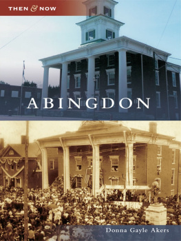
This volume presents a collection of images that tell the stories of Abingdon, Virginia through history, reflecting the change from a peaceful town to a thriving commercial center. This volume is not intended to be a formal history of the town, but its goal is to document the town through postcards and photographs of the past.
This book would not have been possible without the kind cooperation and assistance of the Historical Society of Washington County, especially Melissa Watson, Nancy Leasure, and Kitty Henninger. The historical society allowed the author access to their photograph and postcard archives containing thousands of images. Many individuals and organizations also answered the requests to share photographs of the town and include the Abingdon Volunteer Fire Department, the Abingdon Police Department, George M. Akers, Lorena Harris Bolling, Lowry Bowman, Dora Bradley, Jennifer Bradley, Gilette Brown, Connie Bundy, Muriel Scott Bundy, Mrs. Gilbert Snead Grubb, Evelyn M. Hale, Ethel Handley, Margaret Harris, Edith Maiden Hatcher, Kitty and Gerald Henninger, Betty Hurley, Mrs. James Iredell, Peggy Johnson, Johnston Memorial Hospital, Charles G. Jones, Irene Mead, Doug Patterson, Elmer Rosenbaum, Mary Ann Rhudy, Betty B. Ringley, Robert S. Sterns, Gwendolyn Wright, and Susan Yates. The assistance and advice of Laura New and Kelle Broome of Arcadia Publishing have also been essential to the successful completion of this project.
A portion of the royalties of this book will be donated to the Historical Society of Washington County to assist in their endeavors to preserve the history of Abingdon and Washington County.
The information included in this book has been gathered from a number of different sources, including the memories of local residents. Facts have been checked to the best of the ability of the author, but minor discrepancies may occur.
Find more books like this at
www.imagesofamerica.com
Search for your hometown history, your old
stomping grounds, and even your favorite sports team.
One
CHANGING STREETSCAPES
The first buildings in the town were made of logs, and frame buildings were constructed later. In the 1800s, increasing numbers of brick homes and commercial buildings reflected the towns growing prosperity. As the town became an important political, legal, and trade center, the town limits were expanded in 1803, 1819, and 1834. To accommodate the increased traffic and to improve appearances, Main Street was macadamized in 1833. Property owners with lots on Main Street were required to install a paved brick path in front of their property.
In 1835, Martins Gazetteer of Virginia describes the town with 150200 dwelling-houses (many brick), an academy for females, an academy for males, two hotels, three taverns for wagoners, one manufacturing flour mill, nine mercantile houses, three groceries, one woolen and two cotton manufactories, four tanyards with saddle and harness manufactories, 10 blacksmiths shops, one hat manufactory and store, six wheelwrights and wagon makers, two cabinet warehouses, and two boot and shoe manufactories. Fires occurred in the downtown in 1812, 1856, and 1864, destroying many of the older buildings. Every property owner was required to have a water bucket handy to put out fires. Additional streets were surveyed to the towns original plat to develop more land.
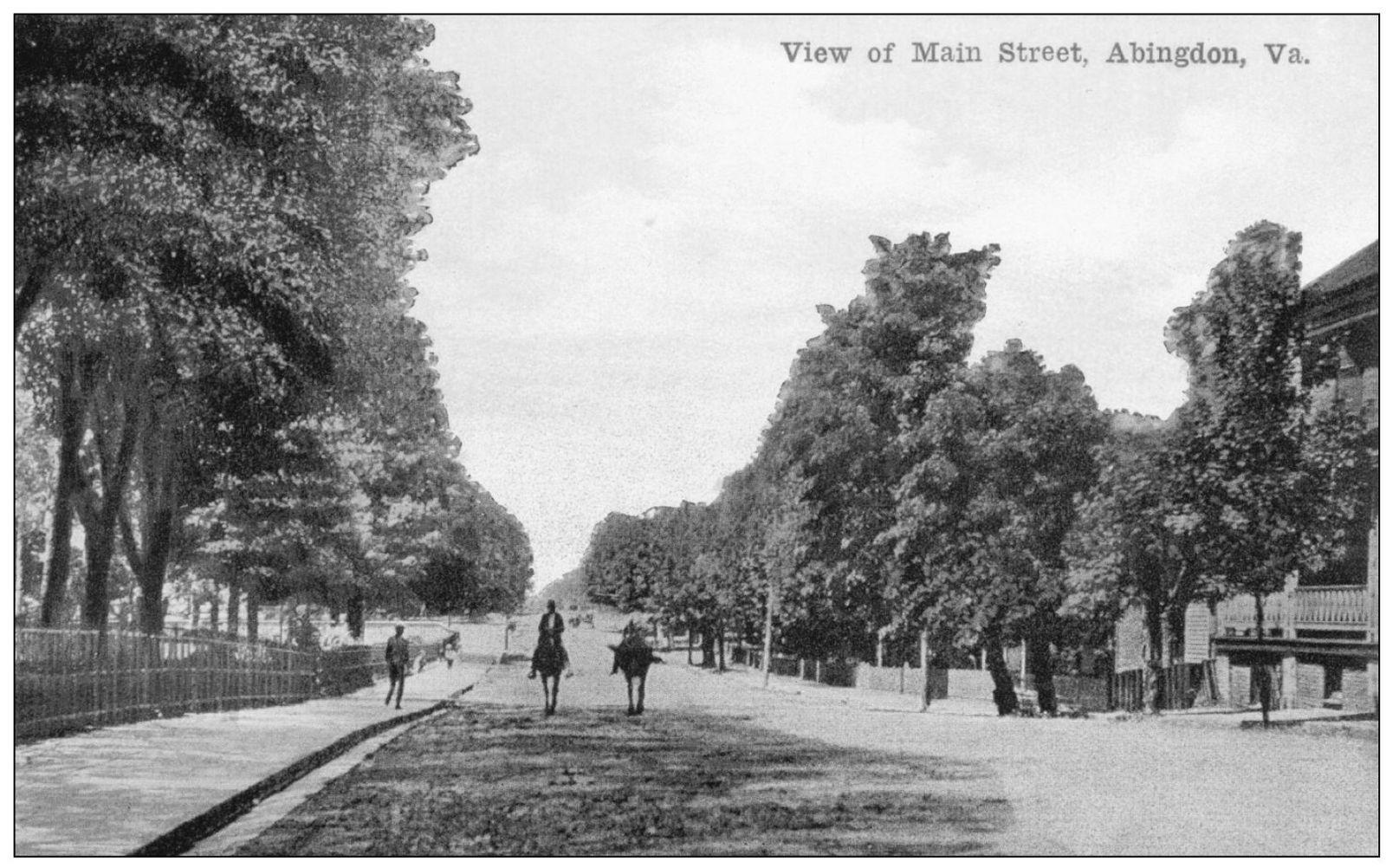
A PEACEFUL MAIN STREET, C . 1900. This postcard from the early 1900s shows pedestrians and horsemen enjoying a peaceful stroll down a deserted Main Street. Sidewalks and curbs seem to have been installed, and attractive trees shade the side of the road. (Courtesy Jennifer Bradley.)
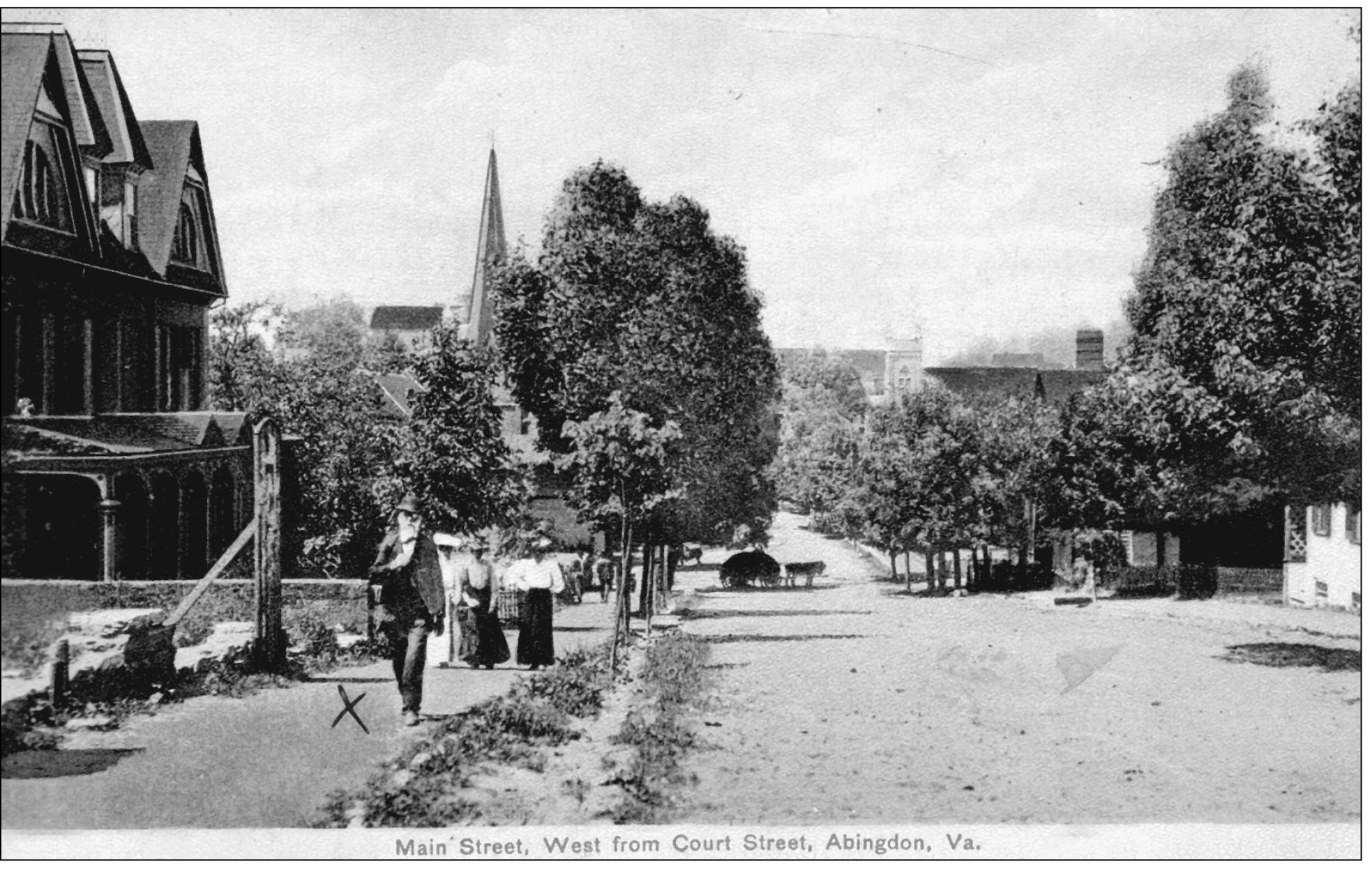
STROLLING ALONG EAST MAIN STREET, C . 1900. This postcard shows residents strolling up Main Street. John Keller is identified as the bearded man walking in the foreground, while the ladies are unidentified. Note the wagon drawn by horses in the center of the image. The Greenway-Trigg building is shown on the left, and the steeple of the Sinking Spring Presbyterian Church is also visible on the left. The white steeple of the Abingdon United Methodist Church can be seen on the right side of the image. The road appears to be dirt, but seems to be in good condition and walking paths or sidewalks have been installed. The small trees planted to the right of Mr. Keller show the interest in an aesthetically pleasing appearance for the street, even in the early 1900s. (Courtesy Edith L. Handley.)
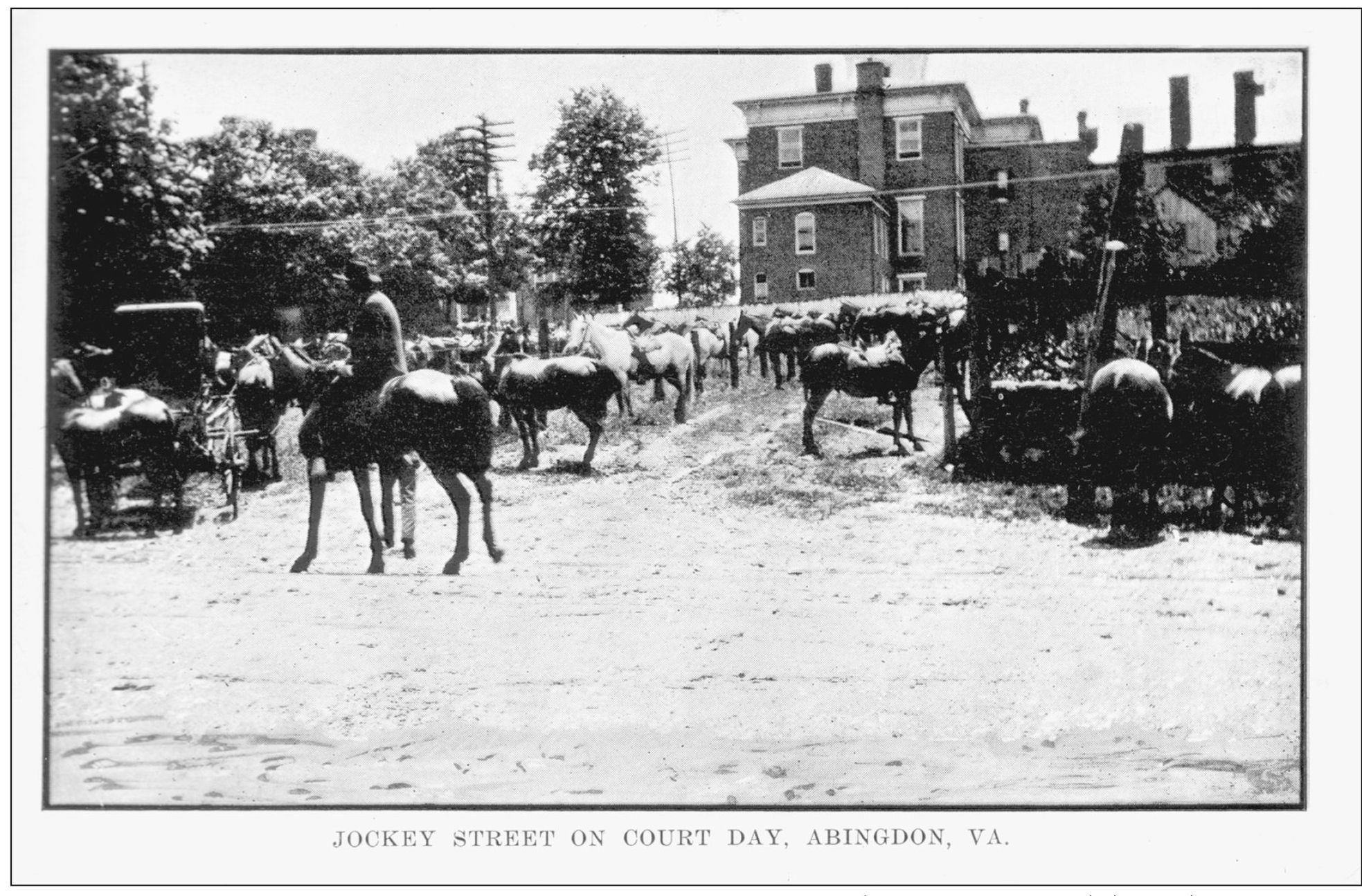
HORSEMEN IN THE JOCKEY LOT BEHIND THE COURTHOUSE. This c . 1900 postcard shows the property behind the courthouse, which was known as Jockey Lot. Since many people came to town on Court Day (the fourth Monday of every month), this lot became a natural place for selling and buying goods and land and conducting business. The lot also became a convenient place to trade horses and mules, thus the name Jockey Lot was given. Court Day must have been exciting, with horses being raced up and down Valley Street for prospective buyers. Newspapers reported that alcohol was often used to supplement the horse trading, so proper ladies were advised to avoid the lot on court days. Politicians made speeches from the courthouse steps to crowds gathered on the lot. (Courtesy Connie Bundy.)
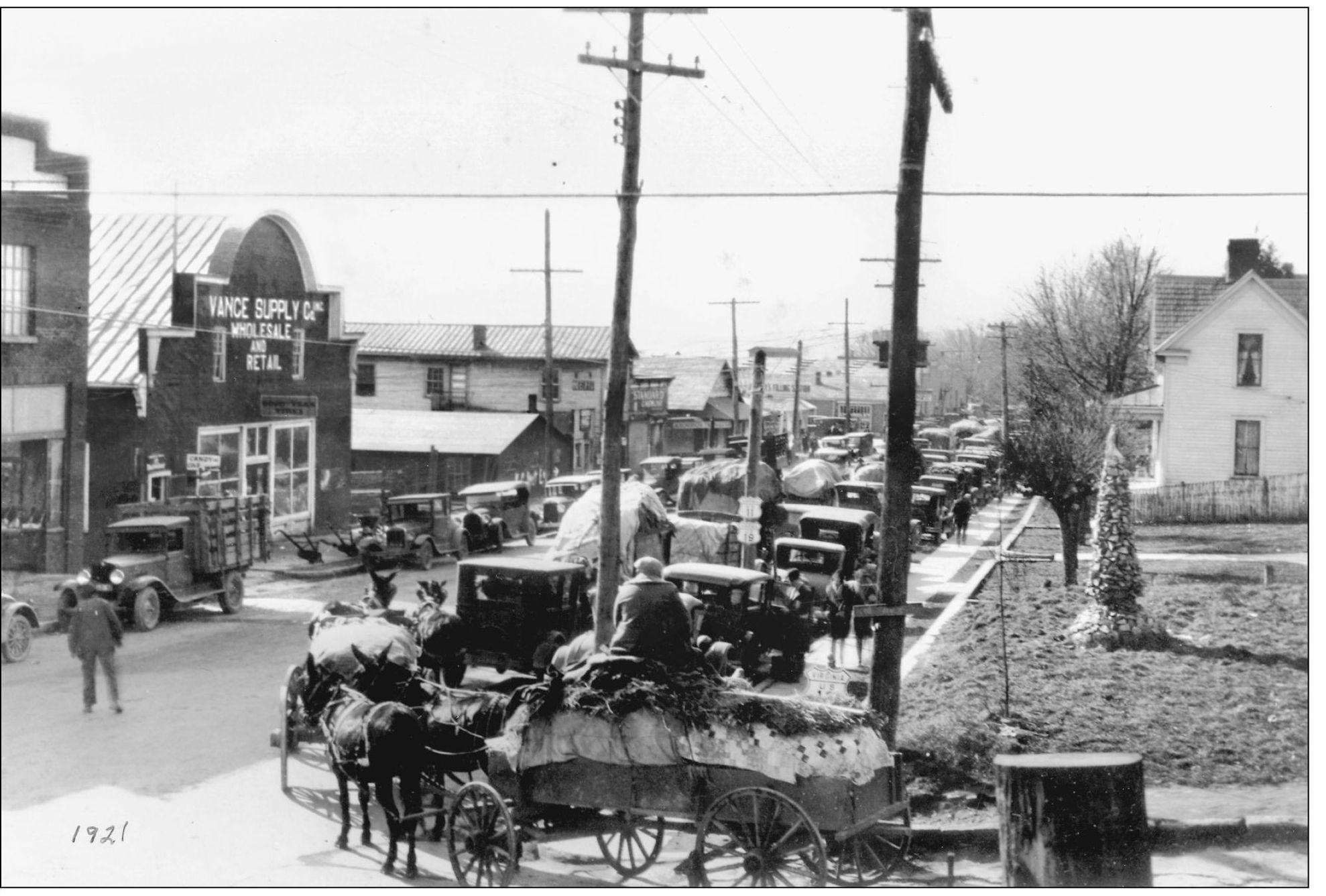
WAGONS LOADED WITH TOBACCO ON WEST MAIN STREET IN 1921. This view of West Main Street was taken from the corner of Russell Road. The wagons drawn by mules are hauling dried tobacco leaves to the warehouses on the western end of Main Street. Tobacco has long been a major part of the regions economy. Vance Supply Company, a mainstay of the town, appears on the left of the image. The building is no longer on the lot, but the adjacent brick building on the far left of the photograph now houses the Highlands Union Bank. (Courtesy Doug Patterson.)
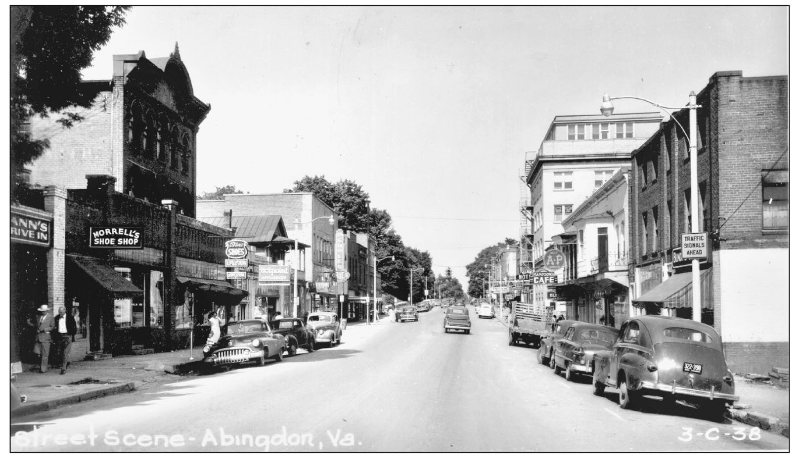
THE BELMONT HOTEL AND COMMERCIAL AREA ALONG WEST MAIN STREET IN 1950. This photograph reflects the commercial growth that occurred in Abingdon. Residents from the larger region surrounding Abingdon would look forward to going to town to shop for food, clothing, and tools. Visitors could see a movie at several theatres in the downtown area or eat a meal at one of the many diners. The Belmont Hotel is the white building on the right with the Caf sign, and the current Wachovia Bank occupies the tall building with the fire escape along the front. In the 1930s and 1940s, H.H. Scott developed the Belmont and much of the commercial areas in this part of downtown. (Courtesy HSWC.)

