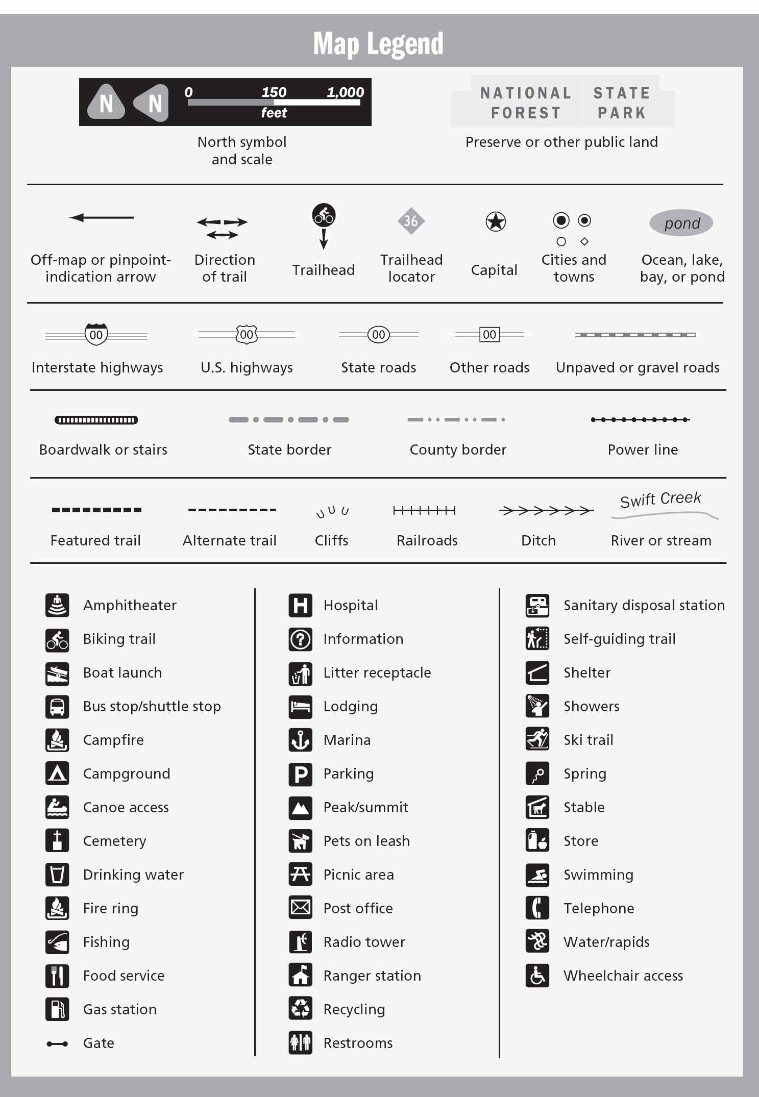
Orange County: Map Legend
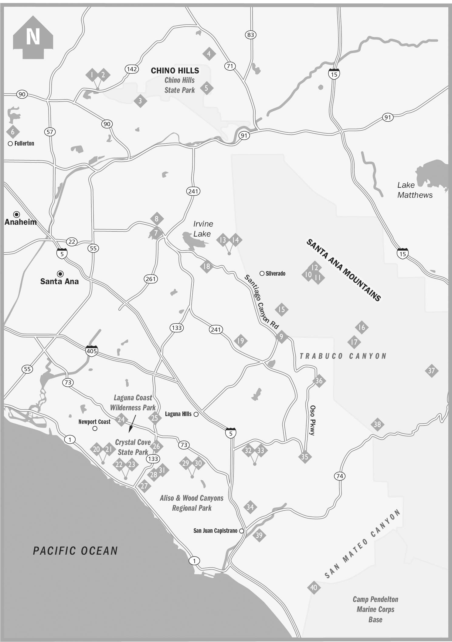
OVERVIEW MAP KEY

DISCLAIMER
This book is meant only as a guide to select trails within Orange County and does not guarantee rider safety in any wayhave fun, but you ride at your own risk. Neither Menasha Ridge Press nor David Womack is liable for property loss or damage, personal injury, or death that result in any way from accessing or riding the trails described in the following pages. Be especially cautious when riding on or near boulders, steep inclines, and drop-offs, and do not at-tempt to explore terrain that may be beyond your abilities. To help ensure an uneventful ride, please read carefully the introduction to this book. Familiarize yourself thoroughly with the areas you intend to visit before venturing out. Ask questions and prepare for the unforeseen. Familiarize yourself with current weather reports, maps of the area you intend to visit, and any applicable trail regulations.
COPYRIGHT 2008 BY DAVID WOMACK
All rights reserved
Published by Menasha Ridge Press
Printed in the United States of America
Distributed by Publishers Group West
First edition, first printing
Cover design by Travis Bryant
Text design by Steveco International
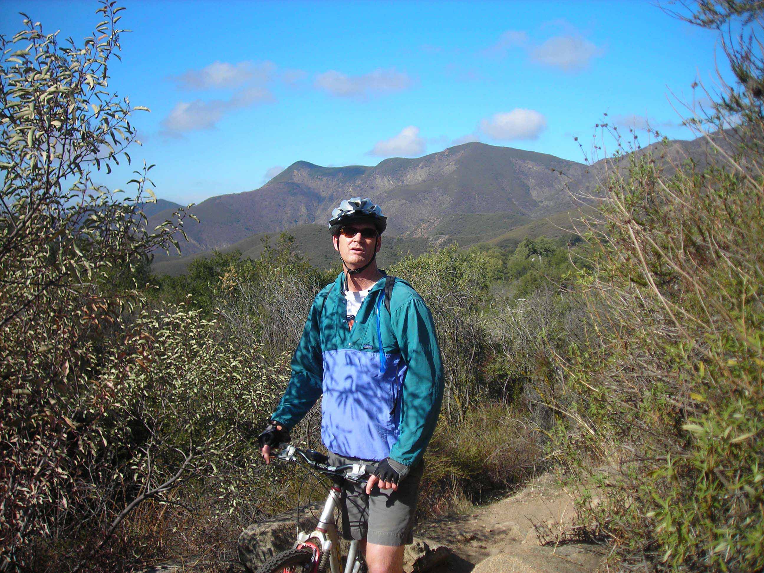
Cover photograph by David Womack
Author photograph by Mark OConnor
Cartography and elevation profiles by David Womack and Chris Erichson
Library of Congress Cataloging-in-Publication Data
Womack, David, 1963Mountain bike! Orange County: a wide-grin ride guide/David Womack. 1st ed.
p. cm.
ISBN-13: 978-0-89732-980-4
ISBN-10: 0-89732-980-5
1. Bicycle trailsCaliforniaOrange CountyGuidebooks.
2. All terrain bicyclesCaliforniaOrange CountyGuidebooks.
3. Orange County (Calif.)Guidebooks. I. Title. GV1045.5.C22O739 2008
388.120979496--dc22
2007026318
MENASHA RIDGE PRESS
P.O. BOX 43673
BIRMINGHAM, ALABAMA 35243
WWW.MENASHARIDGE.COM
ACKNOWLEDGMENTS
First Id like to thank Nathan Derge and GT Bicycles. It is impossible to write a mountain bike book without a bike. Moreover, theres something to be said for maximizing every moment in the saddle and riding every trail with confidence and satisfaction. GT kept me rolling, rubber side down, along the right path.
Thanks to all my riding partners, especially Mark OConnor, Mark Garry, and Brandi Outwin, for being good sports, posing for photos, climbing just one more hill, and, for the most part, not complaining. Also, thanks to Curt Caprine for giving me a proper tour of The Fullerton Loop.
The maps in this book were rendered with a Garmin eTrex and TOPO! mapping software from National Geographic. Thanks to both of those companies for use of their fine products. The Garmin GPS proved to be a valuable tooleasy to use and trail worthyand interfaced seamlessly with the TOPO! software.
Researching this book didnt merely involve riding the trails. Several park Web sites supplied valuable information, including the sites for Chino Hills, Crystal Cove, the Cleveland National Forest, and Orange County Regional Parks. GeoLadders.com provided great leads to new trails and ride times when I didnt trust my own. Its a great resource for all ridersI recommend joining.
Today, more Orange County trails than ever are open to mountain biking. The Warriors Society and SHARE deserve special thanks for the maintenance of and advocacy for our local trails. Every local rider benefits from the work of these groups. Go to their Web sites if you are interested in volunteering your time.
Lastly, Id like to thank Russell Helms and Menasha Ridge Press for showing confidence in me and giving me the opportunity to write this book. Its been a hoot.
NOTE ON THE SANTIAGO FIRE
Last week, just before this book went to press, a fire raged across eastern Orange County. An arsonist started the fire near Santiago Canyon Road. Blustery Santa Ana winds fueled the blaze as it raced across the regions rain-deprived canyons and hillsides. As of this writing, the fire has burned roughly 25,000 acres. This burn area includes nearly all of Whiting Ranch and the Irvine Ranch Land Reserves Limestone Canyon. In the Cleveland National Forest the fire cut a swath across the Santa Ana Mountains from the Modjeska Grade to Live Oak Canyon Road and nearly all the way up to Main Divide Road. Parts of Silverado Canyon and Modjeska Canyon were also affected. Therefore, Santiago Truck Trail, The Luge, Harding Truck Trail, and Maple Springs Road all have been impacted by the fire. According to fire maps, the regions surrounding then Joplin Trail and The Silverado Motorway were not burned. However, the park is still closed and I have not witnessed any damage firsthand.
The good news is that fires play an essential role in Southern Californias ecology. Trees will survive, plants will recover, and animals will find new homes. Some local plant species depend on fires to germinate their seeds. Springtime should beckon a miraculous recovery for the ash-covered hillsides. This does not justify careless behavior in the backcountry though. I have witnessed firsthand the devastation of Southern California wildfires. They are vicious, costly, and sometimes deadly. There is no excuse for starting any kind of fire in our local wilderness areas; always be careful and vigilant.
There will definitely be some trail closures in the fire-impacted areas. No official announcements have been made, so I can only estimate the length and breadth of these closures. Whiting Ranch suffered major damage and may be closed until trails can be repaired and, perhaps, until after the major rains of January and February. The Irvine Ranch Land Reserve, which manages Limestone Canyon, may hold off conducting docent-led rides in the region until spring of 2008. The Cleveland National Forest should be the first fire-affected area to open. The major dirt roads in the National Forest are vital thoroughfares, used daily by utility companies and geologists. The roads might be open to the public as soon as the fire is completely extinguished and the area is determined to be safe. However, if the park service deems that the fire risk is still too high, they could close the region to the public until we get some rain. If there isnt significant rainfall in the coming winter, the Cleveland National Forest could be subject to closures next summer and fall. Its too early too tell, so hopefully not. Check all of the park Web sites for current trail information and please respect all trail closures in the burn areas. Let nature take its course.
David Womack
October 30, 2007
ABOUT THE AUTHOR
