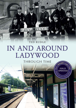
Rudge - In and Around Ladywood Through Time Revised Edition
Here you can read online Rudge - In and Around Ladywood Through Time Revised Edition full text of the book (entire story) in english for free. Download pdf and epub, get meaning, cover and reviews about this ebook. City: England--Birmingham--Ladywood., Ladywood (Birmingham, England), year: 2015, publisher: Amberley Publishing, genre: Non-fiction. Description of the work, (preface) as well as reviews are available. Best literature library LitArk.com created for fans of good reading and offers a wide selection of genres:
Romance novel
Science fiction
Adventure
Detective
Science
History
Home and family
Prose
Art
Politics
Computer
Non-fiction
Religion
Business
Children
Humor
Choose a favorite category and find really read worthwhile books. Enjoy immersion in the world of imagination, feel the emotions of the characters or learn something new for yourself, make an fascinating discovery.

- Book:In and Around Ladywood Through Time Revised Edition
- Author:
- Publisher:Amberley Publishing
- Genre:
- Year:2015
- City:England--Birmingham--Ladywood., Ladywood (Birmingham, England)
- Rating:3 / 5
- Favourites:Add to favourites
- Your mark:
In and Around Ladywood Through Time Revised Edition: summary, description and annotation
We offer to read an annotation, description, summary or preface (depends on what the author of the book "In and Around Ladywood Through Time Revised Edition" wrote himself). If you haven't found the necessary information about the book — write in the comments, we will try to find it.
Rudge: author's other books
Who wrote In and Around Ladywood Through Time Revised Edition? Find out the surname, the name of the author of the book and a list of all author's works by series.


In and Around Ladywood Through Time Revised Edition — read online for free the complete book (whole text) full work
Below is the text of the book, divided by pages. System saving the place of the last page read, allows you to conveniently read the book "In and Around Ladywood Through Time Revised Edition" online for free, without having to search again every time where you left off. Put a bookmark, and you can go to the page where you finished reading at any time.
Font size:
Interval:
Bookmark:

This book is dedicated to the parents and grandparents of my wife Maureen.
Doris May and Stanley Francis Greensall and Annie Eliza and Thomas Stephen Wallis
The five were true old Ladywood residents.
First published 2009
This edition published 2015
Amberley Publishing
The Hill, Stroud
Gloucestershire, GL5 4EP
www.amberley-books.com
Copyright Ted Rudge 2009, 2015
The right of Ted Rudge to be identified as the Author of this work has been asserted in accordance with the Copyrights, Designs and Patents Act 1988.
ISBN 9781445650630 (PRINT)
ISBN 9781445650647 (eBOOK)
All rights reserved. No part of this book may be reprinted or reproduced or utilised in any form or by any electronic, mechanical or other means, now known or hereafter invented, including photocopying and recording, or in any information storage or retrieval system, without the permission in writing from the Publishers.
British Library Cataloguing in Publication Data.
A catalogue record for this book is available from the British Library.
Typesetting by Amberley Publishing.
Printed in the UK.
In 1552 King Edward VI signed a charter which set up the grammar school which carries his name still and which now is situated in Edgbaston. The new establishment was endowed with part of the possessions of the Gild of the Holy Cross, which had been dissolved during the reign of Henry VIII. The grant of lands to the school included all those fields, meadows and pastures, and hereditaments, whatsover with the appurtenances, called or known by the name or names of Long-Croft, Bynges, Rotton-fields, Walmores, and Saint Mary Wood lying and being in the Foreign of Birmingham.
Bynges was the area from which Bingley Hall would take its name; Rotton-fields became Rotton Park; the Walmores was the locality through which Walmer Lane (Lancaster Street) would run; and bearing the name of Our Lady, the mother of Christ, Saint Marys Wood was known later as Ladywood.
The word foreign applied to the agricultural parts of Birmingham and is first documented in the thirteenth century as was that of the borough. As opposed to the rural part of the manor, the borough was that area in which Peter de Birmingham and his heirs granted burgage tenure to anyone who wished to take it up. Held for a rent of normally 8d a year, burgage plots gave the owner privileged access to the market of Birmingham. These liberties and customs marked them out as did their residence in the villa of Birmingham as it was termed by Peters son, William, in 1189.
For centuries, the borough of Birmingham was confined to the south-east corner of the manor and the foreign was by far the greater area although it was less important. West of the red sandstone ridge upon which the borough was sited, the foreign was mostly poor land of sand and gravel which was covered in trees or heather and was regarded as a waste.
Until the early seventeenth century, the town of Birminwwgham was still huddled about Saint Martins church, but in the succeeding years the increase in population encouraged landowners to raise their incomes by granting building leases. Those parts of the foreign closest to the borough were soon swallowed up. However, Ladywood was a distant spot and remained deep in the countryside as was shown in 1690 when John Hinckley bought 79 acres and a good barn in Ladywood.
Along with the rest of western Birmingham, Ladywood was mostly not shown on eighteenth-century maps, but the first indication of urbanisation came in 1790 when it was announced that the Summer Hill Estate had been staked out for a range of elegant and uniform building comprising fifteen houses, along the declivity of the beautiful hill.
Elsewhere in Ladywood there was little change and on the Street Commissioners Map of 1810, only two houses were indicated in the area bounded Sheepcote Lane (Street), Islington (Broad Street) and southern and western parts of Ladywood Lane (Ladywood Road and Monument Lane). They were a cottage on the bend of Sheepcote Lane, and Ladywood House. This was approached through an avenue of elm trees and stood about halfway down where Saint Vincent Street would be cut. Interestingly, at the Ladywood Lane end of the avenue was marked Pest Heath. There were also great open spaces in what would become the Osler Street neighbourhood interrupted only by a house known as Lady Grove. No further development had occurred on Summer Hill and even here there were large gardens as was made plain in an advertisement from 1812. In the upper walk facing Summer Hill Terrace there was a garden with fruit trees, two large and productive asparagus beds, a brick summer house and tool house. Eight years later, gardens with remarkably rich soil were offered in the Sandpits. By the time of Pigott Smiths Map of 18255, the western part of Ladywood was still fields, while the eastern part leading to Broad Street was filled with small gardens.
By the early 1830s, Grosvenor Street had appeared, as had others linking it to Islington (the Five Ways area), whilst Nelson Street was obvious off Summer Hill. But elsewhere in Ladywood the only new building was the large Icknield House of T. Smith. Within twenty years this had gone and working-class Ladywood had thrust itself into history following the decision of its three main landowners to allow building: between Saint Vincent Street and Islington was the Ryland Estate; whilst west of that property were the estates of the Vyse family and the governors of King Edwards School. The whole area took the name of the wood which once had covered it. In contrast to the large houses of Summer Hill, much of Ladywood was covered with back-to-backs and other houses for members of the working class.
In the 1950s and 1960s, Ladywood became the pre-eminent example of the redevelopment of Birmingham through the writings of its vicar, Canon Power. He recognised the social problems that were arising and would arise from the destruction of communities which had their roots in the mid-1800s and which had taken time to grow and flourish. His campaigning against high-rise living and the shifting of local folk to the outskirts of the city was unable to stop the moving out of long-established families, but since then many people have taken on board his ideas. Today the people of Ladywood remain a symbol of working-class Birmingham close to the flagship of the new Birmingham in Broad Street. It is that working-class heartland that Ted Rudge has brought to the fore in this exciting new book. I congratulate him on his achievement.
Carl Chinn, MBE
The building of the Birmingham to Wolverhampton canal in 1769 cut through the middle of Ladywood and, like a river, formed a ward and postal boundary. Warehouses and factories eventually lined the canal from Birmingham to Ladywood and beyond. This in turn attracted a workforce and compounded Birminghams already acute housing problem. Ladywood began to develop around 1840, homes and workplaces were built for the working class on either side of the canal from Great Tindal Street on the Edgbaston side and King Edwards Road on the town side. Back-to-back and terraced housing was built to a very poor standard, compared with today, cramming as many homes on as little land as possible. Eventually, when building reached the canal, most of the infrastructure would have been in place and any available land built over. Before this, in 1854, the London & N. W. Railway Stour Valley line was built through Ladywood alongside the canal with a railway station and an extensive railway goods yard.
Font size:
Interval:
Bookmark:
Similar books «In and Around Ladywood Through Time Revised Edition»
Look at similar books to In and Around Ladywood Through Time Revised Edition. We have selected literature similar in name and meaning in the hope of providing readers with more options to find new, interesting, not yet read works.
Discussion, reviews of the book In and Around Ladywood Through Time Revised Edition and just readers' own opinions. Leave your comments, write what you think about the work, its meaning or the main characters. Specify what exactly you liked and what you didn't like, and why you think so.