ACKNOWLEDGMENTS
No one writes a book alone. It took an island to write this book and many, many generous people who shared their time and knowledge with me.
I could not have done it without the staff of the Kauai Museum, especially Margaret Lovett, who cheered me on in the beginning, and Chris Faye, who jumped in with both feet at the end. Being an author herself was really helpful at crunch time. I also want to thank Carol Lovell, the past director, for her willingness to answer questions; Roy Miyake for his information and encouragement; and Ralph Leaman for finding all the photographs.
The great staff at the Kauai Historical Society, Pres. Randy Wichman, and Executive Director Mary A. Requilman, will have my gratitude forever for the advice and historical knowledge they shared with me.
Carol White, head librarian of the Mission Houses Museum Library, gave me invaluable advice for possible missionaries to include.
Special thanks to those who answered my questions or were willing to be interviewed, including Henry B. Wolter of the U.S. Geological Survey, Aletha Puna Kaohi, Kumu Hula Roselle Bailey, Kumu Hula Jessi Jardin, Pat Griffin-Noyes, Bev Harter, Bob Schleck, David Penhallow, Barbara Richter, Cheri Atkins, Dorothy Cataluna, Carol Hamamura, Eiko Senda Murakawa, Frank Santos, Kuulei Santos, and Philip and Pat Palama.
There are not enough words to thank my husband, Gaetano Vasta, for all the technical help and support he gave me with this project. Grazie mille .
To these I forgot to mention and others who wished to remain anonymous, Mahalo Nui Loa.
Please forgive any errors found; they were unintentional. At the preference of the author, use of the okina has been omitted.
Find more books like this at
www.imagesofamerica.com
Search for your hometown history, your old
stomping grounds, and even your favorite sports team.
One
KING KAUMUALII AND WAIMEA
The ancient Hawaiians believed land and water belonged to the gods. Land was important, but land without water was nothing. To the Hawaiians, water was wealth. The word wai means water, but waiwai means prosperity. They developed a very sophisticated land management system of mokus and ahupuaa . Kauai is divided into five mokus (districts): Kona, Na Pali, Halelea, Koolau, and Puna. Within each moku were usually several ahupuaa. Each ahupuaa needs its own water source. Today this sometimes appears not be the case, because the water source has been diverted or has dried up. Most ahupuaa run from the mountains to the sea. The largest ahupuaa on Kauai is Waimea in the Kona Moku.
Waimea, which literally means reddish water, was one of Kauais largest population centers in ancient times before Captain Cook. Waimea was the capital of the Kona Moku. Kalo (taro) was grown here using a vast irrigation system. They also grew coconuts, bananas, and lesser-known foods such as breadfruit and ko (sugarcane).
Due to Waimeas drier climate, the chiefs would leave Wailua, the wetter location in the Puna Moku, and spend the winters in Waimea. King Kaumualii made Waimea his permanent residence because the newly published maps of Hawaii listed Waimea as the port of call. In the 1800s, it was a busy place to be. Waimea continued to be a port of call until better harbors at Port Allen and Nawiliwili could be built in the late 1920s and early 1930s.
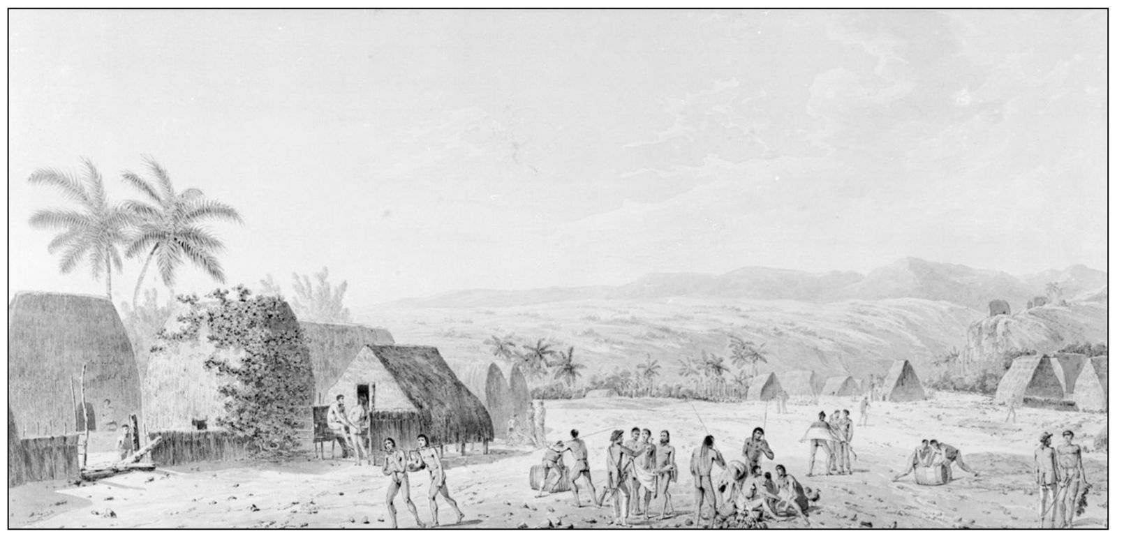
This was Capt. James Cooks first view of Kauai as seen from the sea. Because of ears untrained to the Hawaiian language, all the names were spelled phonetically on Captain Cooks early maps.
This view was labeled Whymea Bay, Atooi (Waimea Bay, Kauai). John Webber was the artist on board Captain Cooks ship. (Courtesy Kauai Museum.)
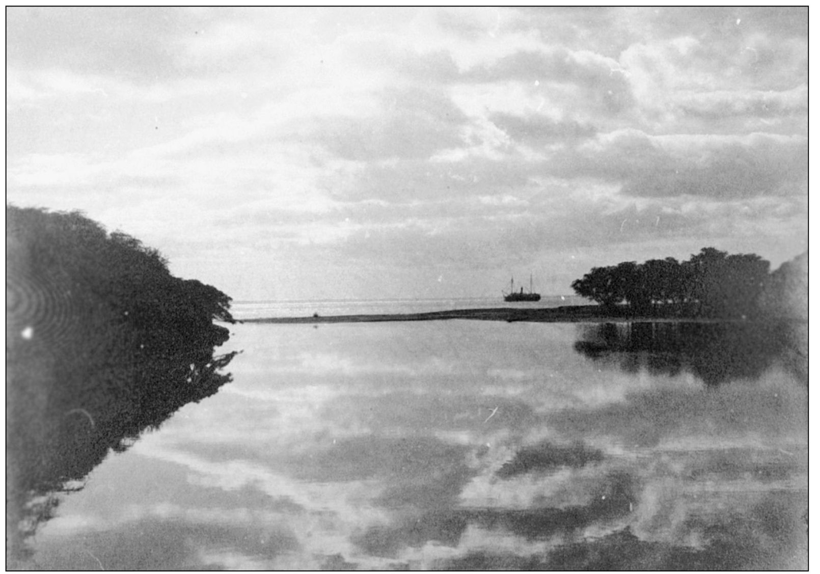
This 1880s photograph taken at the mouth of the Waimea River with a ship at anchor gives one a glimpse of what Captain Cooks arrival might have looked like to those from shore when he first discovered the islands in 1778. (Courtesy Kauai Museum.)
John Webber sketched Heiau Kealii, dedicated to Lono-nui-akea, during Cooks 1778 expedition. The heiau was located in a temple complex area known as Ka naa naa. The exact location of the heiau is not known today, although some guess it was near the Waimea Foreign Church. (Courtesy Kauai Museum.)
The sketch above, drawn by John Webber, is the earliest view available of what Waimea looked like in 1778. The houses were grass. Clothing was light or unnecessary in the warm Waimea climate. The drawing shows that some are wearing malos (a type of loin cloth) and tapa drapes. Chief Kaiana, below, was a Kauai alii and brother to Kaeo and uncle to King Kaumualii. In 1787, Capt. John Meares took Kaiana with him to Canton, China. He had wanted to go to England. He traveled as far as the Pacific Northwest before taking a ship that returned him to Hawaii. His most prized possession from his adventure was the painting of himself painted by an English artist in Canton. He was a very handsome man, over 6 feet tall, and is shown here wearing the emblems of his high rank: the feather helmet and cape. (Both courtesy Kauai Museum.)

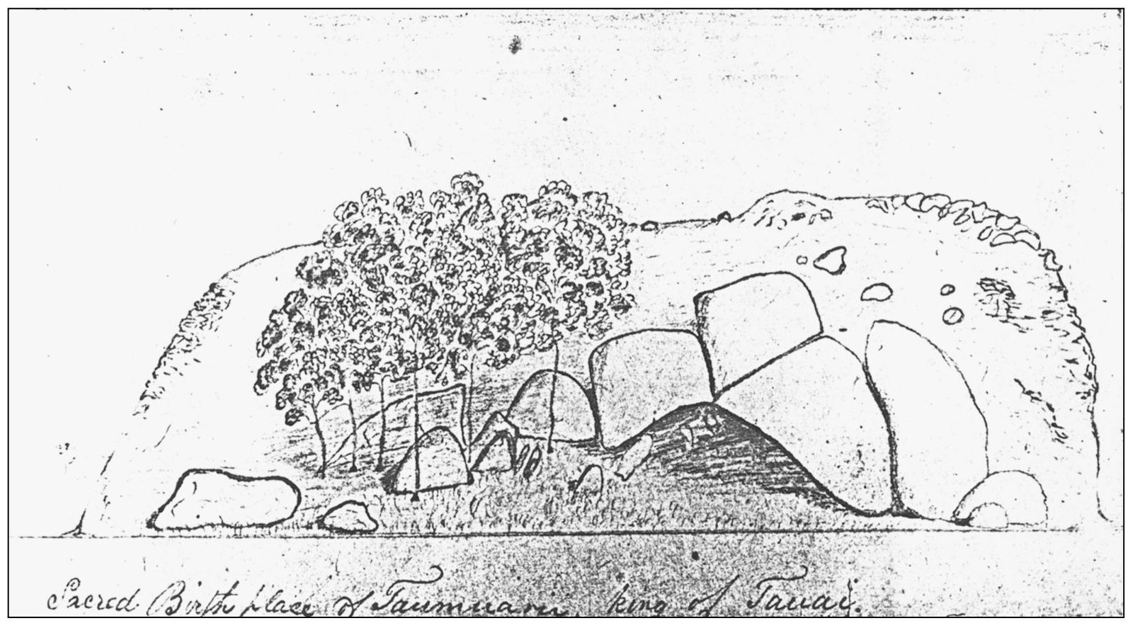
This drawing by Hiram Bingham shows the birthplace of King Kaumualii. Being born in Wailua at Pohaku Hoohanau (the birthstone) insured a child high-ranking status. Bingham traveled around the island many times giving sermons in the various villages. (Courtesy Kauai Museum.)
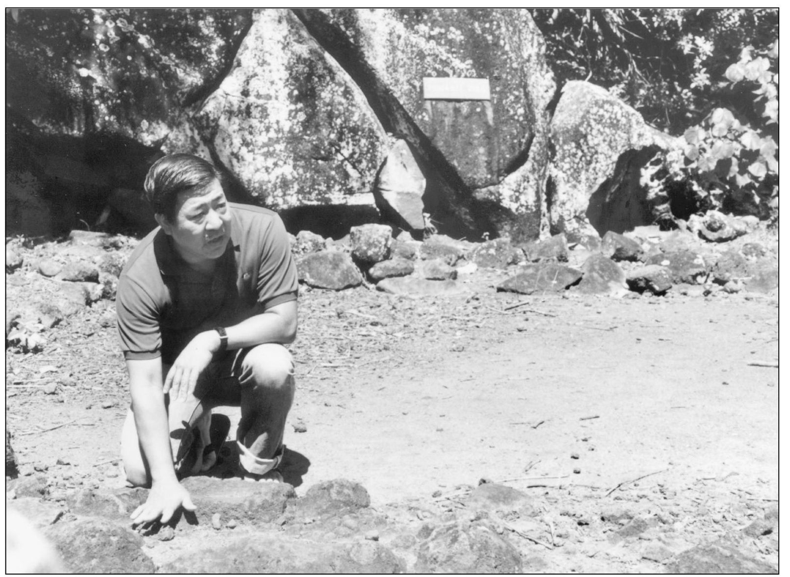
Tourists can still visit the Heiau Holoholoku in Wailua. This photograph taken by Reva Stiglmeier in the late 1970s shows Bill Kukuchi, a well-known professor of anthropology at Kauai Community College and favored lecturer, giving a talk about this royal birthstone and the Wailua area. (Courtesy Kauai Historical Society.)

