ACKNOWLEDGMENTS
Mineral Wells is an area rich in history. Its history is not necessarily that of the Wild Westas is Palo Pinto Countysbut the history of industries and businesses making a town grow in the midst of the Pinto Hills, a town that would be a beacon of rejuvenation and health for many people around the world.
Many people in Mineral Wells and the surrounding area have assisted with information and photographs for this book, and they have been happy to do so. They are acknowledged after each photograph.
Those who were particularly instrumental in helping this book come to life were Lou Hayes Warren, whose grandparents were early settlers; Doris Perry McConnell, whose great-grandfather Cicero Smith was one of the early entrepreneurs to market the waters and grow the town; Joyce Ann Murray Watson, whose grandfather built a caf atop East Mountain to refresh the tourists after their donkey rides; Jim and Louise Dillard; Judith Richards Shubert, whose family pioneered the area; Lottie Williams Eubanks, owner of Century Flight Systems; Bob Kimbrough, whose great-grandfather Pat Gallagher built many area buildings; Doyle Marshall, author of A Cry Unheard ; Sheila Brock Eggleston; and the Boyce Ditto Library, which provided photographs from the Col. Willie Casper and A. F. Weaver Collections.
Raf Seibert, my husband, provided most of the present-day photographs, listened to my thoughts, read my text, and gave me many ideas to enhance this book.
For more information about Mineral Wells history, please contact the following:
Mineral Wells Heritage Association/
Little Rock Schoolhouse Museum
P. O. Box 846
105 Northwest Fifth Avenue
Mineral Wells, TX 76068
Phone: 940-325-2726
Mineral Wells High School 50 Year Club
602 West Hubbard Street
Mineral Wells, TX 76067
Phone: 940-325-5600
50year08@att.net
www.50yearclub.org
Mineral Wells Area Chamber of Commerce
511 East Hubbard Street
P. O. Box 1408
Mineral Wells, TX 76067
Phone: 940-325-2557
info@mineralwellstx.com
www.mineralwellstx.com
Boyce Ditto Public Library
2300 Southeast Martin Luther King Jr. Street
Mineral Wells, TX 76067
Phone: 940-328-7880
library@mineralwellstx.gov
http://boycedittopubliclibrary.org/
BIBLIOGRAPHY
Clarke, Mary Whatley. The Palo Pinto Story . Fort Worth, TX: Manney, 1956.
Fowler, Gene. Crazy Water: The Story of Mineral Wells and Other Texas Health Resorts . Fort Worth, TX: TCU Press, 1991.
Gibson, Barbara Belding. Painted Pole . Austin, TX: Eakin Press, 2001.
Marshall, Doyle. A Cry Unheard . Aledo, TX: Annetta Valley Farm Press, 1990.
Palo Pinto Historical Association. History of Palo Pinto County . Dallas, TX: Taylor, 1978.
Palo Pinto Historical Association. Painted Post PastPalo Pinto County History 1857 . Dallas, TX: 2007.
Weaver, A. F. Time Was in Mineral Wells . Mineral Wells, TX: A. F. Weaver, 1975.
Find more books like this at
www.imagesofamerica.com
Search for your hometown history, your old
stomping grounds, and even your favorite sports team.
One
THE EARLIEST DAYS PREHISTORY
Mineral Wells is a town built on mineral-rich water, and like the oil, gas, and clay in the area, all are the result of what happened here eons before man set foot in this section of the world. If it were not for these prehistoric events, Mineral Wells might very well have never existed at all.
During the Pennsylvanian Period, the Ouachita highlands bordered the eastern margin of several inland marine subbasins, including the area in which Mineral Wells is located. The Pennsylvanian and Mississippian sandstones and the Strawn, Marble Falls, and Ellenburger formations from that period have led to the production of oil and gas wells in the area as well as the healing minerals in the sediments, which were laid down in this period and deposited in the curative waters of Mineral Wells. The clay for local bricks comes from the prevalent shale in the area. The sediments created in the Pennsylvanian Period have enriched the area and given it an abundance of resources not found in other areas of Texas. Recently the Barnett Shale has been explored and developed, and more natural gas has been discovered in the area. The Barnett Shale is a geological formation located in the Ben ArchFort Worth Basin. It underlies the city of Fort Worth for at least 5,000 square miles.
Most of the rocks in the area are limestones, sandstones, or shales. The shales provide the clay minerals to make brick and ceramics. The sandstones and limestones provide the reservoir of water and hydrocarbons that have been so valuable to the region.
The water minerals include calcium, magnesium, potassium, bicarbonate, chloride, sulfate, fluoride, manganese, zinc, silica, and lithium. All these minerals are part of those sediments provided for today in that long-ago age.
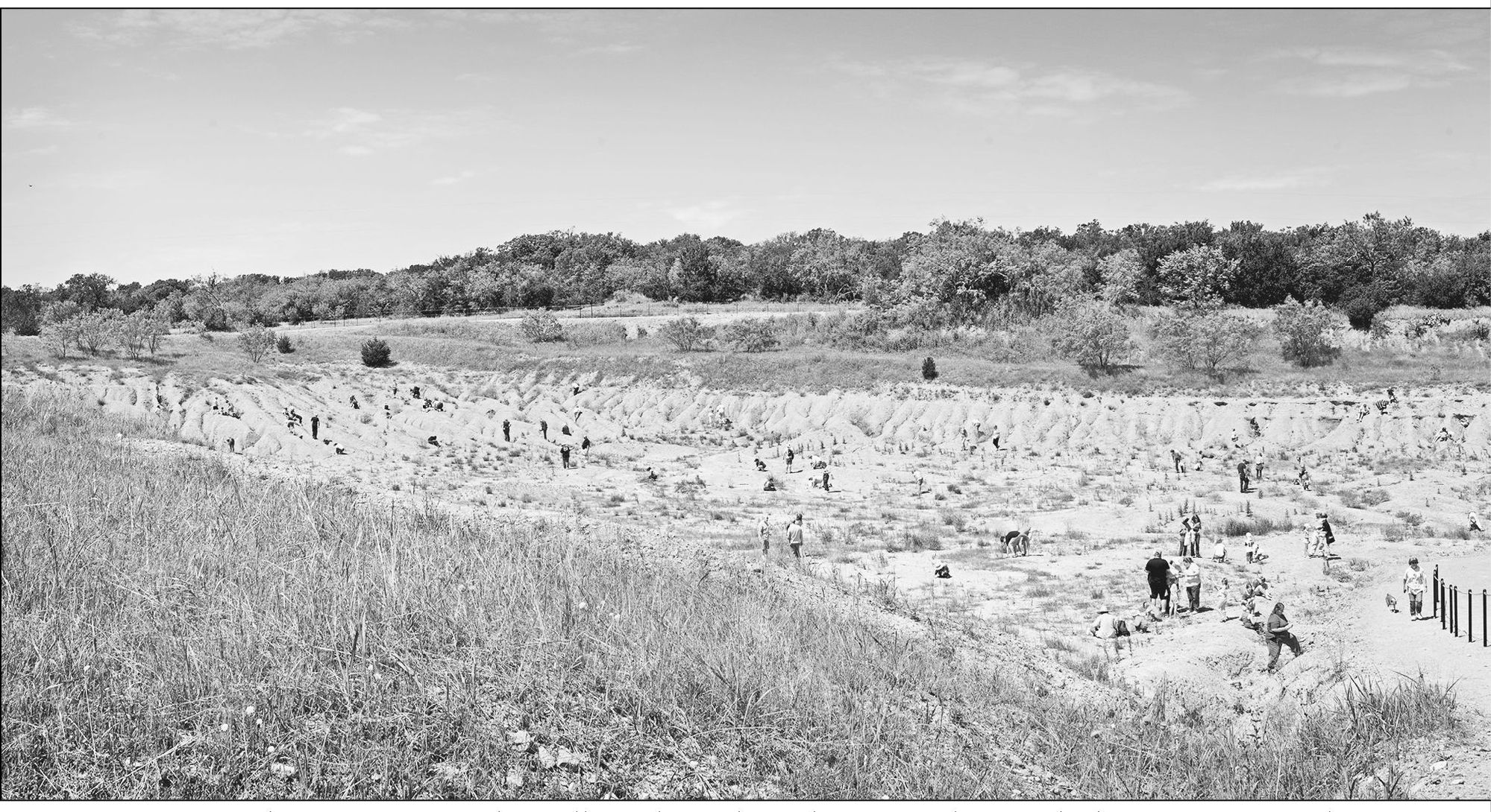
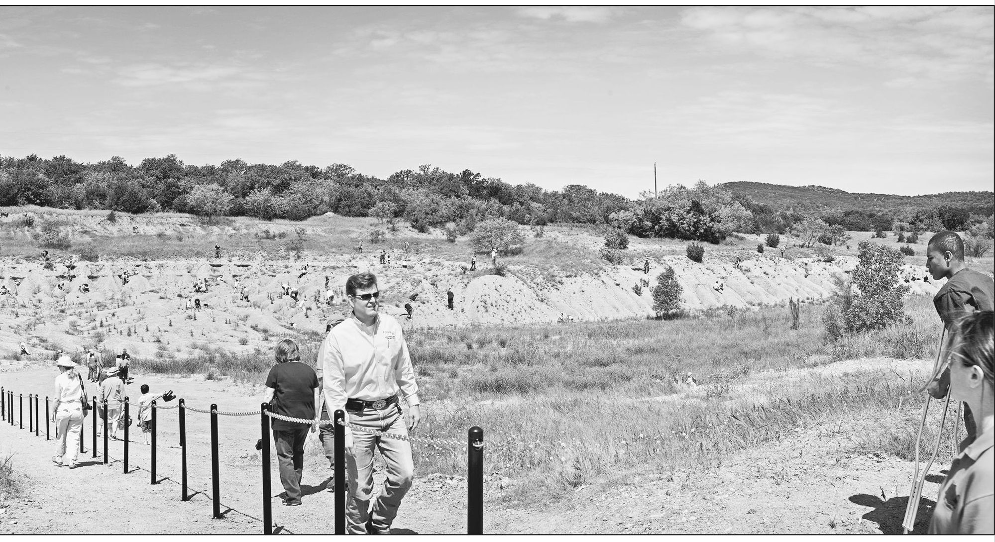
Due to these formations, the Dallas Paleontological Society, along with the City of Mineral Wells, has developed and opened Mineral Wells Fossil Park, which provides the fossil enthusiast, paleontologist, and student an excellent opportunity to see and collect well-preserved Pennsylvanian Period fossils with ease and abundance. These fossils have been dated to be just over 300 million years old, and one may collect and take the fossils out of the park for personal use. The park, as it exists today, is the result of 20 years of erosion to the old City of Mineral Wells landfills borrow pit just west of town, which closed in the early 1990s. The erosion of the borrow pit has revealed fossils documenting ancient sea species of crinoids (sea lilies), echinoids (urchins), brachiopods, pelecypods (clams and oysters), bryozoans, corals, trilobites (arthropods), plants, and even primitive sharks. (Photograph by Raf Seibert.)
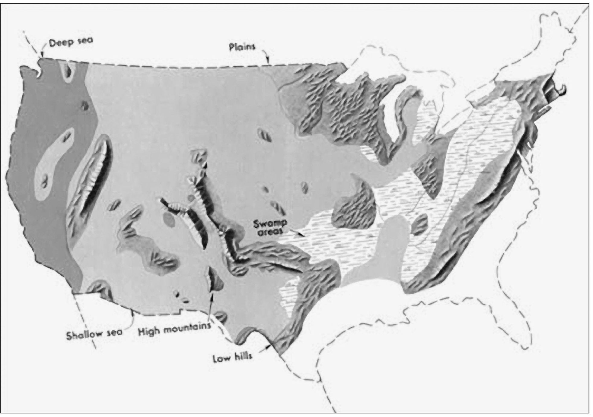
This map shows the low hills that were formed during the Pennsylvanian Period. The hills today in Mineral Wells are called the Pinto Hills, with the primary names East Mountain, West Mountain, and Western Hills. Moving backward in time, however, from the Great Ice Age to the Age of Dinosaurs and then to the Coal Age, the contrast in the distribution of land and water from the ancient past to the present becomes more dramatic. This map shows the outline of the United States as it looked during the Pennsylvanian Period some 300 million years ago. Notice that the low hills of the Mineral Wells area were at the coast during this time. This gives the appearance of reversing present-day geography. A highland which lay to the east, south, and north supplied much of the sedimentary debris that was spread over the Midwestern part of the United States. The Midwest was mainly a low swampy area in which scouring rushes and fern trees grew in profusion. Sediment was carried into the region from deltas to the east. (Courtesy of the U.S. Geological Survey.)

