ACKNOWLEDGMENTS
I would like to thank my cousin, Rose Ann Deak, and her children, Joseph and Mary Ann, for giving me permission to put these wonderful photographs into print. My husband, Bruce A. Buckner, was behind this book all the way. Mary Ann Greenwald was my proofer-in-chief. I could always rely upon my friends, Connie, Ricki, Joe, Karen, and Penny for support. Melissa Basilone, my Arcadia editor, was very helpful and enthusiastic; her assistance made this project a joy to create.
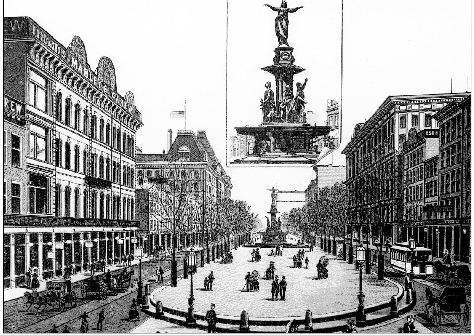
During the time covered in this book, Fountain Square would have looked like this etching. The fountain was facing east, whereas it now faces west. The building to the left with the flag at half mast was the old U.S. Post Office and Courthouse, designed by Samuel Hannaford and completed in 1885 at a cost of five million dollars. The fountain and surrounding plaza were completed in 1871. (William H. Deak Collection.)
One
I GOTTA MULE AND HER NAME IS SAL
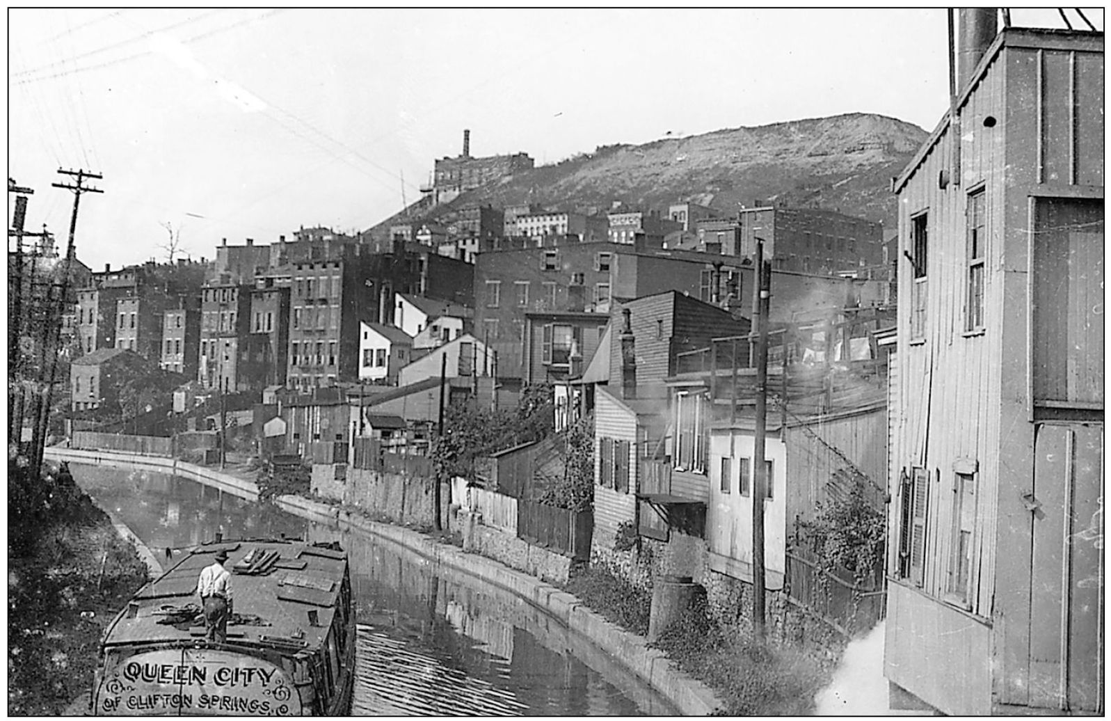
The Queen City rounds the Mohawk bend on its return passage to Northsides Clifton Springs Distillery in 1910. A boat would carry 350450 barrels to a spot behind Music Hall, where workers would unload them. The whiskey would then be hauled to its destinationsteamboat, railroad, or neighborhood barby horse-drawn wagons. Seen on the hill in the background is the Fairview Incline. Steam in the foreground was emitted from the slaughterhouses and tanneries that backed up to the canal.
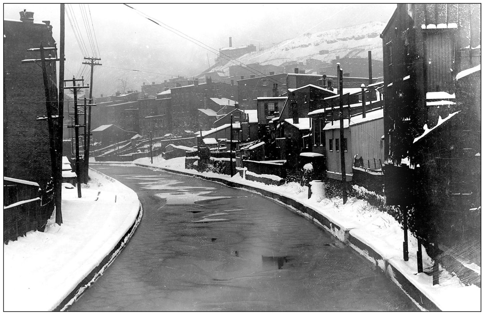
This image shows the scene from the previous page in winter. When the canal iced over, children skated along its length. The canal posed a drowning hazard for the neighborhood children. Over half of the German immigrants settled immediately north of the canal, giving the general area the name of Over-the-Rhine.
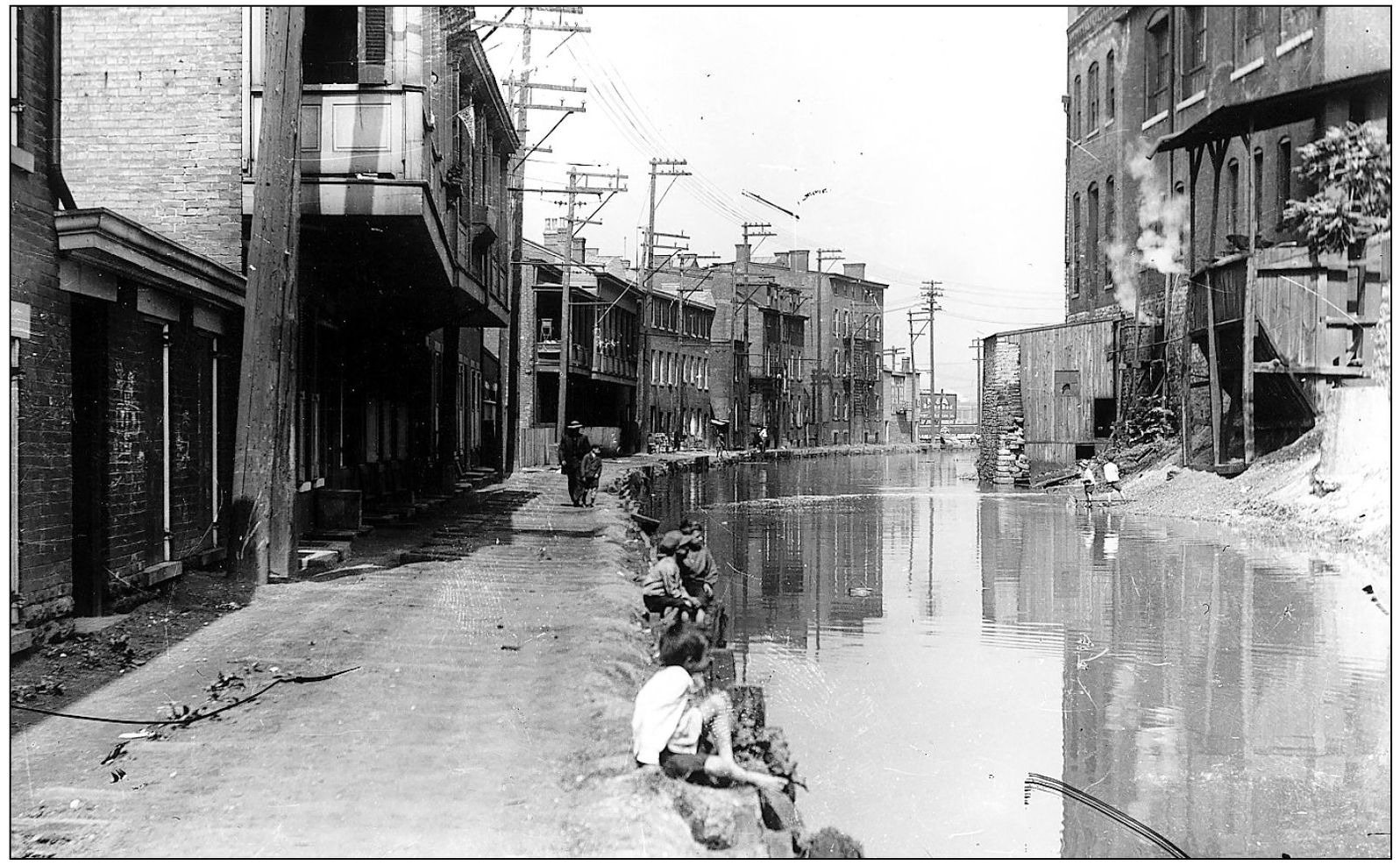
Boys play on the canal bank south of the Brighton bend. Notice the wide towpath on the left, used by mules or horses to pull the boats. Houses backed up to the towpath. When the canal was replaced in the 1920s by the aborted Cincinnati subway, houses this close to the construction sustained damage.
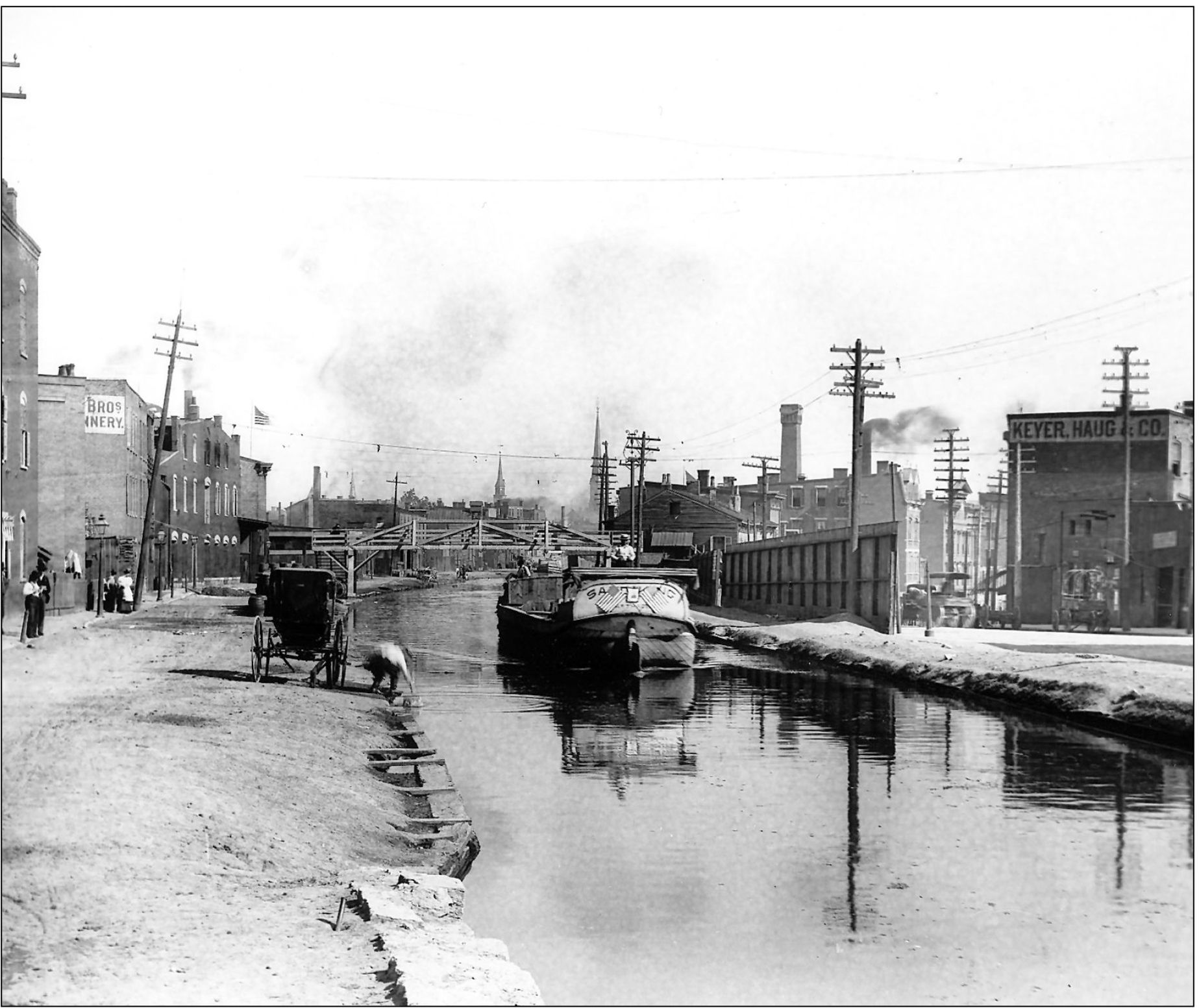
On the canal, a boat travels south from Mohawk Bridge at four miles an hour. Boats had a 10 mile speed limit because the water would wash up and over the berm. They carried lumber, leather goods, soap, meats, whiskey, corn, flour, beer, and just about anything that was manufactured or grown near the canals. Some boats were double walled and insulated, carrying ice packed in sawdust. In the winter, water would be diverted from the canal into flat fields enclosed with three-to-four-foot dirt walls to form ice ponds. Once a pond was frozen, the ice would be cut and stored in warehouses built for that purpose. The largest ice ponds were in West Chester, Fairfield, and Lockland. Smaller ones dotted the canal route. Mr. LeSourd had 10 icehouses and 40 acres of ice ponds, in what is now the location of the lake in the LeSourdsville Lake amusement park. The beer industry used large quantities of ice before the days of reliable refrigeration equipment. The Windisch, Muhlhauser, and Hauck breweries had farms in West Chester where they grew hops and barley, sending it to their breweries via the canal. Visitors can still walk a portion of the route on the Port Union Historic Canal Trail.
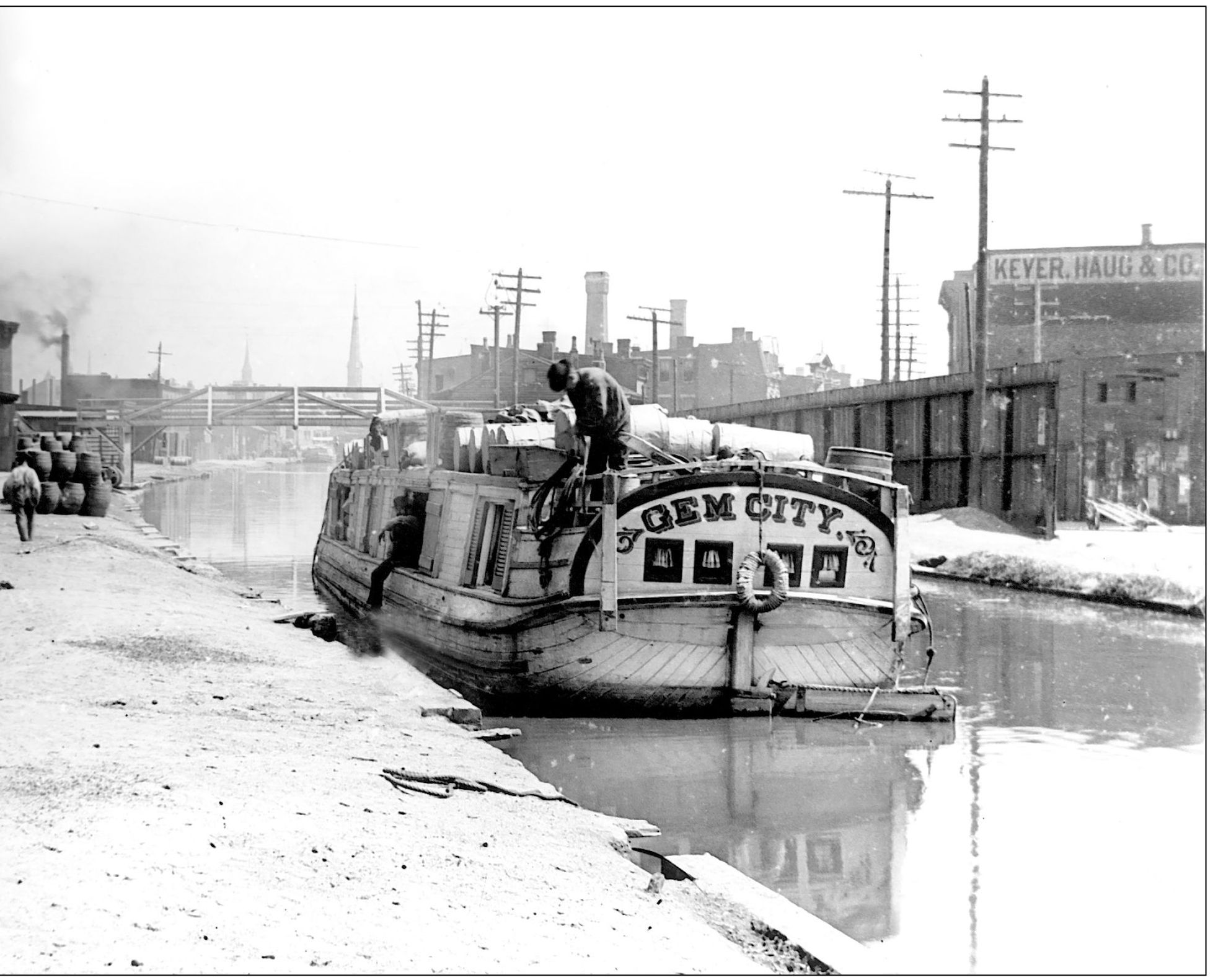
A typical freight canal boat was roughly 85 feet long by 14 feet wide. With only three cabins for the crew, the captain and his family, and mules, only the essentials were carried. The mules would be rotated due to fatigue and had to be included on the boat itself for convenience. Notice the woman, probably the captains wife, looking from the top deck. This boat was moored on North Plum Street, now Central Parkway.
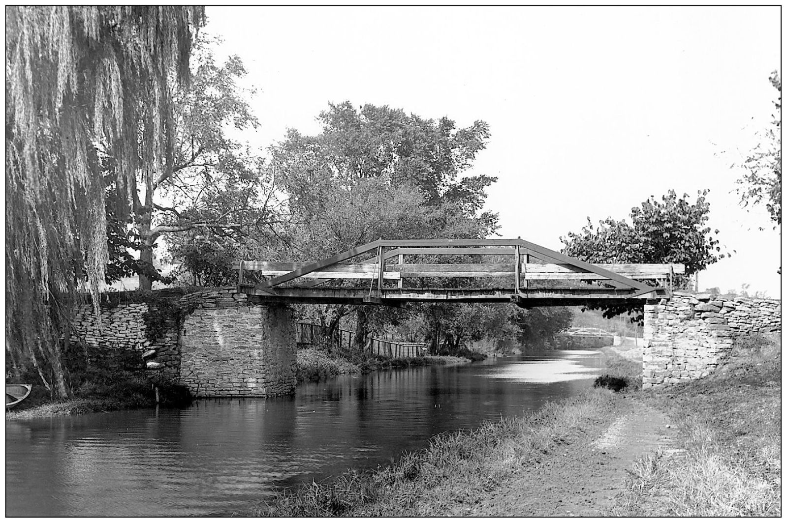
This peaceful canal scene was taken two miles above Lockland. Areas such as this attracted artists and visitors. As long as the canal was used, the flowing water kept it from stagnation.
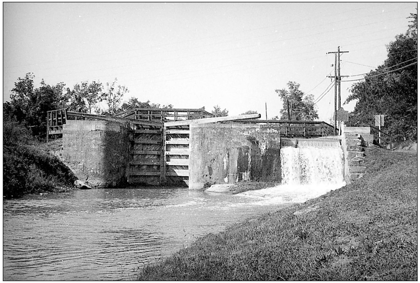
Although the lock is closed for boat traffic, the canal continues to flow from one level to another, as seen on the right. A gatekeeper would be nearby to open the lock and collect a toll fee. Remnants of locks such as this still can be seen in Fairfield and West Chester.
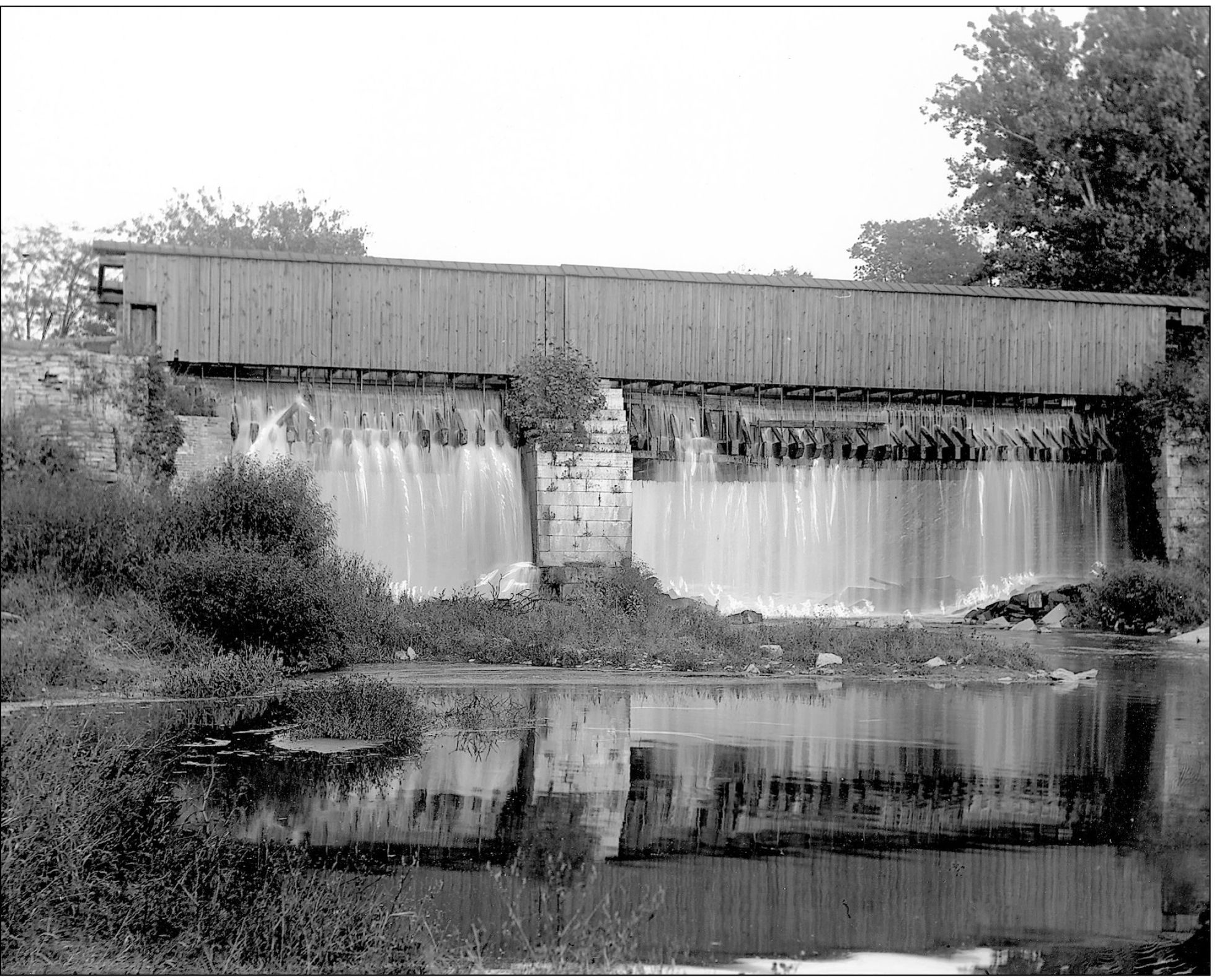
A wooden aqueduct crossed the Mill Creek at Carthage. The canal was contained in the roofed structure. The wooden sides were as high as the depth of the canal, and a towpath allowed the boats to be mule pulled. Swimmers could be washed into the Mill Creek below by the overflow. During the winter, when it froze, it was an impressive sight. The Carthage aqueduct burned, causing local flooding and disrupting canal traffic.
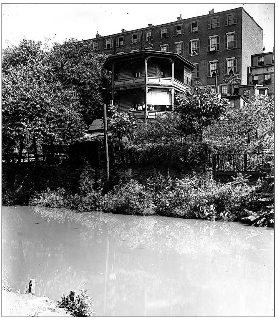
The Brighton Round House was built in 1869 on the slope of McMicken Avenue by Michael Haag for summer concerts. Haag beautified the area and charged a nickel for crossing the canal and using his grounds for picnics. In 1921, it was demolished for new roadwork. Brighton was a busy place with canal traffic, tanneries,slaughterhouses, distilleries, and mills.
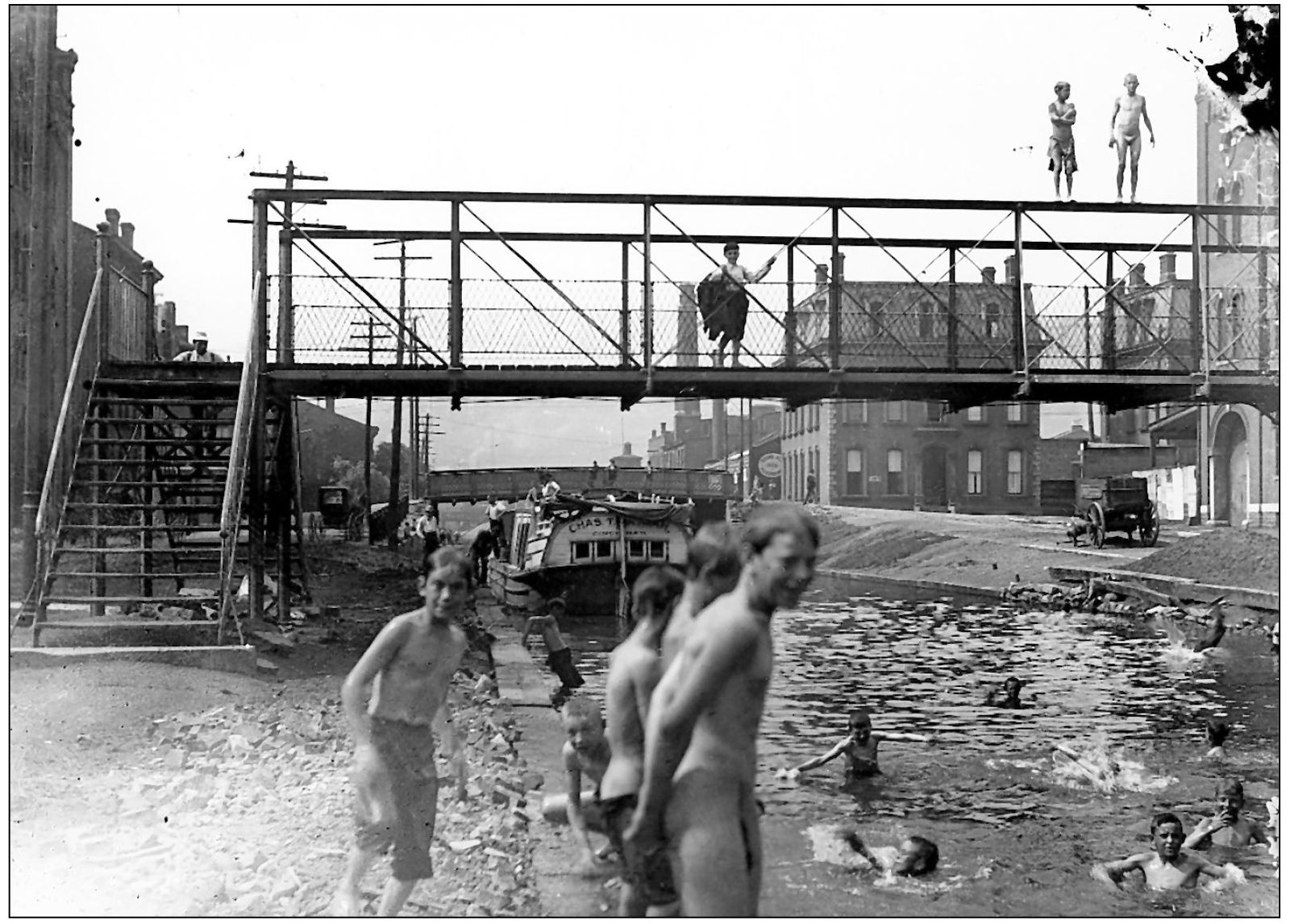
The canal was a popular, although unhealthy, place to swim. These boys at the Wade Street Bridge are having a great time jumping off. Cheese it! The cops! would quickly empty the canal of boys, who would return another day.
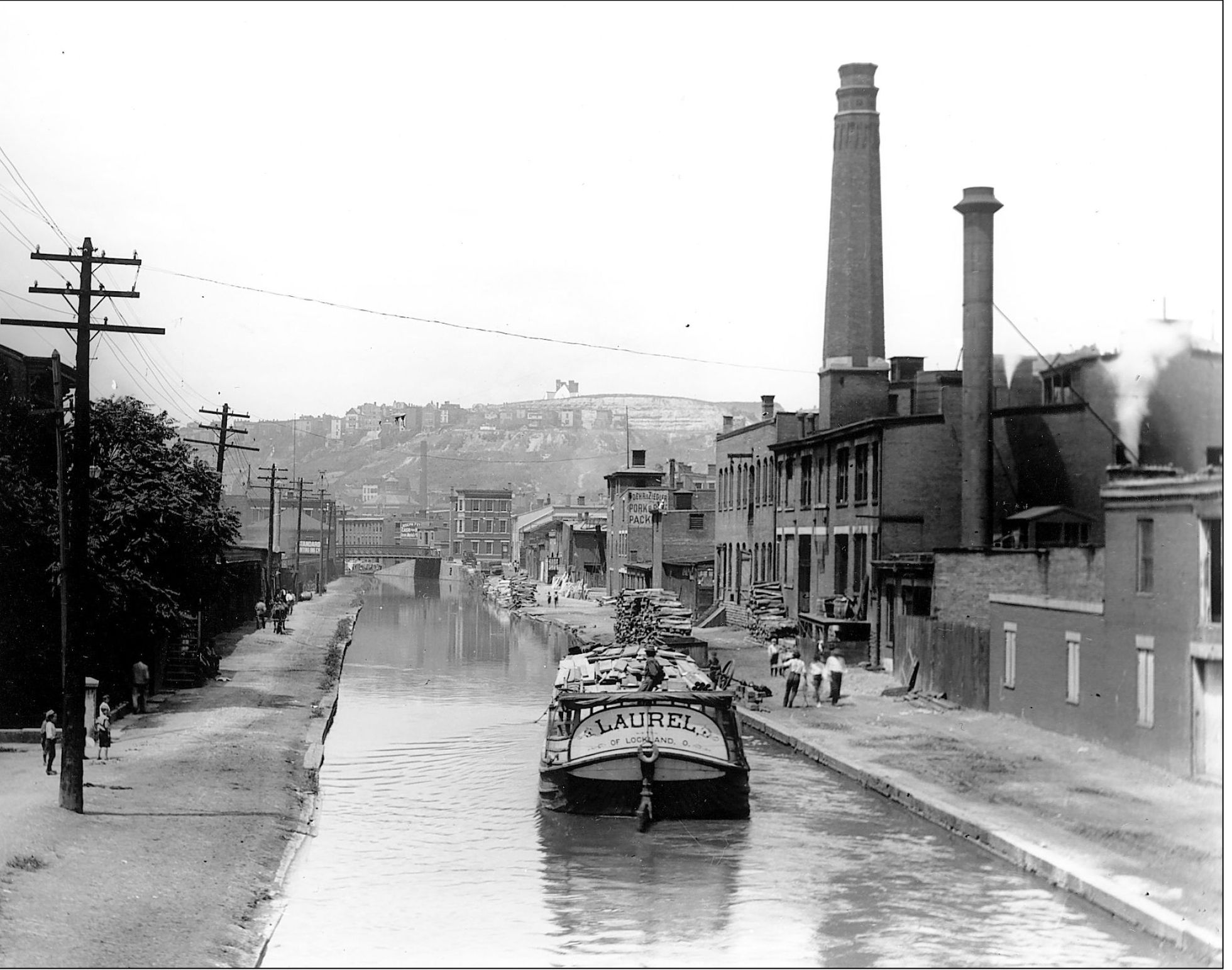
Lockland was home to a variety of industries: cotton, woolen, flour, lumber and paper mills, baking powder, starch, and wagon factories. The Laurel , originating from Lockland, carries a load of boards. Lumber is stacked behind the meat packing businesses. This view is looking north from the Liberty Street Bridge. The sign on the end building on the right reads Foehr & Ziegler Pork & Beef Packers. In the background is the Findlay Street Bridge.

