Ian Finlayson - The Battle for Passchendaele
Here you can read online Ian Finlayson - The Battle for Passchendaele full text of the book (entire story) in english for free. Download pdf and epub, get meaning, cover and reviews about this ebook. publisher: Big Sky Publishing, genre: Non-fiction. Description of the work, (preface) as well as reviews are available. Best literature library LitArk.com created for fans of good reading and offers a wide selection of genres:
Romance novel
Science fiction
Adventure
Detective
Science
History
Home and family
Prose
Art
Politics
Computer
Non-fiction
Religion
Business
Children
Humor
Choose a favorite category and find really read worthwhile books. Enjoy immersion in the world of imagination, feel the emotions of the characters or learn something new for yourself, make an fascinating discovery.

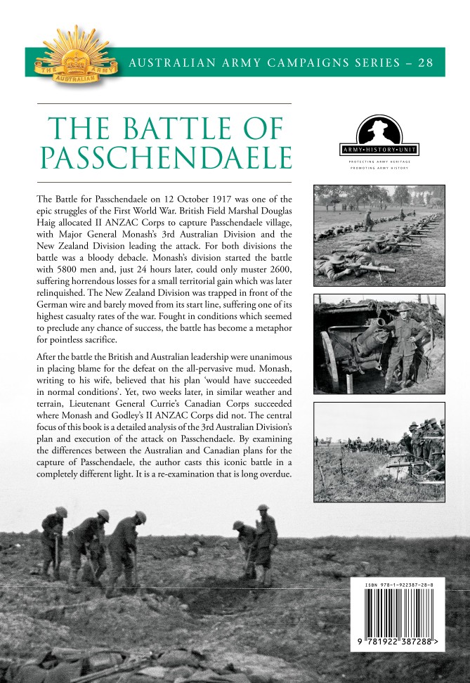
- Book:The Battle for Passchendaele
- Author:
- Publisher:Big Sky Publishing
- Genre:
- Rating:3 / 5
- Favourites:Add to favourites
- Your mark:
The Battle for Passchendaele: summary, description and annotation
We offer to read an annotation, description, summary or preface (depends on what the author of the book "The Battle for Passchendaele" wrote himself). If you haven't found the necessary information about the book — write in the comments, we will try to find it.
Ian Finlayson: author's other books
Who wrote The Battle for Passchendaele? Find out the surname, the name of the author of the book and a list of all author's works by series.

The Battle for Passchendaele — read online for free the complete book (whole text) full work
Below is the text of the book, divided by pages. System saving the place of the last page read, allows you to conveniently read the book "The Battle for Passchendaele" online for free, without having to search again every time where you left off. Put a bookmark, and you can go to the page where you finished reading at any time.
Font size:
Interval:
Bookmark:
ACKNOWLEDGEMENTS
This book is dedicated to my grandfather, Private J.R. Finlayson, a member of the 59th Battalion, AIF, and survivor of the battles of Fromelles, Bullecourt, Polygon Wood, Villers-Bretonneux, Amiens and St Quentin Canal.
The idea for this book was instigated by the previous Head of the Australian Army History Unit, Dr Roger Lee, as part of a series to cover all the major battles involving the Australian Army in the First World War. Many people assisted in the production of this volume, but none more than my fellow historians in the Australian Army History Unit, Dr Andrew Richardson and Mr Nick Anderson. Both provided their invaluable assistance and insights into the processes associated with producing this book and it would not have been published without their assistance. Thanks should also go to those who read this manuscript and provided invaluable suggestions including Dr Roger Lee, Mr Nick Anderson, Mr Richard Pelvin, Ms Grace Finlayson and Lieutenant Colonel Kon Iliadis. My sincere appreciation also goes to the editor of this book, Mrs Cathy McCullagh. Without Cathys diligence, guidance and eye for detail, this book would have been a diminished work. Thanks also to Denny Neave and the team at Big Sky Publishing for the production of this high-quality volume. Finally, many thanks to Mr Bill Frost who, at very short notice, agreed to take some photographs around Passchendaele village during a visit to France.
CHAPTER 1
PASSCHENDAELE: THE OPERATIONAL BACKGROUND TO THE BATTLE
GENESIS OF THE THIRD YPRES OFFENSIVE
An aerial view of Ypres taken from an Allied observation balloon on 31 October 1917. The Cloth Hall and Ypres Cathedral are at the top left of the picture (AWM E01257).
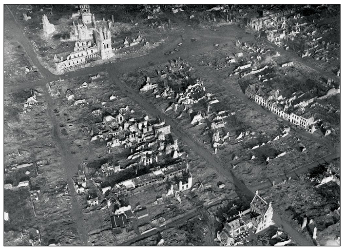
In 1917 Ypres had been transformed from what had previously been a prosperous market town in the Flemish part of Belgium to one of the most important locations on the Western Front. Not only had two major campaigns been fought for its possession in 1914 and 1915, but in 1917 it formed the base of a salient into the German lines, providing a potential starting point for any Allied offensive towards the Belgian ports. The town itself lay on the Yser Canal and derived its military significance from being a road, rail and canal junction linking northern France and Belgium. However, the cost to the town of this significance was high. A British Army padre visiting Ypres in September 1917 described a large a town that had been reduced to ruins, with not a single habitable dwelling. The dominant pre-war feature of the town was the Cloth Hall, one of the Middle Ages largest commercial structures, but bombardment had reduced this unique building to a bare shell. In 1917 the damaged tower of the Cloth Hall was still standing, and was one of the few vertical landmarks in an otherwise horizontal landscape of stone and rubble.
The geography of the region around Ypres is dominated by flat, agricultural plains, broken only by a series of low ridges which form a semi-circle around the south, east and north-east side of the town. South-east of Ypres are the villages of Wytschaete and Messines, which sit on the southern end of the Ypres Ridge. Almost 4 kilometres due north of Ypres is a small feature named Pilckem Ridge which runs in between, and parallel with, the Yser Canal and Steenbeek Creek. All of these features run in a north-south direction. Any advance east of these obstacles would encounter slowly rising ground until it reached the northern end of the Ypres Ridge.
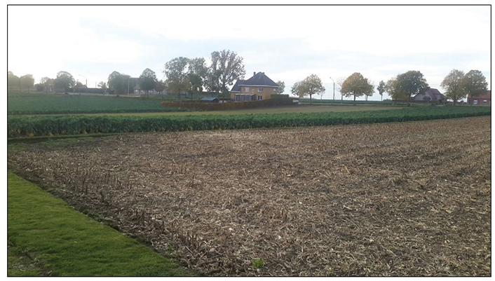
Contemporary farmhouses on the main road (Passendalestraat) leading into Passchendaele village. This gives an impression of what the housing and terrain would have looked like prior to the war (image courtesy of Bill Fraser).
The central mass of the Ypres Ridge was the Gheluvelt Plateau, a flat area crossed by the YpresMenin road. Moving north from the Gheluvelt Plateau the ridge narrowed, but provided sufficient level ground to support the villages of Passchendaele, Westroosebeke and Staden. These villages had provided housing for local businessmen and landowners and the houses were generally of a more substantial nature than those associated with the farming communities on the plains, although by 1917 these villages were in ruins. Small woods and coppice had dotted the Ypres Ridge, but these forested areas were now destroyed. The resulting debris of stumps and broken tree limbs fused with the churned soil, presenting a significant obstacle to advancing infantry or tanks.
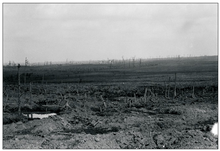
The Ypres battlefield south-east of Broodseinde on 28 September 1917. To the right the ground starts to rise towards the ridge line which would lead to Passchendaele (AWM E00893).
The military significance of the Ypres Ridge lay in the flatness of the surrounding plain. Despite an average height of just 40 to 50 metres (around 60 metres at its highest points), possession of the ridge provided German forces with clear observation of Allied activity in Ypres and the surrounding area, while also obscuring Allied observation of German movements behind the ridge. Because of this, no Allied offensive could move north to the Belgian coast without first securing its left flank on the Ypres Ridge.
A British plan to recapture the Belgian ports of Ostend, Blankenberghe and Zeebrugge from the Germans was first proposed in December 1914 by Winston Churchill, then First Lord of the Admiralty, to the commander of the BEF, Sir John French. Given their location, flanking the main cross-channel troop and supply routes from the British ports of Richborough, Dover and Folkestone to the French ports of Dunkirk, Calais and Boulogne, the Admiraltys interest in recapturing the Belgian ports was self-evident. Their ownership gave German naval forces harbours from which to interdict the vital Allied channel supply links while also supporting German U-boat operations in the Atlantic. In November 1915 the Admiralty presented another proposal to capture the ports to the new commander of the BEF, Field Marshal Sir Douglas Haig. The Admiralty plan involved an amphibious landing near Ostend supported by a limited land offensive from Nieuport. Haig, while supportive of the concept, considered the frontage of the proposed land operation too narrow, confined as it was between coastal dunes and the inland marshes of the Yser River. His concept was far bolder, involving a major offensive from the Ypres salient sweeping north-west to capture Bruges and the entire coastline between Nieuport and Zeebrugge.
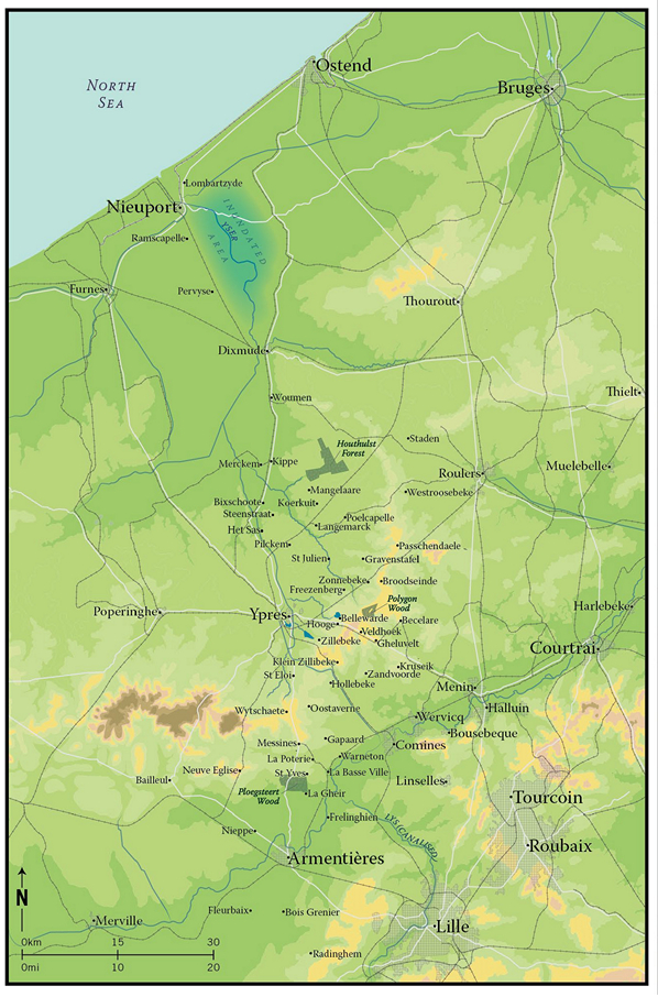
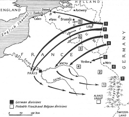
Map 1. The topography of the Ypres area in 1917 showing its significance as a road, rail and canal communications hub. The dominant geographic feature is the crescent-shaped ridge line beginning south of Ypres and sweeping north-east to Passchendaele. The Ypres to Roulers railway line and the Ypres to Menin road are the two transport corridors which bisect the ridge. The marshes south-east of Nieuport restrict an advance directly on Ostend and the other channel ports. The importance of Bruges, with its road and rail network, for the German defence of southern Flanders is also apparent.
Next pageFont size:
Interval:
Bookmark:
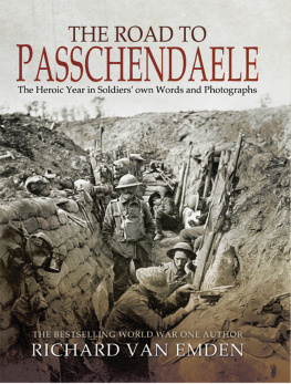
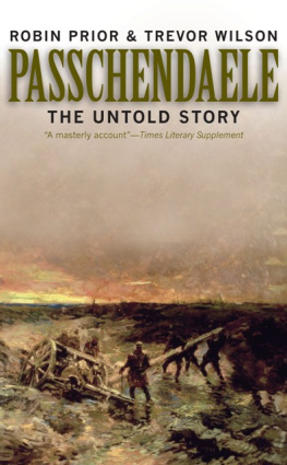
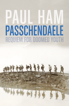
Similar books «The Battle for Passchendaele»
Look at similar books to The Battle for Passchendaele. We have selected literature similar in name and meaning in the hope of providing readers with more options to find new, interesting, not yet read works.
Discussion, reviews of the book The Battle for Passchendaele and just readers' own opinions. Leave your comments, write what you think about the work, its meaning or the main characters. Specify what exactly you liked and what you didn't like, and why you think so.