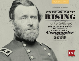
Grant Rising: Mapping the Career of a Great Commander Through 1862
Maps Copyright 2014, Hal Jespersen. Text Copyright 2014, Lombardy Studios.
All rights reserved. No part of this book may be used or reproduced in any manner whatsoever without prior written permission of the copyright holders, except in the case of brief quotations for reviews. Contact Lombardy Studios, 835 8th Avenue, Oakland, California 94606-3608 U.S.A. www.grant-rising.com
First North American Edition.
Library of Congress Control Number 2013946705
ISBN 978-1-940169-01-9
eISBN 978-1-940169-12-5
Mobi ISBN 978-1-940169-12-5
Map Study Series CW No. 1
Cartography by Hal Jespersen
Narrative by James R. Knight
Project Designer & Editor
Dana Lombardy

| Dust Jacket Cover Design By Rinck Heule | Book Layout By Tiffany Neuman and Lindsey Vroma | Orders-of-Battle Design By Mark Schumann |
| Flag Illustrations By Mark J. Simmons | Production Assistant Alicia Hathorne |

Featuring Civil War Paintings By
Keith Rocco

PUBLISHERS PREFACE
A picture is worth a thousand words.
- Napoleon Bonaparte
I f the quote attributed to Napoleon above is correct, then a detailed map can tell an entire story. And the 46 maps in this book create much more than just another atlas of the American Civil War.
There are several things that make Grant Rising a different type of map book:
New information not previously published in map form, including Grants early life and his pre-Civil War career.
In addition to the traditional use of red and blue to distinguish opposing sides, different tints of these colors differentiate commandsessential to understanding command relationships in complex battles.
Different color tints also help distinguish multiple units of the same side, making the action easier to understand.
Lavish color maps with a shaded relief provide an excellent way to understand the shape of the terrain.
3 orders-of-battle are coded to the same command colors on the maps.
Strategic overview maps place regional operations and battles in context.
Concise text is supported by quotations from the participants and observers of the era.
This is both a great reference source and a compelling account of Ulysses S. Grants remarkable story.
We are very grateful to Richard Bliss, Scott Pfeiffer, Cammon Randall, and Mark Schumannand a special thanks to Dennis Donovan of The National Civil War Association ( NCWA.org )who all contributed to the entertaining videos and Kickstarter crowdfunding project that helped us finance this book. These videos can be viewed via the link to our Grant Rising Kickstarter page from the website www.grant-rising.com . We also want to acknowledge the expert assistance of Jimmy Jobe, retired Park Ranger at Fort Donelson National Battlefield, and Tom Parson, National Park Service Ranger at Corinth Civil War Interpretive Center and Shiloh National Military Park.
Hal Jespersen, Jim Knight, and I are pleased to present this bookthe first of what we hope to be a unique series of studies that illustrate the military careers of several famous Civil War generals through maps, period illustrations, photographs, and memoirs.
Dana Lombardy, Publisher

W ITHOUT THE GENEROUS SUPPORT OF THE FOLLOWING PEOPLE , G RANT R ISING WOULD NOT HAVE BEEN POSSIBLE .

Katherine Aldridge
Kenneth A. Balderrama
Brian Beirne
Vince Bellows
Graham Bird
Colonel Raymond K. Bluhm, Jr. USA (Ret.)
John Boswell
David W. Bowers
Jack F. Brown II
Robert T. Carty, Jr.
David Byron Cheever
Conrad L. Chuang
John Crispin
Tom Dalgliesh, Columbia Games Inc.
Matthew Philip Dalton
David M. P. Daly
Tara Drennen
Thomas Eugene Eaton Sr.
Chris Edwards
William L. Ekvall
Stephen Elliott
Hugh Gardner (Illuminations Presentations)
Robert I. Girardi
Michael Gornall
Bruce Harlick
Major Bill Harting USAF (Ret)
Marc Heyhoe
Ray Hosler
William J. Hupp
Eric S. Johnson
Bernard Kempinski
Andrew Kluessendorf
Anne Merritt
Jane Merritt
Mikhail Orlov
Seth Owen
Scott Paterra
John E. Pitcairn
Phillip A. Purcell
Michael J. Raymond
Allan Rothberg
John R. Scales
Mr. and Mrs. Kenneth B. Schumann
Eric Lee Smith
Gerald D. Swick
Paul Tevis
David Thorp
John Vahaly
Julian Wan
Jim York
Josh Young
Church of Tarkus, Minister General Jack Wells II
Gary H. Wishik
David M. Wohlstadter
Louisa Long Jaffe, LTC (ret) USAR/WAC, in memory of her great-grandfather, Thomas Wilson Long, a veteran of the Athens Guards, Co. K, 3rd GA Infantry Regiment

CARTOGRAPHERS FOREWORD
The country, however, was new to us, and we had neither guides nor maps to tell us where the roads were, or where they led to. Engineer and staff officers were put to the dangerous duty of supplying the place of both maps and guides.
Lieutenant General Ulysses S. Grant, writing of Virginia in May 1864
I have always been fascinated by maps, and although I have not received formal cartography training, I developed techniques that I hope will portray Civil War battles in a new way. I got my start drawing over 200 maps to illustrate articles I wrote for Wikipedia. From those earliest days in 2004, my goal has been to use simplicity to reveal the essence of the actions of a battle. I avoid overloading the image with trivial details and multiple timelines, and use colors wherever possible to improve clarity.
For this book of map studies, I continue to pursue my goal with two improved techniques. First, I used shaded relief topography wherever feasible, giving the maps a three dimensional appearance, rather than the more traditional contour lines or hachures. The underlying data for this approach is available from government agencies and I employed two different sources for battlefield versus campaign/strategy maps:
Next page
