Published by
Princeton Architectural Press
37 East Seventh Street
New York, New York 10003
Visit our website at www.papress.com.
2010 Princeton Architectural Press
All rights reserved
13 12 11 10 4 3 2 1 First edition
No part of this book may be used or reproduced in any manner without written permission from the publisher, except in the context of reviews.
Every reasonable attempt has been made to identify owners of copyright. Errors or omissions will be corrected in subsequent editions.
Editor: Nicola Bednarek
Designer: Deb Wood and Bree Anne Apperley
Special thanks to: Nettie Aljian, Sara Bader, Janet Behning, Becca Casbon, Carina Cha, Penny (Yuen Pik) Chu, Tom Cho,
Carolyn Deuschle, Russell Fernandez,
Pete Fitzpatrick, Wendy Fuller, Jan Haux,
Linda Lee, Laurie Manfra, John Myers,
Katharine Myers, Steve Royal, Dan Simon, Andrew Stepanian, Jennifer Thompson,
Paul Wagner, and J2seph Weston of
Princeton Architectural Press
-Kevin C. Lippert, publisher
Library of Congress Catalogin.3g-in
Publication Data
Harzinski, Kris.
From here to there : a curious collection
from the hand drawn map association /
Kris Harzinski. 1st ed.
p. cm.
ISBN 978-1-61689-187-9
1. Map drawing. 2. MapsCollectibles.
I. Hand Drawn Map Association. II. Title.
GA130.H336 206
912dc22
2009050898
The Hand Drawn Map Association wishes to thank everyone who has shared their work with us or helped to support our projects, with an extra special thanks to Harriet Hacker, Will Haughery, and Christian Herr for their unwavering dedication.
We would love to add your work to our collection. Please consider submitting your maps or diagrams to us at handmaps.org.
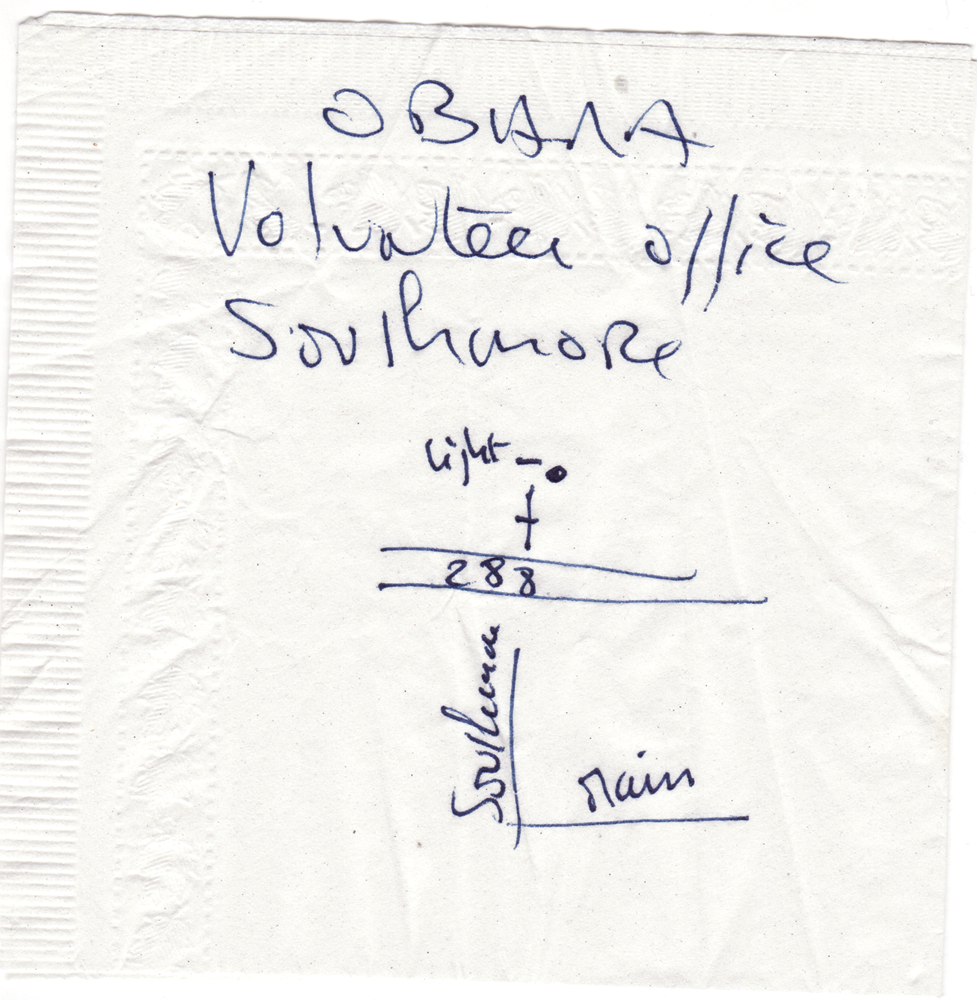
Bernard Bonnet and Margo Handwerker, Obama 2008 Campaign Office in Houston, Texas, Collection of the Hand Drawn Map Association
The idea for the Hand Drawn Map Association (HDMA), an archive of maps and other diagrams drawn by hand, came to me while I was going through some boxes of old papers in preparation for a move. As I was sitting on the floor sorting papers and throwing others away, I came across a number of maps that people had drawn for me over the years. I had saved them for one reason or another, but never thought of them as a collection per se. As I looked at them then, the memories they represented were perfectly re-created in my mind. The maps had become much more than useful directions from one place to another; they had become accidental records of a moment in time.
This eventually inspired me to share these maps with others. I wanted people to see how these seemingly insignificant scraps of paper represented individual stories of peoples lives, and how these simple drawings of a specific place held not just factual information, but personality as well. The HDMA began as a website where I posted the few maps I had collected with a simple invitation to others asking them to contribute their own maps, their stories, and their personal accounts of the places theyve experienced out in the world.
Looking through the maps in my collection, I am always amazed at how the person drawing the map often inadvertently records specific details peculiar to a place. These can be linked to significant events, such as in this simple map to Barack Obamas campaign headquarters, scribbled on a napkin. In one sense, this particular map has become a document of his historic campaign for the presidency. Still others can be related to popular culture: a map noting things to see in Chicago (pages 4849) includes the location of a now famously shuttered music venue, Lounge Ax. A map can also recall something completely mundane, such as a high school party in a Detroit neighborhood (pages 6869), or trying to find a rental location for a U-Haul trailer (page 20). In a larger sense, these maps document people interacting with their environment. They record the human urge to travel, to discover new things, to venture off into unknown places just to see whats around the corner, to take road trips to Chicago, go scuba diving in the Bahamas, or bike across the United States with a group of friends. They represent the power of mundane objects, of seemingly insignificant ephemera, to remind us of a larger human desire to keep a record, to remember, to travel, to wander, and to discover.
Very few maps resembling those in this collection have been intentionally archived throughout history. Most maps collected and preserved in archives around the world are more polished and refined, such as Abraham Lincolns map of the town of Huron, Illinois, created in May 1836 (page 12). This official record was drafted by Lincoln, when he was a deputy surveyor, in order to provide a record of land purchased by John Kennedy Kincaid. An interesting exception, however, is Ernest Shackletons quick sketch of Antarctica (pages 1415). He drew the image on a menu card in 1914 for Clive Morrison-Bell at the London Devonian Associations annual dinner. It depicts the proposed route for his Trans-Antarctic Expedition. Another notable example is by Alexander Calder, who sent an invitation to fellow artist Ben Shahn in 1949 that included a map with directions to his home (page 13).
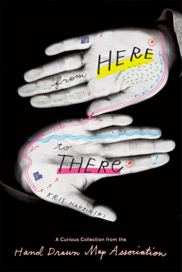
The collection of maps presented in this book is organized into six chapters based on recurring themes. Direction Maps is a series that represents the HDMAs original mission: to collect maps created in a natural and practical way to provide directions from one place to another. These maps are so utilitarian they often find their way not into a book or archive but directly into the trash, yet they offer a unique point of view on a particular place. You may find yourself in Philadelphia some day and Ryan Andersons useful map of things to do in the city could be quite inspiring (pages 4445). Found Maps includes not only the very first map in my collection, rescued from the trash in Glasgow long before the HDMA existed (pages 6668), it also compromises a small number of maps other people have found in their daily lives. Fictional Maps is a collection of maps that document imagined and fictional realities such as Jamie McQuinns map of Quastolia, a country for ants he developed as a child (pages 9697). Artful Maps includes a variety of works that are more elaborate than other maps in the archive, or works that use cartography as a point of reference. A good example is Yumi Roths project, Meta Mapa, where she invites people to draw maps on their hands that lead to interesting places in their city (pages 12627). Maps of Unusual Places is a series of maps that document and diagram places not normally thought to have topology or geography. It includes maps of the body (both for practical and metaphorical purposes), maps of the Internet, and even a map of trash found along the road. The last chapter, Explanatory Maps, is a collection of maps that were not necessarily created to provide directions from one place to another, but are instead maps and diagrams drawn to tell a story or explain a particular concept. Jan Rothuizens map of the Anne Frank House in Amsterdam (pages 17577) combines a variety of narratives enacted within this architectural space. He recounts a personal story while addressing both the historic importance of the space and its importance as the most popular tourist attraction in the city.

