L is for Land of Living Skies
A Saskatchewan Alphabet
From the healing waters of Little Manitou Lake and the 14,000-year-old QuAppelle River valley to the cheering Roughrider fans and jigging to the fiddle music, readers of all ages will enjoy this A-Z tour through the land of living skies, Saskatchewan.
Q is for QuAppelle Valley
Here youll find a chain of lakes,
where we head for summer fun
fishing, camping, sailing, too,
in southeast Saskatchewan.
More than two hundred years ago, explorer David Thompson drew the first maps of the QuAppelle River and the valley it flowed through. In those days it was the main travel route across southern Saskatchewan, while today the QuAppelle Valley is an important recreation area for everyone.
Author Linda Aksomitis enjoys living in QuAppelle. Illustrations from Lorna Bennett help readers enjoy Saskatchewan as much as she does.
L is for Land of Living Skies
A Saskatchewan Alphabet
Written by Linda Aksomitis and Illustrated by Lorna Bennett

This book is dedicated to my grandson, Jonmay he enjoy discovering
our province, along with all of us who live here and those who visit!
With thanks to my writing group, the Childrens Writers
Round Robin, especially Sharon Plumb Hamilton.
Linda

For Simon, Pokani kapi; James, Omahkaniikaapi; George, Jenna
and Jordan; all children of the open, rolling prairie land..
Lorna
A
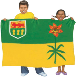
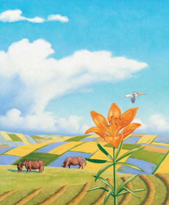
Saskatchewans provincial flag shows the importance of agriculture with its two equal sections of green and goldgreen for our northern forests and gold for our southern grain fields. The western red lily, our provincial flower, is on the right side of the flag. Our provincial shield, on the top left right, bears three yellow wheat sheaves and a red lion.
After the explorers and fur traders, farmers were the first European settlers when homesteading was opened in 1872. Saskatchewan soon became so famous for our wheat crops that we were called the Bread Basket of the World. Today, more farmers grow oilseed crops such as canola, and pulse crops, such as peas and beans, than wheat. In southern Saskatchewan, July fields often look like a patchwork quilt with the bright blue flax in bloom right next to yellow squares of flowering canola.
Cattle also graze in our fields, particularly in the hilly parts of Saskatchewan. If youre lucky you may also see bison, elk, or deer herds roaming the prairies, too!
A is for Agriculture
From our forests in the north, to our crops that feed the worldthink of these things when you see wheat sheaves on our flag unfurled.
B
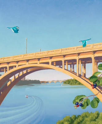
The Bridge CitySaskatoonis Saskatchewans largest city! With the South Saskatchewan River winding through it, there are lots of parks along with hiking and biking trails for everyone to enjoy. Many of the citys older boulevards have stately elm canopies, so Saskatoon is also often called the City of Trees.
Saskatoons first settlers chose its name from the Cree word for the wild Saskatoon berry bushes that grow throughout the province, as well as on the riverbanks of the South Saskatchewan. Originally three settlements grew up in close proximity along the river shores. The only original bridge still standingthe Traffic Bridgea truss bridge, was opened in 1907 when the three joined to become a city. There are four additional traffic bridges today, along with two for the railways.
The South Saskatchewan River, which flows through Saskatoon, is the southern branch of the most important river in Saskatchewan. Our province is named after this river, from a Cree word meaning swift flowing river.
B is for Bridge City Saskatoon is where youll find seven bridges shore to shore, span the South Saskatchewanno other city here has more!
C
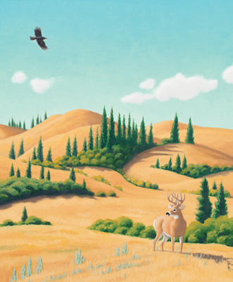
The Cypress Hills are an amazing anomaly in Saskatchewan. Around 18,000 years ago a block of ice about a kilometre thick covered everything but this part of the province. It stuck out of the ice like the cherry on top of an ice cream sundae! At an altitude of 1,466 metres, the Cypress Hills are still the highest point in Canada between the Rocky Mountains in the west, to Labrador and the Appalachians in the east.
Many things make the Cypress Hills a unique place. Its fossils of marine mollusks, ancient rhinoceroses, giant pigs, crocodiles, camels, saber-toothed tigers, and dinosaurs help us discover what happened here millions of years ago. Many rare species of flora and fauna still fill the park todayeven 18 types of wild orchids! Lodgepole pine forests, the only ones in the province, thrive here, too. Indeed, there are four different ecosystems in the park: montane forest, fescue grassland, mixed grass prairie, and wetlands.
C is for Cypress Hills See the park in Cypress Hillsrises from the prairie land, highest point between the heights of Labrador and Rockies grand!
D
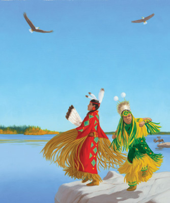
The Denesuline (DENE-su-lee-neh), or Dene people, live in northern Saskatchewan. Its believed that the Dene came to these lands between 8,000 and 12,000 years ago, making them some of Saskatchewans first inhabitants.
The Dene people inhabit much of Saskatchewans Canadian Shield area. Its a landscape of thousands of lakes, rivers, forests, rocks, and bogs that provide an important habitat for many bird and animal species including caribou and moose. Many visitors fly in to visit Northern Dene communities to fish the lakes and hunt.
Our Saskatchewan motto, From many peoples, strength, describes our province as one that is made up of many cultures. In addition to the Dene, we have many other First Nations.
D is also for Tommy Douglas, Saskatchewans premier from 1944 to 1961. With his most important contribution to health care, Tommy Douglas is often called the Father of Medicare.
D is for the Dene Living here since long ago, peoples of the northern lands:
jack pines, spruce, and ancient rocks, Lake Athabascas shifting sands.
E
Elevators are enormous storage bins that hold prairie farmers grain crops. The strange shape, with small centre top and wide body, is formed by the elevating machinery in the middle gable thats surrounded by 16 or 18 storage bins. Each elevator stands 21 metres to 24 metres high.
Over 3,300 grain elevators once towered like giants over every town in southern and central Saskatchewan. Elevators were always built next to the railroad, so the grain could be loaded in grain cars for shipping to the seaports.


