An imprint of The Rowman & Littlefield Publishing Group, Inc.
4501 Forbes Blvd., Ste. 200
Lanham, MD 20706
www.rowman.com
Falcon and FalconGuides are registered trademarks and Make Adventure Your Story is a trademark of The Rowman & Littlefield Publishing Group, Inc.
Distributed by NATIONAL BOOK NETWORK
Copyright 2018 The Rowman & Littlefield Publishing Group, Inc.
A previous edition of this book was published by Falcon Publishing, Inc. in 1999, 2005, and 2014.
TOPO! Maps copyright 2018 National Geographic Partners, LLC. All Rights Reserved.
Maps: The Rowman & Littlefield Publishing Group, Inc.
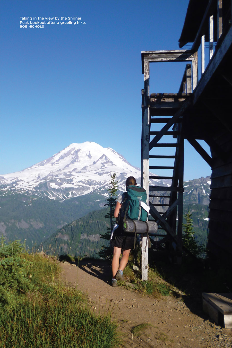
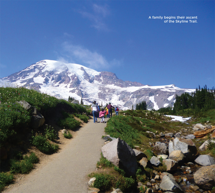
All photos by Laurence Parent unless otherwise noted
All rights reserved. No part of this book may be reproduced in any form or by any electronic or mechanical means, including information storage and retrieval systems, without written permission from the publisher, except by a reviewer who may quote passages in a review.
British Library Cataloguing in Publication Information available
Library of Congress Cataloging-in-Publication Data available
ISBN 978-1-4930-3202-0 (paperback)
ISBN 978-1-4930-3203-7 (e-book)
 The paper used in this publication meets the minimum requirements of American National Standard for Information SciencesPermanence of Paper for Printed Library Materials, ANSI/NISO Z39.48-1992.
Printed in the United States of America
The authors and Globe Pequot Press assume no liability for accidents happening to, or injuries sustained by, readers who engage in the activities described in this book.
MEET YOUR GUIDES
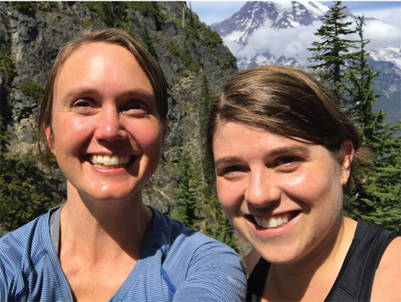
We are somewhat unorthodox guidebook writers. Heidi (Radlinski) is a family medicine physician who delivers babies, serves families, and instructs residents in southwest Washington. Mary (Skjelset) is a civil rights lawyer in Portland, Oregon; she delivers only subpoenas and headaches. We have been friends since childhood, when Heidis family would let me (Mary) tag along on some of their many outdoor escapades in our home state of Montana.
Well, eons ago, at the tender age of 19, we were approached by Falcon Press to write a guidebook to Mount Rainier National Park. Heidi was a college student at Lewis and Clark in Portland, Oregon; I attended Reed College across town. In the summer of 1998, we traversed every foot of trail in Mount Rainier National Park and wrote two guides based on the knowledge and information we gathered during our backbreaking adventures. At that time we were the youngest author team to complete a FalconGuide. Needless to say, we are no longer the youngest authors.
Now we take our creaky knees and our sprouting children into the park to revise the guides, and enjoy every second of the arduous work. The guidebooks have evolved as we have. For instance, we estimate more hours to complete hikes than we did as teenagers. The revisions also capture trail changes, road closures, updated services and new structures in the park. With this guide, may you find yourself a bit more prepared for your adventure on the mountain, and may you fall in love with this place, like we have.
FIVE HIKING TIPS
1. Think about using poles to take the load off your knees or, in a pinch, creating a makeshift walking stick out of a downed branch. Elevation changes on Mount Rainier are dramatic. You will often descend 3,000 feet in 3 miles, merely to cross a river and then ascend an equally steep slope.
2. Always bring iodine tablets, if only a few, on longer hikes. In some years, clear streams dry up early, and your only water source may be the bigger rivers loaded with filter-clogging glacial silt. Water is life, and giardiasis is no fun.
3. When the National Park Service posts a sign that says Cramp-ons and ice axes recommended beyond this point, they mean it! Weve almost slipped a thousand feet to our death by failing to heed one of these signs. Mary still has flashbacks.
4. Visit Mount Rainier midweek to avoid crowds and traffic.
5. Dont feed the critters. Their survival depends on their ability to fend for themselves, and their digestive tracks are not suited for Cheetos. (We have actually witnessed visitors feeding marmots Cheetos. Not OK.)
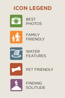
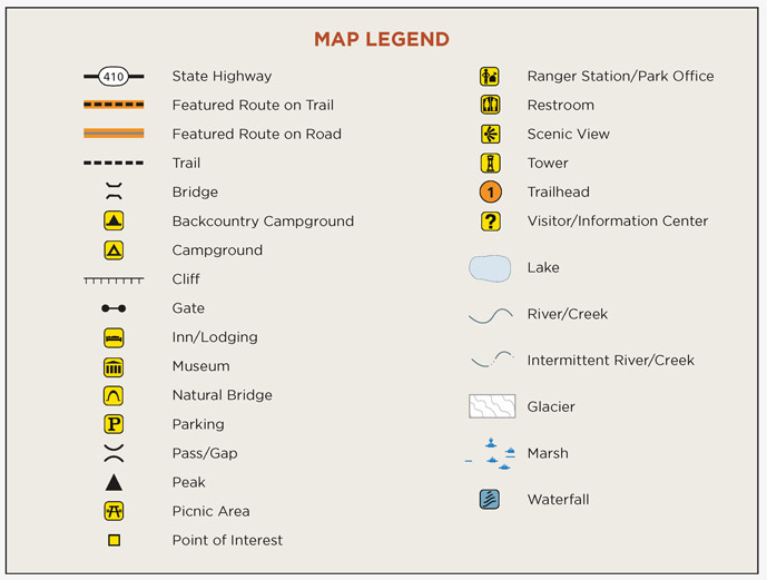
Map and Icon Legends
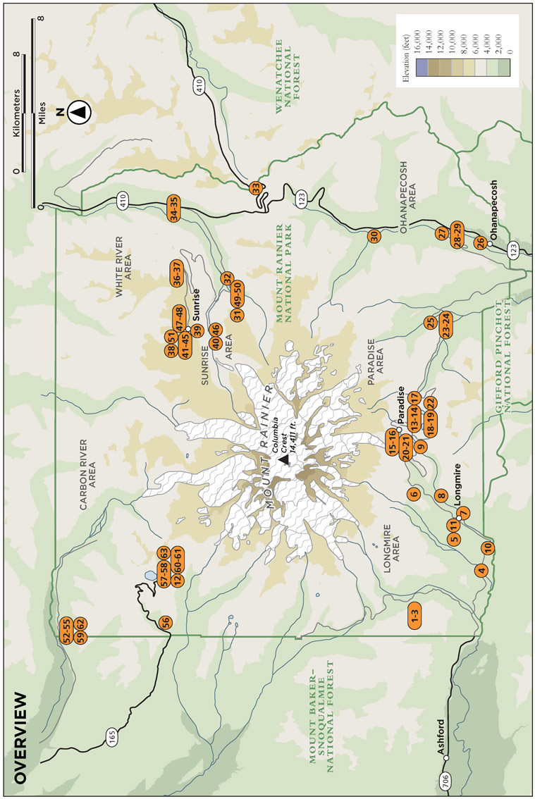
NOTES ON MAPS
Topographic maps are essential companions to the activities in this guide. Falcon has partnered with National Geographic to provide the best mapping resources. Each activity is accompanied by a detailed map and the name of the National Geographic TOPO! map (USGS), which can be downloaded for free from natgeomaps.com.
If the activity takes place on a National Geographic Trails Illustrated map, it will be noted. Continually setting the standard for accuracy, each Trails Illustrated topographic map is crafted in conjunction with local land managers and undergoes rigorous review and enhancement before being printed on waterproof, tearresistant material. Trails Illustrated maps and information about their digital versions, which can be used on mobile GPS applications, can be found at natgeomaps.com.
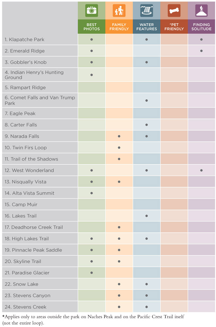
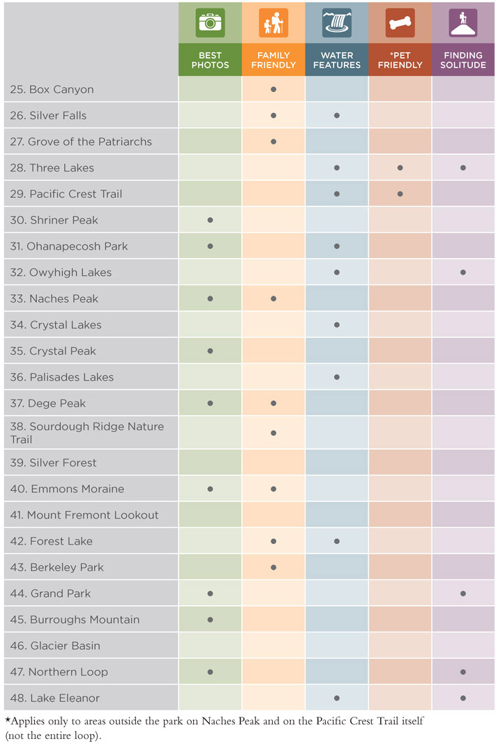
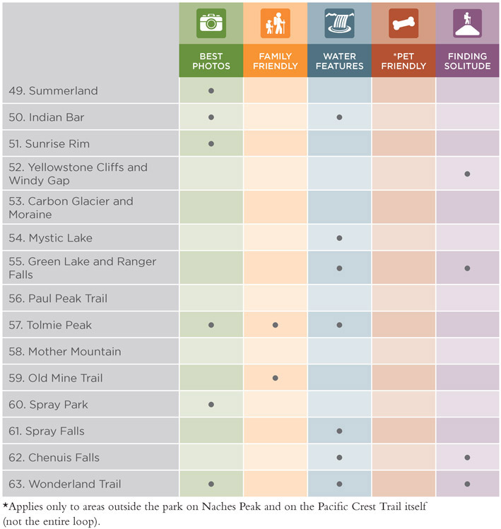
TRAIL FINDER
HOW TO USE THIS GUIDE
To use this book effectively, please note the following categorical descriptions.
TYPES OF HIKES
Suggested hikes have been split into the following categories:
LoopStarts and finishes at the same trailhead, with no (or very little) retracing of your steps. Sometimes the definition of loop is stretched to include lollipops and trips that involve a short walk on a road at the end of the hike to get back to your vehicle.
ShuttleA point-to-point trip that requires two vehicles (one left at the other end of the trail) or a prearranged pickup at a designated time and place. One good way to manage the logistical problems of shuttles is to arrange for another party to start at the other end of the trail. The two parties meet at a predetermined point and then trade keys. When finished, they drive each others vehicles home.



 The paper used in this publication meets the minimum requirements of American National Standard for Information SciencesPermanence of Paper for Printed Library Materials, ANSI/NISO Z39.48-1992.