Best Easy Day Hikes Series
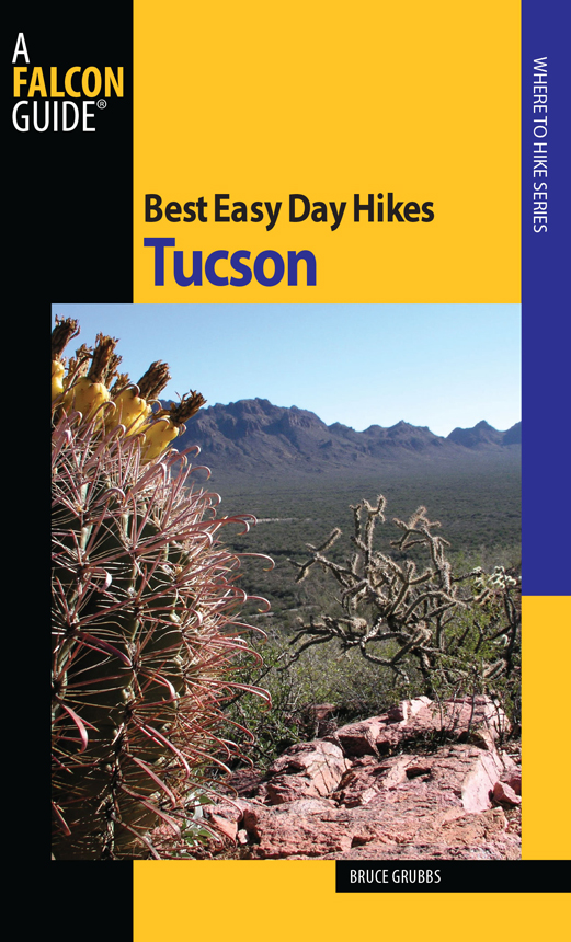
Best Easy Day Hikes Tucson
Bruce Grubbs
Help Us Keep This Guide Up to Date
Every effort has been made by the author and editors to make this guide as accurate and useful as possible. However, many things can change after a guide is publishedtrails are rerouted, regulations change, facilities come under new management, etc.
We would love to hear from you concerning your experiences with this guide and how you feel it could be improved and kept up to date. While we may not be able to respond to all comments and suggestions, well take them to heart and well also make certain to share them with the author. Please send your comments and suggestions to the following address:
Globe Pequot Press
Reader Response/Editorial Department
P.O. Box 480
Guilford, CT 06437
Or you may e-mail us at:
editorial@GlobePequot.com
Thanks for your input, and happy trails!
Copyright 2010 by Morris Book Publishing, LLC
ALL RIGHTS RESERVED. No part of this book may be reproduced or transmitted in any form by any means, electronic or mechanical, including photocopying and recording, or by any information storage and retrieval system, except as may be expressly permitted in writing from the publisher. Requests for permission should be addressed to Globe Pequot Press, Attn: Rights and Permissions Department, P.O. Box 480, Guilford, CT 06437.
Falcon, FalconGuides, and Outfit Your Mind are registered trademarks of Morris Book Publishing, LLC.
Layout: Kevin Mak
Project editor: John Burbidge
Maps by Bruce Grubbs Morris Book Publishing, LLC
Library of Congress Cataloging-in-Publication Data
Grubbs, Bruce (Bruce O.)
Best easy day hikes, Tucson / Bruce Grubbs.
p. cm. (Falconguides)
ISBN 978-1-4930-0572-7
1. HikingArizonaTucson RegionGuidebooks. 2. Tucson Region (Ariz.)Guidebooks. I. Title.
GV199.42.A72T835 2009
917.91'776--dc22
2009029486
The author and Globe Pequot Press assume no liability for accidents happening to, or injuries sustained by, readers who engage in the activities described in this book.
Contents
The Hikes
Acknowledgments
I would like to thank my many hiking companions down the years, whove put up with my incessant trail mapping and photography. Thanks to Duart Martin, for her support and encouragement. And finally, thanks to my editors at Globe Pequot Press, Scott Adams and John Burbidge, for making a book out of my rough manuscript.
Introduction
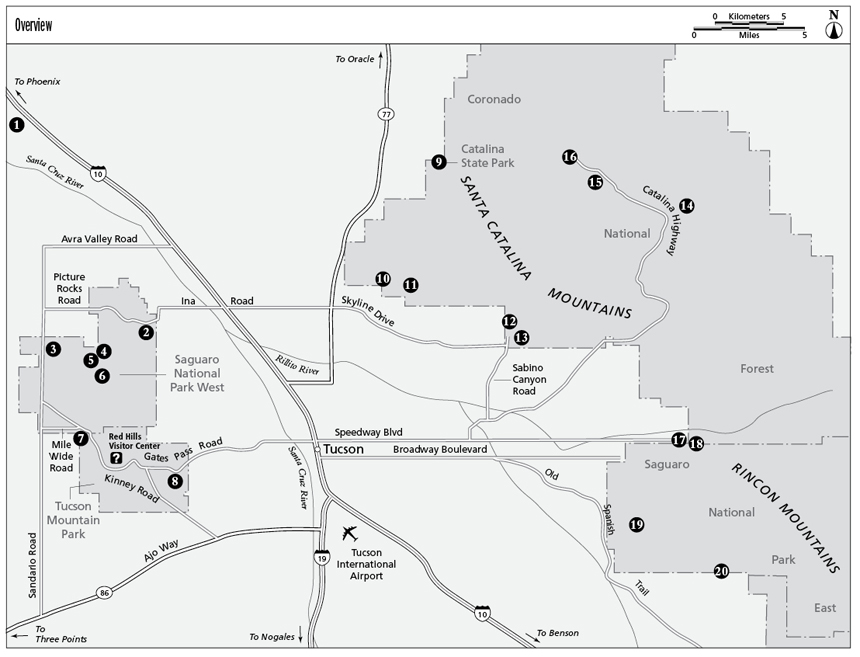
Tucson residents and visitors are very lucky. Within a few miles of the city, there are several great hiking areasthe Tucson Mountains, the Santa Catalina Mountains, and the Rincon Mountains. Each of these three ranges has its own unique characteristics.
The Tucson Mountains are west of the city. This low desert mountain range, which reaches 4,687 feet at Wasson Peak, is largely protected within Saguaro National Park West and Tucson Mountain Park. Within the two parks are some of the finest examples of Sonoran Desert landscape in the Southwest, as well as large stands of giant saguaro cactus, the symbol of the Sonoran Desert.
At the north side of Tucson, the Santa Catalina Mountains are the highest of the three areas covered by this book, reaching 9,157 feet at Mount Lemmon. The Catalinas have a paved highway to the top of the mountain, giving easy access to campgrounds, trails, summer homes, rock climbing crags, and even a ski area (the southernmost in the country). Luckily for the hiker, much of this complex range south and west of the Catalina Highway is included in the Pusch Ridge Wilderness, which is traversed by an extensive trail system.
The Rincon Mountains, which lie at the east edge of the city, rise more than 5,600 feet from their base to the 8,619-foot summit at Mica Mountain. Because of this great elevation range, the Rincon Mountains feature four distinct life zones, ranging from desert scrub to fir-aspen forest. There are numerous isolated mountain ranges that reach similar elevations in southeastern Arizona, but the Rincon high country is one of the few that has no road access to the high country. The Rincons are the domain of the hiker, backpacker, and horseback rider. Saguaro National Park East includes most of the Rincon Mountains, and the rest lies in the Coronado National Forest.
Millions of years ago, during the formation of the North American continent, the area that is now southern Arizona was stretched from east to west by crustal forces. Numerous north-tending fractures, or faults, formed as the rocks broke under the strain. Some of the resulting blocks sank to form the valleys, while others rose to form the mountains. As the faulting continues to lower the basins and raise the mountains, erosion from water flowing downhill tends to wear down the mountains and fill the valleys. The topography we see today reflects the fact that the faulting is still active enough to keep the mountains from being worn down to a flat plain.
Hazards
Dehydration
Even in the mountains where the summer air is cool, dehydration is a serious concern. Because the humidity is usually very low, your body loses moisture insensibly. Carry and drink plenty of water, and eat high-energy snacks for fuel and to help keep your electrolytes in balance. Both these measures are necessary to prevent heat exhaustion, which can develop into life-threatening sunstroke.
Plants and Animals
Various plants and animals can pose hazards to hikers in the Arizona desert and mountains. Plants that are hazardous to the touch include poison ivy and stinging nettle. Spiny plants like cactus are easy to avoid. Never eat any plant unless you know what you are doing. Many common plants, especially mushrooms, are deadly.
Animals will normally leave you alone unless molested or provoked. Never feed wild animals, as they rapidly get used to the handouts and then will vigorously defend their new food source.
Rattlesnakes cause concern but can easily be avoided. They usually warn off intruders by rattling well before you reach striking range. Since rattlesnakes can strike no farther than half their body length, avoid placing your hands and feet in areas you cannot see, and walk several feet away from rock overhangs and shady ledges. Snakes prefer surfaces at about 80F, so during hot weather they prefer the shade of bushes or rock overhangs, and in cool weather will be found sunning themselves on open ground.
Arizonas Sonoran Desert is home to a poisonous lizard, the Gila monster. This yellow, orange, red, and black lizard is about a foot and a half long and is unmistakable. Although they are rare and protected by state law, if you do see one dont be fooled by its torpid appearance. If molested, Gila monsters can bite very suddenly.
Mosquitoes are occasionally around in small numbers after snowmelt at the higher elevations. Spring rains can sometimes bring out a few mosquitoes in the desert. Because mosquitoes can transmit West Nile virus, use repellent and sleep in a tent when they are present. DEET in various concentrations seems to be the most effective repellent.
Africanized bees, originally released in South America, have spread north and are now well established in the Arizona deserts. Avoid all concentrations of bees, especially hives and swarms. If attacked, drop your pack and run. Protect your eyes and dont swat at the bees. Try to get into brush or dense foliage, which confuses the bees.


