Published in 2020 by The Rosen Publishing Group, Inc. 29 East 21st Street, New York, NY 10010
Copyright 2020 by The Rosen Publishing Group, Inc.
All rights reserved. No part of this book may be reproduced in any form without permission in writing from the publisher, except by a reviewer.
First Edition
Editor: Sarah Machajewski
Book Design: Tanya Dellaccio
Photo Credits: Cover Posnov/Moment Open/Getty Images; p. 5 Weredragon/Shutterstock.com; p. 7 (top) John Sidorowicz/Shutterstock.com; p. 7 (bottom) LesPalenik/Shutterstock.com; p. 9 https://upload.wikimedia.org/wikipedia/commons/e/ef/Sea_Ice_off_Baffin_Island.jpg; p. 11 (top) SF photo/ Shutterstock.com; p. 11 (bottom) Alex Dumitrescu/Shutterstock.com; p. 13 John McCormick/Shutterstock. com; p. 14 Elena Elisseeva/Shutterstock.com; p. 15 UniversalImagesGroup/Universal Images Group/Getty Images; p. 17 (top left) DeymosHR/Shutterstock.com; p. 17 (top right) Gilberto Mesquita/Shutterstock.com; p. 17 (bottom) Wally Stemberger/Shutterstock.com; p. 19 Print Collector/Hulton Archive/Getty Images; p. 21 (top) https://commons.wikimedia.org/wiki/Category:Le_Griffon_(ship,_1679)#/media/File:Image_ taken_from_page_44_of_%27Annals_of_Fort_Mackinac%27_(11279194954).jpg; p. 21 (bottom) https://upload.wikimedia.org/wikipedia/commons/c/c5/Cavelier_de_la_salle.jpg; p. 23 (top) Graham Taylor Photography/Shutterstock.com; p. 23 (bottom) StonePhotos/Shutterstock.com; p. 25 (top) Karen Bell/ Shutterstock.com; p. 25 (bottom) Erni/Shutterstock.com; p. 27 (top) Basotxerri/Shutterstock.com; p. 27 (bottom) Scott Olsen/Getty Images News/Getty Images; p. 29 Chicago Tribune/Tribune News Service/ Getty Images; p. 30 Helen Filatova/Shutterstock.com.
Cataloging-in-Publication Data
Names: Emminizer, Theresa.
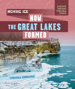
Title: Moving ice: how the Great Lakes formed / Theresa Emminizer.
Description: New York : PowerKids Press, 2020. | Series: Earths history through rocks | Includes glossary and index.
Identifiers: ISBN 9781725301566 (pbk.) | ISBN 9781725301580 (library bound) | ISBN 9781725301573 (6pack)
Subjects: LCSH: Glacial lakes--Great Lakes (North America) | Glacial epoch--Great Lakes (North America) | Geology--Great Lakes (North America)--Juvenile literature. | Great Lakes (North America)--Juvenile literature.
Classification: LCC F551.E46 2020 | DDC 551.3150977--dc23
Manufactured in the United States of America
CPSIA Compliance Information: Batch #CSPK19. For Further Information contact Rosen Publishing, New York, New York at 1-800-237-9932.
WHAT ARE THE GREAT LAKES?
The Great Lakes and their connecting waterways make up the largest surface freshwater system on Earth. Theyre sometimes called the Laurentian Great Lakes. The five lakes in this system are Lake Superior, Lake Michigan, Lake Huron, Lake Erie, and Lake Ontario. The Saint Marys, Saint Clair, Detroit, and Niagara rivers, with other smaller waterways, connect them.
The Great Lakes are mighty both in size and importance. They hold about 6 quadrillion gallons (22.7 quadrillion L) of water. Their combined surface spans over 94,000 square miles (244,000 sq. km). The lakes support thousands of plant and animal species, as well as the economy of the surrounding states and regions.
The Great Lakes are some of North Americas most treasured geological features. How exactly did these amazing lakes form? The story begins hundreds of millions of years ago.
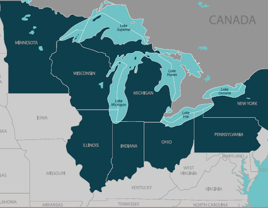
Theres enough water in the Great Lakes to cover the continental United States in nearly 10 feet (3 m)of water!
READING THE ROCKS
THE GREAT LAKES ARE HOME TO THE BIGGEST SUPPLY OF FRES HWATE RIN THE WORLD. THEY HOLD ABOUT 90 PERCENT OF THE SURFACE FRESHWATER IN THE UNITED STATES AND ABOUT ONE-FIFTH OF THE TOTAL SURFACE FRESHWATER IN THE WORLD!
BEGINNING WITH BEDROCK
The rocks of the Great Lakes formed much earlier than the lakes themselves. These rocks are made of many layers. The bottom layer is bedrockthe hard, solid rock that lies underneath loose deposits of soil. The bedrock in the Great Lakes basin formed over two time periods. The deepest layer is made of metamorphosed igneous and sedimentary rocks from the Precambrian period. These rocks formed between 36 billion and 1 billion years ago.
The Precambrian bedrock gradually wore away due to erosion. Later, seas covered the Great Lakes basin, depositing sediments on top of the eroded Precambrian bedrock. The second layer of bedrock, called the Phanerozoic bedrock, includes sedimentary rocks such as shale and limestone.
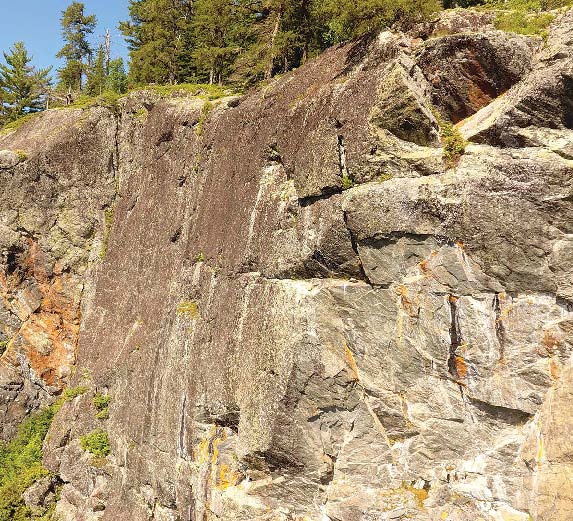
The Precambrian period is the earliest geologic age. It occurred 4.5 billion to 542 million years ago. The Precambrian rocks pictured here make up the Canadian Shield, a mass of rock in eastern Canada and the northeastern United States.
GLACIERS ON THE MOVE
About 500,000 years ago, during a period called the Pleistocene Epoch, temperatures in North America dropped. The cold temperatures and increased precipitation caused glaciation. Glacial snow and ice built up on the land over thousands of years. The heavy glacial ice pressed the earth down, causing it to sink in certain places. Deep, wide depressions formed.
Later, as temperatures began to warm, the ice retreated. The glacier carved out new landforms as it slid slowly across the land. This glacial movement is what created the Great Lakes about 14,000 years ago.
As the glacier slid, it picked up rocks and chunks of earth, carried them away, and deposited them elsewhere. This created a layer of loose sediment.
THE LAURENTIDE ICE SHEET
The Great Lakes are in a part of North America that was once entirely covered with ice. The Laurentide Ice Sheet covered more than 5 million square miles (13 million sq. km) and was more than 8,000 feet (2,438 m) thick. The last piece of the Laurentide Ice Sheet is now in the Canadian Arctic. Scientists study the rocks around what remains of the ice sheet to see how it has grown and shrunk over millions of years.
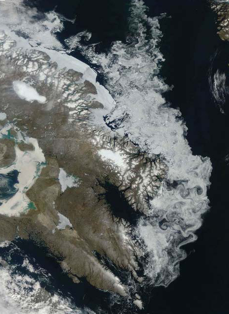
Today, glaciers cover 10 percent of the total land area in the world. During the last ice age, ice covered almost 32 percent of Earths land.
READING THE ROCKS
THE LAST GLACIATION TO TAKE PLACE IN NORTH AMERICA IS CALLED THE WISCONSIN GLACIAL STAGE. DURING THIS TIME, MANY NEW LANDFORMS WERE CREATED IN THE REGION THAT IS NOW WISCONSIN.
THE EARLY LAKES
As the glacier retreated, it melted, filling in the deep depressions it left behind. These depressions became the early forms of what would become the Great Lakes.
The Great Lakes didnt always look like they do today. During their early days, the lakes and rivers changed in size and shape as new drainage systems were carved out by the moving glacier. For example, Lake Chicago and Lake Maumee, the

