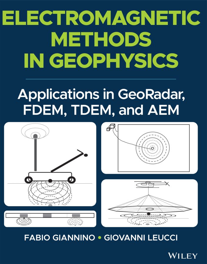
Fabio Giannino - Electromagnetic Methods in Geophysics: Applications in GeoRadar, FDEM, TDEM, and AEM
Here you can read online Fabio Giannino - Electromagnetic Methods in Geophysics: Applications in GeoRadar, FDEM, TDEM, and AEM full text of the book (entire story) in english for free. Download pdf and epub, get meaning, cover and reviews about this ebook. year: 2021, publisher: Wiley, genre: Computer. Description of the work, (preface) as well as reviews are available. Best literature library LitArk.com created for fans of good reading and offers a wide selection of genres:
Romance novel
Science fiction
Adventure
Detective
Science
History
Home and family
Prose
Art
Politics
Computer
Non-fiction
Religion
Business
Children
Humor
Choose a favorite category and find really read worthwhile books. Enjoy immersion in the world of imagination, feel the emotions of the characters or learn something new for yourself, make an fascinating discovery.

- Book:Electromagnetic Methods in Geophysics: Applications in GeoRadar, FDEM, TDEM, and AEM
- Author:
- Publisher:Wiley
- Genre:
- Year:2021
- Rating:3 / 5
- Favourites:Add to favourites
- Your mark:
Electromagnetic Methods in Geophysics: Applications in GeoRadar, FDEM, TDEM, and AEM: summary, description and annotation
We offer to read an annotation, description, summary or preface (depends on what the author of the book "Electromagnetic Methods in Geophysics: Applications in GeoRadar, FDEM, TDEM, and AEM" wrote himself). If you haven't found the necessary information about the book — write in the comments, we will try to find it.
Discover the utility of four popular electromagnetic geophysical techniques
In GeoRadar, FDEM, TDEM, and AEM Methods, accomplished researchers Fabio Giannino and Giovanni Leucci deliver an in-depth exploration of the theory and application of four different electromagnetic geophysical techniques: ground penetrating radar, the frequency domain electromagnetic method, the time domain electromagnetic method, and the airborne electromagnetic method. The authors offer a full description of each technique as they relate to the economics, planning, and logistics of deploying each of them on-site.
The book also discusses the potential output of each method and how it can be combined with other sources of below- and above-ground information to create a digitized common point cloud containing a wide variety of data.
Giannino and Leucci rely on 25 years of professional experience in over 40 countries around the world to provide readers with a fulsome description of the optimal use of GPR, FDEM, TDEM, and AEM, demonstrating their flexibility and applicability to a wide variety of use cases.
Readers will also benefit from the inclusion of:
- A thorough introduction to electromagnetic theory, including the operative principles and theory of ground penetrating radar (GPR) and the frequency domain electromagnetic method (FDEM)
- An exploration of hardware architecture and surveying, including GPR, FDEM, time domain electromagnetic method (TDEM), and airborne electromagnetic (AEM) surveying
- A collection of case studies, including a multiple-geophysical archaeological GPR survey in Turkey and a UXO search in a building area in Italy using FDEM /li>
- Discussions of planning and mobilizing a campaign, the shipment and clearance of survey equipment, and managing the operative aspects of field activity
Perfect for forensic and archaeological geophysicists, GeoRadar, FDEM, TDEM, and AEM Methods will also earn a place in the libraries of anyone seeking a one-stop reference for the planning and deployment of GDR, FDEM, TDEM, and AEM surveying techniques.
Fabio Giannino: author's other books
Who wrote Electromagnetic Methods in Geophysics: Applications in GeoRadar, FDEM, TDEM, and AEM? Find out the surname, the name of the author of the book and a list of all author's works by series.

Electromagnetic Methods in Geophysics: Applications in GeoRadar, FDEM, TDEM, and AEM — read online for free the complete book (whole text) full work
Below is the text of the book, divided by pages. System saving the place of the last page read, allows you to conveniently read the book "Electromagnetic Methods in Geophysics: Applications in GeoRadar, FDEM, TDEM, and AEM" online for free, without having to search again every time where you left off. Put a bookmark, and you can go to the page where you finished reading at any time.
Font size:
Interval:
Bookmark:
- Chapter 2
- Chapter 3
- Chapter 7
- Chapter 2
- Chapter 3
- Chapter 4
- Chapter 5
- Chapter 6
- Chapter 7
Fabio Giannino
IDS GeoRadar s.r.l.Pisa, Italy
and
Giovanni Leucci
Institute of Heritage Sciences (ISPC)
National Research Council of Italy (CNR)
Lecce, Italy
This edition first published 2022
2022 John Wiley & Sons, Inc.
All rights reserved. No part of this publication may be reproduced, stored in a retrieval system, or transmitted, in any form or by any means, electronic, mechanical, photocopying, recording or otherwise, except as permitted by law. Advice on how to obtain permission to reuse material from this title is available at http://www.wiley.com/go/permissions.
The right of Fabio Giannino and Giovanni Leucci to be identified as the authors of this work has been asserted in accordance with law.
Registered Office
John Wiley & Sons, Inc., 111 River Street, Hoboken, NJ 07030, USA
Editorial Office
111 River Street, Hoboken, NJ 07030, USA
For details of our global editorial offices, customer services, and more information about Wiley products visit us at www.wiley.com.
Wiley also publishes its books in a variety of electronic formats and by printondemand. Some content that appears in standard print versions of this book may not be available in other formats.
Limit of Liability/Disclaimer of Warranty
While the publisher and authors have used their best efforts in preparing this work, they make no representations or warranties with respect to the accuracy or completeness of the contents of this work and specifically disclaim all warranties, including without limitation any implied warranties of merchantability or fitness for a particular purpose. No warranty may be created or extended by sales representatives, written sales materials or promotional statements for this work. The fact that an organization, website, or product is referred to in this work as a citation and/or potential source of further information does not mean that the publisher and authors endorse the information or services the organization, website, or product may provide or recommendations it may make. This work is sold with the understanding that the publisher is not engaged in rendering professional services. The advice and strategies contained herein may not be suitable for your situation. You should consult with a specialist where appropriate. Further, readers should be aware that websites listed in this work may have changed or disappeared between when this work was written and when it is read. Neither the publisher nor authors shall be liable for any loss of profit or any other commercial damages, including but not limited to special, incidental, consequential, or other damages.
Library of Congress CataloginginPublication Data
Names: Giannino, Fabio, author. | Leucci, Giovanni, author.
Title: Electromagnetic methods in geophysics : applications in GeoRadar, FDEM, TDEM, and AEM / Fabio Giannino and Giovanni Leucci.
Description: Hoboken, NJ : Wiley, 2022. | Includes bibliographical references and index.
Identifiers: LCCN 2021027149 (print) | LCCN 2021027150 (ebook) | ISBN 9781119770985 (hardback) | ISBN 9781119770992 (adobe pdf) | ISBN 9781119771005 (epub)
Subjects: LCSH: Magnetic prospecting. | Ground penetrating radar.
Classification: LCC TN269 .G433 2022 (print) | LCC TN269 (ebook) | DDC 622/.153dc23
LC record available at https://lccn.loc.gov/2021027149
LC ebook record available at https://lccn.loc.gov/2021027150
Cover Design: Wiley
Cover Image: Fabio Giannino
Geophysical techniques have many environmental, archaeological, forensic, geological, geotechnical, or engineering applications, as well as in the oil and gas, the mining industry, or for general academic research. Because of this, all the aspects connected with the logistics, designing, data collection, analysis, interpretation, and visualization, must be evaluated on a casebycase basis.
Regardless of the geophysical technique deployed for a specific subsoil exploration campaign, the final objective is always to search for the variations of a specific physical property of the system to be investigated, and to infer the possible anthropogenic or natural factor(s), which caused the variation itself.
The properties which, more often, are the main subject of an applied geophysics measurements campaign are the electrical conductivity (electrical resistivity), the seismic waves velocity propagation (either in their vertical and/or horizontal component), the EM waves velocity propagation, the dielectric constant, the magnetic field, the gravity acceleration, and so on. Measuring of the abovementioned properties, in boreholes, on surface, in the sea, or airborne, is carried out with instrumentation specifically designed and manufactured, and the data gathered through these tools, are analyzed by means of specific software, whose proper use allows even very small variations of a given quantity to be highlighted. The survey and laboratory/office operations addressed to the acquisition and analysis of such specific data, result in those geophysical methodologies known as Geoelectrical techniques, EM induction methods, seismic methods (seismic refraction, seismic reflection, seismic tomography, MASW, Re.Mi.), ultrasound, Ground Penetrating Radar (GPR), Magnetic method, Microgravimetry, and so on.
The list outlined is obviously partial, but on the other hand may be useful to give an idea of the macroareas within which the most commonly used geophysical techniques can be allocated, with respect to the industry, the academic research, or in the professional services activities.
Tools deployed for the data acquisition, as well as the software to be used for the purposes of data processing and visualization, improved very much in the last three decades, and became rather complex and of a specific use. Moreover, the possibility to apply a specific technique for the purposes of a given project, cannot disregard the knowledge of the theoretical basis on which every geophysical technique is founded on. As a direct consequence of this, a poor awareness on the hardware, the software, and the theoretical aspects, will most likely lead to a geophysical approach, whose possibility of technical success is low.
Another very important factor in planning and performing a geophysical survey, is the collection of the greater possible amount of information relating to the nature, dimension, geometry, and burial depth of the target of the measurements campaign, and the (geological) background where the object is imbedded. In this case, the word target means every buried feature determining a contrast in physical properties detectable by the technique. The knowledge of this, can also positively contribute to selecting the geophysical technique, which increases the probability to maximize the differences of a given physical property between the background and the target. Hence, the possibility to locate the latter with a higher degree of confidence and increasing the resolution of the final result.
Many geophysical techniques are based on the propagation in the space of electromagnetic (EM) waves (wave field methods), and a unique classification of them can be difficult and, to a certain extent, of no use. However, in order to optimize the results deriving from their application to projectrelated issues, it is of a paramount importance to have a clear idea about the existing EM techniques and what are the characteristics differentiating one from another. To do this, it may be used as a classification factor, at a first instance, the fact that a known amplitude and frequency transmitter may be used as a source of EM energy, as it happens for the
Next pageFont size:
Interval:
Bookmark:
Similar books «Electromagnetic Methods in Geophysics: Applications in GeoRadar, FDEM, TDEM, and AEM»
Look at similar books to Electromagnetic Methods in Geophysics: Applications in GeoRadar, FDEM, TDEM, and AEM. We have selected literature similar in name and meaning in the hope of providing readers with more options to find new, interesting, not yet read works.
Discussion, reviews of the book Electromagnetic Methods in Geophysics: Applications in GeoRadar, FDEM, TDEM, and AEM and just readers' own opinions. Leave your comments, write what you think about the work, its meaning or the main characters. Specify what exactly you liked and what you didn't like, and why you think so.