A Forest of History
T HE M AYA AFTER THE E MERGENCE OF D IVINE K INGSHIP
EDITED BY
T RAVIS W . S TANTON AND M . K ATHRYN B ROWN
U NIVERSITY P RESS OF C OLORADO
Louisville
2020 by University Press of Colorado
Published by University Press of Colorado
245 Century Circle, Suite 202
Louisville, Colorado 80027
All rights reserved
 The University Press of Colorado is a proud member of the Association of University Presses.
The University Press of Colorado is a cooperative publishing enterprise supported, in part, by Adams State University, Colorado State University, Fort Lewis College, Metropolitan State University of Denver, Regis University, University of Colorado, University of Northern Colorado, University of Wyoming, Utah State University, and Western Colorado University.
ISBN: 978-1-64642-045-2 (hardcover)
ISBN: 978-1-64642-046-9 (ebook)
https://doi.org/10.5876/9781646420469
Library of Congress Cataloging-in-Publication Data
Names: Stanton, Travis W., 1971 editor. | Brown, M. Kathryn, 1965 editor.
Title: A forest of history : the Maya after the emergence of divine kingship / Travis W. Stanton, M. Kathryn Brown.
Description: Louisville, Colorado : University Press of Colorado, [2020] | Includes bibliographical references and index.
Identifiers: LCCN 2020001812 (print) | LCCN 2020001813 (ebook) | ISBN 9781646420452 (cloth) | ISBN 9781646420469 (ebook)
Subjects: LCSH: Schele, Linda. Forest of kings. | MayasKings and rulers. | MayasHistory. | MayasAntiquities. | Indians of Central AmericaAntiquities. | Tikal Site (Guatemala)Antiquities. | Caracol Site (Belize)Antiquities. | Calakmul Site (Mexico)
Classification: LCC F1435.3.K55 F67 2020 (print) | LCC F1435.3.K55 (ebook) | DDC 972.81dc23
LC record available at https://lccn.loc.gov/2020001812
LC ebook record available at https://lccn.loc.gov/2020001813
The University Press of Colorado gratefully acknowledges the generous support of the University of Texas at San Antonio toward the publication of this book.
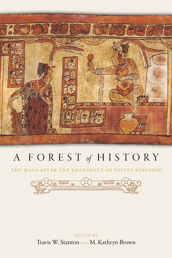
Cover photograph, A Lady from Tikal bows to a Ruler from the Ik site, Justin Kerr. K2573
Contents
Jeremy A. Sabloff
Travis W. Stanton and M. Kathryn Brown
Arthur A. Demarest
Arlen F. Chase and Diane Z. Chase
Joyce Marcus
Olivia C. Navarro-Farr, Griselda Prez Robles, Damaris Menndez, and Juan Carlos Prez Caldern
Michelle Rich and Keith Eppich
Charles W. Golden and Andrew K. Scherer
Wendy Ashmore
Travis W. Stanton, Aline Magnoni, Stanley P. Guenter, Jos Osorio Len, Francisco Prez Ruz, and Mara Rocio Gonzlez de la Mata
Karl A. Taube
Annabeth Headrick
Marilyn A. Masson, Wilberth Cruz Alvarado, Carlos Peraza Lope, and Susan Milbrath
Stanley P. Guenter
David A. Freidel
Distribution of Caracol residential groups with excavated eastern interments at the beginning of the Late Classic Period.
Tikal Burial 195, the interment of Caracol Yajaw Te Kinich II.
Tikal Burial 23, the interment of Caracol Kan II.
Tikal Burial 24, the interment of a probable dwarf from Caracol.
Caracol emblem on stuccoed wooden bowl in Tikal Burial 195.
Photograph of the Naranjo hieroglyphic stairway.
Weapons of war: (a) goggle-eyed warrior holding darts and a knife that pierces a bleeding heart (Atetelco mural, Teotihuacan); (b) goggled-eye warrior wearing mosaic helmet (Burial 10 vessel, Tikal); (c) warrior wearing mosaic helmet and holding darts (Stela 1, Tres Islas); (d) helmet (kohaw) (Temple of the Inscriptions, Palenque); (e) warrior holding atlatl and darts (Problematical Deposit 50, Tikal).
Green mask from Burial 85, Tikal.
Tikals early texts reveal (a) the name of the fifteenth ruler, Yax Nuun Ayiin I; (b) the name Sihyaj Kahk; (c) that Chak Tok Ichaak died.
Two examples of Spearthrower Owl compound.
Yax Nuun Ayiin I with mosaic helmet, atlatl, and Tlaloc shield (from Tikals Stela 31).
Portrait of Yax Kuk Mo from Temple 16, Copn.
Altar Q at Copn shows the founder (Yax Kuk Mo) handing the scepter of office to the sixteenth ruler (Yax Pasaj) on the latters inauguration in AD 763.
Waka 2016 site map with plan of Structure M13-1 including excavation units, some exposed architecture, and select excavated features. All images and photographs pertain to the Proyecto Arqueolgico Waka.
East-facing profile of Structure M13-1s terminal adosada wall: (a) upper section of Stela 9 seen reset into upright position; (b) circular altar including a view of in situ terminal phase stair risers overlying the monument; (c) fragments of Stela 43 seen adorning the south and southwest basal faces of the terminal adosada walls.
Fire Shrinethree views: (a) illustration of north wall of fire shrine interior; (b) illustration of south wall of fire shrine interior; (c) excavated fire shrine looking west; (d) illustration of east wall of fire shrine interior including location of burial 60.
Photogrammetric composite image of Burial 61.
Stela 44-2 views: (a) complete view of Stela 44 in situ; (b) close-up view of standing ruler with hands in crab claw position carrying a bundle.
Urban core of El PerWaka.
Plan drawing of El PerWaka Burial 38.
Preliminary plan drawing of El PerWaka Burial 39. Shaded image denotes general location of human skeleton remains. Objects in the mortuary assemblage obscured by other objects or skeletal material are not included. Ceramics are depicted whole, but were broken in situ when the tomb was infilled after ancient reentry.
Three Vessels from Burial 39: (a) deep-bottomed bowl/dish with polychrome designs in red and black on orange; (b) vertical-walled small cylinder vase with red, orange, and black polychrome designs executed in reserve; (c) highly glossy bowl with designs in black and red on a bright honey-yellow base slip.
Three Vessels from Burial 38: (a) deep-bottomed bowl/dish with polychrome designs in red and black on orange; (b) vertical-walled small cylinder vase with red, orange, and black polychrome designs executed in reserve; (c) highly glossy bowl with designs in black and red on a bright honey-yellow base slip.
Location of the Usumacinta River region including Yaxchiln and its neighbors inset in a modern political map.
Regional map of the region encompassing Yaxchiln and its neighbors.
Panel 3 from Piedras Negras showing (a) Kan Mo Te baah sajal; and (c) an unknown lord making first-person statement, awinaken yokibI am your person, Yokib..
Four-looted lintels from an as-yet-unidentified hinterland site in the Yaxchiln kingdom.
Copn Altar Q, west side looking northeast, showing founder Kinich Yax Kuk Mo (left of center) transferring authority to the sixteenth ruler, Yax Pasaj Chan Yopaat, the two facing each other across a pair of glyphs for the date of the latters accession.
Cutaway view of sequential construction overlying the Copn axis mundi, culminating in Structure 10L-16, whose frontal, western stair is visible at right. Note earliest fifth-century construction with founders tomb, and anciently preserved sixth-century Rosalila.
Copn principal Group (plan with structure labels: Acropolis, 26, 16, Group 10L-2).
Vessel 13N/48-1 from Quirigu Structure 3C-2. Height 8.9 cm, diameter 15.0 cm.
Map of the northern Maya lowlands.
LiDAR image of the North Acropolis of Yaxun showing the EPCC.
Next page



 The University Press of Colorado is a proud member of the Association of University Presses.