Baxter - Best Easy Day Hikes Washington, D.C.
Here you can read online Baxter - Best Easy Day Hikes Washington, D.C. full text of the book (entire story) in english for free. Download pdf and epub, get meaning, cover and reviews about this ebook. City: Guilford;Conn;Washington Metropolitan Area;Washington (D.C.) Metropolitan Area, year: 2011;2014, publisher: FalconGuides, genre: Home and family. Description of the work, (preface) as well as reviews are available. Best literature library LitArk.com created for fans of good reading and offers a wide selection of genres:
Romance novel
Science fiction
Adventure
Detective
Science
History
Home and family
Prose
Art
Politics
Computer
Non-fiction
Religion
Business
Children
Humor
Choose a favorite category and find really read worthwhile books. Enjoy immersion in the world of imagination, feel the emotions of the characters or learn something new for yourself, make an fascinating discovery.

- Book:Best Easy Day Hikes Washington, D.C.
- Author:
- Publisher:FalconGuides
- Genre:
- Year:2011;2014
- City:Guilford;Conn;Washington Metropolitan Area;Washington (D.C.) Metropolitan Area
- Rating:4 / 5
- Favourites:Add to favourites
- Your mark:
Best Easy Day Hikes Washington, D.C.: summary, description and annotation
We offer to read an annotation, description, summary or preface (depends on what the author of the book "Best Easy Day Hikes Washington, D.C." wrote himself). If you haven't found the necessary information about the book — write in the comments, we will try to find it.
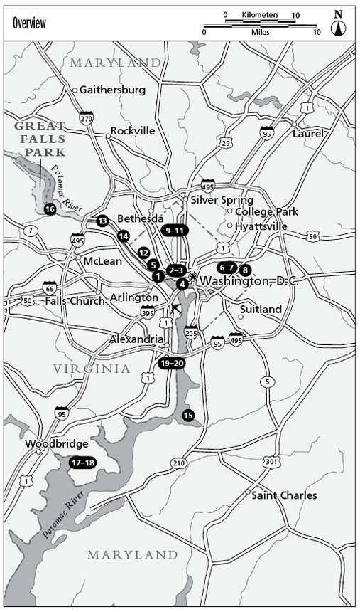
Look inside for: & bull; Casual hikes to half-day adventures & bull; Hikes for everyone, including families & bull; Mile-by-mile directions and clear trail maps & bull; Trail Finder for best hikes for history buffs, nature lovers, and water views & bull; GPS coordinates.;Front Cover; Copyright; TOC; Introduction; Historical Washington; Gardens and Nature; The C & O Canal; Just Outside the District; Back Cover; Spine.
Baxter: author's other books
Who wrote Best Easy Day Hikes Washington, D.C.? Find out the surname, the name of the author of the book and a list of all author's works by series.


Best Easy Day Hikes Washington, D.C. — read online for free the complete book (whole text) full work
Below is the text of the book, divided by pages. System saving the place of the last page read, allows you to conveniently read the book "Best Easy Day Hikes Washington, D.C." online for free, without having to search again every time where you left off. Put a bookmark, and you can go to the page where you finished reading at any time.
Font size:
Interval:
Bookmark:

Best Easy Day Hikes Series
Best Easy Day Hikes Washington, D.C.
Louise S. Baxter

Copyright 2011 by Morris Book Publishing, LLC
ALL RIGHTS RESERVED. No part of this book may be reproduced or transmitted in any form by any means, electronic or mechanical, including photocopying and recording, or by any information storage and retrieval system, except as may be expressly permitted in writing from the publisher. Requests for permission should be addressed to Globe Pequot Press, Attn: Rights and Permissions Department, P.O. Box 480, Guilford, CT 06437.
FalconGuides is an imprint of Globe Pequot Press.
Falcon, FalconGuides, and Outfit Your Mind are registered trademarks of Morris Book Publishing, LLC.
TOPO! Explorer software and SuperQuad source maps courtesy of National Geographic Maps. For information about TOPO! Explorer, TOPO!, and Nat Geo Maps products, go to www.topo.com or www.natgeomaps.com.
Maps by Design Maps Inc. Morris Book Publishing, LLC
Layout: Kevin Mak
Project editor: Gregory Hyman
Library of Congress Cataloging-in-Publication Data is available on file.
ISBN 978-1-4930-0575-8

The author and Globe Pequot Press assume no liability for accidents happening to, or injuries sustained by, readers who engage in the activities described in this book.
Contents
Acknowledgments
Many thanks to my friends, who gave me great ideas for hikes and supported me throughout this process. A special thanks to my brother, Craig, who has always believed in me. I want to express my great appreciation for the National Park Service, Virginia State Parks, and private preservation organizations that do a wonderful job of making sure that we understand the importance, historically and environmentally, of the parklands they protect. It is because of them that we will enjoy these areas for years to come.
Introduction
Washington, D.C., is a designed city, mostly urban and residential, without a lot of wild areas. That said, however, there are many opportunities for hiking and getting back to nature. The citys biggest park, Rock Creek Park, has many trails and outdoor activities. The C&O Canal begins its 185-mile run in Georgetown and a towpath follows the entire route; and the Potomac River is flanked with walking trails on the Washington, D.C.; Maryland; and Virginia sides. Being the nations capital means that much of the land here is federally owned and protected for monuments and memorials, and for environmental preserves. Part of the city is built on what was once swampland, so water plays a big part in the natural ecosystem of the area. Marshes and wetlands abound along the river.
Washington, D.C., was designed on a grid system, with lettered streets running eastwest and numbered streets running northsouth. The US Capitol is the center of the city and from it four sections are created: Northwest (NW), Southwest (SW), Northeast (NE), and Southeast (SE). Thats why every address in Washington has one of these suffixes on it. To make things more interesting, however, diagonal avenues named for states pierce through the grid, creating squares and circles. But what the city loses in easy navigation it gains in beauty, as many of these squares and circles provide opportunities to honor history and make some green space. Ironically, the city was designed this way to prevent enemy armies from finding easy access to important buildings. The British, however, in 1814, had no trouble getting in and burning both the White House and the US Capitol. So the plan really only serves to confuse those trying to get around today. Best advice: Carry a good map and be patient.
Weather
Washington, D.C., is in the mid-Atlantic region, which has a humid climate. The area is known for its hot and sticky summers and, generally, mild winters, with roughly a foot of snow accumulated through the season. While every hike in this book can be done throughout the year, spring and fall usually offer comfortable temperatures and are the ideal times for hiking. In summer try to walk in the morning or evening. Trails, especially those that follow the river or the canal, can get buggy, so bring insect repellent. The sun can be strong too, even in winter, so wear sunscreen on trails that are out in the open. These hikes are designed for all levels of ability; generally a good pair of sneakers is enough to navigate the trails.
Traffic
The Washington, D.C. metro area boasts some of the worst traffic in the country! That said, its still a great place to live and visit. Just be aware and plan a little extra time to get around. Also, many roads have strict rush-hour restrictions on weekdays, except major holidaysin particular I-66, Canal Road, and Rock Creek Parkway.
- I-66 inside the Beltway (I-495) is HOV-2 (a high-occupancy vehicle lane; at least two persons in car) inbound (east toward Washington) from 6:30 a.m. to 9 a.m. and outbound (west from Washington, D.C.) from 4 p.m. to 6 p.m.
- Canal Road is one way going south from 6:15 a.m. to 10 a.m. and one way going north from 2:45 p.m. to 7:15 p.m.
- Rock Creek Parkway is one way going south from 6:45 a.m. to 9:30 a.m. and one way going north from 3:45 p.m. to 6:30 p.m.
Its best to avoid those streets on weekdays before 10 a.m. and after 4 p.m. If you find yourself in these areas during rush-hour times, be sure to have a map handy for detour routes. Washington, D.C.area public transportation information for Metrorail and Metrobus can be found at www.wmata.com. Some of the trailheads in this guide are accessible via public transportation; when they are, the corresponding route is included with the hike description.
Leave No Trace
Most of the trails in this book are maintained by governmental or private organizations and are well taken care of. Please take care when you visit to preserve the areas for others.
- Stay on the designated trails. Many off-trail areas are not safe or they may be in the process of revegetation projects.
- Dont leave anything behind; pack your trash and discard it in a trash receptacle, if available, or take it with you when you leave the park.
- Be careful of wild animals and dont feed them.
- Leave flowers, rocks, and other souvenirs behind. Take only pictures and memories.
- Be mindful of other users on the trails. Many trails are used by cyclists; listen for the familiar On your left warning and move to the right to let them pass.
- Keep your noise level at a minimum. Shouting can be startling to wildlife and other humans.
- Dogs are permitted on most of the trails. They must be on leashes no longer than 6 feet. Please pick up after them.
- Please do not smoke on the trails. Its not expressly prohibited, but can mar the enjoyment of other trail users.
Safety
The trails featured here are short and, often, near populated areas where help is readily available. However, its best to be prepared.
- Always carry water. Especially in the summer, humidity can take its toll on the body and dehydration is a danger.
- There is cell service available from most of the trails. Carry a phone with you in case of emergency. But keep it on vibrate or a low ring so others arent disturbed.
Font size:
Interval:
Bookmark:
Similar books «Best Easy Day Hikes Washington, D.C.»
Look at similar books to Best Easy Day Hikes Washington, D.C.. We have selected literature similar in name and meaning in the hope of providing readers with more options to find new, interesting, not yet read works.
Discussion, reviews of the book Best Easy Day Hikes Washington, D.C. and just readers' own opinions. Leave your comments, write what you think about the work, its meaning or the main characters. Specify what exactly you liked and what you didn't like, and why you think so.